Seymour’s post office opened in 1852, and 14% of its homes were built before 1940
More historic than 72% of U.S. towns · #279 of 593 in Indiana. What drives it
8 places in town are on the National Register, among them three historic districts with 593 buildings between them. Below: 3 old photos and papers, maps from 1887 on, and the census since 1860.
The Seymour post office opened in 1852, the earliest record of the town by name. Another post office, Jackson (1820), opened inside today’s city and later closed.
First census: 966 in 18602020 census: 21,569174 years
How historic is Seymour?
B+
More historic than 72% of U.S. towns, on its age, its old homes and the National Register.
Founding year: the first Seymour post office (Blevins & Helbock, CC0).The full story ↓
History grade
What drives Seymour’s History grade
On its age, its old homes and the National Register, Seymour is more historic than 72% of U.S. towns, #279 of 593 in Indiana. Its National Register listings hold the grade up; its age pulls it down.
B+
HistoryA character grade: shown, never part of Seymour’s overall grade.
Indiana towns list more on the Register than most of the country (a typical Indiana town has 7.9 per 10,000 residents, the U.S. 2.4), so Seymour’s 268 sits above most of its state (91% of Indiana towns have fewer) while its 599 historic buildings outnumber those of 98% of U.S. towns.
How sure. Graded on any two of the three inputs instead, the letter would range from C+ to A. The pre-1940 share (±2.4 points) is firm at this size. The founding year is the first post office, not a stated founding date.
Founding year: the first post office (other dates in Quick answers). Homes: Census ACS 2020–24. National Register: National Park Service, May 2026 list; each listing counted once (boundary changes and added documentation belong to their listing), and a historic district counts its contributing buildings. How TownRatings grades history →
What stands out about Seymour’s past
Read from the archive, the National Register and the record. The page puts what stands out first.
Fire insurance maps drew every building, what it was made of and what it was used for, so insurers could price the risk of fire. Pick a year, then a sheet.
The land around Seymour was inhabited by the Lenape (Delaware), who had been displaced westward from the Delaware River valley. The 1805 Treaty of Grouseland opened the area to white settlement. After the 1812 Pigeon Roost massacre, the Battle of Tipton's Island took place, where Major John Tipton and some thirty men overcame a larger party of Native raiders. Native Americans killed fifteen settlers between 1811 and 1815, and by 1816—the year Indiana attained statehood—only five families remained in the area. In 1817 the state built a blockhouse to trade with the Lenape until they ceded the land under the 1818 Treaty of St. Mary's, after which the county saw significant depopulation between 1822 and 1832.
Passages that mention Seymour, cut from the printed page as they were published.
Seymour and vicinity, Historical collections1878Read the page →
Seymour and vicinity, Historical collections1878Read the page →
Read the text
In 1852, by joint action of the School Society and the 1st and 4th districtSj the Squantuck di.strict was consolidated with the Great Hill district, and the lines were defined as follows : Whereas, The legal voters of the school society in the town of Seymour, at a meeting warned and held on the 3rd day of July, 1852, voted to annex the Squantuck School District to the First School District in said school society; Therefore, We, the undersigned Society's Committee, hereby establish the following described lines and boundaries annexed, viz: Beginning at the Ousatonic river, at the mouth of the Old Field brook at the boundary of the school society line between Derby
Text read by machine from the scan; it may contain errors.
The Seymour family, history and romance1911 · page 146Read the page →
Read the text
As we have seen, Sir Francis Seymour died in July 1664. His son became second Baron Seymour of Trowbridge, but only held the honour just over a year, dying on the 25th of August 1665. His death is entered in the Preshute parish register, and he was buried in the chancel of Trowbridge Church on the 7th of September.
Text read by machine from the scan; it may contain errors.
Seymour. Maryland, Illinois, Texas, Delaware, Virginia, Vermont, Georgia and Louisiana were heard above the din, and such announcement added fuel to the roaring flame. Sovereign States scrambled forward with unseemly haste, and rudely jostled each other in their rush to be first in changing to Seymour. The end was seen, and the order issued for the battery in Union square, which had been waiting, for two days to belch forth the nominations from the cannon's mouth, to begin. "With the roar of the first gun the crowd within the
Text read by machine from the scan; it may contain errors.
Scans and text from the Internet Archive. Books published in 1930 or earlier, which are in the public domain.
Timeline
Seymour, 1820 to 1977
Woven from the archive, old maps, post office records, the National Register and the people born here.
Nothing in the archives for these yearsWeddings on Main Street, storms, parades, school pictures, the old store. If it’s in your family album, it belongs here.
The Seymour post office opened in 1852, the earliest record of the town by name (U.S. post office records).
How does Seymour rank for history?
Seymour is more historic than 72% of U.S. towns, #279 of 593 in Indiana. The History grade combines the town’s founding era, the share of homes built before 1940 and its National Register listings. It’s a character grade, so it isn’t part of the overall grade. How it works.
What is on the National Register in Seymour?
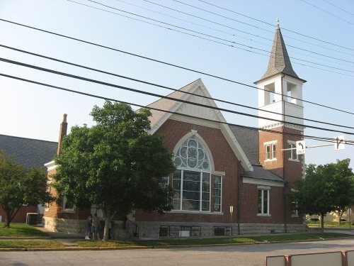
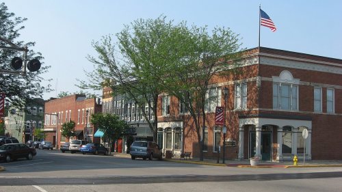
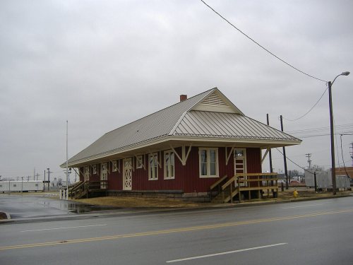
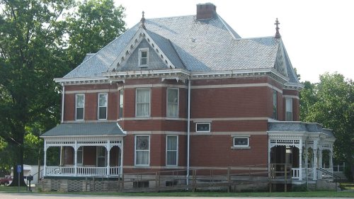
8 listings: 5 buildings, among them the Farmers Club (listed 1983, the first), and 3 historic districts, the Seymour Commercial Historic District, the Walnut Street Historic District and the Westside Historic District, with 593 contributing buildings. 599 historic buildings in all.
How old are the homes in Seymour?
14% of Seymour’s homes were built before 1940 (Census estimate, ±2.4 points), against a typical 14% for an Indiana town; the median home was built in 1976.
Founding dates: Wikidata, Wikipedia, the U.S. post office records of Blevins & Helbock (CC0) and the Census. Homes by year built: Census ACS 2020–24. National Register of Historic Places: National Park Service (list of May 22, 2026). Old photos, postcards and papers: Wikimedia Commons, the Library of Congress and other public archives, credited on each item’s page. Maps: U.S. Geological Survey historical topographic maps (via Esri) and Sanborn fire-insurance maps (Library of Congress). History text and census tables: Wikipedia (CC BY-SA 4.0). Places that used to be: USGS Geographic Names Information System (2021).
From Wikimedia Commons (5), Wikidata (1), the National Register of Historic Places (8), Wikipedia, Wikidata and Wikipedia for famous people, U.S. Geological Survey historical maps, U.S. Census counts (via Wikipedia), the US Post Offices dataset (Blevins & Helbock), the USGS Geographic Names Information System, Sanborn fire insurance maps (Library of Congress) and old county and town histories (Internet Archive). Archive images are copied here with their credits and licenses, shown on each photo’s page. Refreshed monthly.






 1910
 2010
 2010