Rockville’s post office opened in 1824, and 35% of its homes were built before 1940
More historic than 97% of U.S. towns · #37 of 593 in Indiana. What drives it
3 places in town are on the National Register, among them a historic district with 210 buildings. Below: 1 old photo or paper, maps from 1883 on, and the census since 1850.
The Rockville post office opened in 1824, the earliest record of the town by name. Another post office, Park (1820), opened inside today’s town and later closed.
First census: 726 in 18502020 census: 2,510202 years
How historic is Rockville?
A+
More historic than 97% of U.S. towns, on its age, its old homes and the National Register.
Founding year: the first Rockville post office (Blevins & Helbock, CC0).The full story ↓
History grade
What drives Rockville’s History grade
On its age, its old homes and the National Register, Rockville is more historic than 97% of U.S. towns, #37 of 593 in Indiana. All 3 inputs are above most U.S. towns; its National Register listings ranks highest and its age lowest.
A+
HistoryA character grade: shown, never part of Rockville’s overall grade.
Indiana towns list more on the Register than most of the country (a typical Indiana town has 7.9 per 10,000 residents, the U.S. 2.4), so Rockville’s 832 sits above most of its state (98% of Indiana towns have fewer) while its 213 historic buildings outnumber those of 94% of U.S. towns.
How sure. Graded on any two of the three inputs instead, the letter would range from A to A+. The pre-1940 share is a Census survey estimate (±8.2 points). The founding year is the first post office, not a stated founding date.
Founding year: the first post office (other dates in Quick answers). Homes: Census ACS 2020–24. National Register: National Park Service, May 2026 list; each listing counted once (boundary changes and added documentation belong to their listing), and a historic district counts its contributing buildings. How TownRatings grades history →
What stands out about Rockville’s past
Read from the archive, the National Register and the record. The page puts what stands out first.
Fire insurance maps drew every building, what it was made of and what it was used for, so insurers could price the risk of fire. Pick a year, then a sheet.
1883Sheet 1 of 1
Edition
Sheets
BrickWoodStone
Sanborn Map Company, via the Library of Congress. Editions published in 1930 or earlier, which are in the public domain.
Rockville was laid out in 1824, three years after the county was founded, and became the county seat. In 1825, its population was between 500 and 600. The residents voted to incorporate the town in July 1854.
The Rockville Chautauqua Pavilion and Rockville Historic District are listed on the National Register of Historic Places.
An earthquake measuring 3.8 on the moment magnitude scale was recorded in the city and confirmed by the USGS on June 17, 2021, with numerous aftershocks reported in cities around the state and Illinois
The establishing and building the First church was the greatest event for Rockville tliat had ever transpired up to 1840 ; then a post office and the hotel made Rockville a place in fact. It ma}- Ijc said that up to the time of building the hotel Rockville atlbrded no place for amusement — such as balls and other social parties so common in all ages past, whereby young gentlemen and ladies were, aiul ought to be tolerated social interchange of rustic conviviality. The spell must come to an end, and on the completion of the hotel a great party
Text read by machine from the scan; it may contain errors.
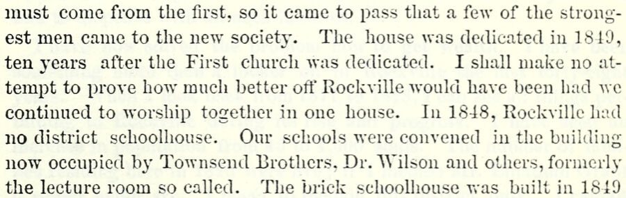
must come from the first, so it came to pass that a few of the strongest men came to the new society. The house was dedicated in 1810, ten 3'ears after the First church was dedicated. I shall make no attempt to prove how much better off Rockville would have been luid we continued to worship together in one house. In 1848, Rockville luid no district schoolhouse. Our schools were convened in the building now occupied by Townsend Brothers. Dr. "Wilson and others, formerly the lecture room so called. The brick schoohiouse v>-as built in 1849
Text read by machine from the scan; it may contain errors.
Scans and text from the Internet Archive. Books published in 1930 or earlier, which are in the public domain.
Timeline
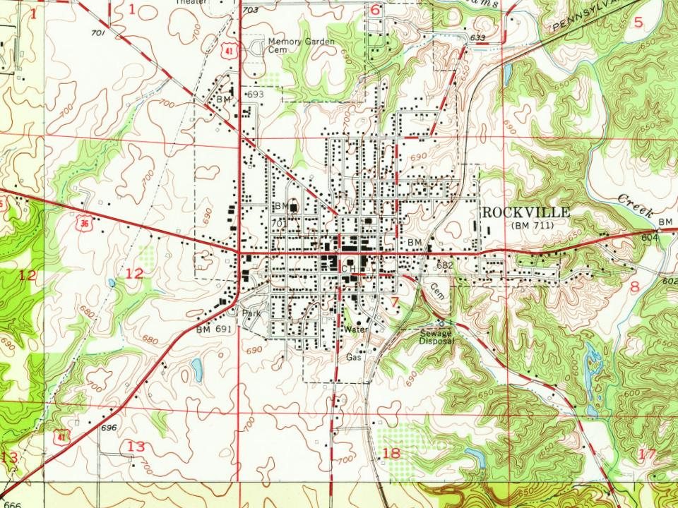
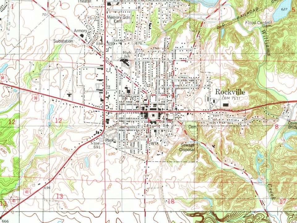
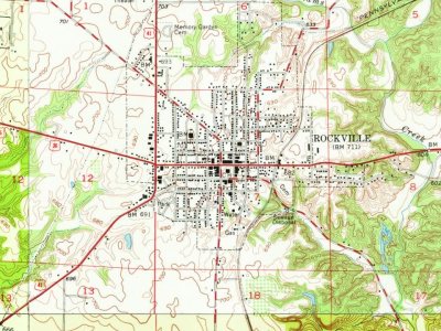
Rockville, 1820 to 1955
Woven from the archive, old maps, post office records, the National Register and the people born here.
Nothing in the archives for these yearsWeddings on Main Street, storms, parades, school pictures, the old store. If it’s in your family album, it belongs here.
Rockville’s post office has been open since 1824. Another post office, Park, opened and closed inside today’s town.
Park
1820–1824
Rockville
1824–today
18201920today
1cemetery inside Rockville
Memory Garden
US Post Offices dataset (Blevins & Helbock, CC0). Places and cemeteries from the USGS Geographic Names Information System (2021).
Questions about Rockville’s history
What year was Rockville founded?
The Rockville post office opened in 1824, the earliest record of the town by name (U.S. post office records).
How does Rockville rank for history?
Rockville is more historic than 97% of U.S. towns, #37 of 593 in Indiana. The History grade combines the town’s founding era, the share of homes built before 1940 and its National Register listings. It’s a character grade, so it isn’t part of the overall grade. How it works.
What is on the National Register in Rockville?
Three places: the Rockville Historic District (listed 1993), the Rockville Chautauqua Pavilion (1999) and the William E. and Carolyn Davis House (2022).
How old are the homes in Rockville?
35% of Rockville’s homes were built before 1940 (Census estimate, ±8.2 points), against a typical 14% for an Indiana town; the median home was built in 1957.
Founding dates: Wikidata, Wikipedia, the U.S. post office records of Blevins & Helbock (CC0) and the Census. Homes by year built: Census ACS 2020–24. National Register of Historic Places: National Park Service (list of May 22, 2026). Old photos, postcards and papers: Wikimedia Commons, the Library of Congress and other public archives, credited on each item’s page. Maps: U.S. Geological Survey historical topographic maps (via Esri) and Sanborn fire-insurance maps (Library of Congress). History text and census tables: Wikipedia (CC BY-SA 4.0). Places that used to be: USGS Geographic Names Information System (2021).
From Wikimedia Commons (2), Wikidata (1), the National Register of Historic Places (3), Wikipedia, Wikidata and Wikipedia for famous people, U.S. Geological Survey historical maps, U.S. Census counts (via Wikipedia), the US Post Offices dataset (Blevins & Helbock), the USGS Geographic Names Information System, Sanborn fire insurance maps (Library of Congress) and old county and town histories (Internet Archive). Archive images are copied here with their credits and licenses, shown on each photo’s page. Refreshed monthly.
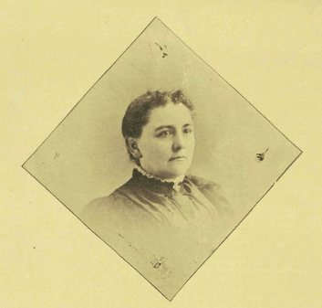



 2008