
Paintings at the University of Notre Dame - The University of Notre Dame, 1917
Notre Dame’s story
175 years in pictures
The archive holds 18 old photos and papers going back to 1917 and 4 maps from 1958 on.
- 1851Notre Dame is settled
Each edition grades its towns against each other only.

A town of 6,890, settled in 1851.
Notre Dame’s best subject grades are an A for walkability and an A− for health; its weakest is a C− for incomes. 79% of adults 25 and older hold a bachelor’s degree or more in Notre Dame, against 22% in Indiana’s towns and 29% across U.S. towns. No town in Indiana scores higher than Notre Dame on hazard risk. Notre Dame's public schools trail 82% of Indiana towns on state tests and graduation. Notre Dame’s trail density is 1.6 miles per square mile, above both the Indiana town median (0.2) and the median of U.S. towns (0.4). On the outdoors, just 76 of Indiana’s 1,098 towns do better. Notre Dame has no overall grade: it has no figures for cost of living and safety, and an overall grade needs at least three of the four big subjects (cost of living, safety, schools and health).
Where Notre Dame beats most towns.
5,973 counted in 2010 and 7,234 in 2020.
U.S. Census 2010 & 2020 counts
Each subject compared with towns across the country (schools within Indiana), ordered by how far Notre Dame is from typical.
Notre Dame has no overall grade: it has no figures for cost of living and safety, and an overall grade needs at least three of the four big subjects (cost of living, safety, schools and health).
How TownRatings grades towns →
The archive holds 18 old photos and papers going back to 1917 and 4 maps from 1958 on.
Museums, parks, gardens and other places to visit around Notre Dame. Close and well known come first.
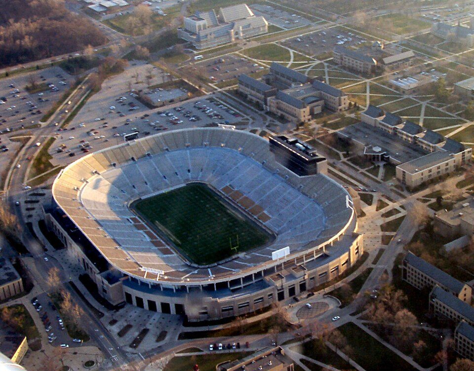 Big drawin town Stadium & arenaNotre Dame Stadium
 in town CaveGrotto of Our Lady of Lourdes, Notre Dame
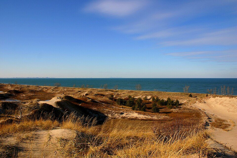 31 mi National ParkIndiana Dunes National Park2.6M visitors a year
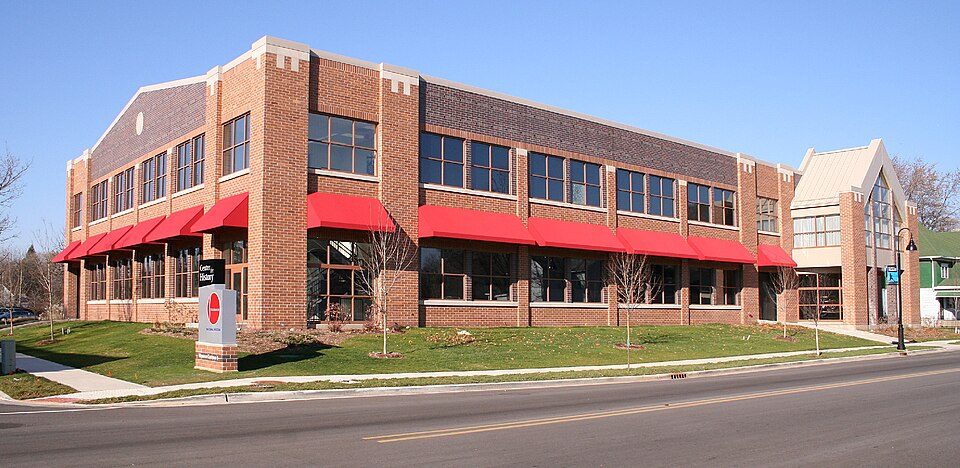 2 mi MuseumStudebaker National Museum
 8 mi Ancient siteFort St. Joseph2 mi Zoo & aquariumPotawatomi Zoo
Notre Dame Stadium: Tysto, Public domain · Grotto of Our Lady of Lourdes, Notre Dame: Know1one1, CC BY-SA 3.0 · Indiana Dunes National Park: J. Crocker, Attribution · Studebaker National Museum: Unknown, Public domain · Fort St. Joseph: Chris Light (talk), CC BY-SA 3.0
Notre Dame is unincorporated, so St. Joseph County and regional agencies provide most services.
EPA SDWIS (Oct 9, 2026) · HIFLD + EIA-861 2025 · Census 2020 ZCTAs · NCES 2024–25 · registration: vote.gov, updated Nov 18, 2024.
Ordered by what stands out in Notre Dame.
49% of residents live below the poverty line in Notre Dame. No town among the 593 in Indiana we compare has a lower average trip to work than Notre Dame. 24% of workers work from home in Notre Dame.
| Notre Dame | Indiana towns | U.S. towns | |
|---|---|---|---|
| Average trip to work | 10 minutes | 24 minutes | 25 minutes |
| Below the poverty line | 49% | 10% | 9.6% |
| Work from home | 24% | 7.8% | 11% |
| Working residents who work in town | 6.5% | 11% | 8% |
Census LEHD 2023 · ACS
Notre Dame’s FEMA risk score is 0 of 100. One flood insurance claim has been paid in Notre Dame since 2018.
FEMA flood insurance claims · FEMA National Risk Index · OpenFEMA
Notre Dame beats the Indiana average on 11 of 32 CDC measures and trails it on 10. 25% of Notre Dame adults have obesity. No town among the 589 in Indiana we compare has a lower share of adults who have diabetes than Notre Dame.
| Notre Dame | Indiana towns | U.S. towns | |
|---|---|---|---|
| Obesity (CDC PLACES) | 25% | 39% | 35% |
| Diabetes (CDC PLACES) | 2.4% | 13% | 12% |
| Frequent mental distress (CDC PLACES) | 28% | 18% | 17% |
| Frequent physical distress (CDC PLACES) | 8.8% | 15% | 14% |
| What stands out | Notre Dame | IN |
|---|---|---|
| Fewer adults who have had cancer | 1.3% | 8.3% |
| Fewer adults with diabetes | 2.4% | 13% |
| More adults without reliable transportation | 13.5% | 7.7% |
CDC PLACES 2025 · modeled estimates for adults · CMS · HRSA
Notre Dame has chilly, snowy winters and pleasant summers. July afternoons reach 83°, January nights drop to 18° and about 65 inches of snow falls in a winter.
NOAA U.S. Climate Normals, 1991–2020
| Biggest places to walk | Trails | Acres |
|---|---|---|
| 1. Charles B. Hayes Sculpture Park | 0.1 mi | 8 |
| 2. Our Lady of the Lake World Peace Plaza | 0.1 mi | 1 |
Trails & parks © OpenStreetMap contributors · Conserved land: USGS PAD-US
7 within 15 miles of the center of Notre Dame
College town 97 of every 100 Notre Dame residents are enrolled in college, against 6 across Indiana.
Where Notre Dame’s working residents go each day. Line width shows the share.
Census LEHD 2023
Census-designated place in the United States
Notre Dame is a census-designated place and unincorporated community north of the city of South Bend in St. Joseph County, in the U.S. state of Indiana. It includes the campuses of three Catholic colleges: the University of Notre Dame, Saint Mary's College, and Holy Cross College. Notre Dame is split between Clay and Portage townships. As of the 2020 census, its population was 7,234.
From Wikipedia, licensed CC BY-SA 4.0 · facts via Wikidata (CC0)
3 towns share a border with Notre Dame.
| Town | IN rank | Overall | Cost | Safety | Schools | Health |
|---|---|---|---|---|---|---|
| Notre Dame | — | — | — | — | C− | A− |
| South Bend | #579 | D | B+ | D | C− | D |
| Clay Township | #397 | B− | C+ | — | C− | B+ |
| Portage Township | #515 | C | B+ | — | C− | D |
Notre Dame, Clay Township and Portage Township report no FBI crime data of their own. Notre Dame isn’t graded (fewer than 1,000 residents, or not enough data). Compare Notre Dame with a neighbor →
Short answers, built from the data on this page.
Notre Dame has no overall grade: it has no figures for cost of living and safety, and an overall grade needs at least three of the four big subjects (cost of living, safety, schools and health).


