Muncie dates to 1827, and 20% of its homes were built before 1940
More historic than 92% of U.S. towns · #125 of 593 in Indiana. What drives it
38 places in town are on the National Register, among them ten historic districts with 954 buildings between them. Below: 1 old photo or paper, maps from 1883 on, and the census since 1850.
Founding year: Wikidata. First post office: 1828.The full story ↓
History grade
What drives Muncie’s History grade
On its age, its old homes and the National Register, Muncie is more historic than 92% of U.S. towns, #125 of 593 in Indiana. All 3 inputs are above most U.S. towns; its National Register listings ranks highest and its share of homes from before 1940 lowest.
A
HistoryA character grade: shown, never part of Muncie’s overall grade.
Indiana towns list more on the Register than most of the country (a typical Indiana town has 7.9 per 10,000 residents, the U.S. 2.4), so Muncie’s 152 sits above most of its state (85% of Indiana towns have fewer) while its 981 historic buildings outnumber those of 99% of U.S. towns.
How sure. Graded on any two of the three inputs instead, the letter would range from A− to A. The pre-1940 share (±1.8 points) is firm at this size. Two sources give 1827.
Founding year: Wikidata (other dates in Quick answers). Homes: Census ACS 2020–24. National Register: National Park Service, May 2026 list; each listing counted once (boundary changes and added documentation belong to their listing), and a historic district counts its contributing buildings. How TownRatings grades history →
What stands out about Muncie’s past
Read from the archive, the National Register and the record. The page puts what stands out first.
The area was first settled in the 1790s by the Lenape (Delaware) people, who were forced west from their tribal lands in the Mid-Atlantic region (all of New Jersey, southeastern New York, eastern Pennsylvania, and northern Delaware) to new lands in present-day Ohio and eastern Indiana. The Lenape founded several towns along the White River, including Munsee Town, near the site of present-day Muncie. The term Munsee denotes a subgroup of the Lenape people.
Passages that mention Muncie, cut from the printed page as they were published.
A twentieth century history of Delaware County, Indiana1908 · page 229Read the page →
Read the text
in the report of the Board of Public Works, extracts from which are here given : "On the 6th day of May, 1901, Mr. George F. McCulloch informed the Common Council of the City of Muncie by letter that he would make a gift of the grounds known as McCulloch Park to the City of Muncie, the onlycondition to said gift being that the City of Muncie hold the real estate in trust as a public park for the free use of all the inhabitants of the city. In his letter to the Council he further slated that he would give a further sum
Text read by machine from the scan; it may contain errors.
A twentieth century history of Delaware County, Indiana1908 · page 454Read the page →
Read the text
When the church was first organized in 1868 it took the name of "Church of Christ meeting in Muncie, Indiana." Soon after the congregation began worshipping in their building on Jackson and Council streets they adopted the name '*First Christian Church of Muncie, Indiana," and this name was continued until 1905, although during a portion of that time the title of the real estate owned by the church remained in the original name. In 1905 the congregation adopted the name "Jackson Street Christian Church of Muncie, Indiana."
Text read by machine from the scan; it may contain errors.
the factory or building ; no cart.iue, no liandling-, and no t'ailure in supply determines its worth to trie factory operator. Witli tlie sanie number ot' hands, under such conditions, double the amount ot work can be turned out. Herein lies the great secret of increased shipments noted abo\e, and herein lies the great iuture of Muncie. To t\irther show the growth of Muncie Irom a business point of view, tiie annual receipts of the Muncie p o s t o Ifi c e bear indisputable evidence.
Text read by machine from the scan; it may contain errors.
Scans and text from the Internet Archive. Books published in 1930 or earlier, which are in the public domain.
Timeline
Muncie, 1827 to 1993
Woven from the archive, old maps, post office records, the National Register and the people born here.
Nothing in the archives for these yearsWeddings on Main Street, storms, parades, school pictures, the old store. If it’s in your family album, it belongs here.
Every edition of the U.S. Geological Survey’s map of Muncie. Tap a year, or press play to watch the town change.
1952Muncie West sheet · 1:24,000
U.S. Geological Survey historical topographic maps (public domain), via Esri’s collection of the scans. The red ring marks the center of Muncie.
Every building
Muncie, building by building, 1883–1911
Fire insurance maps drew every building, what it was made of and what it was used for, so insurers could price the risk of fire. Pick a year, then a sheet.
In 1827, according to Wikidata. Muncie’s post office opened in 1828, and the census of 1850 counted 666 people here.
How does Muncie rank for history?
Muncie is more historic than 92% of U.S. towns, #125 of 593 in Indiana. The History grade combines the town’s founding era, the share of homes built before 1940 and its National Register listings. It’s a character grade, so it isn’t part of the overall grade. How it works.
What is on the National Register in Muncie?
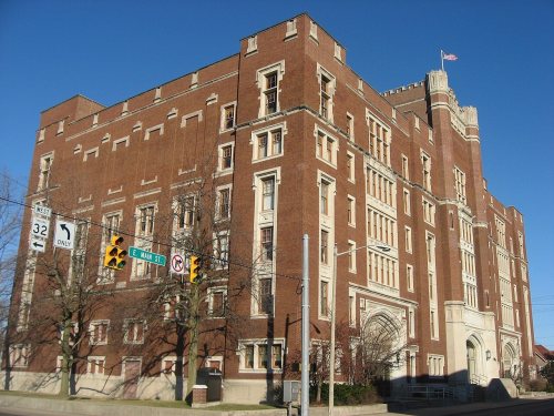
38 listings: 26 buildings, among them the Muncie Public Library (listed 1976, the first), 11 historic districts with 954 contributing buildings, and 1 structure. 981 historic buildings in all.
How old are the homes in Muncie?
20% of Muncie’s homes were built before 1940 (Census estimate, ±1.8 points), against a typical 14% for an Indiana town; the median home was built in 1963.
Founding dates: Wikidata, Wikipedia, the U.S. post office records of Blevins & Helbock (CC0) and the Census. Homes by year built: Census ACS 2020–24. National Register of Historic Places: National Park Service (list of May 22, 2026). Old photos, postcards and papers: Wikimedia Commons, the Library of Congress and other public archives, credited on each item’s page. Maps: U.S. Geological Survey historical topographic maps (via Esri) and Sanborn fire-insurance maps (Library of Congress). History text and census tables: Wikipedia (CC BY-SA 4.0). Places that used to be: USGS Geographic Names Information System (2021).
From Wikimedia Commons (8), Wikidata (4), the National Register of Historic Places (38), Wikipedia, Wikidata and Wikipedia for famous people, U.S. Geological Survey historical maps, U.S. Census counts (via Wikipedia), the US Post Offices dataset (Blevins & Helbock), the USGS Geographic Names Information System, Sanborn fire insurance maps (Library of Congress) and old county and town histories (Internet Archive). Archive images are copied here with their credits and licenses, shown on each photo’s page. Refreshed monthly.








 2022
 2019
 2014
 2014
 2014
 2012
 2004


