Founding year: the first Middlebury post office (Blevins & Helbock, CC0).The full story ↓
History grade
What drives Middlebury’s History grade
On its age, its old homes and the National Register, Middlebury is more historic than 51% of U.S. towns, #376 of 593 in Indiana. Its age holds the grade up; its National Register listings pull it down.
B−
HistoryA character grade: shown, never part of Middlebury’s overall grade.
Indiana towns list more on the Register than most of the country (a typical Indiana town has 7.9 per 10,000 residents, the U.S. 2.4), so Middlebury’s 0.0 sits below most of its state (22% of Indiana towns have fewer) while its 0 listings outnumber those of 23% of U.S. towns.
How sure. Graded on any two of the three inputs instead, the letter would range from C to B+. The pre-1940 share is a Census survey estimate (±6.8 points). The founding year is the first post office, not a stated founding date.
Founding year: the first post office (other dates in Quick answers). Homes: Census ACS 2020–24. National Register: National Park Service, May 2026 list; each listing counted once (boundary changes and added documentation belong to their listing), and a historic district counts its contributing buildings. How TownRatings grades history →
What stands out about Middlebury’s past
Read from the archive, the National Register and the record. The page puts what stands out first.
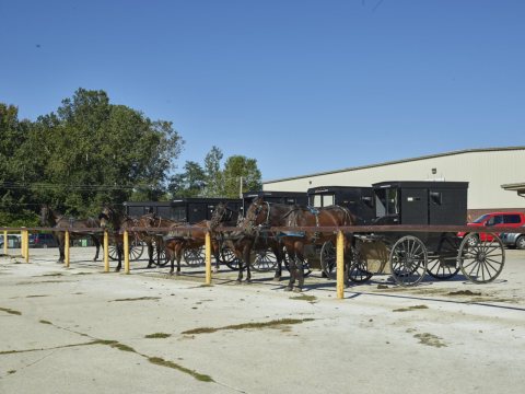
Before the Europeans came to the region, the Miami and later the Potawatomi ruled the area. That changed in 1832, when the first settlers came from Middlebury, Vermont. They chose this specific area because the rolling hills reminded them of Vermont. Later, in 1841, the first Amish families came from Somerset County, Pennsylvania and settled in the countryside surrounding the town. Middlebury Township was organized in 1834 and the town of Middlebury was finally incorporated in 1868.
In 1888, the railroad came to Middlebury and began to diversify the town's economy to include manufacturing as well as farming.
Passages that mention Middlebury, cut from the printed page as they were published.
History of the town of Middlebury, in the country of Addison, Vermont1859 · page 164Read the page →
Read the text
' ' An act annexing part of the town of Cornwall to Middlebury : It is hereby enacted by the General xissembly of the State of Vermont, that the northeasterly part of the town of Cornwall, in the County of Addison, hereinafter described, be, and the same is hereby annexed to the town of Middlebury, in said County, bounded as follows, viz : beginning at the southwest corner of said Middlebury, then running west so far that a north line will strike the west end of the long causeway, so-called, then on a straight
Text read by machine from the scan; it may contain errors.
History of the town of Middlebury, in the country of Addison, Vermont1859 · page 150Read the page →
Read the text
4. Voted that, if any man or men, by the first day of May next shall appear and give sufficient bond to the propi-ietor's Coiiimittee to build a good saw-mill, within fifteen months from this day in the township of Middlebury, he shall have any mill-place, which he or they shall choose insaid township, viz: in the undivided part thereof, anc", also fifty acres of land adjoining said mill-place, he or they to be at the cost of laying out said fifty acres, and build said mill so as to leave room for fifty acres, to be laid out to accommodate a grist mill, and proper place to set a grist mill, if the proprietors see fit to improve it.
Text read by machine from the scan; it may contain errors.
A standard history of Elkhart County, Indiana1916 · page 403Read the page →
Read the text
Vistula, in the extreme northeastern part of the county on the New York Central, came into existence as the result of the demand by the people of Middlebury for a near-by station on the Lake Shore Railroad, and for some time the depot and shipping point thus established was known as Middlebury Station. About 1851 the railroad was built through the northwestern comer of the township, and, according to the story, a woodshed was placed alongside the track about half a mile west of where the Vistula depot now
Text read by machine from the scan; it may contain errors.
Scans and text from the Internet Archive. Books published in 1930 or earlier, which are in the public domain.
Every edition of the U.S. Geological Survey’s map of Middlebury. Tap a year, or press play to watch the town change.
1961Middlebury sheet · 1:24,000
U.S. Geological Survey historical topographic maps (public domain), via Esri’s collection of the scans. The red ring marks the center of Middlebury.
Every building
Middlebury, building by building, 1909–1917
Fire insurance maps drew every building, what it was made of and what it was used for, so insurers could price the risk of fire. Pick a year, then a sheet.
1909Sheet 1 of 1
Edition
Sheets
BrickWoodStone
Sanborn Map Company, via the Library of Congress. Editions published in 1930 or earlier, which are in the public domain.
People over time
Middlebury, census by census
Grew from 502 people in 1880 to 3,466 in 2020, 6 times over.
15 censuses, 1880–2020.
U.S. Census Bureau decennial counts, from the census table on Middlebury’s Wikipedia page.
Famous people
Famous people close to Middlebury
Nobody well known was born in Middlebury itself, so here are the best known from just nearby.
The Middlebury post office opened in 1836, the earliest record of the town by name (U.S. post office records).
How does Middlebury rank for history?
Middlebury is more historic than 51% of U.S. towns, #376 of 593 in Indiana. The History grade combines the town’s founding era, the share of homes built before 1940 and its National Register listings. It’s a character grade, so it isn’t part of the overall grade. How it works.
How old are the homes in Middlebury?
12% of Middlebury’s homes were built before 1940 (Census estimate, ±6.8 points), against a typical 14% for an Indiana town; the median home was built in 1986.
Founding dates: Wikidata, Wikipedia, the U.S. post office records of Blevins & Helbock (CC0) and the Census. Homes by year built: Census ACS 2020–24. National Register of Historic Places: National Park Service (list of May 22, 2026). Old photos, postcards and papers: Wikimedia Commons, the Library of Congress and other public archives, credited on each item’s page. Maps: U.S. Geological Survey historical topographic maps (via Esri) and Sanborn fire-insurance maps (Library of Congress). History text and census tables: Wikipedia (CC BY-SA 4.0). Places that used to be: USGS Geographic Names Information System (2021).
From Wikimedia Commons (1), the Library of Congress (11), Wikipedia, U.S. Geological Survey historical maps, U.S. Census counts (via Wikipedia), the US Post Offices dataset (Blevins & Helbock), the USGS Geographic Names Information System, Sanborn fire insurance maps (Library of Congress) and old county and town histories (Internet Archive). Archive images are copied here with their credits and licenses, shown on each photo’s page. Refreshed monthly.


 2016
 2016
 2016
 2016
 2016
 2016
 2016
 2016
 2016
 2016
 2016
 2010


