Fort Wayne dates to 1794, and 15% of its homes were built before 1940
More historic than 90% of U.S. towns · #151 of 593 in Indiana. What drives it
70 places in town are on the National Register, among them 2 National Historic Landmarks and ten historic districts with 7,421 buildings between them. Below: 15 old photos and papers, maps from 1885 on, and the census since 1850.
Founding year: Wikidata; Wikipedia’s history section gives the same year. First post office: 1851.The full story ↓
History grade
What drives Fort Wayne’s History grade
On its age, its old homes and the National Register, Fort Wayne is more historic than 90% of U.S. towns, #151 of 593 in Indiana. All 3 inputs are above most U.S. towns; its National Register listings ranks highest and its share of homes from before 1940 lowest.
A
HistoryA character grade: shown, never part of Fort Wayne’s overall grade.
Among the 400 U.S. cities of 100,000 or more, Fort Wayne ranks #69 on History.
Indiana towns list more on the Register than most of the country (a typical Indiana town has 7.9 per 10,000 residents, the U.S. 2.4), so Fort Wayne’s 278 sits above most of its state (91% of Indiana towns have fewer) while its 7,470 historic buildings outnumber those of 100% of U.S. towns.
How sure. Graded on any two of the three inputs instead, the letter would range from B+ to A. The pre-1940 share (±0.7 points) is firm at this size. Two sources give 1794.
Founding year: Wikidata (other dates in Quick answers). Homes: Census ACS 2020–24. National Register: National Park Service, May 2026 list; each listing counted once (boundary changes and added documentation belong to their listing), and a historic district counts its contributing buildings. How TownRatings grades history →
What stands out about Fort Wayne’s past
Read from the archive, the National Register and the record. The page puts what stands out first.
National Park Service, National Register of Historic Places. Photos from Wikimedia Commons, credited on each place’s page.
Places that used to be
Lost post offices, old corners, places now gone and burying grounds
Five other post offices opened and closed inside today’s town.
Saint Joseph
1851–1854
Saint Vincent
1866–1901
Wallen
1871–1924
Adams Station
1876–1881
Academie
1878–1880
18501940today
Hamlets and corners on the map
AcademieAnthony Wayne VillageAvalonBrierwood HillsBrookside EstatesConcordia GardensCountry Club GardensCovington DellsCrestwoodDwenger FieldEastland GardensEllisvilleFairfaxForest RidgeGolden AcresGreendaleHacienda VillageHillcrestIndian VillageLake ShoresLiberty HillsLincolnshireLudwig ParkManor Woods
Gone or out of use
Indiana School for Feeble Minded YouthschoolMemorial Stadiumlocale
9cemeteries and burying grounds inside Fort Wayne
BowersConcordia Cemetery and Cremation GardensCovington Memorial GardensHatfieldLindenwoodOak GrovePrairie GroveSaint Johns LutheranSaint Pauls Evangelical Lutheran
US Post Offices dataset (Blevins & Helbock, CC0). Places and cemeteries from the USGS Geographic Names Information System (2021).
This area here on the river confluence was occupied by successive cultures of indigenous peoples for as long as 10,000 years. The Miami tribe would eventually establish its settlement of Kekionga at this confluence of the Maumee, St. Joseph, and St. Marys rivers in the late stages of the Beaver Wars in the 1690s. It was the capital of the Miami nation and related Algonquian tribes.
Passages that mention Fort Wayne, cut from the printed page as they were published.
The pictorial history of Fort Wayne, Indiana1917 · page 588Read the page →
Read the text
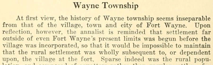
Wayne Township At first view, the history of Wayne township seems inseparable from that of the village, town and city of Fort Wayne. Upon reflection, however, the annalist is reminded that settlement far outside of even Fort Wayne's present limits was begim before the village was incorporated, so that it would be impossible to maintain that the rural settlement was wholly subsequent to, or dependent upon, the village at the fort. Sparse indeed was the rural popu-
Text read by machine from the scan; it may contain errors.
The pictorial history of Fort Wayne, Indiana1917 · page 482Read the page →
Read the text
During the period of three years — 1869 to 1871 — four lines of steam railroad were completed to connect the growing city of Fort Wayne with the outside world. These lines were the Fort Wayne, Jackson and Saginaw road, the Grand Rapids and Indiana, the Fort Wayne, Muncie and Cincinnati, and the Fort Wayne, Richmond and Cincinnati.
Text read by machine from the scan; it may contain errors.
Scans and text from the Internet Archive. Books published in 1930 or earlier, which are in the public domain.
Timeline
Fort Wayne, 1794 to 1957
Woven from the archive, old maps, post office records, the National Register and the people born here.
Nothing in the archives for these yearsWeddings on Main Street, storms, parades, school pictures, the old store. If it’s in your family album, it belongs here.
Every edition of the U.S. Geological Survey’s map of Fort Wayne. Tap a year, or press play to watch the town change.
1957Huntertown sheet · 1:24,000
U.S. Geological Survey historical topographic maps (public domain), via Esri’s collection of the scans. The red ring marks the center of Fort Wayne.
Every building
Fort Wayne, building by building, 1885–1918
Fire insurance maps drew every building, what it was made of and what it was used for, so insurers could price the risk of fire. Pick a year, then a sheet.
In 1794, according to Wikidata and Wikipedia’s history of the town. Fort Wayne’s post office opened in 1851, and the census of 1850 counted 4,282 people here.
How does Fort Wayne rank for history?
Fort Wayne is more historic than 90% of U.S. towns, #151 of 593 in Indiana. The History grade combines the town’s founding era, the share of homes built before 1940 and its National Register listings. It’s a character grade, so it isn’t part of the overall grade. How it works.
What is on the National Register in Fort Wayne?
70 listings, 2 of them National Historic Landmarks: 38 buildings, among them the Allen County Courthouse (a National Historic Landmark since 2003), 29 historic districts with 7,421 contributing buildings, 2 sites, and 1 structure. 7,470 historic buildings in all.
How old are the homes in Fort Wayne?
15% of Fort Wayne’s homes were built before 1940 (Census estimate), against a typical 14% for an Indiana town; the median home was built in 1972.
Founding dates: Wikidata, Wikipedia, the U.S. post office records of Blevins & Helbock (CC0) and the Census. Homes by year built: Census ACS 2020–24. National Register of Historic Places: National Park Service (list of May 22, 2026). Old photos, postcards and papers: Wikimedia Commons, the Library of Congress and other public archives, credited on each item’s page. Maps: U.S. Geological Survey historical topographic maps (via Esri) and Sanborn fire-insurance maps (Library of Congress). History text and census tables: Wikipedia (CC BY-SA 4.0). Places that used to be: USGS Geographic Names Information System (2021).
From Wikimedia Commons (11), the Library of Congress (9), Wikidata (3), the National Register of Historic Places (70), Wikipedia, Wikidata and Wikipedia for famous people, U.S. Geological Survey historical maps, U.S. Census counts (via Wikipedia), the US Post Offices dataset (Blevins & Helbock), the USGS Geographic Names Information System, Sanborn fire insurance maps (Library of Congress) and old county and town histories (Internet Archive). Archive images are copied here with their credits and licenses, shown on each photo’s page. Refreshed monthly.


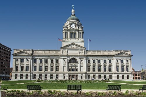 ★ Landmark
 ★ Landmark

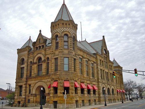

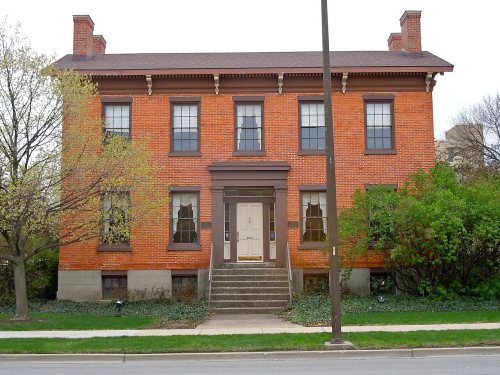

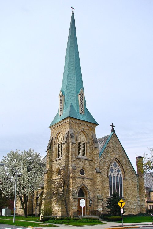



 1902
 1902
 1902
 1902
 1902
 1909
 1917
 1919
 1982
 2016
 2016
 2012
 2011
 2006