
Lancaster Covered Bridge · National Register of Historic Places
Clay Township’s story
Clay Township in pictures
The archive holds 2 maps from 1961 on.
1 place on the National Register of Historic Places.
Explore the history →Each edition grades its towns against each other only.
A town of 1,273. Public schools that outperform most of Indiana.
Clay Township’s best subject grades are an A+ for schools, an A for civic life, and an A− for history; its weakest is a C− for walkability. Lancaster Covered Bridge is on the National Register of Historic Places. Clay Township has fewer than 2,500 residents, so it gets subject grades but no overall grade.
Where Clay Township beats most towns.
| School | Grades | Students |
|---|---|---|
| New Hope School C/O John Hess | 1–7 | 16 |
 Lancaster Covered Bridge
In a town this size, neighbors are the best guide. Ask them anything.
Each subject compared with towns across the country (schools within Indiana), ordered by how far Clay Township is from typical.
How TownRatings grades towns →
The archive holds 2 maps from 1961 on.
1 place on the National Register of Historic Places.
Explore the history →Who provides power, water and the rest in Clay Township, and how to reach them.
EPA SDWIS (Oct 9, 2026) · HIFLD + EIA-861 2025 · Census 2020 ZCTAs · NCES 2024–25 · registration: vote.gov, updated Nov 18, 2024.
Ordered by what stands out in Clay Township.
| School | Level | Students | Letter |
|---|---|---|---|
| New Hope School C/O John Hess PrivateLargest elementary schoolGrades 1–7 | Grades 1–7 | 16 | – |
NCES · EDFacts · graded within IN on state tests and graduation
The median commute is under 13 miles. The mean commuting time for Clay Township comes to 19 minutes. The top destinations are Lafayette (30%), Deer Creek Township (8%) and West Lafayette (7%).
| Clay Township | Indiana towns | U.S. towns | |
|---|---|---|---|
| Average trip to work | 19 minutes | 24 minutes | 25 minutes |
| Working residents who work in town | 0.2% | 11% | 8% |
| Below the poverty line | 13% | 10% | 9.6% |
Census LEHD 2023 · ACS
The share of adults in Clay Township who have high blood pressure is 39%, near the Indiana town median (39%) and above the median of U.S. towns (35%). Clay Township: 31% of adults feel lonely.
| Clay Township | Indiana towns | U.S. towns | |
|---|---|---|---|
| Obesity (CDC PLACES) | 40% | 39% | 35% |
| Feel lonely (CDC PLACES) | 31% | 32% | 33% |
| Smoke cigarettes (CDC PLACES) | 17% | 17% | 14% |
| High blood pressure (CDC PLACES) | 39% | 39% | 35% |
| What stands out | Clay Township | IN |
|---|---|---|
| More adults who have had cancer | 9.4% | 8.3% |
CDC PLACES 2025 · modeled estimates for adults · CMS · HRSA
Expect July afternoons of 84° and January nights of 18°, with about 20 inches of snow a winter.
NOAA U.S. Climate Normals, 1991–2020
Adults 18 to 34 are 16% of residents (23% statewide); children under 18 are 29% of residents (23% statewide). Among adults 25 and older, 20% have a four-year degree or more, against 30% across Indiana. 1,273 people lived in Clay Township by the Census Bureau’s 2025 estimate, 2.1% more than in 2020.
| Clay Township | Indiana towns | U.S. towns | |
|---|---|---|---|
| Bachelor’s degree or more, 25+ | 20% | 22% | 29% |
| Median age | 41.3 years | 39.4 years | 40.5 years |
44% women, 56% men
About 129 men for every 100 women (the survey’s margin: ±5.4 points). Across Indiana, 50.4% of residents are women.
| Clay Township | IN | U.S. | |
|---|---|---|---|
| Under 10 | 12.5% | 12.4% | 11.6% |
| 10 to 17 | 16% | 10.9% | 10.3% |
| 18 to 24 | 4.6% | 9.6% | 9.1% |
| 25 to 34 | 11.2% | 13.1% | 13.7% |
| 35 to 44 | 15.5% | 12.7% | 13.2% |
| 45 to 54 | 11.2% | 12% | 12.2% |
| 55 to 64 | 8.4% | 12.5% | 12.7% |
| 65 to 74 | 14.8% | 10.1% | 10.2% |
| 75 and older | 5.9% | 6.7% | 7% |
| No diploma | 5.8% | 9.6% | 10.4% |
| High school | 35.4% | 32.5% | 26% |
| Some college | 18.4% | 19.3% | 19.1% |
| Associate’s | 20.4% | 9.1% | 8.8% |
| Bachelor’s | 18.5% | 18.7% | 21.6% |
| Graduate | 1.5% | 10.8% | 14.1% |
Census population estimates, 2025 · U.S. Census Bureau · ACS 2020-2024 5-year estimates · in a town of 1,300, single groups can be off by several points
FEMA puts 55% of Clay Township’s expected hazard losses down to inland flooding, and 13% to cold waves. Expected storm and flood damage is lower than in 54% of U.S. communities.
FEMA National Risk Index · OpenFEMA
1.1 miles of trail. Clay Township’s density of trails comes in at 0.1 miles per square mile.
| Clay Township | Indiana towns | U.S. towns | |
|---|---|---|---|
| Miles of trail per square mile | 0.1 miles per square mile | 0.2 | 0.4 |
| Conserved land | 0.8% | 1.9% | 4.3% |
Trails & parks © OpenStreetMap contributors · Conserved land: USGS PAD-US
Museums, parks, gardens and other places to visit around Clay Township. Close and well known come first.
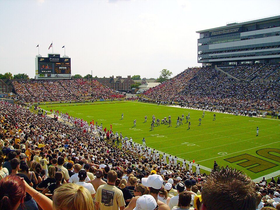 15 mi Stadium & arenaRoss–Ade Stadium9 mi LandmarkWabash and Erie Canal
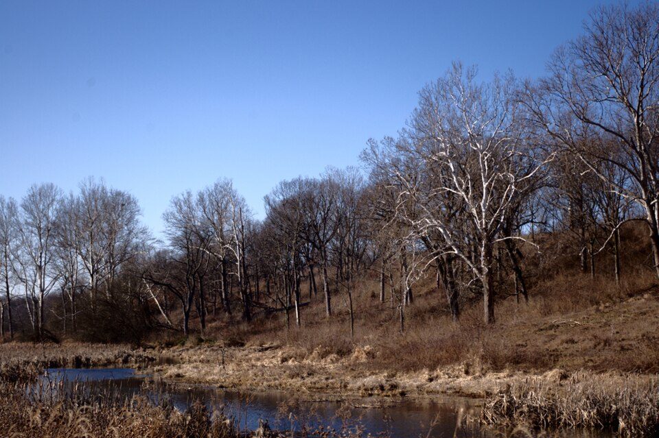 10 mi State parkProphetstown State Park24 mi Theme parkIndiana Beach
 14 mi MuseumSamara31 mi MuseumGrissom Air Museum
Ross–Ade Stadium: Tstuddud at English Wikipedia, Public domain · Prophetstown State Park: Flickr user: Dan https://www.flickr.com/photos/dwmizell/, CC BY-SA 2.0 · Samara: Tim Musson, CC BY-SA 2.0
2 within 15 miles of the center of Clay Township
About 2 of every 100 Clay Township residents are enrolled in college, against 6 across Indiana.
Where Clay Township’s working residents go each day. Line width shows the share.
Census LEHD 2023
Township in Indiana, United States
Clay Township is one of fourteen townships in Carroll County, Indiana. As of the 2020 census, its population was 1,218 (down from 1,255 at 2010) and it contained 475 housing units. Clay Township is part of the Rossville, Indiana school district.
From Wikipedia, licensed CC BY-SA 4.0 · facts via Wikidata (CC0)
Short answers, built from the data on this page.
Public schools that outperform most of Indiana.
Cost of living, which also weighs rents, property taxes and how many households pay 30% or more of their income for housing, grades C+.


