The story
Read it all →How Tennessee came to be
From Wikipedia’s history of Tennessee.
A post office called Tennessee has been in operation since 1856. The village was named after the state of Tennessee.
Text from Wikipedia, licensed CC BY-SA 4.0.
Each edition grades its towns against each other only.
Below: maps from 1913 on and the census since 1880.
The Tennessee post office opened in 1856, the earliest record of the town by name.
Read from the archive, the National Register and the record. The page puts what stands out first.
The first neighbors to add old photos shape how Tennessee’s history is told.
Peaked at 327 in 1900; 101 people lived here in 2020.
15 censuses, 1880–2020.
U.S. Census Bureau decennial counts, from the census table on Tennessee’s Wikipedia page.
From Wikipedia’s history of Tennessee.
A post office called Tennessee has been in operation since 1856. The village was named after the state of Tennessee.
Text from Wikipedia, licensed CC BY-SA 4.0.
Passages that mention Tennessee, cut from the printed page as they were published.

and in breadth from north to south 102 miles ; forming an area of 40,000 square miles, or 26,600,000 acres. But by a treaty concluded with the Indians in October, 1818, by which all the lands west of Tennessee river, in the states of Kentucky and Tennessee, have been ceded to the United States government, an immense addition has been made to both these states, and particularly to Tennessee, in which there will be not less than 4,000,000 acres of ex-
Text read by machine from the scan; it may contain errors.
Milton Johnson, from St. Mary's, Illinois, came to the town of Tennessee in company with his family, in the early part of 1855. He put a general stock of goods into a building where Houck's blacksmith shop now stands, and continued in business until 1861, when he closed it out entirely and re-
Text read by machine from the scan; it may contain errors.Scans and text from the Internet Archive. Books published in 1930 or earlier, which are in the public domain.
Woven from the archive, old maps, post office records, the National Register and the people born here.
 On the mapFirst mapped by the U.S. Geological Survey
Weddings on Main Street, storms, parades, school pictures, the old store. If it’s in your family album, it belongs here.
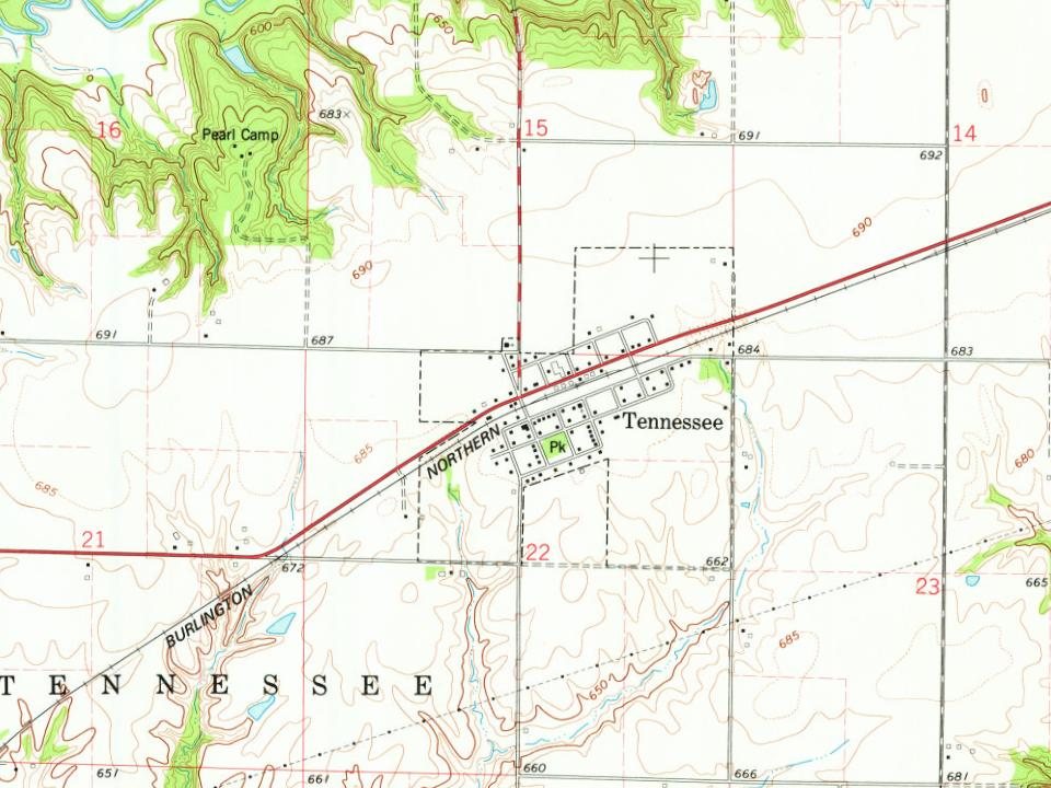
Every edition of the U.S. Geological Survey’s map of Tennessee. Tap a year, or press play to watch the town change.
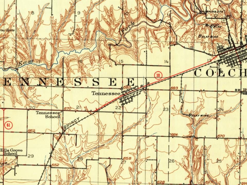
U.S. Geological Survey historical topographic maps (public domain), via Esri’s collection of the scans. The red ring marks the center of Tennessee.
The Tennessee post office opened in 1856, the earliest record of the town by name (U.S. post office records).
What the archives can’t tell you, neighbors can.
Founding dates: Wikidata, Wikipedia, the U.S. post office records of Blevins & Helbock (CC0) and the Census. Homes by year built: Census ACS 2020–24. National Register of Historic Places: National Park Service (list of May 22, 2026). Old photos, postcards and papers: Wikimedia Commons, the Library of Congress and other public archives, credited on each item’s page. Maps: U.S. Geological Survey historical topographic maps (via Esri) and Sanborn fire-insurance maps (Library of Congress). History text and census tables: Wikipedia (CC BY-SA 4.0). Places that used to be: USGS Geographic Names Information System (2021). How TownRatings grades history →
From Wikipedia, U.S. Geological Survey historical maps, U.S. Census counts (via Wikipedia), the US Post Offices dataset (Blevins & Helbock), the USGS Geographic Names Information System and old county and town histories (Internet Archive). Archive images are copied here with their credits and licenses, shown on each photo’s page. Refreshed monthly.