Rockford dates to 1834, and 22% of its homes were built before 1940
More historic than 93% of U.S. towns · #44 of 768 in Illinois. What drives it
34 places in town are on the National Register, among them six historic districts with 786 buildings between them. Below: 4 old photos and papers, maps from 1887 on, and the census since 1860.
Founding year: Wikidata. First post office: 1837.The full story ↓
History grade
What drives Rockford’s History grade
On its age, its old homes and the National Register, Rockford is more historic than 93% of U.S. towns, #44 of 768 in Illinois. All 3 inputs are above most U.S. towns; its National Register listings ranks highest and its share of homes from before 1940 lowest.
A
HistoryA character grade: shown, never part of Rockford’s overall grade.
Among the 400 U.S. cities of 100,000 or more, Rockford ranks #56 on History.
Few Illinois towns list much on the Register (a typical Illinois town has 0.5 per 10,000 residents, the U.S. 2.4), so Rockford’s 55.7 sits above most of its state (91% of Illinois towns have fewer) while its 822 historic buildings outnumber those of 98% of U.S. towns.
How sure. Graded on any two of the three inputs instead, the letter would range from A− to A. The pre-1940 share (±1.1 points) is firm at this size. Two sources give 1834.
Founding year: Wikidata (other dates in Quick answers). Homes: Census ACS 2020–24. National Register: National Park Service, May 2026 list; each listing counted once (boundary changes and added documentation belong to their listing), and a historic district counts its contributing buildings. How TownRatings grades history →
What stands out about Rockford’s past
Read from the archive, the National Register and the record. The page puts what stands out first.
Rockford traces its roots to 1834, as the combined settlements of Midway were founded on both banks of the Rock River. On the west bank, Germanicus Kent and Thatcher Blake (with his slave Lewis Lemon) founded Kentville; the east bank was settled by Daniel Shaw Haight. With the location of the Rock River equidistant between Lake Michigan and the Mississippi River, the combined settlement derived the name "Midway". In 1836, Winnebago County was created (from both Jo Daviess and LaSalle counties), with Midway named as its county seat, as it was "halfway between Galena and Chicago on a line of four-horse coaches."
He was next employed in a responsible capacity by the Edison General Electric Company of New York, from which place he came to Rockford in July, 1892, as general manager of the Rockford City Railway Company. Under his management the Rockford system has been almost entirely rebuilt, new lines have been extended to cover all parts of the city, the service has been
Text read by machine from the scan; it may contain errors.
The History of Winnebago County, Illinois1877 · page 428Read the page →
Read the text
This township, one of the best in the conntj for general agricultural purposes, is bounded on the north by the town of Burritt, east bv the town of Rockford, south by the town of Byron (Ogle County), and west by the town of Seward, and contains an area of 21,089 97-100 acres of land. The first settler was David Adams Holt, who settled here in 1835, making his claim on Section 34.
Text read by machine from the scan; it may contain errors.
The History of Winnebago County, Illinois1877 · page 279Read the page →
Read the text
The ancient date borne by the old court house — 1492 — is the work of one of Rockford's wags, and had its origin in this: The completion of the Rockford Central Railroad, running from Rockford to Rochelle, was signalized by a railroad jubilee — that is to say, the people of Rockford extended an invitation to "all the world and the rest of mankind" to come and see them on that occasion. Ample preparations were made to entertain their guests. The city put on its best. Public and private buildings were handsomely decorated — all but the old court house. Frank Peats was the
Text read by machine from the scan; it may contain errors.
the college was formally founded in 1 85 1 . Up to 1892, it was known as Rockford Female Seminary, but in this year was changed to its present name — Rockford College. The site was purchased from Buell G. Wheeler, and has not changed in its contour except a strip taken from the west end by the Chicago & Iowa railroad.
Text read by machine from the scan; it may contain errors.
Scans and text from the Internet Archive. Books published in 1930 or earlier, which are in the public domain.
Timeline
Rockford, 1834 to 1980
Woven from the archive, old maps, post office records, the National Register and the people born here.
Nothing in the archives for these yearsWeddings on Main Street, storms, parades, school pictures, the old store. If it’s in your family album, it belongs here.
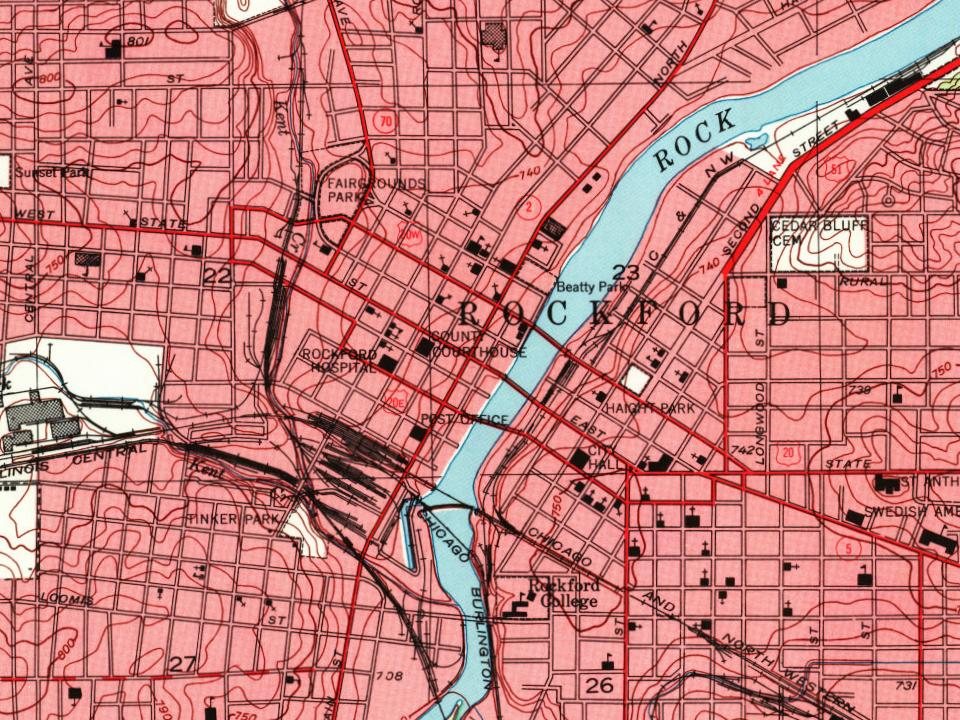
Every edition of the U.S. Geological Survey’s map of Rockford. Tap a year, or press play to watch the town change.
1918Rockford sheet · 1:62,500
U.S. Geological Survey historical topographic maps (public domain), via Esri’s collection of the scans. The red ring marks the center of Rockford.
Every building
Rockford, building by building, 1887–1913
Fire insurance maps drew every building, what it was made of and what it was used for, so insurers could price the risk of fire. Pick a year, then a sheet.
In 1834, according to Wikidata. Rockford’s post office opened in 1837, and the census of 1860 counted 6,979 people here.
How does Rockford rank for history?
Rockford is more historic than 93% of U.S. towns, #44 of 768 in Illinois. The History grade combines the town’s founding era, the share of homes built before 1940 and its National Register listings. It’s a character grade, so it isn’t part of the overall grade. How it works.
What is on the National Register in Rockford?
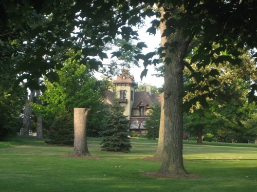
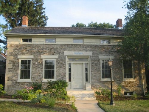
34 listings: 27 buildings, among them the Tinker Swiss Cottage (listed 1972, the first), 6 historic districts with 786 contributing buildings, and 1 site. 822 historic buildings in all.
How old are the homes in Rockford?
22% of Rockford’s homes were built before 1940 (Census estimate, ±1.1 points), against a typical 11% for an Illinois town; the median home was built in 1963.
Founding dates: Wikidata, Wikipedia, the U.S. post office records of Blevins & Helbock (CC0) and the Census. Homes by year built: Census ACS 2020–24. National Register of Historic Places: National Park Service (list of May 22, 2026). Old photos, postcards and papers: Wikimedia Commons, the Library of Congress and other public archives, credited on each item’s page. Maps: U.S. Geological Survey historical topographic maps (via Esri) and Sanborn fire-insurance maps (Library of Congress). History text and census tables: Wikipedia (CC BY-SA 4.0). Places that used to be: USGS Geographic Names Information System (2021).
From Wikimedia Commons (4), Wikidata (2), the National Register of Historic Places (34), Wikipedia, Wikidata and Wikipedia for famous people, U.S. Geological Survey historical maps, U.S. Census counts (via Wikipedia), the US Post Offices dataset (Blevins & Helbock), the USGS Geographic Names Information System, Sanborn fire insurance maps (Library of Congress) and old county and town histories (Internet Archive). Archive images are copied here with their credits and licenses, shown on each photo’s page. Refreshed monthly.





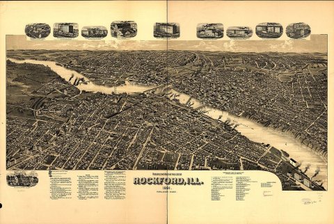


 1876