From Pontiac Township’s archive · credits on each photo
Quick answers
How Pontiac Township began
When was Pontiac Township founded?
1837
The Pontiac Township post office opened in 1837, the earliest record of the town by name. Another post office, Rooks Creek (1847), opened inside today’s town and later closed.
First census: 733 in 18602020 census: 12,290189 years
Founding year: the first Pontiac Township post office (Blevins & Helbock, CC0).The full story ↓
What stands out about Pontiac Township’s past
Read from the archive, the National Register and the record. The page puts what stands out first.
Pontiac was established on July 27, 1837, by Henry Weed and brothers Lucius and Seth M. Young, who aimed to create the county seat for the newly formed Livingston County. Jesse W. Fell named the post office "Pontiac" in honor of the Native American leader. The town was designed during a time of economic depression, and the founders promised land and financial contributions for essential infrastructure, such as a courthouse and a bridge across the Vermilion River. However, within weeks of the town's founding, the Young brothers died, and Weed soon drifted away, leaving others to fulfill the town's early promises. Before leaving the county, Weed had built the first house in Pontiac.
Passages that mention Pontiac Township, cut from the printed page as they were published.
The History of Livingston County, Illinois1878 · page 386Read the page →
Read the text
McDowell, the widow of William McDowell, Nathan Popejoy, who first settled in Pontiac Township, and James Blake, built the first school house. It was a little log cabin, 16x18 feet, having a big wood fire-place that would take in a stick ten feet long ; and in this cabin Breese taught the first school as noted above. James McDowell held the office of School Treasurer for twenty-seven years in succession. Lyman Burgit was the first Treasurer, but died soon after his appointment to the office, when McDowell was elected to succeed him, and held the position until his removal into Indian Grove Township. When he
Text read by machine from the scan; it may contain errors.
Scans and text from the Internet Archive. Books published in 1930 or earlier, which are in the public domain.
By decade
Pontiac Township, decade by decade
4 decades in the archive, from the 1860s to the 1900s. Scroll each row; tap a photo for its story.
Nothing in the archives for these yearsWeddings on Main Street, storms, parades, school pictures, the old store. If it’s in your family album, it belongs here.
Every edition of the U.S. Geological Survey’s map of Pontiac Township. Tap a year, or press play to watch the town change.
1935Pontiac sheet · 1:62,500
U.S. Geological Survey historical topographic maps (public domain), via Esri’s collection of the scans. The red ring marks the center of Pontiac Township.
Then & now
Stand where they stood
No then-and-now pairs yet. Take a photo from the same spot as an old one and they appear here side by side.
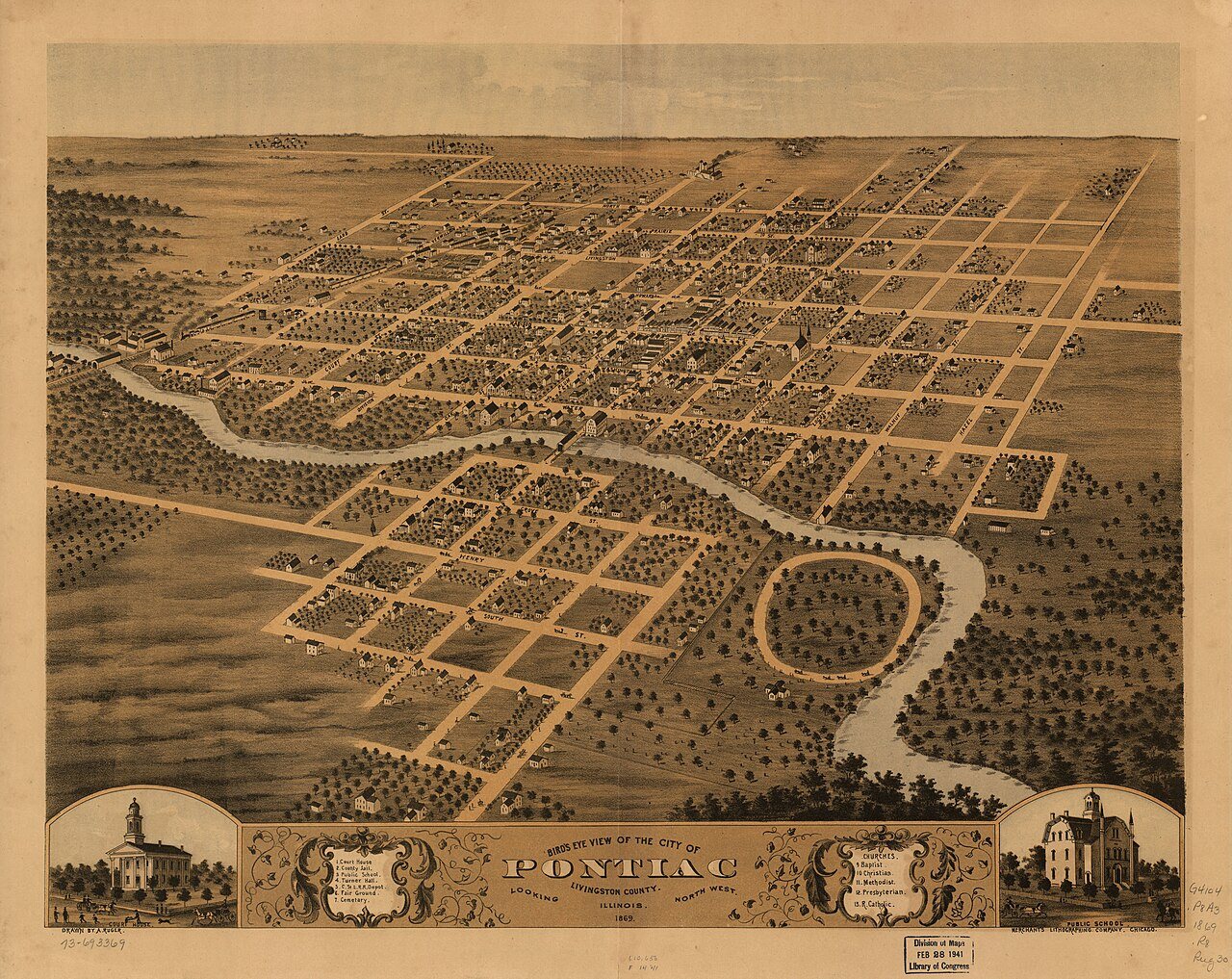
Retake this viewBird's eye view of the city of Pontiac, Livingston County, Illinois 1869, 1869
Find the spot, match the angle, and add your photo. It becomes the first then-and-now pair on Pontiac Township’s page.
Founding dates: Wikidata, Wikipedia, the U.S. post office records of Blevins & Helbock (CC0) and the Census. Homes by year built: Census ACS 2020–24. National Register of Historic Places: National Park Service (list of May 22, 2026). Old photos, postcards and papers: Wikimedia Commons, the Library of Congress and other public archives, credited on each item’s page. Maps: U.S. Geological Survey historical topographic maps (via Esri) and Sanborn fire-insurance maps (Library of Congress). History text and census tables: Wikipedia (CC BY-SA 4.0). Places that used to be: USGS Geographic Names Information System (2021). How TownRatings grades history →
From Wikimedia Commons (12), the Library of Congress (5), Wikidata (1), the National Register of Historic Places (1), Wikipedia, U.S. Geological Survey historical maps, U.S. Census counts (via Wikipedia), the US Post Offices dataset (Blevins & Helbock), the USGS Geographic Names Information System and old county and town histories (Internet Archive). Archive images are copied here with their credits and licenses, shown on each photo’s page. Refreshed monthly.




 1880
 1880
 1890
 1900
 2013
 2012
 2012
 2011
 2008
 2008
 2007
 2007
 2007

