Founding year: Wikidata; Wikipedia’s history section gives the same year. First post office: 1839.The full story ↓
History grade
What drives New Athens’ History grade
On its age, its old homes and the National Register, New Athens is more historic than 71% of U.S. towns. Its share of homes from before 1940 holds the grade up; its National Register listings pull it down.
B+
HistoryA character grade: shown, never part of New Athens’ overall grade.
Few Illinois towns list much on the Register (a typical Illinois town has 0.5 per 10,000 residents, the U.S. 2.4), so New Athens’ 0.0 sits below most of its state (28% of Illinois towns have fewer) while its 0 listings outnumber those of 23% of U.S. towns.
How sure. Graded on any two of the three inputs instead, the letter would range from B− to A. The pre-1940 share is a Census survey estimate (±10.7 points). Two sources give 1836.
Founding year: Wikidata (other dates in Quick answers). Homes: Census ACS 2020–24. National Register: National Park Service, May 2026 list; each listing counted once (boundary changes and added documentation belong to their listing), and a historic district counts its contributing buildings. How TownRatings grades history →
What stands out about New Athens’ past
Read from the archive, the National Register and the record. The page puts what stands out first.
The first organized settlement in what would later become the future town of New Athens, Illinois was Manville Ferry named after early settler and ferryman on the Kaskaskia River, Ira Manville. Manville ran the ferry until his death in 1821. By 1818, the third generation of the Sturdivant family counterfeiters, known as the "Sturdivant Gang", were organized by Roswell S. Sturdivant and his brother, Merrick Sturdivant, who led the criminal organization, would base their southwestern Illinois counterfeiting operations at Manville Ferry and the other part of their criminal operation in southeastern Illinois on the Ohio River at Sturdivant's Fort, in Pope County, Illinois, now present-day Rosiclare, Hardin County, Illinois.
Passages that mention New Athens, cut from the printed page as they were published.
History of St. Clair County, Illinois. With illustrations ... and biographical sketches of some of its prominent men and pioneers1881 · page 49Read the page →
Read the text
still reside in that part of the county. Isaac Quick had a son, Moses Quick, who exhibited considerable enterprise. In the year 1810, in company with Major Jacob Short, he built a flat-boat below the present town of New Athens, which was loaded with beef cattle, and successfully floated down to New Orleans. This is said to have been the first flat-boat that ever navigated the Okaw. John Woods settled some distance south-west of Turkey Hill. Like some others among the early pioneers, he was too liberal a patron
Text read by machine from the scan; it may contain errors.
History of St. Clair County, Illinois. With illustrations ... and biographical sketches of some of its prominent men and pioneers1881 · page 263Read the page →
Read the text
Isaac Hill was licensed to keep a tavern at what is now the village of New Athens in 1816, paying into the County Treasury the sum of four dollars per annum for the privilege. This was the nucleus of the town itself. It drew to the vicinity other settlers, and trade demanded the location of the TOWN OF NEW ATHENS.
Text read by machine from the scan; it may contain errors.
Centennial, McKendree college, with St. Clair County history1928Read the page →
Read the text
Issac Quick had a son, Moses, who was an enterprising young man. In company with Major Jacob Short he built a flat boat, below the present town of New Athens, which was loaded with beef cattle and successfully floated down to New Orleans. This is said to have been the first flat boat that ever navigated the Okaw River.
Text read by machine from the scan; it may contain errors.
Centennial, McKendree college, with St. Clair County history1928Read the page →
Read the text
New Athens was first laid out by Narcisse Pensoneau m 1836. The plat consisted of forty -eight blocks comprising four hundred and sixty-one lots and a public square. The streets are of uniform width, sixty-six feet, except Water street which is ninety-nine. The Illinois Central railroad formerly known as the "Cairo Short Line" crosses the river at this point. The first train crossed the bridge there on New Year's day 1870. It is also on route thirteen of the Illinois
Text read by machine from the scan; it may contain errors.
Scans and text from the Internet Archive. Books published in 1930 or earlier, which are in the public domain.
Timeline
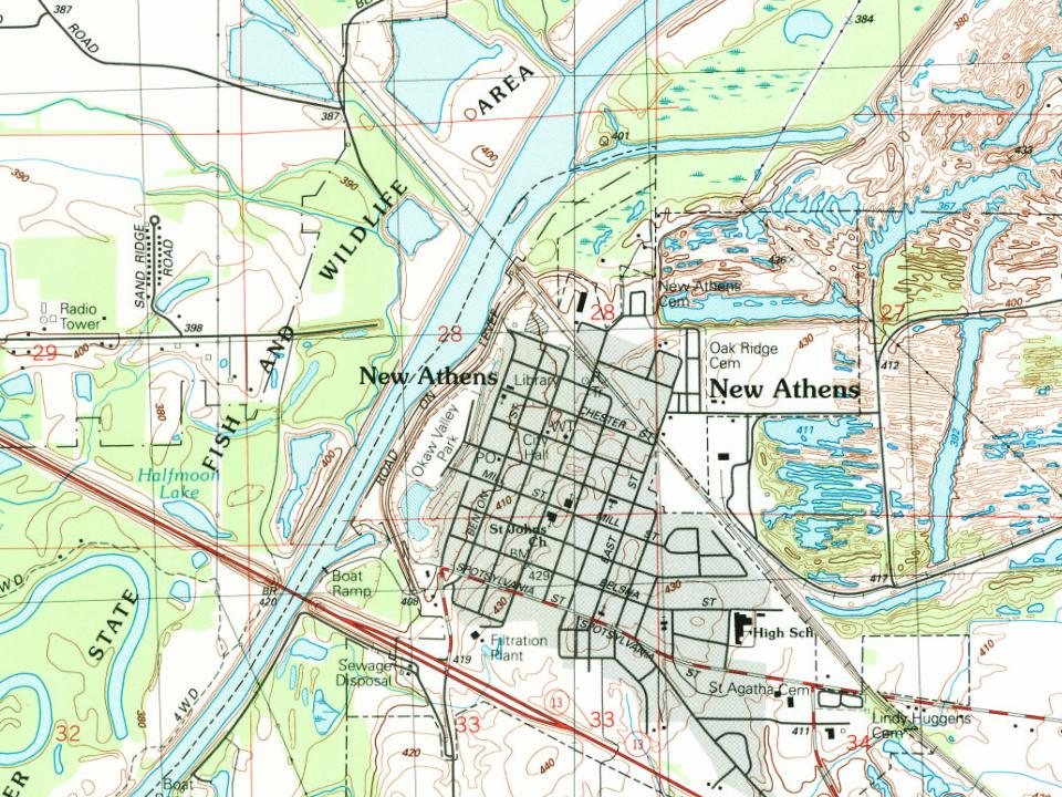
New Athens, 1836 to 1931
Woven from the archive, old maps, post office records, the National Register and the people born here.
In 1836, according to Wikidata and Wikipedia’s history of the town. New Athens’ post office opened in 1839, and the census of 1880 counted 603 people here.
How does New Athens rank for history?
New Athens is more historic than 71% of U.S. towns. The History grade combines the town’s founding era, the share of homes built before 1940 and its National Register listings. It’s a character grade, so it isn’t part of the overall grade. How it works.
How old are the homes in New Athens?
31% of New Athens’ homes were built before 1940 (Census estimate, ±10.7 points), against a typical 11% for an Illinois town; the median home was built in 1958.
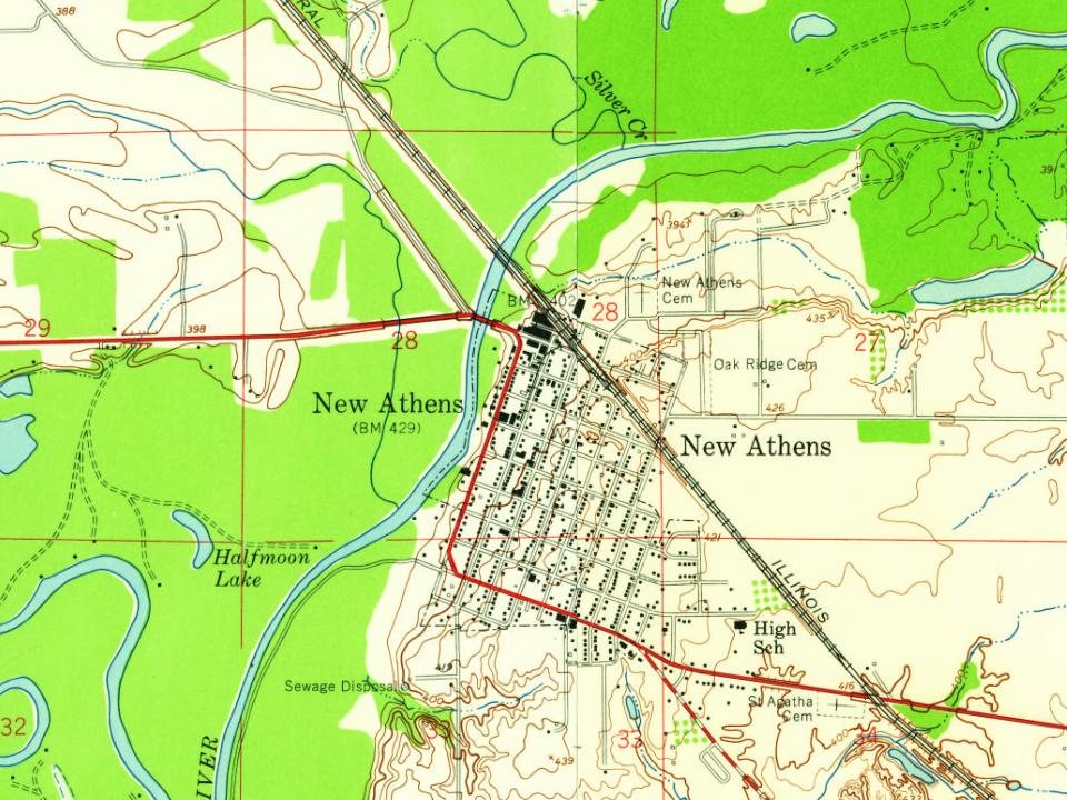
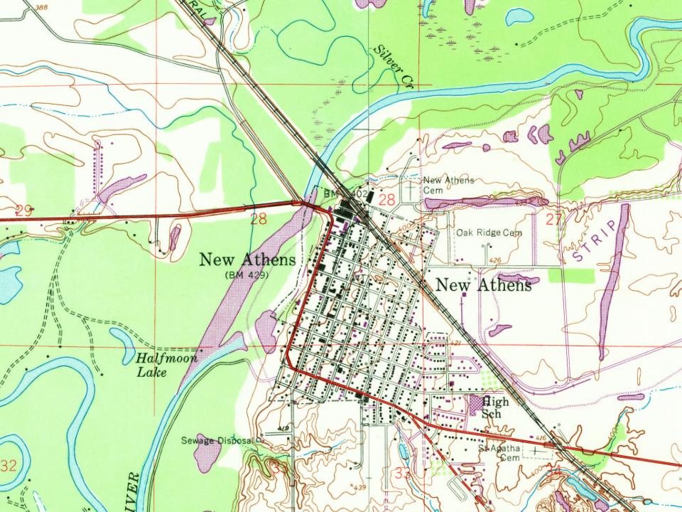
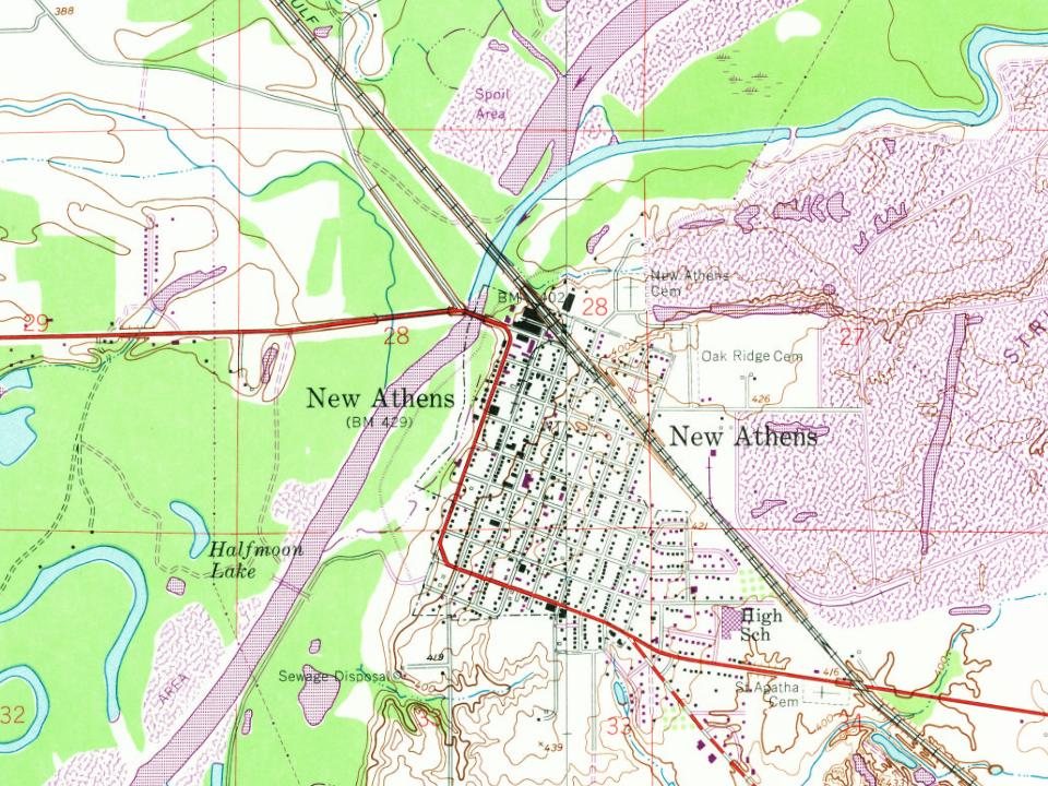
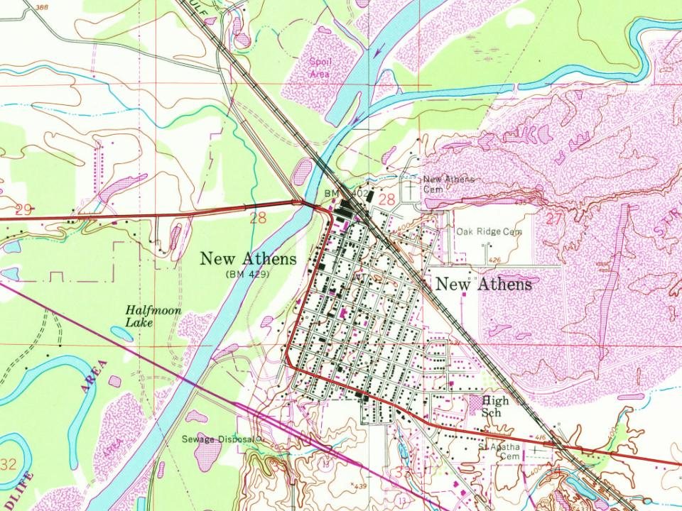
Founding dates: Wikidata, Wikipedia, the U.S. post office records of Blevins & Helbock (CC0) and the Census. Homes by year built: Census ACS 2020–24. National Register of Historic Places: National Park Service (list of May 22, 2026). Old photos, postcards and papers: Wikimedia Commons, the Library of Congress and other public archives, credited on each item’s page. Maps: U.S. Geological Survey historical topographic maps (via Esri) and Sanborn fire-insurance maps (Library of Congress). History text and census tables: Wikipedia (CC BY-SA 4.0). Places that used to be: USGS Geographic Names Information System (2021).
From Wikimedia Commons (1), Wikipedia, Wikidata and Wikipedia for famous people, U.S. Geological Survey historical maps, U.S. Census counts (via Wikipedia), the US Post Offices dataset (Blevins & Helbock), the USGS Geographic Names Information System and old county and town histories (Internet Archive). Archive images are copied here with their credits and licenses, shown on each photo’s page. Refreshed monthly.



 2026