Guest, Sign inJoin

Post to Metamora Township

We’ll email a one-tap link to publish your post. No password, and nothing is public until you click it.
Already a member? Sign in
Metamora-Courthouse-008Photo: ProfDEH · Public domain
–Not graded
History · Metamora Township

Metamora Township dates to 1836, and 15% of its homes were built before 1940

2 places in town are on the National Register. Below: 1 old photo or paper, maps from 1893 on, and the census since 1860.

1836founded
2on the National Register
15%homes built before 1940
1old photo or paper
From Metamora Township’s archive · credits on each photo
Quick answers

How Metamora Township began, and where its name came from

When was Metamora Township founded?

1836

Metamora Township dates its founding to 1836 (Wikidata). The census first counted it in 1860.

First census: 966 in 18602020 census: 4,588190 years

How did Metamora Township get its name?

Metamora Township was named for Hanover, New Hampshire by a consortium of land speculators called the Hanover Company.

More on the name

New post office conventions required towns to have unique names, forcing the town to differentiate itself from others in Illinois named Hanover.

Founding year: Wikidata. First post office: 1836. Name: Wikipedia, licensed CC BY-SA 4.0.The full story ↓

What stands out about Metamora Township’s past

Read from the archive, the National Register and the record. The page puts what stands out first.

★ What stands out · Help out

Start Metamora Township’s collection

The first neighbors to add old photos shape how Metamora Township’s history is told.

Decades since 1900 with photos
00s10s20s30s40s50s60s70s80s90s
0 of 10 decades. The empty ones are waiting for someone’s album.
On the map

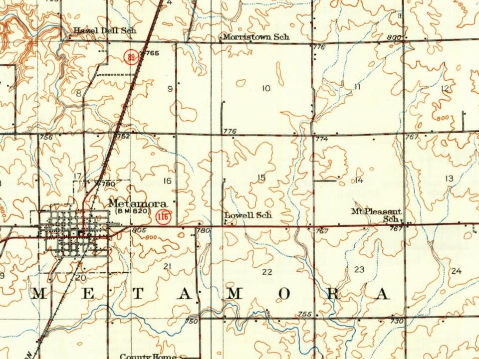
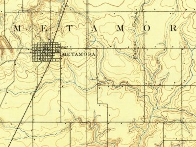
Metamora Township on the map, 1893 to 1972

Every edition of the U.S. Geological Survey’s map of Metamora Township. Tap a year, or press play to watch the town change.

Metamora Township on the 1893 USGS mapMetamora Township on the 1937 USGS mapMetamora Township on the 1948 USGS mapMetamora Township on the 1972 USGS map1893Metamora sheet · 1:62,500

U.S. Geological Survey historical topographic maps (public domain), via Esri’s collection of the scans. The red ring marks the center of Metamora Township.

Timeline

Metamora Township, 1836 to 1893

Woven from the archive, old maps, post office records, the National Register and the people born here.

  1. 19th century
  2. 1836
    FoundingMetamora Township is established
  3. 1836Post officeThe Black Partridge post office opens
  4. 1837Post officeThe Black Partridge post office closes
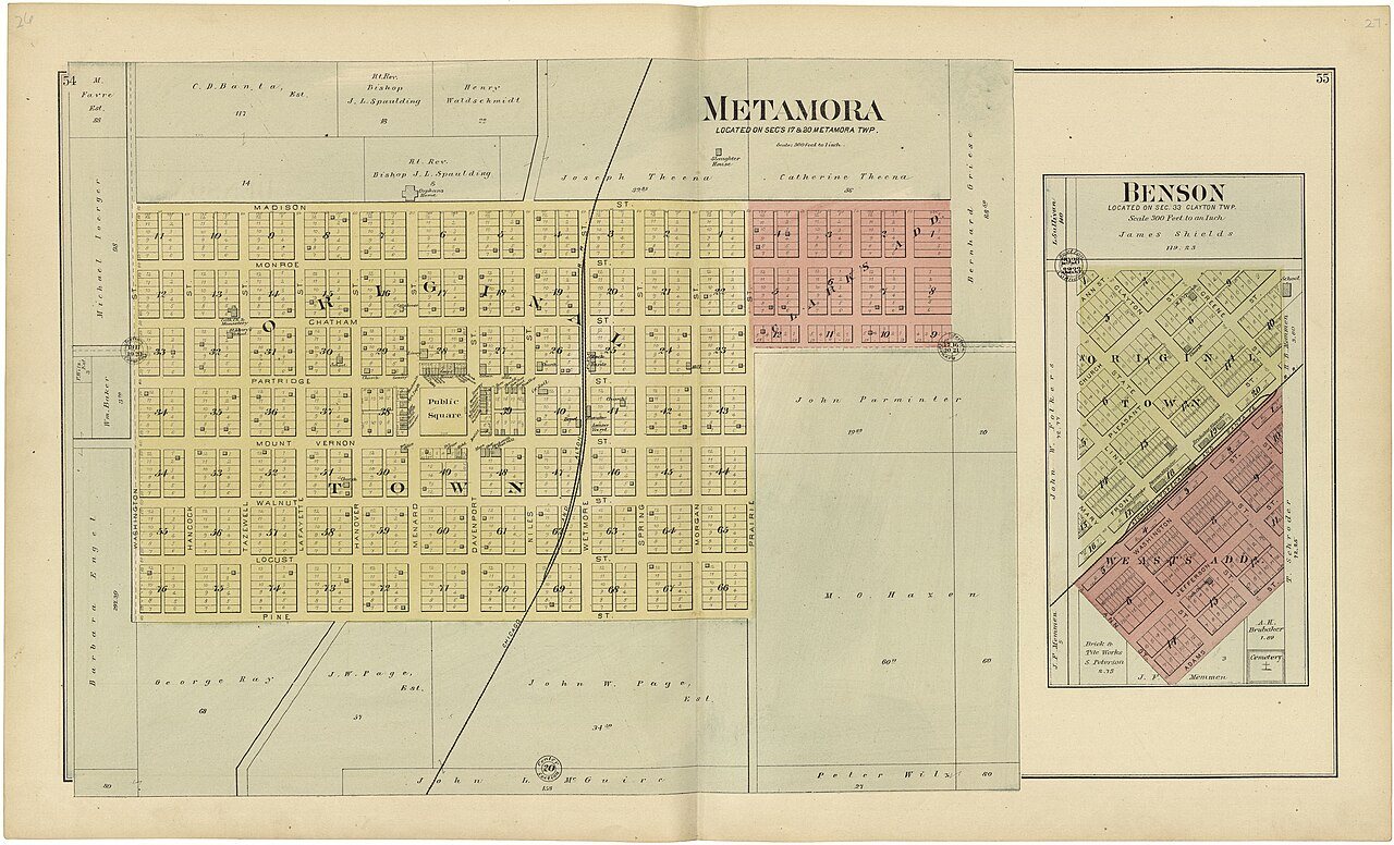
  5. 1893In the archivePlat book of Woodford County, Illinois
  6. 1893On the mapFirst mapped by the U.S. Geological Survey
The story

How Metamora Township came to be

From Wikipedia’s history of Metamora Township.

Read it all →

Metamora was settled by Yankee settlers. These were people from New England who were descended from the English Puritans who settled that region in the 1600s. The first group were settlers from Hanover, New Hampshire, organized by a company from Gilmanton, New Hampshire who named the town Hanover. A New England man named John Page scouted the area for the company and decided that this particular tract of land would be a good place for farms. When they arrived the area was a forest, with no roads and no structures. The New Hampshire settlers cleared the forest, constructed roads and built farms as well as a small town to support the farms. Other New England settlers arrived shortly thereafter from the states of Rhode Island, Vermont and Massachusetts. Metamora was the county seat of Woodford County from 1843 until 1896. The Metamora Courthouse State Historic Site, a courthouse from this…

Text from Wikipedia, licensed CC BY-SA 4.0.

From the old history books

What they wrote about Metamora Township in 1878

Passages that mention Metamora Township, cut from the printed page as they were published.

Metamora Township enjoyed railroad agitation ab« least twenty-five years tigo. In 1856, a route was surveyed for a road, known as the Tonica k Peter.sburg Railroad. The next year it was graded through the township, when the work on it ceased. This constituted the township railroad facilities until …
The Past and present of Woodford County, Illinois1878 · page 287Read the page →
Read the text

Metamora Township enjoyed railroad agitation ab« least twenty-five years tigo. In 1856, a route was surveyed for a road, known as the Tonica k Peter.sburg Railroad. The next year it was graded through the township, when the work on it ceased. This constituted the township railroad facilities until IbTU, when it was completed to the village of Metamora, under the title of the St.

Text read by machine from the scan; it may contain errors.
The facts pertaining to the early settlement of Metamora Township are of historical interest, and comprise as much of importance as any of the early settlements of Woodford County. As early, it is said, as 1823-4, white men had begun to wander this way, and to erect their cabins in the great forest…
The Past and present of Woodford County, Illinois1878 · page 267Read the page →
Read the text

The facts pertaining to the early settlement of Metamora Township are of historical interest, and comprise as much of importance as any of the early settlements of Woodford County. As early, it is said, as 1823-4, white men had begun to wander this way, and to erect their cabins in the great forests bordering Walnut and Partridge Creeks, which have their sources in this township ; but whether so far back as the date above given, is a point subject to some doubt and conjecture. It is, however, pretty generally admitted, that a half a century or more has passed since settlements were first made in this section, and within

Text read by machine from the scan; it may contain errors.

Scans and text from the Internet Archive. Books published in 1930 or earlier, which are in the public domain.

By decade

Metamora Township, decade by decade

One decade in the archive so far: the 1890s. Scroll each row; tap a photo for its story.

Then & now

Stand where they stood

No then-and-now pairs yet. Take a photo from the same spot as an old one and they appear here side by side.

Plat book of Woodford County, Illinois
Retake this viewPlat book of Woodford County, Illinois, 1893

Find the spot, match the angle, and add your photo. It becomes the first then-and-now pair on Metamora Township’s page.

Retake this view · +15
On the National Register

2 historic places in Metamora Township

The country’s official list of buildings and places worth saving.

places listed
2
National Historic Landmarks
0
none yet
historic buildings protected
2
each building in a district counts

National Park Service, National Register of Historic Places. Photos from Wikimedia Commons, credited on each place’s page.

People over time

Metamora Township, census by census

05001,0001,5002,0002,5003,0003,5004,0001900195020003,904

Grew from 966 people in 1860 to 3,904 in 2020, 4 times over.

17 censuses, 1860–2020.

U.S. Census Bureau decennial counts, from the census table on Metamora Township’s Wikipedia page.

Places that used to be

Lost post offices, places now gone and burying grounds

Another post office, Black Partridge, opened and closed inside today’s town.

Gone or out of use
Happy Hour SchoolschoolHazel Dell SchoolschoolLowell SchoolschoolMaple Grove SchoolschoolMorristown SchoolschoolMount Pleasant SchoolschoolTom Schoolschool
5cemeteries and burying grounds inside Metamora Township
Black PartridgeMorsetownOakwoodStewart HarmonyWoodford County Home

US Post Offices dataset (Blevins & Helbock, CC0). Places and cemeteries from the USGS Geographic Names Information System (2021).

Stories next door

History across the town line

Each neighbor’s History grade, on the same three inputs.

Questions about Metamora Township’s history

What year was Metamora Township founded?

In 1836, according to Wikidata. Metamora Township’s post office opened in 1836, and the census of 1860 counted 966 people here.

Memory lane

What the archives can’t tell you, neighbors can.

Town Square →
Start a conversation
Sources

Where this page comes from

Founding dates: Wikidata, Wikipedia, the U.S. post office records of Blevins & Helbock (CC0) and the Census. Homes by year built: Census ACS 2020–24. National Register of Historic Places: National Park Service (list of May 22, 2026). Old photos, postcards and papers: Wikimedia Commons, the Library of Congress and other public archives, credited on each item’s page. Maps: U.S. Geological Survey historical topographic maps (via Esri) and Sanborn fire-insurance maps (Library of Congress). History text and census tables: Wikipedia (CC BY-SA 4.0). Places that used to be: USGS Geographic Names Information System (2021). How TownRatings grades history →

From Wikimedia Commons (10), Wikidata (2), Wikipedia, U.S. Geological Survey historical maps, U.S. Census counts (via Wikipedia), the US Post Offices dataset (Blevins & Helbock), the USGS Geographic Names Information System and old county and town histories (Internet Archive). Archive images are copied here with their credits and licenses, shown on each photo’s page. Refreshed monthly.