Guest, Sign inJoin

Post to Elsah

We’ll email a one-tap link to publish your post. No password, and nothing is public until you click it.
Already a member? Sign in
–Not graded
History · Elsah

Elsah’s post office opened in 1859, and 51% of its homes were built before 1940

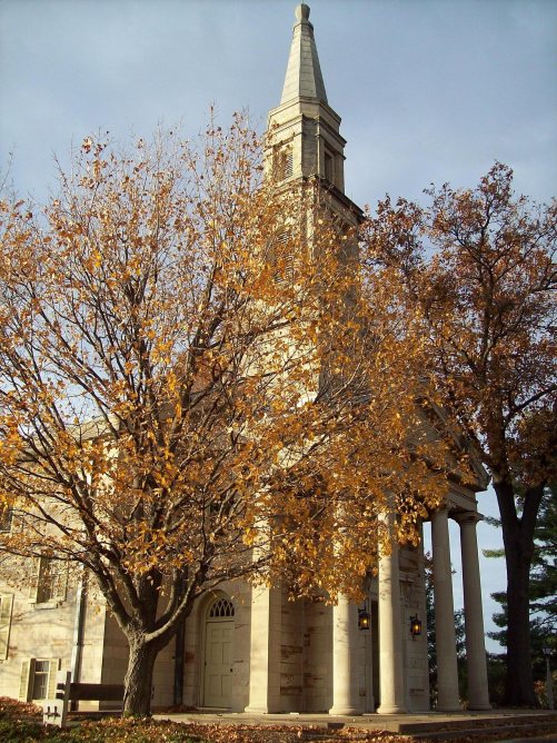
2 places in town are on the National Register, among them the Principia College Historic District, a National Historic Landmark, and two historic districts with 72 buildings between them. Below: 3 old photos and papers, maps from 1921 on, and the census since 1880.

1859first post office
2on the National Register
51%homes built before 1940
3old photos & papers
From Elsah’s archive · credits on each photo
Quick answers

How Elsah began

When was Elsah founded?

1859

The Elsah post office opened in 1859, the earliest record of the town by name. Another post office, Jersey Landing (1852), opened inside today’s town and later closed.

First census: 250 in 18802020 census: 519167 years
Founding year: the first Elsah post office (Blevins & Helbock, CC0).The full story ↓

What stands out about Elsah’s past

Read from the archive, the National Register and the record. The page puts what stands out first.

★ What stands out · Help out

Start Elsah’s collection

The first neighbors to add old photos shape how Elsah’s history is told.

Decades since 1900 with photos
00s10s20s30s40s50s60s70s80s90s
1 of 10 decades. The empty ones are waiting for someone’s album.
People over time

Elsah, census by census

02004006008001,00018801900192019401960198020002020271 in 1890Low: 137

Lost half of its people between 1890 and 1930, then grew 3-fold.

15 censuses, 1880–2020.

U.S. Census Bureau decennial counts, from the census table on Elsah’s Wikipedia page.

On the National Register

2 listings protect 72 historic buildings

The country’s official list of buildings and places worth saving. One is a National Historic Landmark, the highest tier.

places listed
2
National Historic Landmark
1
Principia College Historic District
historic buildings protected
72
each building in a district counts
first listed
1973
Elsah Historic District
Districts★ landmark

Architectural styles listings

Tudor Revival1
Colonial Revival1
Greek Revival1
American Gothic1
Italianate1

National Park Service, National Register of Historic Places. Photos from Wikimedia Commons, credited on each place’s page.

The story

How Elsah came to be

From Wikipedia’s history of Elsah.

Read it all →

James Semple, a local lawyer, prominent politician and United States Senator from Illinois, founded Elsah in 1853 and offered free lots to anyone who built houses with stone from his quarry. It is believed that he named the village of Elsah after Ailsa Craig, the last outcropping his family saw as they departed Scotland for the United States. By 1861, the village had grown to its current size, as geographic and economic limitations prevented further expansion.

Text from Wikipedia, licensed CC BY-SA 4.0.

From the old history books

What they wrote about Elsah in 1919

Passages that mention Elsah, cut from the printed page as they were published.

RAILROADS In 1882, on the first day of January, what is now known as the Chi¬ cago, Peoria & St. Louis Railroad was operated from the station of Bates on the Wabash west of Springfield to Elsah on the Mississippi River. The first train was run over the road on January 1, from Bates, over the top of…
History of Jersey County, Illinois1919 · page 467Read the page →
Read the text

RAILROADS In 1882, on the first day of January, what is now known as the Chi¬ cago, Peoria & St. Louis Railroad was operated from the station of Bates on the Wabash west of Springfield to Elsah on the Mississippi River. The first train was run over the road on January 1, from Bates, over the top of the bluff to Elsah, this being known as the “Shoofly.”

Text read by machine from the scan; it may contain errors.
wife, Addison Greene and other parties, a large body of land in sec¬ tions 17, 18, 19 and 20, township 6, range 11, the three last named being fractional sections along the Mississippi River. On April 7, 1855, he platted the village of Elsah, on the fractional northwest quarter of section 20, exten…
History of Jersey County, Illinois1919 · page 366Read the page →
Read the text

wife, Addison Greene and other parties, a large body of land in sec¬ tions 17, 18, 19 and 20, township 6, range 11, the three last named being fractional sections along the Mississippi River. On April 7, 1855, he platted the village of Elsah, on the fractional northwest quarter of section 20, extending north from the river up what was then known as “Askew Hollow,” named for Col. Josiah T. Askew, who, during his life¬ time, owned a sugar camp there. James Mason had entered this tract in 1820.

Text read by machine from the scan; it may contain errors.

Scans and text from the Internet Archive. Books published in 1930 or earlier, which are in the public domain.

Timeline

Elsah, 1852 to 1993

Woven from the archive, old maps, post office records, the National Register and the people born here.

  1. 19th century
  2. 1852Post officeThe Jersey Landing post office opens
  3. 1859Post officeThe Jersey Landing post office closes
  4. 1859Post officeThe Elsah post office opens
  5. 1895In the archiveEdgar Ames sitting on a porch at Notchcliff, Elsah (Ill.), ca. 1890s
  6. 20th century
  7. 1910In the archiveTakuma Kajiwara and Frederick Oakes Sylvester at
  8. 1927On the mapFirst mapped by the U.S. Geological Survey
  9. 1980CensusPopulation peaks at 990
  10. 1993LandmarkPrincipia College Historic District named a National Historic Landmark
By decade

Elsah, decade by decade

2 decades in the archive, from the 1890s to the 1910s. Scroll each row; tap a photo for its story.

1920s–1990snothing yet
Nothing in the archives for these yearsWeddings on Main Street, storms, parades, school pictures, the old store. If it’s in your family album, it belongs here.
Add from your album
On the map

Elsah on the map, 1927 to 1991

Every edition of the U.S. Geological Survey’s map of Elsah. Tap a year, or press play to watch the town change.

Elsah on the 1927 USGS mapElsah on the 1933 USGS mapElsah on the 1954 USGS mapElsah on the 1968 USGS mapElsah on the 1974 USGS mapElsah on the 1991 USGS map1927St Charles sheet · 1:62,500

U.S. Geological Survey historical topographic maps (public domain), via Esri’s collection of the scans. The red ring marks the center of Elsah.

Every building

Elsah, building by building, 1921

Fire insurance maps drew every building, what it was made of and what it was used for, so insurers could price the risk of fire. Pick a sheet.

Elsah fire insurance map, 1921, sheet 11921Sheet 1 of 1
Sheets
BrickWoodStone

Sanborn Map Company, via the Library of Congress. Editions published in 1930 or earlier, which are in the public domain.

Then & now

Stand where they stood

No then-and-now pairs yet. Take a photo from the same spot as an old one and they appear here side by side.

Edgar Ames sitting on a porch at Notchcliff, Elsah (Ill.), ca. 1890s
Retake this viewEdgar Ames sitting on a porch at Notchcliff, Elsah (Ill.), ca. 1890s, c. 1895

Find the spot, match the angle, and add your photo. It becomes the first then-and-now pair on Elsah’s page.

Retake this view · +15
Famous people

Famous people close to Elsah

Nobody well known was born in Elsah itself, so here are the best known from just nearby.

See all →
Places that used to be

Lost post offices

Elsah’s post office has been open since 1859. Another post office, Jersey Landing, opened and closed inside today’s town.

Jersey Landing
1852–1859
Elsah
1859–today
18501940today

US Post Offices dataset (Blevins & Helbock, CC0). Places and cemeteries from the USGS Geographic Names Information System (2021).

Questions about Elsah’s history

What year was Elsah founded?

The Elsah post office opened in 1859, the earliest record of the town by name (U.S. post office records).

What is on the National Register in Elsah?

Two places: the Principia College Historic District (listed 1993) and the Elsah Historic District (1973).

Memory lane

What the archives can’t tell you, neighbors can.

Town Square →
Start a conversation
Sources

Where this page comes from

Founding dates: Wikidata, Wikipedia, the U.S. post office records of Blevins & Helbock (CC0) and the Census. Homes by year built: Census ACS 2020–24. National Register of Historic Places: National Park Service (list of May 22, 2026). Old photos, postcards and papers: Wikimedia Commons, the Library of Congress and other public archives, credited on each item’s page. Maps: U.S. Geological Survey historical topographic maps (via Esri) and Sanborn fire-insurance maps (Library of Congress). History text and census tables: Wikipedia (CC BY-SA 4.0). Places that used to be: USGS Geographic Names Information System (2021). How TownRatings grades history →

From Wikimedia Commons (5), the Library of Congress (1), the National Register of Historic Places (2), Wikipedia, U.S. Geological Survey historical maps, U.S. Census counts (via Wikipedia), the US Post Offices dataset (Blevins & Helbock), the USGS Geographic Names Information System, Sanborn fire insurance maps (Library of Congress) and old county and town histories (Internet Archive). Archive images are copied here with their credits and licenses, shown on each photo’s page. Refreshed monthly.