Decatur dates to 1823, and 23% of its homes were built before 1940
More historic than 94% of U.S. towns · #36 of 768 in Illinois. What drives it
8 places in town are on the National Register, among them three historic districts with 2,426 buildings between them. Below: 6 old photos and papers, maps from 1887 on, and the census since 1860.
Founding year: Wikidata. First post office: 1831.The full story ↓
History grade
What drives Decatur’s History grade
On its age, its old homes and the National Register, Decatur is more historic than 94% of U.S. towns, #36 of 768 in Illinois. All 3 inputs are above most U.S. towns; its National Register listings ranks highest and its share of homes from before 1940 lowest.
A
HistoryA character grade: shown, never part of Decatur’s overall grade.
Few Illinois towns list much on the Register (a typical Illinois town has 0.5 per 10,000 residents, the U.S. 2.4), so Decatur’s 348 sits above most of its state (98% of Illinois towns have fewer) while its 2,433 historic buildings outnumber those of 99% of U.S. towns.
How sure. Graded on any two of the three inputs instead, the letter would range from A− to A+. The pre-1940 share (±1.5 points) is firm at this size. Two sources give 1823.
Founding year: Wikidata (other dates in Quick answers). Homes: Census ACS 2020–24. National Register: National Park Service, May 2026 list; each listing counted once (boundary changes and added documentation belong to their listing), and a historic district counts its contributing buildings. How TownRatings grades history →
What stands out about Decatur’s past
Read from the archive, the National Register and the record. The page puts what stands out first.
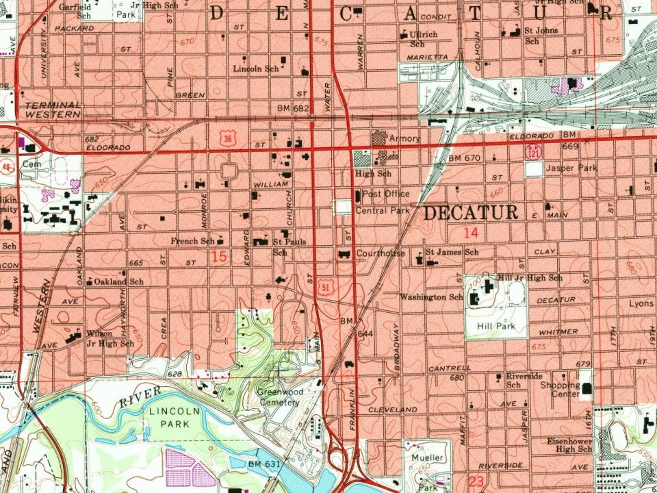
Fire insurance maps drew every building, what it was made of and what it was used for, so insurers could price the risk of fire. Pick a year, then a sheet.
The city is named after War of 1812 naval hero Stephen Decatur. The Potawatomi Trail of Death passed through the city in 1838. Post No. 1 of the Grand Army of the Republic was founded as a fraternal organization composed of veterans of the Union Army (United States Army), Union Navy (U.S. Navy), and the Marines who served in the American Civil War. It was founded in Decatur on April 6, 1866.
Passages that mention Decatur, cut from the printed page as they were published.
Centennial history of Decatur and Macon county1930 · page 209Read the page →
Read the text
He located the line from Springfield to Decatur, and from Decatur to Tolono, also, later on, the road from Decatur to East St. Louis, and was in charge of the construction work of. the latter line from Decatur to Taylorville. He located railroads in various other sections of the country, also. Afterwards he was a partner in business with Charles A. Tuttle, who had been division engineer with the Illinois Central when its line was under construction.
Text read by machine from the scan; it may contain errors.
History of Macon County, Illinois1880 · page 51Read the page →
Read the text
Decatur was legally established, and the rates of charges were fixed by the following orders: “ On application of James Renshaw to keep a tavern in the town of Decatur, it is ordered that license be and is hereby granted to said Renshaw, to keep a tavern in said town of Decatur, for one year from the twenty-sixth day of October, 1829, by his paying four dollars into the county treasury, which is done.1’ UNIVERSID 'll
Text read by machine from the scan; it may contain errors.
History of Macon County, Illinois1880 · page 133Read the page →
Read the text
With the railroad interests of Decatur he has had much to do. He recognized the fact that the prosperity of the place depended largely on its railroad connections, and from 1867 to 1872 was actively engaged in securing new lines to important points. He was connected with the Pekin, Lincoln and Decatur (now the Peoria, Decatur and Evansville) road from the first inception of the enterprise till the road was completed and trains ran into Decatur.
Text read by machine from the scan; it may contain errors.
History of Decatur, Illinois, its resources, advantages for business, and attractions as a home, with a brief sketch of its manufactories, prominent business and professional men. Also, a complete classified business directory1871 · page 16Read the page →
Read the text
Regions convey their cargo direct to Decatur without breaking hulk. The supply ot stone and lime at quarries and kilns within the State and adjacent thereto, by like facilities of railroads, is fully equal to any demand ; and while the immediate vicinity of Decatur is not enriched by natural products of soft wood,, lumber, stone and lime, yet with cheap transportation and a healthy competition purifying in its results in that direction, building in the aggregate, taking into consideration all material
Text read by machine from the scan; it may contain errors.
Scans and text from the Internet Archive. Books published in 1930 or earlier, which are in the public domain.
Timeline
Decatur, 1823 to 1971
Woven from the archive, old maps, post office records, the National Register and the people born here.
Nothing in the archives for these yearsWeddings on Main Street, storms, parades, school pictures, the old store. If it’s in your family album, it belongs here.
Between 3,839 and 93,939 people in every census since 1860.
17 censuses, 1860–2020.
U.S. Census Bureau decennial counts, from the census table on Decatur’s Wikipedia page.
Places that used to be
Old corners, places now gone and burying grounds
Decatur’s post office has been open since 1831.
Hamlets and corners on the map
Faries ParkLarkdaleLongview Place
Gone or out of use
Decatur and Macon County Welfare Home for GirlsbuildingE A Gastman Public SchoolschoolEhrhart SchoolschoolElm Grove SchoolschoolLakeview High SchoolschoolMeyer ClinichospitalRenshaw SchoolschoolTrinity Methodist Episcopal ChurchchurchWalnut Grove Schoolschool
10cemeteries and burying grounds inside Decatur
Boiling SpringsCalvaryFairlawnGracelandGreenwoodNorth ForkSaint Johns LutheranSharonSpanglerWalnut Grove
US Post Offices dataset (Blevins & Helbock, CC0). Places and cemeteries from the USGS Geographic Names Information System (2021).
Help out
Finish Decatur’s story
Most archives stop around 1920. The photos from after that are in family albums, not libraries.
Decades since 1900 with photos
00s10s20s30s40s50s60s70s80s90s
1 of 10 decades. The empty ones are waiting for someone’s album.
In 1823, according to Wikidata. Decatur’s post office opened in 1831, and the census of 1860 counted 3,839 people here.
How does Decatur rank for history?
Decatur is more historic than 94% of U.S. towns, #36 of 768 in Illinois. The History grade combines the town’s founding era, the share of homes built before 1940 and its National Register listings. It’s a character grade, so it isn’t part of the overall grade. How it works.
What is on the National Register in Decatur?
8 listings: 5 buildings, among them the James Millikin House (listed 1974, the first), and 3 historic districts, the Decatur Historic District, the Decatur Downtown Historic District and the West End Historic District, with 2,426 contributing buildings. 2,433 historic buildings in all.
How old are the homes in Decatur?
23% of Decatur’s homes were built before 1940 (Census estimate, ±1.5 points), against a typical 11% for an Illinois town; the median home was built in 1960.
Founding dates: Wikidata, Wikipedia, the U.S. post office records of Blevins & Helbock (CC0) and the Census. Homes by year built: Census ACS 2020–24. National Register of Historic Places: National Park Service (list of May 22, 2026). Old photos, postcards and papers: Wikimedia Commons, the Library of Congress and other public archives, credited on each item’s page. Maps: U.S. Geological Survey historical topographic maps (via Esri) and Sanborn fire-insurance maps (Library of Congress). History text and census tables: Wikipedia (CC BY-SA 4.0). Places that used to be: USGS Geographic Names Information System (2021).
From Wikimedia Commons (6), the National Register of Historic Places (8), Wikipedia, Wikidata and Wikipedia for famous people, U.S. Geological Survey historical maps, U.S. Census counts (via Wikipedia), the US Post Offices dataset (Blevins & Helbock), the USGS Geographic Names Information System, Sanborn fire insurance maps (Library of Congress) and old county and town histories (Internet Archive). Archive images are copied here with their credits and licenses, shown on each photo’s page. Refreshed monthly.
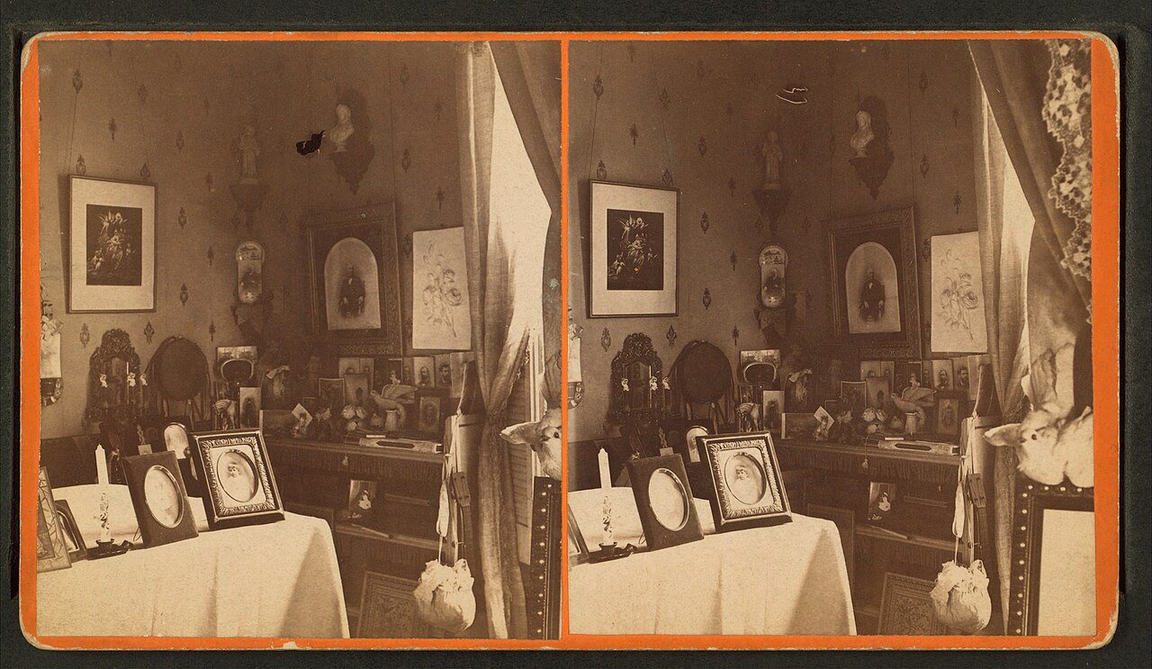


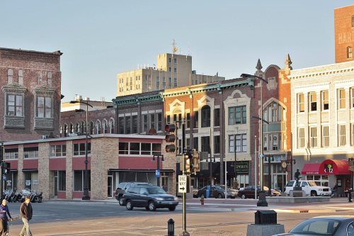




 c. 1865
 1869
 1908