Columbia’s post office opened in 1822, and 1 of its places is on the National Register
More historic than 66% of U.S. towns · #281 of 768 in Illinois. What drives it
Most of Columbia was built recently: 8% of its homes predate 1940 and the median home dates from 1991. Its Register listing is the Gundlach-Grosse House. Below: 6 old photos and papers, maps from 1894 on, and the census since 1850.
Founding year: the first Columbia post office (Blevins & Helbock, CC0). Wikidata: 1859.The full story ↓
History grade
What drives Columbia’s History grade
On its age, its old homes and the National Register, Columbia is more historic than 66% of U.S. towns, #281 of 768 in Illinois. Its age holds the grade up; its share of homes from before 1940 pulls it down.
B+
HistoryA character grade: shown, never part of Columbia’s overall grade.
Few Illinois towns list much on the Register (a typical Illinois town has 0.5 per 10,000 residents, the U.S. 2.4), so Columbia’s 1.8 sits above most of its state (66% of Illinois towns have fewer) while its 2 historic buildings outnumber those of 60% of U.S. towns.
How sure. Graded on any two of the three inputs instead, the letter would range from B− to A−. The pre-1940 share (±2.3 points) is firm at this size. The founding year is the first post office, not a stated founding date; Wikidata gives 1859.
Founding year: the first post office (other dates in Quick answers). Homes: Census ACS 2020–24. National Register: National Park Service, May 2026 list; each listing counted once (boundary changes and added documentation belong to their listing), and a historic district counts its contributing buildings. How TownRatings grades history →
What stands out about Columbia’s past
Read from the archive, the National Register and the record. The page puts what stands out first.
Fire insurance maps drew every building, what it was made of and what it was used for, so insurers could price the risk of fire. Pick a year, then a sheet.
Columbia was first incorporated in 1859 as a small farming settlement, but had been occupied by various Native American cultures for 12,000 years. The earliest group encountered by European settlers were members of what became the Illinois Confederation, though they had moved to the area from the Great Lakes region only a few centuries before.
Passages that mention Columbia, cut from the printed page as they were published.
Statistical gazetteer of the state of Maryland, and the District of Columbia1856 · page 137Read the page →
Read the text
The portion of territory ceded by Maryland to the General Government, and incorporated with the District of Columbia, was set off between 1790 and 1800. The number of its inhabitants in the latter year should be properly taken into account, in stating the population of Maryland, when the second census was taken. But the figures could not be conveniently admitted into the tables. The number of whites, with whom were reckoned a few free colored persons, was- 8,144, and of slaves, 2,072. Adding these amounts to the figures in the lines referring to the census of 1800, it will be seen that but for this cession of terri-
Text read by machine from the scan; it may contain errors.
At this point it will be interesting, also instructive, to pause for a moment to enquire into the manner of the naming of British Columbia. Heretofore the term Columbia, as far as the West was concerned, had only been applied to the Columbia River and sometimes to the Western Department of the Hudson’s Bay Company, which was quite frequently termed the Columbia Department. It was proposed at first to name the country New Caledonia, by which appellation, indeed, it had been known for some time, but the Government of France objected to that name being given to the pro-
Text read by machine from the scan; it may contain errors.
Sketch of the natural history of the District of Columbia together with an indexed ed. of the U. S. Geological survey's 1917 map of Washington and vicinity.1918Read the page →
Read the text
Maps of the District of Columbia and City of Washington and Plats of the Squares and Lots of the City of Washington. Printed in pursuance of a resolution of the Senate of the United States, 1852. Contains 3 large maps as follows: Map of the City of Washington in the District of Columbia, Established as the Permanent Seat of the Government of the United States of America, 1839; Reprint of map of the Territory of Columbia by Andrew Ellicott (1793) ?; Plan of the City of Washington in the Territory of
Text read by machine from the scan; it may contain errors.
the Dominion authorities. The delegates left Victoria for Ottawa on May 10th, 1870, and on July 7th the Terms were agreed upon, the Dominion accepting almost in their entirety British Columbia’s proposals. The most important clause in the treaty between Canada and British Columbia, known as the Terms of Union, provided for the construction of a railway to connect the seaboard of British Columbia with the railway system of Canada. That famous provision, the interpretation of which gave rise to so much ill-feeling and controversy in after years, reads:
Text read by machine from the scan; it may contain errors.
Scans and text from the Internet Archive. Books published in 1930 or earlier, which are in the public domain.
By decade
Columbia, decade by decade
One decade in the archive so far: the 1930s. Scroll each row; tap a photo for its story.
Nothing in the archives for these yearsWeddings on Main Street, storms, parades, school pictures, the old store. If it’s in your family album, it belongs here.
The Columbia post office opened in 1822, the earliest record of the town by name (U.S. post office records). Wikidata gives 1859.
How does Columbia rank for history?
Columbia is more historic than 66% of U.S. towns, #281 of 768 in Illinois. The History grade combines the town’s founding era, the share of homes built before 1940 and its National Register listings. It’s a character grade, so it isn’t part of the overall grade. How it works.
What is on the National Register in Columbia?
One place: the Gundlach-Grosse House (listed 1978).
How old are the homes in Columbia?
8% of Columbia’s homes were built before 1940 (Census estimate, ±2.3 points), against a typical 11% for an Illinois town; the median home was built in 1991.
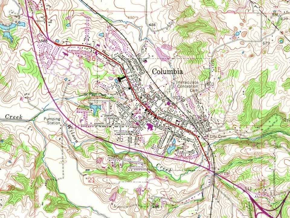
Founding dates: Wikidata, Wikipedia, the U.S. post office records of Blevins & Helbock (CC0) and the Census. Homes by year built: Census ACS 2020–24. National Register of Historic Places: National Park Service (list of May 22, 2026). Old photos, postcards and papers: Wikimedia Commons, the Library of Congress and other public archives, credited on each item’s page. Maps: U.S. Geological Survey historical topographic maps (via Esri) and Sanborn fire-insurance maps (Library of Congress). History text and census tables: Wikipedia (CC BY-SA 4.0). Places that used to be: USGS Geographic Names Information System (2021).
From Wikimedia Commons (6), the National Register of Historic Places (1), Wikipedia, Wikidata and Wikipedia for famous people, U.S. Geological Survey historical maps, U.S. Census counts (via Wikipedia), the US Post Offices dataset (Blevins & Helbock), the USGS Geographic Names Information System, Sanborn fire insurance maps (Library of Congress) and old county and town histories (Internet Archive). Archive images are copied here with their credits and licenses, shown on each photo’s page. Refreshed monthly.
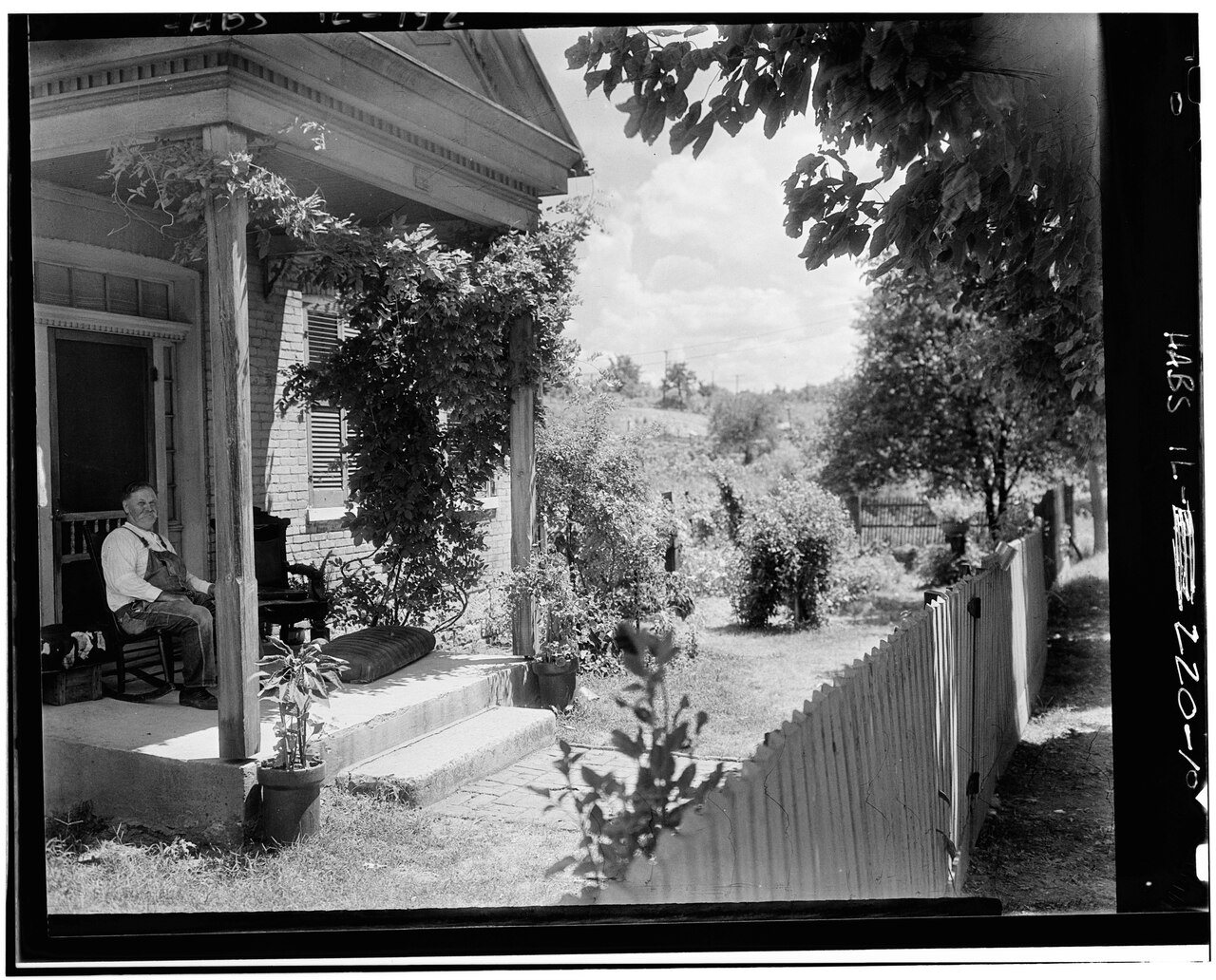




 1933
 1933
 1933
 1933
 1933

