West Des Moines dates to 1893, and 7 of its places are on the National Register
More historic than 42% of U.S. towns · #106 of 140 in Iowa. What drives it
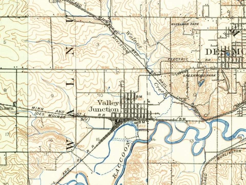
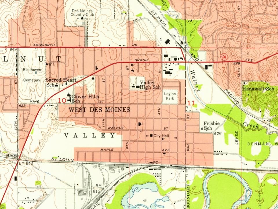
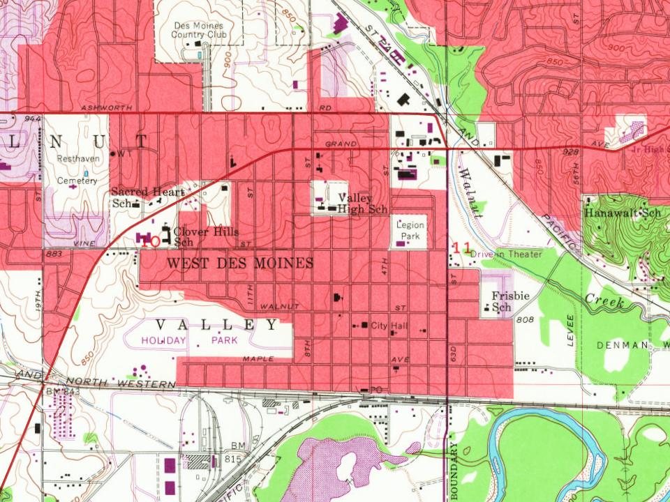
Most of West Des Moines was built recently: 4% of its homes predate 1940 and the median home dates from 1994. 7 places in town are on the National Register, among them a historic district with 52 buildings. Below: maps from 1905 on and the census since 1900.
Founding year: Wikidata. First post office: 1868.The full story ↓
History grade
What drives West Des Moines’ History grade
On its age, its old homes and the National Register, West Des Moines is more historic than 42% of U.S. towns, #106 of 140 in Iowa. Its National Register listings hold the grade up; its share of homes from before 1940 pulls it down.
C+
HistoryA character grade: shown, never part of West Des Moines’ overall grade.
Iowa towns list more on the Register than most of the country (a typical Iowa town has 9.1 per 10,000 residents, the U.S. 2.4), so West Des Moines’ 8.2 sits near the middle of its state (53% of Iowa towns have fewer) while its 58 historic buildings outnumber those of 86% of U.S. towns.
How sure. Graded on any two of the three inputs instead, the letter would range from C− to B−. The pre-1940 share (±0.9 points) is firm at this size. Two sources give 1893.
Founding year: Wikidata (other dates in Quick answers). Homes: Census ACS 2020–24. National Register: National Park Service, May 2026 list; each listing counted once (boundary changes and added documentation belong to their listing), and a historic district counts its contributing buildings. How TownRatings grades history →
What stands out about West Des Moines’ past
Read from the archive, the National Register and the record. The page puts what stands out first.
Lost post offices, old corners, places now gone and burying grounds
West Des Moines had its own post office from 1938 to 1972. Five other post offices opened and closed inside today’s town.
Commerce
1868–1944
Nordyk
1868–1876
Commerce Mills
1870–1881
Ashawa
1871–1904
Valley Junction
1871–1938
West Des Moines
1938–1972
18601940today
Hamlets and corners on the map
AshawaCommerceValley JunctionWestern Village Mobile Home Park
Gone or out of use
AshawalocaleAshawa Post Officepost officeCommerce Post Officepost officeNordyklocaleNordyke Post Officepost officePonderosa Public Golf CourselocaleWest Des Moines Post Officepost office
4cemeteries and burying grounds inside West Des Moines
HustonJordanResthavenSaint Johns
US Post Offices dataset (Blevins & Helbock, CC0). Places and cemeteries from the USGS Geographic Names Information System (2021).
Help out
Start West Des Moines’s collection
The first neighbors to add old photos shape how West Des Moines’s history is told.
Decades since 1900 with photos
00s10s20s30s40s50s60s70s80s90s
0 of 10 decades. The empty ones are waiting for someone’s album.
The West Des Moines area used to be home to the Sac and Meskwaki peoples. Near the stroke of midnight on October 11, 1845, a gunshot was fired by a cattle farmer, James Cunningham Jordan (1813–1891) to declare that the area was open for Anglo-European settlement. His residence, the Jordan House, has been restored and is now an historical home museum and home to the West Des Moines Historical Society. The Jordan House was a stop on the Underground Railroad, and abolitionist John Brown visited the Jordan property multiple times, at least once while escorting a group of freedom-seeking enslaved people to Canada. In West Des Moines' early years, the town was a trading and shipping junction. West Des Moines incorporated as the city of Valley Junction on October 9, 1893.
Passages that mention West Des Moines, cut from the printed page as they were published.
The history of Polk County, Iowa1880 · page 269Read the page →
Read the text
much suffering, as the heavy snows of 1848. At Fort Des Moines the river overflowed its banks, and a current having washed its way westward near where is now Walnut street bridge, formed a channel around through what is the chief business quarter of West Des Moines. It is said by persons who were then here that they had to construct a raft in order to be able to cross the street from the place of business to the hotel. Early in the summer the quantity of rainfall gradually diminished and the water in the streams subsided. The flood was at its highest point during the latter
Text read by machine from the scan; it may contain errors.
Scans and text from the Internet Archive. Books published in 1930 or earlier, which are in the public domain.
Timeline
West Des Moines, 1868 to 2005
Woven from the archive, old maps, post office records, the National Register and the people born here.
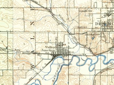
Every edition of the U.S. Geological Survey’s map of West Des Moines. Tap a year, or press play to watch the town change.
1905Des Moines sheet · 1:62,500
U.S. Geological Survey historical topographic maps (public domain), via Esri’s collection of the scans. The red ring marks the center of West Des Moines.
People over time
West Des Moines, census by census
Grew from 1,700 people in 1900 to 68,723 in 2020, more than tenfold.
13 censuses, 1900–2020.
U.S. Census Bureau decennial counts, from the census table on West Des Moines’ Wikipedia page.
Famous people
7 famous people were born in West Des Moines
Writers, athletes, leaders and more, ranked by how widely they’re known.
In 1893, according to Wikidata. West Des Moines’ post office opened in 1868, and the census of 1900 counted 1,700 people here.
How does West Des Moines rank for history?
West Des Moines is more historic than 42% of U.S. towns, #106 of 140 in Iowa. The History grade combines the town’s founding era, the share of homes built before 1940 and its National Register listings. It’s a character grade, so it isn’t part of the overall grade. How it works.
What is on the National Register in West Des Moines?
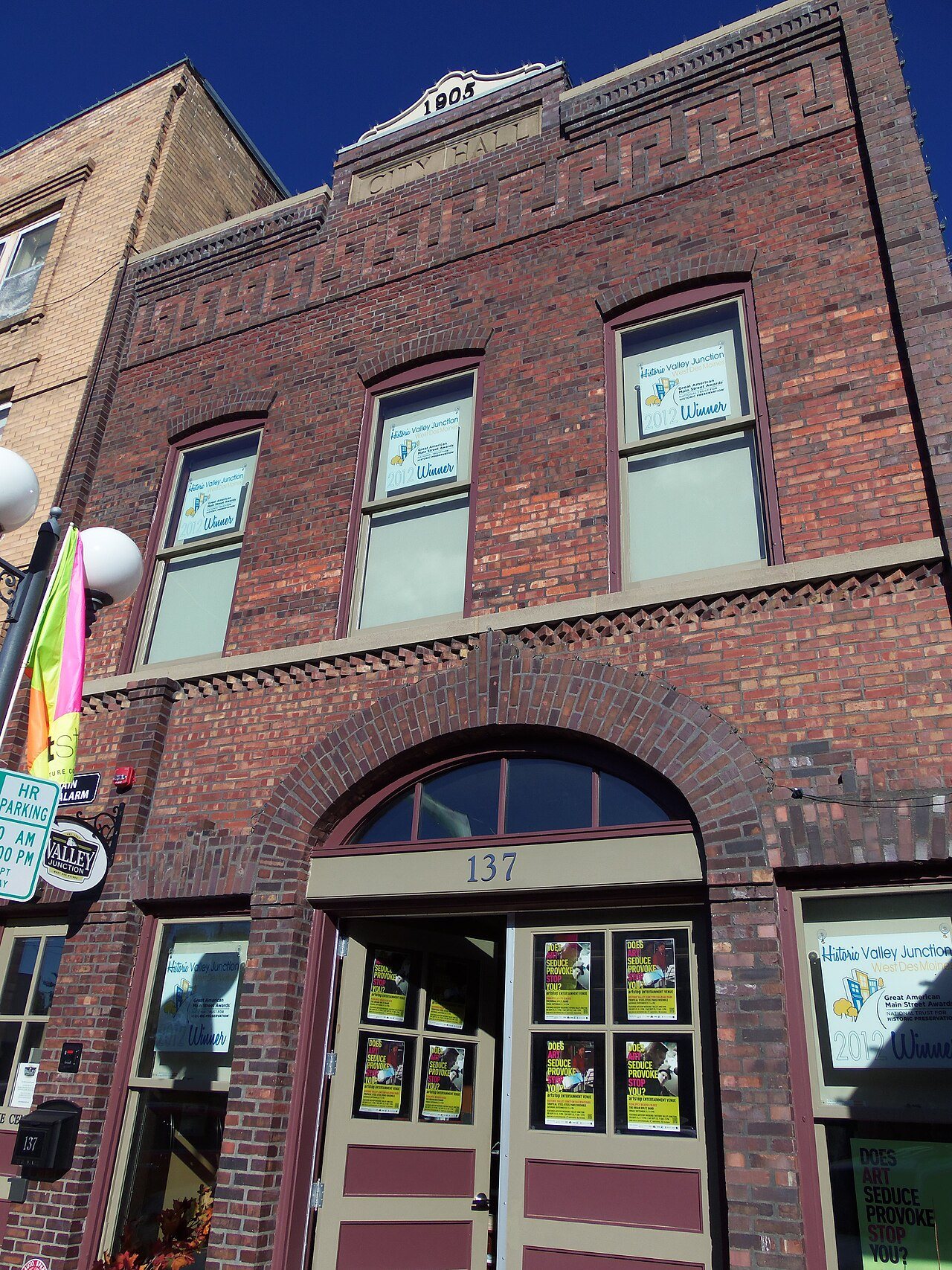
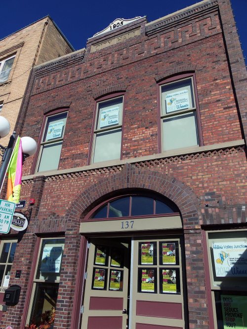
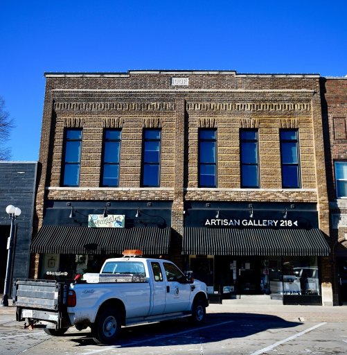
7 listings: 6 buildings, among them the Jordan House (listed 1973, the first), and 1 historic district, the Valley Junction Commercial Historic District, with 52 contributing buildings. 58 historic buildings in all.
How old are the homes in West Des Moines?
4% of West Des Moines’ homes were built before 1940 (Census estimate), against a typical 22% for an Iowa town; the median home was built in 1994.
Founding dates: Wikidata, Wikipedia, the U.S. post office records of Blevins & Helbock (CC0) and the Census. Homes by year built: Census ACS 2020–24. National Register of Historic Places: National Park Service (list of May 22, 2026). Old photos, postcards and papers: Wikimedia Commons, the Library of Congress and other public archives, credited on each item’s page. Maps: U.S. Geological Survey historical topographic maps (via Esri) and Sanborn fire-insurance maps (Library of Congress). History text and census tables: Wikipedia (CC BY-SA 4.0). Places that used to be: USGS Geographic Names Information System (2021).
From Wikimedia Commons (10), Wikidata (2), the National Register of Historic Places (7), Wikipedia, Wikidata and Wikipedia for famous people, U.S. Geological Survey historical maps, U.S. Census counts (via Wikipedia), the US Post Offices dataset (Blevins & Helbock), the USGS Geographic Names Information System and old county and town histories (Internet Archive). Archive images are copied here with their credits and licenses, shown on each photo’s page. Refreshed monthly.







 2019
 2019
 2019
 2018
 2016
 2014
 2010
 2008
 2004
 2004