Waukee dates to 1869, and 1 of its places is on the National Register
More historic than 23% of U.S. towns · #122 of 140 in Iowa. What drives it
Most of Waukee was built recently: 2% of its homes predate 1940 and the median home dates from 2011. Its Register listing is the St. Boniface Catholic Church. Its Register listing is the St. Boniface Catholic Church. Below: maps from 1908 on and the census since 1880.
Founding year: Wikipedia. First post office: 1869.The full story ↓
History grade
What drives Waukee’s History grade
On its age, its old homes and the National Register, Waukee is more historic than 23% of U.S. towns, #122 of 140 in Iowa. Its National Register listings hold the grade up; its share of homes from before 1940 pulls it down.
C−
HistoryA character grade: shown, never part of Waukee’s overall grade.
Iowa towns list more on the Register than most of the country (a typical Iowa town has 9.1 per 10,000 residents, the U.S. 2.4), so Waukee’s 0.3 sits below most of its state (34% of Iowa towns have fewer) while its 1 listings outnumber those of 51% of U.S. towns.
How sure. Graded on any two of the three inputs instead, the letter would range from C− to C. The pre-1940 share (±1.0 points) is firm at this size. Two sources give 1869.
Founding year: Wikipedia (other dates in Quick answers). Homes: Census ACS 2020–24. National Register: National Park Service, May 2026 list; each listing counted once (boundary changes and added documentation belong to their listing), and a historic district counts its contributing buildings. How TownRatings grades history →
What stands out about Waukee’s past
Read from the archive, the National Register and the record. The page puts what stands out first.
Passages that mention Waukee, cut from the printed page as they were published.
The History of Dallas County, Iowa, containing a history of the county, its cities, towns, &c. ..1879 · page 384Read the page →
Read the text
met with any considerable degree of success until during the last year by indomitable energy and unflinching pluck of the enterprising citizens and leading men of Adel a narrow gauge railroad has been constructed and put in running order from Waukee to Adel, which is destined before many years to traverse the county and connect Des Moines and Panora by a narrow gauge railroad, giving new life and energy to all the towns along its line, and perfecting the railroad conveniences of Dallas county by a central railroad through its county seat.
Text read by machine from the scan; it may contain errors.
The History of Dallas County, Iowa, containing a history of the county, its cities, towns, &c. ..1879 · page 541Read the page →
Read the text
east over two main roads to Chicago. Being situated so near Des Moines, also makes Grant a good feeding and shipping point. It has no town or post-office within its limits, but Dallas Center being so near, and Minburn and Waukee not far distant, the facilities for trading and market are comparatively convenient, and these three post-offices, together with Snyder, P. 0., so near the north line, in Des Moines township, all parts of the township can easily get and send mail matter. » Mr. Humphrey was the first settler in Grant township. He settled on
Text read by machine from the scan; it may contain errors.
Scans and text from the Internet Archive. Books published in 1930 or earlier, which are in the public domain.
Timeline
Waukee, 1869 to 2002
Woven from the archive, old maps, post office records, the National Register and the people born here.
In 1869, according to Wikipedia’s history of the town. Waukee’s post office opened in 1869, and the census of 1880 counted 245 people here.
How does Waukee rank for history?
Waukee is more historic than 23% of U.S. towns, #122 of 140 in Iowa. The History grade combines the town’s founding era, the share of homes built before 1940 and its National Register listings. It’s a character grade, so it isn’t part of the overall grade. How it works.
What is on the National Register in Waukee?
One place: the St. Boniface Catholic Church (listed 2024).
How old are the homes in Waukee?
2% of Waukee’s homes were built before 1940 (Census estimate, ±1.0 points), against a typical 22% for an Iowa town; the median home was built in 2011.
Founding dates: Wikidata, Wikipedia, the U.S. post office records of Blevins & Helbock (CC0) and the Census. Homes by year built: Census ACS 2020–24. National Register of Historic Places: National Park Service (list of May 22, 2026). Old photos, postcards and papers: Wikimedia Commons, the Library of Congress and other public archives, credited on each item’s page. Maps: U.S. Geological Survey historical topographic maps (via Esri) and Sanborn fire-insurance maps (Library of Congress). History text and census tables: Wikipedia (CC BY-SA 4.0). Places that used to be: USGS Geographic Names Information System (2021).
From Wikimedia Commons (4), the National Register of Historic Places (1), Wikipedia, Wikidata and Wikipedia for famous people, U.S. Geological Survey historical maps, U.S. Census counts (via Wikipedia), the US Post Offices dataset (Blevins & Helbock), the USGS Geographic Names Information System and old county and town histories (Internet Archive). Archive images are copied here with their credits and licenses, shown on each photo’s page. Refreshed monthly.


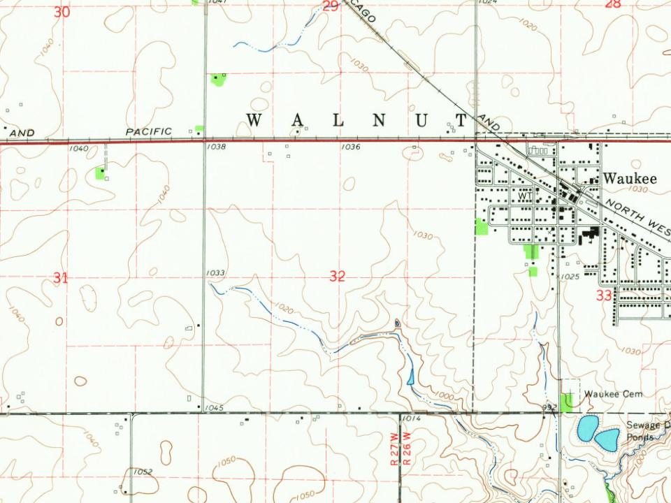


 2025
 2021
 2008
 2004