Guest, Sign inJoin

Post to Urban Honolulu

We’ll email a one-tap link to publish your post. No password, and nothing is public until you click it.
Already a member? Sign in
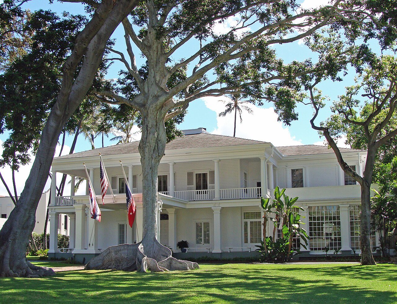
Washington PlaceWashington Place · Photo: CaesarGJ · Public domain
AOutdoors
Outdoors in Urban Honolulu

30% of Urban Honolulu’s land is conserved: 11,640 acres

106 miles of mapped trail cross Urban Honolulu, 1.7 per square mile of land. 97% of residents live within a half mile of a park. The biggest trail networks: Round Top Forest Reserve (40.4 mi), Honolulu Forest Reserve (14.4 mi), Sand Island State Recreation Area (2.1 mi).

Ahead of 90% of U.S. towns · #7 of 93 in Hawaii. What drives it

Conserved land
30%
11,640 acres · of 60.6 sq mi of land
Trails
106 mi
1.7 per sq mi of land
Park land
2,457 ac
7.1 acres per 1,000 residents
Near a park
97%
of residents within ½ mile
Bike routes
62 mi
25 mi lanes · 18 mi paths
Highest peak
2,779 ft
Kahoʻomoe ʻihikapulani
Lakes & rivers
16
28 beaches · 4 boat launches

What kind of outdoors town is Urban Honolulu?

Read from the map. The page puts what stands out first.

Outdoors grade

How much outdoors does Urban Honolulu have?

On conserved land, trails, park land and how close residents live to a park, Urban Honolulu is ahead of 90% of U.S. towns, #7 of 93 in Hawaii. Conserved land holds the grade up; park acres per resident pull it down.

A
OutdoorsA character grade: shown, never part of Urban Honolulu’s overall grade.
All U.S. towns we grade (21,298)Ahead of 90%
LessMore
Hawaii towns of 2,500+ (93)Ahead of 93%

Among the 400 U.S. cities of 100,000 or more, Urban Honolulu ranks #82 on Outdoors.

Hawaii towns conserve more land than most (a typical one, 14%; the U.S., 4%), so Urban Honolulu’s 30% is ahead of 79% of Hawaii towns, while its trails per square mile lead 89% of them.

Water is 11% of Urban Honolulu’s area (8 of 68 square miles), so every share here is of land; over land and water together, the conserved share would read 27%.

Park acres per resident are where Urban Honolulu trails most U.S. towns: 7.1 per 1,000 against 12.6 typical, since 345,482 people share 2,457 acres.

How sure. Graded on any three of the four inputs instead, the letter would range from A− to A+. Trails and many small parks come from OpenStreetMap, mapped by volunteers, so coverage varies from town to town; the half mile is a straight line from each census block, so a river or highway in the way isn’t counted against it.

PAD-US, OpenStreetMap (© OpenStreetMap contributors), Census 2025 Gazetteer and 2020 blocks; details in Sources below. How TownRatings grades the outdoors →

The map

Conserved land, trails & bike routes

Tap a number to zoom to a park. Tap a layer to hide it.

12345678
Easements protect land from building but are usually private.© OpenStreetMap contributors · USGS PAD-US
Places to walk

Pick a walk

The longest trail network is Round Top Forest Reserve, with 40.4 miles. Directions go to the nearest trailhead or public parking.

Round Top Forest Reserve

Managed by State of Hawaii
8,265 acres40.4 mi of trail
Ka'au Crater TrailKapalama TrailWa'ahila TrailPuʻu Kōnāhuanui Ridge Trail+1
Dog rules not recorded
Directionsto the trailhead

Honolulu Forest Reserve

Managed by State of Hawaiʻi
4,772 acres14.4 mi of trail
Tripler Ridge TrailBowman Ridge TrailKulana’ahane TrailMoanalua Ridge Trail+1
Dog rules not recorded
Directionsto the parking lot

Sand Island State Recreation Area

Managed by State of Hawaii - Division of State Parks
146 acres2.1 mi of trail
Dog rules not recorded
Directionsto the parking lotWebsite ↗

Diamond Head State Monument

Managed by Hawai'i State Parks
499 acres1.8 mi of trail
Diamond Head Summit Trail
Dog rules not recorded
Directionsto the trailheadWebsite ↗

Keʻehi Lagoon Beach Park

Park
57 acres0.9 mi of trail
Dog rules not recorded
Directionsto the parking lot

Ala Puumalu Community Park

Park
26 acres0.9 mi of trail
Dog rules not recorded
Directionsto the parking lot

Waʻahila Ridge State Recreation Area

Park
27 acres0.7 mi of trail
Kalepohaku Lower TrailWaahila Mountain Bike RouteWa'ahila TrailBravery Rock Mini-Trail
Dog rules not recorded
Directionsto the parking lot

Ala Moana Beach Park

Managed by City and County of Honolulu Department of Parks and Recreation
97 acres0.5 mi of trail
Dog rules not recorded
Directionsto the parking lot
All 92 parks & preserves
Round Top Forest Reserve8,265 acres · 40.4 mi of trail · State of Hawaii
Directions
Honolulu Forest Reserve4,772 acres · 14.4 mi of trail · State of Hawaiʻi
Directions
Sand Island State Recreation Area146 acres · 2.1 mi of trail · State of Hawaii - Division of State Parks
Directions
Diamond Head State Monument499 acres · 1.8 mi of trail · Hawai'i State Parks
Directions
Keʻehi Lagoon Beach Park57 acres · 0.9 mi of trail
Directions
Ala Puumalu Community Park26 acres · 0.9 mi of trail
Directions
Waʻahila Ridge State Recreation Area27 acres · 0.7 mi of trail
Directions
Ala Moana Beach Park97 acres · 0.5 mi of trail · City and County of Honolulu Department of Parks and Recreation
Directions
Aala Park7 acres · 0.5 mi of trail
Directions
Fort De Russy71 acres · 0.4 mi of trail · United States Army
Directions
Kakaako Waterfront Park24 acres · 0.4 mi of trail
Directions
Old Honolulu Stadium Park7 acres · 0.4 mi of trail · City and County of Honolulu Department of Parks and Recreation
Directions
Thomas Square7 acres · 0.4 mi of trail · City and County of Honolulu
Directions
Honolulu Zoo36 acres · 0.3 mi of trail
Directions
Kapiolani Regional Park94 acres · 0.2 mi of trail
Directions
Kaau Crater36 acres · 0.2 mi of trail
Manoa Valley District Park28 acres · 0.2 mi of trail
Directions
Ala Wai Community Park22 acres · 0.2 mi of trail
Directions
Diamond Head Beach Park19 acres · 0.2 mi of trail · City and County of Honolulu
Directions
Fort DeRussy Beach Park17 acres · 0.2 mi of trail
Directions
Kaimuki District Park2 acres · 0.2 mi of trail · City and County of Honolulu Department of Parks and Recreation
Directions
Moanalua Community Park14 acres · 0.1 mi of trail
Directions
Ke'ehi Lagoon Memorial11 acres · 0.1 mi of trail
Directions
Kewalo Basin Park4 acres · 0.1 mi of trail
Directions
Kakaako Makai Park3 acres · 0.1 mi of trail
Directions
Waiʻalae Beach Park2 acres · 0.1 mi of trail
Directions
Pu'unui Community Park2 acres · 0.1 mi of trail · City and County of Honolulu
Japanese Garden2 acres · 0.1 mi of trail
Directions
Na Pueo Mini Park1 acres · 0.1 mi of trail
Directions
Likini Street Mini Park1 acres · 0.1 mi of trail
Directions
Waikīkī Gateway Park1 acres · 0.1 mi of trail
Directions
Waikīkī-Diamond Head Shoreline Fisheries Management Area237 acres · State of Hawaiʻi Division of Aquatic Resources
Directions
Waikīkī MLCD80 acres · State of Hawaiʻi Division of Aquatic Resources
Directions
Mauumae Nature Park32 acres
Moanalua Gardens20 acres
Directions
Salt Lake District Park12 acres
Directions
Palolo Valley Recreational Park11 acres · City and County of Honolulu Department of Parks and Recreation
Directions
Palm Circle11 acres
ʻIolani Palace Grounds11 acres
Directions
McCarthy Mall10 acres
Directions
Makiki District Park9 acres · City and County of Honolulu
Directions
Kanewai Community Park9 acres · City and County of Honolulu Department of Parks and Recreation
Directions
Kalihi Valley District Park9 acres
Directions
Kāhala Community Park9 acres · City and County of Honolulu
Directions
Kamehemeha Community Park8 acres · City and County of Honolulu
Directions
Beretania Community Park5 acres
Directions
Nuuanu Valley Park5 acres
Directions
Kapaolono Community Park5 acres
Booth District Park5 acres
Kamāmalu Playground5 acres
Directions
Kuilei Cliffs Beach Park5 acres
Directions
Wilson Community Park5 acres · City and County of Honolulu
Directions
Kilauea District Park4 acres · City and County of Honolulu
Directions
Crane Community Park4 acres · City and County of Honolulu
Directions
Petrie Community Park4 acres
Hunakai Park4 acres
Hoa Aloha Neighborhood Park4 acres
Directions
Paki Community Park4 acres
Directions
Kaimana Beach Park4 acres
Directions
Kamanele Park4 acres
Directions
Fort Ruger Mini Park4 acres
Directions
Moiliili Triangle Park & Baseball Fields3 acres · City and County of Honolulu Department of Parks and Recreation
Directions
Victoria Ward Park3 acres · Victoria Ward
Directions
Dole Park3 acres
Directions
Mother Waldron Park3 acres
Directions
Puu O Kaimuki Mini Park3 acres
Kawananakoa Neighborhood Park3 acres
Directions
Kakaako Makai Gateway Park3 acres
Directions
Ala Wai Promenade2 acres
Directions
Archie Baker Mini Park2 acres
Queen Kapiolani Park2 acres
Directions
Alewa Neighborhood Park2 acres
Pāwaʻa In-Ha Park2 acres
Directions
McCully District Park2 acres
Directions
Sheridan Community Park2 acres · City and County of Honolulu
Directions
Loi Kalo Mini Park2 acres
Directions
Auwaiolimu Neighborhood Park2 acres
Directions
Kolowalu Park1 acres
Directions
Gulston Park1 acres
Lē'ahi Beach Park1 acres
State of HI, Department of Agriculture's Tree Park1 acres
Directions
Park at Chaminade University1 acres
Directions
Papakolea Community Park1 acres
Kalo Place Mini Park1 acres
Directions
Puu Panani Park1 acres
Kamalii Mini Park1 acres
Directions
Tamarind Park1 acres
Directions
Pukele Avenue Mini Park1 acres · City and County of Honolulu Department of Parks and Recreation
Directions
Punahou Square Park1 acres · City of Honolulu
Directions
Walker Park1 acres
Directions
Lau‘ula Park1 acres
Directions
Dr. Sun Yat-Sen Memorial Park1 acres
Directions
Who protects it

11,640 conserved acres

30% of Urban Honolulu’s land. Water is left out: Urban Honolulu has 60.6 square miles of land and 7.8 of water, so the share counts land only. Who manages Urban Honolulu’s conserved land, from the USGS Protected Areas Database. Approximate, because parcels can overlap.

State Department of Land5,740 ac
County4,531 ac
Private owners1,531 ac
State parks826 ac
Land trusts & nonprofits101 ac
State natural resources43 ac
Joint21 ac
State Resource Management Area · 5,744 acLocal Other or Unknown · 3,334 acWatershed Protection Area · 1,270 acLocal Park · 1,203 acState Historic or Cultural Area · 504 ac
Good to know

Conserved doesn’t always mean open to visitors. Public access isn’t recorded for 3 of 116 parcels. The walks above are places people visit.

The biggest protected parcels
Parcel (PAD-US)Managed byAcresPublic access
State Department of Land State Resource Management Area
State Resource Management Area
State Department of Land5,727Open
County Land Local Other or Unknown
Local Other or Unknown
County3,334Unknown
Private Landowner Watershed Protection Area
Watershed Protection Area
Private owners1,270Closed
Diamond Head State Monument
State Historic or Cultural Area
State parks504Open
Honolulu Country Club
Local Park
Private owners176Open
Sand Island State Recreation Area
State Park
State parks145Open
Ala Wai Golf Course
Local Recreation Area
County144Open
Kapiolani Regional Park
Local Park
County123Open
Ala Moana Regional Park
Local Park
County112Open
Ho‘oulu ‘Āina
Local Conservation Area
Land trusts & nonprofits100Open

5 smaller protected places aren’t shown.

Things to do

248 places to go in Urban Honolulu

Beaches, playgrounds, peaks, falls and more. Pick a kind.

Beaches in Urban Honolulu
Ala Moana Beach
Directions
Cromwell's Beach
Directions
Hunakai Beach
Directions
Kaimana beach
Directions
Lē'ahi BeachHours: 05:00-22:00 · In Waikīkī-Diamond Head Shoreline Fisheries Management Area
Directions
Magic Island lagoon
Directions
Mākālei BeachHours: 05:00-22:00
Directions
Queen Kapi'olani BeachIn Diamond Head Beach Park
Directions
2 more beaches
Thukkie Beach
Directions
Waikīkī Beach
Directions

Plus 18 beaches without a name on the map. Tap “Show all on map” to see them.

Trails & water

25 named trails and 16 lakes & rivers

Named trails
Unpaved · 38.6 mi
Ka'au Crater Trail3.8 mi
Kapalama Trail3.6 mi
Tripler Ridge Trail3.5 mi
Bowman Ridge Trail3.1 mi
Lanipo Ridge Trail3.1 mi
Wa'ahila Trail2.5 mi
Puʻu Kōnāhuanui Ridge Trail2.1 mi
Manoa Cliff Trail1.9 mi
Nu'uanu Trail1.8 mi
Kulana’ahane Trail1.8 mi
15 more trails
Moanalua Ridge Trail
1.7 mi
Makiki Valley Trail
1.3 mi
Kalawahine Trail
1.3 mi
Waahila Mountain Bike Route
1.3 mi
Aihualama
1.2 mi
Judd Trail
1.2 mi
Manoa Contour Trail
1.1 mi
Kalepohaku Lower Trail
1.1 mi
Pu'u Pia trail
1.0 mi
Moanalua Valley Trail
1.0 mi
Manoa Middle Ridge Trail
1.0 mi
Waipuilani Falls Trail
0.9 mi
Kolowalu Trail
0.9 mi
Kanealole Trail
0.8 mi
'Ualaka'a Trail
0.8 mi
Lakes & rivers tap for directions
Biking & sports

62 miles of bike routes

Bike lanes are often missing from the map in smaller towns, so that number is likely low.

25 mi
painted or protected bike lanes
18 mi
off-road bike paths
19 mi
shoulders & shared lanes
Courts & fields
256Tennis
193Basketball
59Baseball
22Volleyball
21Pickleball
9Football
6Soccer
4Softball

Includes school and college facilities, which aren’t always open to the public.

History along the way

92 places on the National Register, 4 of them National Historic Landmarks

The country’s official list of places worth saving (National Park Service). The map also marks 50 historic points from OpenStreetMap: plaques, memorials and old buildings.

History →
★
Iolani PalaceNational Historic Landmark · Building · listed 1966
About it
★
Kawaiahao Church and Mission HousesNational Historic Landmark · Building · listed 1966
About it
★
Washington PlaceNational Historic Landmark · Building · listed 1973
About it
★
Palm Circle Historic DistrictNational Historic Landmark · District · listed 1984
About it
Aliiolani HaleBuilding · listed 1972
About it
Honolulu Academy of ArtsBuilding · listed 1972
About it
Thomas SquareSite · listed 1972
About it
Kamehameha V Post OfficeBuilding · listed 1972
About it
Moana HotelBuilding · listed 1972
About it
Punahou School CampusDistrict · listed 1972
About it
Queen Emma's Summer HomeBuilding · listed 1972
About it
Royal MausoleumBuilding · listed 1972
About it

80 more on the History page.

When to get out

The best walking months in Urban Honolulu: April to June and August

NOAA’s 1991–2020 normals for the town and the daylight at its latitude. Outlined months have long days, highs of 59 to 86 °F and little rain for the place.

JanFebMarAprMayJunJulAugSepOctNovDec
Daylight (h)11.011.412.012.613.113.413.312.912.211.611.110.8
High (°F)767676767878798081807876
Rain (in)10.69.113.712.99.312.915.412.712.212.915.114.2

February is the driest month (9.1 in) and September the warmest (highs of 81 °F). 15.4 inches fall in July, the wettest month. The climate in Urban Honolulu →

Next door

Urban Honolulu and its neighbors

Urban Honolulu has the most mapped trails of the 4 towns around it. Tap a town to see its outdoors.

TownConserved
of land
Trail mi
per sq mi
Park acres
per 1,000
Near a park
½ mile
Outdoors
Urban Honolulu30%1.7797%A
East Honolulu26%1.43685%A
Hickam Housing1%1.2588%B
Halawa17%0.5499%+A−

The four inputs of the Outdoors grade, from the engine; shares are of land, not water.

Questions about parks and trails in Urban Honolulu

Where can I hike in Urban Honolulu?

The longest trail networks: Round Top Forest Reserve, 40.4 miles; Honolulu Forest Reserve, 14.4 miles; Sand Island State Recreation Area, 2.1 miles; Diamond Head State Monument, 1.8 miles. Each one is on the map above, with directions to the nearest trailhead or parking.

How much of Urban Honolulu is conserved land?

30% of its land, against a typical 14% for a Hawaii town and 4% nationally (PAD-US). Conserved doesn’t always mean open to visitors: easements are usually private land.

Are dogs allowed on Urban Honolulu’s trails?

Round Top Forest Reserve and Honolulu Forest Reserve don’t have dog rules recorded on the map; check the signs at the trailhead.

Where can I bike in Urban Honolulu?

62 miles of bike routes are on the map: 25 of painted or protected lanes, 18 of off-road paths and 19 of shoulders and shared lanes.

Is there public land near Urban Honolulu?

30,023 acres of parks and open public land lie inside Urban Honolulu or within 10 miles of it (PAD-US), 7,250 of them inside the town line.

How much outdoors does Urban Honolulu have?

Ahead of 90% of U.S. towns on the Outdoors grade, #7 of 93 in Hawaii. The grade combines the share of land that is conserved, miles of mapped trail per square mile of land, park acres per 1,000 residents and the share of residents within a half mile of a park. It’s a character grade, so it isn’t part of the overall grade. How it works.

Trail talk

Conditions, parking and favorite walks from Urban Honolulu neighbors.

Town Square →
Share a tip
Sources

Where this page comes from

Conserved and public land: USGS Protected Areas Database of the United States (PAD-US), service updated July 2026. Parks, trails, playgrounds, beaches and other places: OpenStreetMap (© OpenStreetMap contributors, ODbL), map data as of 2026-10-28. Land and water area: Census 2025 Gazetteer. Residents near a park: 2020 Census blocks. National Register: National Park Service. How TownRatings grades the outdoors →