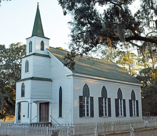
Walthourville’s post office opened in 1837, and 1 of its places is on the National Register
More historic than 43% of U.S. towns · #131 of 263 in Georgia. What drives it
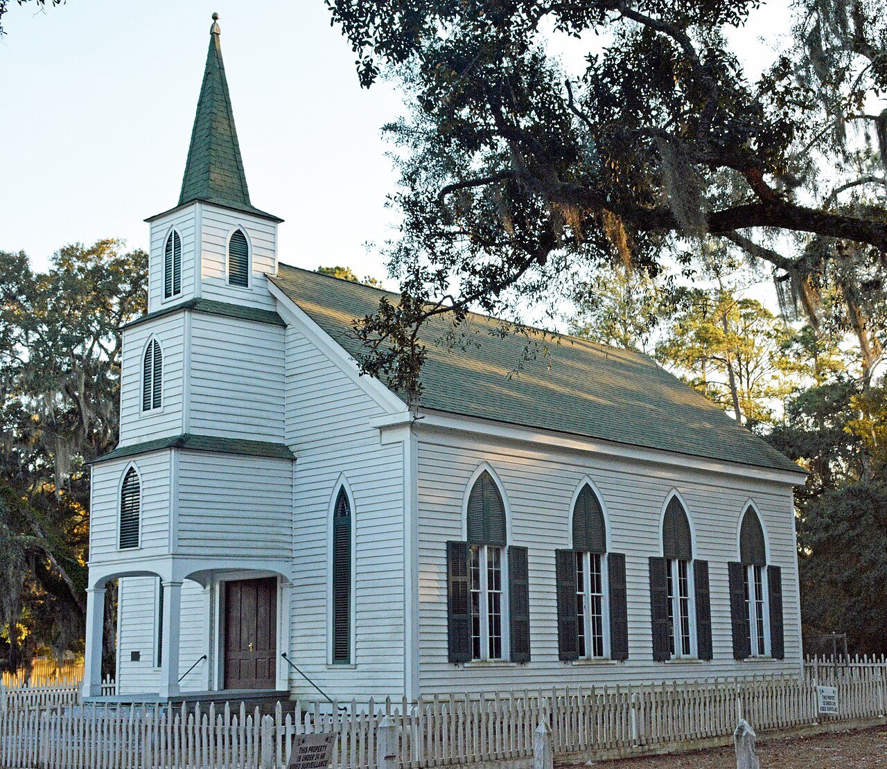
Most of Walthourville was built recently: 2% of its homes predate 1940 and the median home dates from 1996. Its Register listing is the Walthourville Presbyterian Church. Below: maps from 1918 on and the census since 1980.
The Walthourville post office opened in 1837, the earliest record of the town by name. Another post office, Lambert (1895), opened inside today’s city and later closed.
First census: 905 in 19802020 census: 3,680189 years
How historic is Walthourville?
C+
More historic than 43% of U.S. towns, on its age, its old homes and the National Register.
Founding year: the first Walthourville post office (Blevins & Helbock, CC0).The full story ↓
History grade
What drives Walthourville’s History grade
On its age, its old homes and the National Register, Walthourville is more historic than 43% of U.S. towns, #131 of 263 in Georgia. Its age holds the grade up; its share of homes from before 1940 pulls it down.
C+
HistoryA character grade: shown, never part of Walthourville’s overall grade.
Georgia towns list more on the Register than most of the country (a typical Georgia town has 10.0 per 10,000 residents, the U.S. 2.4), so Walthourville’s 2.6 sits near the middle of its state (39% of Georgia towns have fewer) while its 1 listings outnumber those of 51% of U.S. towns.
How sure. Graded on any two of the three inputs instead, the letter would range from C− to B. The pre-1940 share (±2.2 points) is firm at this size. The founding year is the first post office, not a stated founding date.
Founding year: the first post office (other dates in Quick answers). Homes: Census ACS 2020–24. National Register: National Park Service, May 2026 list; each listing counted once (boundary changes and added documentation belong to their listing), and a historic district counts its contributing buildings. How TownRatings grades history →
What stands out about Walthourville’s past
Read from the archive, the National Register and the record. The page puts what stands out first.
Every edition of the U.S. Geological Survey’s map of Walthourville. Tap a year, or press play to watch the town change.
1918Hinesville sheet · 1:62,500
U.S. Geological Survey historical topographic maps (public domain), via Esri’s collection of the scans. The red ring marks the center of Walthourville.
Timeline
Walthourville, 1814 to 1951
Woven from the archive, old maps, post office records, the National Register and the people born here.
Walthourville draws its name from Andrew Walthour, a revolutionary soldier and a physician who established a plantation in the area circa 1795. The Walthourville Presbyterian Church was originally housed in a structure, erected in 1820, which served as a meeting place for both Baptists and Presbyterians. In 1845 a Presbyterian church was erected, which was destroyed by fire in 1877. The following year a new church was completed, with that structure being destroyed in a storm in 1881. The present church was dedicated in July 1884.
The Walthourville Academy, a non-sectarian co-educational school, was founded in 1823. A post office was established on July 3, 1837
Passages that mention Walthourville, cut from the printed page as they were published.
History of the Midway Congregational Church, Liberty County, Georgia /1903Read the page →
Read the text
On account of the withdrawal of the Walthourville and Flemington people, and abandonment of so many of the winter homes and farms, and the general dispersion and impoverishment of the inhabitants, caused by the war, the few families, some fifteen or twenty in all, composing the village of Dorchester, were about all that, was left of the white membership of the old church; the village of Jonesville the last of the summer retreats being hopelessly broken up,
Text read by machine from the scan; it may contain errors.
History of the Midway Congregational Church, Liberty County, Georgia /1903Read the page →
Read the text
Dr. Jones commenced his work in a regular systematic way. He divided the district into six stations, viz.: Sunbury, Pleasant Grove, Newport, Midway, Fraser’s plantation, and Sand Hills or Walthourville. He preached regularly, and in rotation every Sabbath at these places, except Sunbury, where the Baptists had a church, and Walthourville, where the work was greatly retarded in not having a house of their own. His plan was also to hold plantation meet-
Text read by machine from the scan; it may contain errors.
Scans and text from the Internet Archive. Books published in 1930 or earlier, which are in the public domain.
The Walthourville post office opened in 1837, the earliest record of the town by name (U.S. post office records).
How does Walthourville rank for history?
Walthourville is more historic than 43% of U.S. towns, #131 of 263 in Georgia. The History grade combines the town’s founding era, the share of homes built before 1940 and its National Register listings. It’s a character grade, so it isn’t part of the overall grade. How it works.
What is on the National Register in Walthourville?
One place: the Walthourville Presbyterian Church (listed 1987).
How old are the homes in Walthourville?
2% of Walthourville’s homes were built before 1940 (Census estimate, ±2.2 points), against a typical 3.8% for a Georgia town; the median home was built in 1996.
Founding dates: Wikidata, Wikipedia, the U.S. post office records of Blevins & Helbock (CC0) and the Census. Homes by year built: Census ACS 2020–24. National Register of Historic Places: National Park Service (list of May 22, 2026). Old photos, postcards and papers: Wikimedia Commons, the Library of Congress and other public archives, credited on each item’s page. Maps: U.S. Geological Survey historical topographic maps (via Esri) and Sanborn fire-insurance maps (Library of Congress). History text and census tables: Wikipedia (CC BY-SA 4.0). Places that used to be: USGS Geographic Names Information System (2021).
From Wikimedia Commons (12), the National Register of Historic Places (1), Wikipedia, Wikidata and Wikipedia for famous people, U.S. Geological Survey historical maps, U.S. Census counts (via Wikipedia), the US Post Offices dataset (Blevins & Helbock), the USGS Geographic Names Information System and old county and town histories (Internet Archive). Archive images are copied here with their credits and licenses, shown on each photo’s page. Refreshed monthly.



 2022
 2017
 2017
 2017
 2017
 2017
 2017
 2017
 2017
 2017
 2017
 2005