Guest, Sign inJoin

Post to Walthourville

We’ll email a one-tap link to publish your post. No password, and nothing is public until you click it.
Already a member? Sign in
Walthourville City Hall
Georgia›Liberty County
Photo: Michael Rivera · CC BY-SA 4.0
Photo of Walthourville

Walthourville, GA · Photo: Michael Rivera · CC BY-SA 4.0 · Source ↗

Is Walthourville a good place to live?

Walthourville grades D overall, 179th among Georgia's 258 graded towns. One bright spot: the median household earns $74K. On hazard risk, just 2 of Georgia’s 374 towns do worse. Most errands need a car: it is less walkable than 87% of U.S. towns. Walthourville's civic life (library use, community groups, volunteering) trails 98% of U.S. towns.

What makes Walthourville stand out

Where Walthourville beats most towns, and one thing worth knowing.

A shrinking town

Walthourville has shrunk 3% since 2010

4,111 counted in 2010 and 3,680 in 2020; an estimated 4,003 in 2025.

The decline has turned around: up 8.8% since 2020, after a 10.5% drop in the decade before.

4,1112010
3,6802020
4,0032025 est.

U.S. Census 2010 & 2020 counts · Census Bureau estimate, July 1, 2025

How Walthourville grades

Each subject compared with towns across the country (schools within Georgia), ordered by how far Walthourville is from typical.

How grading works
Character Graded, but not part of the overall grade.
Described, not graded Taste, not quality: snow or an older crowd is neither good nor bad.

How TownRatings grades towns →

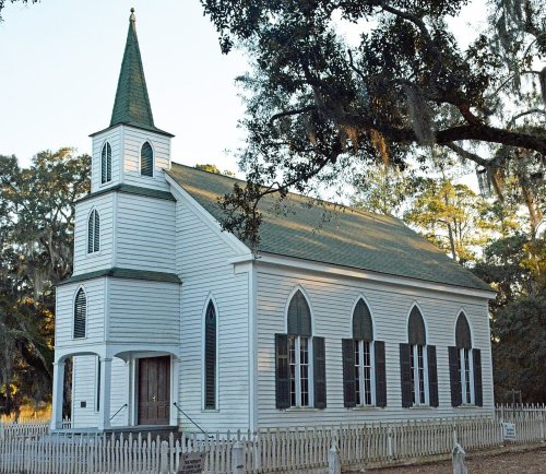
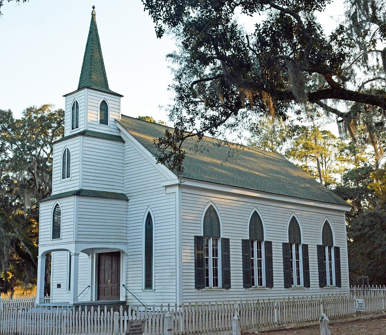
Walthourville Presbyterian Church
Walthourville Presbyterian Church · National Register of Historic Places
Walthourville’s story

189 years in pictures

Census counts: 905 in 1980, 3,680 in 2020. The archive holds 12 old photos and papers going back to 2005 and 4 maps from 1918 on.

1 place on the National Register of Historic Places.

  • 1837Walthourville is settled
Explore the history →
Getting set up

Moving to Walthourville: who provides what

Who provides power, water and the rest in Walthourville, and how to reach them.

The full setup list →
PowerGeorgia Power16.3¢/kWh · EIA 2025HIFLD · EIA
WaterWalthourville Water SystemNo health-based violations in 5 years · EPAEPA
Internet6 providers100% of addresses get 100/20 MbpsFCC
Trash & dumpFrom the town’s siteTrash and recycling rulesTown site
SchoolsLiberty County School DistrictWhich school depends on your addressNCES
Register to voteOnlineIn Georgia you can register online until 29 days before Election Day, in person until 29 days before Election Day, or by mail (postmarked 29 days before).vote.gov
Who runs elections hereLiberty County Board of Elections and Voter RegistrationLiberty County; contacts on the Handbook page.FVAP, Nov 2025
ZIP codes31301, 31313, 3133331301 58% · 31313 39% · 31333 4%Census 2020

EPA SDWIS (Oct 9, 2026) · HIFLD + EIA-861 2025 · Census 2020 ZCTAs · NCES 2024–25 · registration: vote.gov, updated Nov 18, 2024.

The data

Ordered by what stands out in Walthourville.

Walthourville has homes that are cheap against local pay and sends most of its workers to Hinesville and beyond, but it carries more natural-hazard risk than most of Georgia (mostly hurricanes).

Natural hazardsHazard risk grade D−

Compared with most of Georgia and the rest of the country, the FEMA risk score in Walthourville is higher

FEMA rates its natural-hazard risk higher than 99% of Georgia towns, with expected losses of about $887 per resident a year; that rating is what its D− for hazard risk is built on.

2 flood insurance claims have been paid in Walthourville since 1998. Expected losses in Walthourville break down as 78% from hurricanes and 15% from inland flooding. Federal disaster aid has reached households in Walthourville after 4 declared disasters, most recently in 2024.

97risk score of 100
FEMA risk score
97Very high riskLowerHigher
HurricanesInland flooding
2
paid flood claims since 1998
4
federal disasters paid out here

FEMA flood insurance claims · FEMA disaster declarations and aid · FEMA National Risk Index · OpenFEMA

40%of GA districts it outscoresC+School Grade
SchoolLevelStudentsLetter
Gods Heritage Christian Academy PrivateLargest high schoolGrades K–12Grades K–1254–

NCES · EDFacts · graded within GA on state tests and graduation

Work & commuteJobs & income grade B

Few of Walthourville’s working residents work in town

Walthourville has 217 jobs for its 1,282 working residents: even if every job went to a resident, most would still commute out.

Commuting out is the norm in Walthourville: 1% of working residents work locally. The average commute for Walthourville comes to 30 minutes, where Georgia’s towns sit at 26 minutes and U.S. towns at 25 minutes. Jobs in Walthourville grew by 36 from 2013 to 2023, reaching 217. The top destinations are Hinesville (19%), Savannah (15%) and Pooler (4%).

1%work in town
WalthourvilleGeorgia townsU.S. towns
Average trip to work30 minutes26 minutes25 minutes
Working residents who work in town0.9%9.2%8%
Below the poverty line10%15%9.6%
Median household income$74,000$63,000$80,000

Where working residents work

In Walthourville1%
Hinesville19%
Savannah15%
Pooler4%
Richmond Hill3%
34 mi
median commute distance
217
jobs based in Walthourville
A commuter town
jobs vs. working residents
D
Walkability grade: more walkable than 13% of U.S. towns

Census LEHD 2023 · ACS

HealthC

Residents of Walthourville are less healthy than 70% of U.S. towns

The share of adults in Walthourville who get no exercise outside work: 30%. The town does better than the Georgia average on 2 of 32 CDC measures and worse on 7. Among adults locally, 25% worry about having enough food and 42% sleep under 7 hours.

30%healthier than U.S. townsCHealth Grade
WalthourvilleGeorgia townsU.S. towns
Feel lonely (CDC PLACES)40%38%33%
Food insecurity (CDC PLACES)25%22%14%
Sleep under 7 hours (CDC PLACES)42%40%36%
Frequent mental distress (CDC PLACES)19%19%17%
32 measures vs. Georgia
2 better23 too close to call7 worse
What stands outWalthourvilleGA
Fewer adults who have had cancer4.6%7%
Fewer adults with heart disease5%6.1%
More adults facing a utility shut-off14.1%9.6%
Liberty Regional Medical Center
5.1 mi away · emergency room
3 of 3
care shortages: primary care, dental, mental health
48th
percentile among GA towns

CDC PLACES 2025 · modeled estimates for adults · CMS · HRSA

Climate

Expect mild winters and hot summers in Walthourville

For Walthourville, the typical July afternoon high is 93°F.

93°summer high

Typical low → high °F

Winter41–64°
Spring54–79°
Summer71–92°
Fall57–79°
Nov 29
typical first frost
Mar 5
typical last frost
+1.0°
vs. the 20th-century average
93°
typical summer high

NOAA U.S. Climate Normals, 1991–2020

OutdoorsC−

Open space protected for good: 1.4% of Walthourville

The trail density for Walthourville comes to 0.1 miles per square mile, against 0.3 in Georgia’s towns and 0.4 across U.S. towns. 0.4 miles of trail wind through 2 parks and preserves.

1.4%conserved
WalthourvilleGeorgia townsU.S. towns
Miles of trail per square mile0.1 miles per square mile0.30.4
Conserved land1.4%2.3%4.3%
1.4%
conserved · 34 of 2,450 acres
0.4 mi
of trails · 0.1 per sq mi
Biggest places to walkTrailsAcres
1. Hillary Park0.3 mi7
2. Johnnie Frasier Park—4

Trails & parks © OpenStreetMap contributors · Conserved land: USGS PAD-US

HousingCost of living grade B−

A home in Walthourville sells for about $256K at the median

At 2.6 years of the Hinesville metro’s $62K median household income, the typical home costs less against local pay than in 83% of Georgia towns; that ratio is one input to its B− for cost of living.

For households in Walthourville, the share who live in a home they own is 47%. A home in Walthourville typically sold within 104 days of listing. Bidding over the asking price: 29% of homes sold locally.

$256Kmedian sale price
WalthourvilleGeorgia townsU.S. towns
Households that own their home47%58%73%
Median rent$1,077 a month$1,160 a month$1,185 a month
Market temperature
BalancedA seller's marketBuyer’sSeller’s
104
days on market
100.5%
sale-to-list price
7
homes sold in May

Census ACS, 2020–24 · Zillow Home Value Index · Redfin Data Center

Keep exploring

Everything we know about Walthourville

19pages on Walthourville
After high school

Colleges nearby

None within 15 miles of Walthourville; the nearest are

A commuter town

99% of working residents leave Walthourville for work

Where Walthourville’s working residents go each day. Line width shows the share.

19% → Hinesville Hinesville 19% 15% → Savannah Savannah 15% 4% → Pooler Pooler 4% 3% → Richmond Hill Richmond Hill 3% 3% → Riceboro Riceboro 3% 2% → Midway Midway 2% Walthourville · 1% stay
217jobs based in Walthourville
1%of working residents work in town
34 mimedian commute distance

Census LEHD 2023

About Walthourville

City in Georgia, United States

Official town website ↗

Walthourville () is a city in Liberty County, Georgia, United States. When it was incorporated in 1974, it had a government entirely composed of women; and in 1978 it elected Carrie Kent, the first African-American woman mayor in Georgia history. Walthourville is a part of the Hinesville-Fort Stewart metropolitan statistical area (MSA). The population was 3,680 at the 2020 Census.

From Wikipedia, licensed CC BY-SA 4.0 · facts via Wikidata (CC0)

Area
3.8 sq mi
Elevation
89 ft
ZIP code
31333
Area code
912

Walthourville’s neighbors

2 towns share a border with Walthourville.

Explore the map →
How the neighbors grade
TownGA rankOverallCostSafetySchoolsHealth
Walthourville#179DB−—C+C
Hinesville#246D−C−DC+C+
Allenhurst——————

Walthourville reports no FBI crime data of its own. Allenhurst isn’t graded (fewer than 1,000 residents, or not enough data). Compare Walthourville with a neighbor →

Questions about Walthourville

Short answers, built from the data on this page.

Is Walthourville, GA a good place to live?

Walthourville grades D overall, better than 14% of U.S. towns and #179 of 258 in Georgia. It grades C for health and C+ for schools. Hazard risk is its weak spot, with a D−.

Is Walthourville, GA expensive?

The typical home is worth about $159,000, 52% below the Georgia typical home.