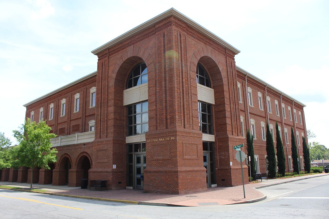
189 years in pictures
Census counts: 162 in 1880, 34,891 in 2020. The archive holds 12 old photos and papers going back to 1892 and 4 maps from 1918 on.
3 places on the National Register of Historic Places.
- 1837Hinesville is settled
Each edition grades its towns against each other only.

Hinesville grades D− overall, 246th among Georgia's 258 graded towns, mostly because of safety and incomes. Its crime rate is higher than 90% of U.S. towns, with 279 violent crimes reported to the FBI in 2025. The median household income is $60K, and 14% of residents live below the poverty line. Hinesville’s violent crime rate is 7.5 per 1,000 residents, above both the Georgia town median (2.2) and the median of U.S. towns (1.6). On hazard risk, just 3 of Georgia’s 374 towns do worse. Hinesville's civic life (library use, community groups, volunteering) trails 92% of U.S. towns.
Where Hinesville beats most towns, and one thing worth knowing.
Liberty County Courthouse
Davion MitchellEach subject compared with towns across the country (schools within Georgia), ordered by how far Hinesville is from typical.
How TownRatings grades towns →
Census counts: 162 in 1880, 34,891 in 2020. The archive holds 12 old photos and papers going back to 1892 and 4 maps from 1918 on.
3 places on the National Register of Historic Places.
Who provides power, water and the rest in Hinesville, and how to reach them.
EPA SDWIS (Oct 9, 2026) · HIFLD + EIA-861 2025 · Census 2020 ZCTAs · NCES 2024–25 · registration: vote.gov, updated Nov 18, 2024.
Ordered by what stands out in Hinesville.
Hinesville is healthier than towns with similar incomes, but it carries more natural-hazard risk than most of Georgia (mostly hurricanes) and reports violent crime at about twice the Georgia rate.
FEMA rates its natural-hazard risk higher than 99% of Georgia towns, with expected losses of about $578 per resident a year; that rating is what its D− for hazard risk is built on.
The FEMA risk score in Hinesville is 97 of 100. Since 1980, 25 flood insurance claims have been paid out in Hinesville.
FEMA flood insurance claims · FEMA National Risk Index · OpenFEMA
Its public schools are run by the Liberty County school district. Two of its 10 schools are below, each with why it’s listed.
| School | Level | Students | Letter |
|---|---|---|---|
| Button Gwinnett Elementary SchoolLargest public elementary schoolGrades PK–5 | Grades PK–5 | 1,162 | C |
| Bradwell InstituteLargest public high schoolGrades 9–12 | Grades 9–12 | 1,900 | C |
NCES · EDFacts · graded within GA on state tests and graduation
Violent crime runs at 7.5 per 1,000 residents, about twice the Georgia rate; the Safety Grade counts each violent crime four times, so this weighs most on its D. At 50.3 crimes per 1,000 residents a year, it reports more crime than 76% of Georgia’s graded towns.
Hinesville’s property crime rate is 22.1 per 1,000 residents. Hinesville reports more crime per resident than most U.S. towns we grade: about 90% report less.
FBI crime data, 2025 · crimes reported to police
About one in 5 of Hinesville’s working residents works in town. The top destinations are Savannah (14%), Pooler (4%) and Riceboro (3%). Half commute less than 31 miles.
| Hinesville | Georgia towns | U.S. towns | |
|---|---|---|---|
| Working residents who work in town | 22% | 9% | 8% |
| Work from home | 7.1% | 9.2% | 11% |
| Median household income | $60,000 | $63,000 | $80,000 |
Census LEHD 2023 · ACS
6.2 miles of trail in 12 parks and preserves. Bryant Commons Park, at 70 acres with 1.3 miles of trail, is the biggest park or preserve.
| Hinesville | Georgia towns | U.S. towns | |
|---|---|---|---|
| Conserved land | 2.4% | 2.2% | 4.3% |
| Miles of trail per square mile | 0.3 miles per square mile | 0.3 | 0.4 |
| Biggest places to walk | Trails | Acres |
|---|---|---|
| 1. James Brown Park | 1.4 mi | 38 |
| 2. Bryant Commons Park | 1.3 mi | 70 |
| 3. Liberty Independent Troop Park | 0.4 mi | 35 |
Trails & parks © OpenStreetMap contributors · Conserved land: USGS PAD-US
Home values rose 43% in five years, to about $239K, against 21% across Georgia.
The typical Hinesville home is worth about $239,000, down 1% in a year, 27% below the Georgia typical home. 47% of Hinesville households own their home.
| Hinesville | Georgia towns | U.S. towns | |
|---|---|---|---|
| Households that own their home | 47% | 58% | 73% |
| Median rent | $1,212 a month | $1,152 a month | $1,185 a month |
Census ACS, 2020–24 · Zillow Home Value Index · Redfin Data Center
Hinesville has mild winters and hot summers, with plenty of rain. July afternoons reach 93°, January nights drop to 40° and snow is almost unheard of.
NOAA U.S. Climate Normals, 1991–2020
Against the 8,921 U.S. towns with household incomes like Hinesville’s, it is healthier than 63%, so its C+ isn’t only a matter of income.
Hinesville beats the Georgia average on 6 of 32 CDC measures and trails it on 9. 41% of adults feel lonely in Hinesville.
| Hinesville | Georgia towns | U.S. towns | |
|---|---|---|---|
| Feel lonely (CDC PLACES) | 41% | 38% | 33% |
| Frequent mental distress (CDC PLACES) | 20% | 19% | 17% |
| Food insecurity (CDC PLACES) | 24% | 22% | 14% |
| No health insurance, 18–64 (CDC PLACES) | 15% | 14% | 8.1% |
| What stands out | Hinesville | GA |
|---|---|---|
| Fewer adults who have had cancer | 4.6% | 7% |
| Fewer adults with heart disease | 4.7% | 6.1% |
| More adults facing housing insecurity | 20.6% | 15% |
CDC PLACES 2025 · modeled estimates for adults · CMS · HRSA
None within 15 miles of Hinesville; the nearest are
About 7 of every 100 Hinesville residents are enrolled in college, about the same as Georgia.
3 places in Hinesville on the National Register of Historic Places.
14 notable people were born in Hinesville.


City in Georgia, United States
Hinesville is a city in the U.S. state of Georgia and is located on the Atlantic coastal plain. The county seat of Liberty County, it had a population of 34,891 at the 2020 U.S. census. It is the principal city of the Hinesville metropolitan area, which comprises all of Liberty County, including the Fort Stewart army installation, plus neighboring Long County.
From Wikipedia, licensed CC BY-SA 4.0 · facts via Wikidata (CC0)
4 towns share a border with Hinesville.
| Town | GA rank | Overall | Cost | Safety | Schools | Health |
|---|---|---|---|---|---|---|
| Hinesville | #246 | D− | C− | D | C+ | C+ |
| Walthourville | #179 | D | B− | — | C+ | C |
| Flemington | — | — | — | — | — | — |
| Fort Stewart | — | — | D− | — | — | A− |
| Allenhurst | — | — | — | — | — | — |
Walthourville and Fort Stewart report no FBI crime data of their own. Flemington, Fort Stewart and Allenhurst aren’t graded (fewer than 1,000 residents, or not enough data). Compare Hinesville with a neighbor →
Short answers, built from the data on this page.
Hinesville grades D− overall, better than 2% of U.S. towns and #246 of 258 in Georgia. It grades C+ for health, D for safety and C+ for schools. Hazard risk is its weak spot, with a D−.
Yes. That is 3.9 years of the area's median household income ($61,709 across the Hinesville, GA metro area). Cost of living, which also weighs rents, property taxes and how many households pay 30% or more of their income for housing, grades C−.
14 notable people were born here, including Davion Mitchell and Kevin Harris.