Savannah dates to 1733, and 16% of its homes were built before 1940
More historic than 96% of U.S. towns · #2 of 263 in Georgia. What drives it
52 places in town are on the National Register, among them 10 National Historic Landmarks and ten historic districts with 7,421 buildings between them. Below: 12 old photos and papers, maps from 1884 on, and the census since 1800.
Founding year: Wikidata. First post office: 1789.The full story ↓
History grade
What drives Savannah’s History grade
On its age, its old homes and the National Register, Savannah is more historic than 96% of U.S. towns, #2 of 263 in Georgia. All 3 inputs are above most U.S. towns; its age ranks highest and its share of homes from before 1940 lowest.
A+
HistoryA character grade: shown, never part of Savannah’s overall grade.
Among the 400 U.S. cities of 100,000 or more, Savannah ranks #41 on History.
Georgia towns list more on the Register than most of the country (a typical Georgia town has 10.0 per 10,000 residents, the U.S. 2.4), so Savannah’s 504 sits above most of its state (90% of Georgia towns have fewer) while its 7,455 historic buildings outnumber those of 100% of U.S. towns.
NoteThe founding year comes from Wikidata alone; no second source gives 1733.
How sure. Graded on any two of the three inputs instead, the letter would range from A to A+. The pre-1940 share (±0.9 points) is firm at this size.
Founding year: Wikidata (other dates in Quick answers). Homes: Census ACS 2020–24. National Register: National Park Service, May 2026 list; each listing counted once (boundary changes and added documentation belong to their listing), and a historic district counts its contributing buildings. How TownRatings grades history →
What stands out about Savannah’s past
Read from the archive, the National Register and the record. The page puts what stands out first.
The country’s official list of buildings and places worth saving. 10 are National Historic Landmarks, the highest tier. Boundary changes and added documentation are counted with their listing.
On February 12, 1733, General James Oglethorpe and settlers from the ship Anne landed at Yamacraw Bluff and were greeted by Tomochichi, the Yamacraws, and Indian traders John and Mary Musgrove. Mary Musgrove often served as an interpreter. The city of Savannah and the colony of Georgia were founded on that date. In 1751, Savannah and the rest of Georgia became a Royal Colony, with Savannah as its capital.
Passages that mention Savannah, cut from the printed page as they were published.
History of Savannah and South Georgia1913 · page 656Read the page →
Read the text
ing army camps at Tampa and other places in the South, and also at Montauk, Long Island. In September, 1898, he again joined his station at Havana and remained there until July 1, 1899, when he received an invitation from the city of Savannah to again become its health officer, which he accepted, entering his old duties again in that month, and has remained in that position ever since. His efficiency and success as an expert in preventative medicine and as a public health official are widely known and recognized ; and his services are greatly appreciated
Text read by machine from the scan; it may contain errors.
History of Savannah and South Georgia1913 · page 571Read the page →
Read the text
the responsibilities of which office is now successfully vested in his son. Col. A. R. Lawton. His identification with Georgia railway affairs did not end with this for he was also at one time president of the Augusta & Savannah Railroad. He was a curator of the Georgia Historical Society and served as alderman of the city of Savannah from 1853 to 1855. In all relations, he was a credit to his city and every cause with which he became aligned had reason to be proud of its representative. He was one of the most public-spirited of men, in his
Text read by machine from the scan; it may contain errors.
Scans and text from the Internet Archive. Books published in 1930 or earlier, which are in the public domain.
Timeline
Savannah, 1733 to 1973
Woven from the archive, old maps, post office records, the National Register and the people born here.
Every edition of the U.S. Geological Survey’s map of Savannah. Tap a year, or press play to watch the town change.
1955Savannah sheet · 1:24,000
U.S. Geological Survey historical topographic maps (public domain), via Esri’s collection of the scans. The red ring marks the center of Savannah.
Every building
Savannah, building by building, 1884–1916
Fire insurance maps drew every building, what it was made of and what it was used for, so insurers could price the risk of fire. Pick a year, then a sheet.
In 1733, according to Wikidata. Savannah’s post office opened in 1789, and the census of 1800 counted 5,146 people here.
How does Savannah rank for history?
Savannah is more historic than 96% of U.S. towns, #2 of 263 in Georgia. The History grade combines the town’s founding era, the share of homes built before 1940 and its National Register listings. It’s a character grade, so it isn’t part of the overall grade. How it works.
What is on the National Register in Savannah?
52 listings, 10 of them National Historic Landmarks: 29 buildings, 21 historic districts with 7,421 contributing buildings, and 2 sites. 7,455 historic buildings in all.
How old are the homes in Savannah?
16% of Savannah’s homes were built before 1940 (Census estimate), against a typical 3.8% for a Georgia town; the median home was built in 1971.
Founding dates: Wikidata, Wikipedia, the U.S. post office records of Blevins & Helbock (CC0) and the Census. Homes by year built: Census ACS 2020–24. National Register of Historic Places: National Park Service (list of May 22, 2026). Old photos, postcards and papers: Wikimedia Commons, the Library of Congress and other public archives, credited on each item’s page. Maps: U.S. Geological Survey historical topographic maps (via Esri) and Sanborn fire-insurance maps (Library of Congress). History text and census tables: Wikipedia (CC BY-SA 4.0). Places that used to be: USGS Geographic Names Information System (2021).
From Wikimedia Commons (11), the Library of Congress (1), Wikidata (6), the National Register of Historic Places (52), Wikipedia, Wikidata and Wikipedia for famous people, U.S. Geological Survey historical maps, U.S. Census counts (via Wikipedia), the US Post Offices dataset (Blevins & Helbock), the USGS Geographic Names Information System, Sanborn fire insurance maps (Library of Congress) and old county and town histories (Internet Archive). Archive images are copied here with their credits and licenses, shown on each photo’s page. Refreshed monthly.


 ★ Landmark
 ★ Landmark
 ★ Landmark
 ★ Landmark
 ★ Landmark
 ★ Landmark
 ★ Landmark
 ★ Landmark


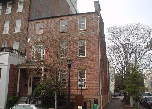


 1796
 1859
 1859
 c. 1862
 c. 1862
 1864


