Roseraie du Val-de-Marne
Rose garden at L'Haÿ-les-Roses, Val-de-Marne, France.
Each edition grades its towns against each other only.

L'Haÿ-les-Roses’ list takes in 17 gardens, 7 museums and 6 forts. Look within 5 km of its centre and the list grows by 56 beyond the 2 in L'Haÿ-les-Roses. Among the sites in town, one is a listed historic monument. The middle of town keeps 2 within 1 km. Travel 9.7 km and you reach Tour Eiffel.
After Roseraie du Val-de-Marne come 2 gardens, a château and a gallery.
 GardenRoseraie du Val-de-Marnein townGardenGardenParc départemental de la Roseraiein town
 ChâteauChâteau de Sceaux2.9 km west, in Sceaux
 Art galleryMusée d'Art contemporain du Val-de-Marne4 km northeast, in Vitry-sur-Seine
 MuseumMusée de l'Assistance publique - Hôpitaux de Paris3.8 km north, in Le Kremlin-BicêtreGardenGardenParc Kellermann4.9 km north, in Paris 13e
Best known first: by how many Wikipedia and sister-site articles cover each place (Wikidata’s count). It isn’t a ranking of how good they are.
The list reaches out to Square Hélène-Boucher, 5 km away.
The first 20 on the list, numbered as below. The shape is the commune of L'Haÿ-les-Roses; the orange dot is its centre. © OpenStreetMap contributors · commune boundary: IGN
17 gardens and 13 châteaux or heritage sites top the count.
Dark: in L'Haÿ-les-Roses. Light: in the communes within 5 km of its centre.
First the 2 in town, then the 56 within 5 km of its centre.
Rose garden at L'Haÿ-les-Roses, Val-de-Marne, France.
Museum in Vitry-sur-Seine, France.
Museum dedicated to the history of Parisian hospitals.
Urban park in Paris, France.
Monastery located in Val-de-Marne, in France.
The 2 places in L'Haÿ-les-Roses first, then those within 5 km of its centre. Nearby, the first 40 of 56.
The history of L'Haÿ-les-Roses → · Parks and trails in L'Haÿ-les-Roses →
The 12 days out are led by Tour Eiffel, 9.7 km away.
 AttractionTour Eiffel9.7 km north, in Paris 7eMuseumMuseumMusée du Louvre9.4 km north, in Paris 1er
 AttractionCathédrale Notre-Dame de Paris8.6 km north, in Paris 4e
 MuseumMusée d'Orsay9.3 km north, in Paris 7e
 AttractionAvenue des Champs-Élysées11 km north, in Paris 8e
 AttractionChâteau de Versailles16 km west, in Versailles
 AttractionArc de triomphe de l'Étoile11 km north, in Paris 8eAttractionAttractionPendule de Foucault7.8 km north, in Paris 5e
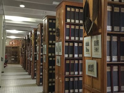 MuseumHerbier7.5 km north, in Paris 5e
 AttractionCimetière du Père-Lachaise10 km northeast, in Paris 20e
 AttractionPanthéon7.8 km north, in Paris 5eMuseumMuseumCentre national d'art et de culture Georges-Pompidou9.4 km north, in Paris 4e
Places within 40 km of L'Haÿ-les-Roses with an article in both French and English Wikipedia, nearest first.
The first on our list in L'Haÿ-les-Roses are Roseraie du Val-de-Marne and Parc départemental de la Roseraie. We list 2 places in town. Another 56 are within 5 km of the centre.
11 museums and galleries in town or within 5 km, including Musée d'Art contemporain du Val-de-Marne, Musée de l'Assistance publique - Hôpitaux de Paris, Exploradôme and Maison de la photographie Robert-Doisneau.
One place on this page in L'Haÿ-les-Roses is a listed or registered historic monument (Mérimée): Roseraie du Val-de-Marne.
The nearest with articles in both French and English Wikipedia: Tour Eiffel (9.7 km), Musée du Louvre (9.4 km), Cathédrale Notre-Dame de Paris (8.6 km), Musée d'Orsay (9.3 km).
From OpenStreetMap and Wikidata: named museums, galleries, châteaux, abbeys, gardens, zoos, theme parks and other visitor attractions whose mapped point lies inside the commune of L'Haÿ-les-Roses, then those in the communes within 5 km of its centre, and well-known places within 40 km. Houses, ruins and gardens need a sign they’re open to visitors; places marked private, closed or disused are left out. The historic-monument link is the Culture ministry’s Mérimée record. A place that isn’t mapped isn’t listed, so this isn’t everything there is to see.
Sources: OpenStreetMap (© OpenStreetMap contributors, ODbL), Wikidata (CC0: descriptions, websites, Wikipedia articles), the Culture ministry’s Mérimée database (Licence Ouverte 2.0), IGN commune boundaries. Distances are from the commune’s centre point.
Photos from Wikimedia Commons, each under its own licence (our copy, resized).
Contains public sector information under the Licence Ouverte / Open Licence 2.0 (Etalab): INSEE, DGFiP, the Interior Ministry’s statistics service (SSMSI), the Ministry of Education (DEPP), the Health Ministry’s statistics service (DREES) and the Housing Ministry (Carte des loyers). Commune boundaries: IGN Admin Express.
 9
 11