
Château de Versailles
Château de Versailles is a palace in Versailles, France and location of the Museum of the History. Since 1906 it has been a classé historic monument. Look also at Tour Eiffel, 14 km away, first of 743 more within 15 km.
Attraction in Versailles
One of the best-known places to visit in France
#6 of the 37,318 museums, châteaux, gardens and other attractions we list in France, by how widely it is covered (109 Wikipedia and sister-site articles). About ↓
In Versailles
Château de Versailles is in the commune of Versailles, with 102 more places to visit within 5 km. Towns near it ↓
Classé historic monument
Protected as a historic monument since 1906; built in the 17th and 18th centuries (Mérimée record PA00087673). About ↓
Written from OpenStreetMap, Wikidata, the Culture ministry’s Mérimée database and Météo-France 1991–2020 normals.
The climate through the year
May to September are the warmest in Versailles, with afternoon highs of 19–25°C.
Château de Versailles
Its story is told in 109 languages on Wikipedia.
- Type
- Attraction
- Protection
- Classé historic monument · 1906
- Built
- 17th and 18th centuries
- Covered in
- 109 Wikipedia and sister-site articles
- Commune
- Versailles, Yvelines
- Official site
- en.chateauversailles.fr
When it is open
Map of Château de Versailles and nearby
Orange marks Château de Versailles, and the numbered points match the list of places below.
© OpenStreetMap contributors · The dashed line is the commune of Versailles. · commune boundary: IGN
Towns near Château de Versailles
The most populous of the 8 is Versailles, at 84,095. The towns are in order of distance, its own town first.
- 1Versailles
- 2Le Chesnay-Rocquencourt
- 3Buc
- 4Viroflay
- 5Saint-Cyr-l'École
- 6La Celle-Saint-Cloud
- 7Bailly
- 8Chaville
Versailles
Le Chesnay-Rocquencourt
Buc
Viroflay
Compare the 8 towns
| Town | Where Château de Versailles is | People |
|---|---|---|
| Versailles | It’s in this commune | 84,095 |
| Le Chesnay-Rocquencourt | 2.3 km north of it | 30,689 |
| Buc | 3.2 km south of it | 5,816 |
| Viroflay | 3.9 km east of it | 17,237 |
| Saint-Cyr-l'École | 4.2 km west of it | 21,268 |
| La Celle-Saint-Cloud | 4.9 km north of it | 20,460 |
| Bailly | 4.9 km northwest of it | 3,731 |
| Chaville | 5 km east of it | 20,594 |
What else is near Château de Versailles
Our list has 743 more within 15 km, among them 5 attractions, a cathedral and a garden.
 AttractionTour Eiffel14 km northeast, in Paris 7e2
 AttractionPetit Trianon1.6 km northwest, in Versailles3
 AttractionGrand Trianon1.7 km northwest, in Versailles4
 AttractionArc de triomphe de l'Étoile15 km northeast, in Paris 8e5CathedralCathedralCathédrale Saint-Louis de Versailles700 m southeast, in Versailles6
 GardenJardin de Versailles1 km northwest, in Versailles7Art galleryArt galleryGalerie des Batailles100 m east, in Versailles8
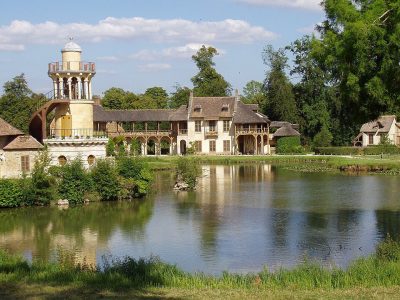 AttractionHameau de la Reine1.7 km north, in Versailles
Within 15 km, close and well known first. Numbers match the map.
Questions people have about Château de Versailles
Where is Château de Versailles?
Château de Versailles is in Versailles, in Yvelines (Île-de-France).
What is Château de Versailles?
Palace in Versailles, France and location of the Museum of the History of France.
Is Château de Versailles a historic monument?
Yes: Classé historic monument, since 1906, Mérimée record PA00087673.
How well known is Château de Versailles?
Château de Versailles has 109 Wikipedia and sister-site articles in different languages: #6 of the 37,318 French places we list.
When is the best time to visit Château de Versailles?
May to September are the warmest months in Versailles, with afternoon highs of 19–25°C (Météo-France 1991–2020 normals).
What else is there to see near Château de Versailles?
Within 15 km: Tour Eiffel (14 km), Petit Trianon (1.6 km), Grand Trianon (1.7 km) and Arc de triomphe de l'Étoile (15 km).
Sources: OpenStreetMap (© OpenStreetMap contributors, ODbL), Wikidata (CC0: what it is, its articles, how widely it is covered), the Culture ministry’s Mérimée database (Licence Ouverte 2.0), IGN commune boundaries, Météo-France 1991–2020 normals (Licence Ouverte 2.0).
Photos from Wikimedia Commons, each under its own licence (our copy, resized).
Photo credits (7)
- Château de Versailles: ToucanWings, CC BY-SA 3.0, Wikimedia Commons
- Tour Eiffel: Benh LIEU SONG, Public domain, Wikimedia Commons
- Petit Trianon: KimonBerlin, CC BY-SA 2.0, Wikimedia Commons
- Grand Trianon: Lionel Allorge, CC BY-SA 3.0, Wikimedia Commons
- Arc de triomphe de l'Étoile: ZeusUpsistos, CC BY-SA 4.0, Wikimedia Commons
- Jardin de Versailles: Anonymous Unknown author, Public domain, Wikimedia Commons
- Hameau de la Reine: Daderot, CC BY-SA 3.0, Wikimedia Commons
Contains public sector information under the Licence Ouverte / Open Licence 2.0 (Etalab): INSEE, DGFiP, the Interior Ministry’s statistics service (SSMSI), the Ministry of Education (DEPP), the Health Ministry’s statistics service (DREES) and the Housing Ministry (Carte des loyers). Commune boundaries: IGN Admin Express.