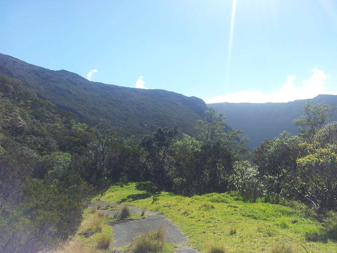
 Photo: regulator974 · CC BY-SA 3.0
Sainte-Rose lies in the heart of Réunion National Park
100% of Sainte-Rose’s land lies in protected areas. 48% of Sainte-Rose is mapped woodland. 88 km of footpaths cross Sainte-Rose (0.5 km per km²). France has no Outdoors Grade yet: these are the figures, each beside the compared towns’ median.
Throughout this page, the Réunion median and the France median are the median of compared communes (those with an overall grade), each figure its own median.
What kind of outdoors place is Sainte-Rose?
Read from the data: what stands out first, good and less good.
What sets Sainte-Rose apart: the national park all around it, then its woods. It is shorter on footpaths.
How Sainte-Rose compares with French towns
Each figure against the 3,798 compared French towns (communes with an overall grade): the marked bar is the town’s, the line the median. Described, not graded.
Percentiles among compared French towns; ties count half.
Sainte-Rose has the 7th fewest footpaths per km² of 41 towns its size
The 40 compared French towns nearest in population (6,507 to 6,605 residents), by km of footpath per km². Hover for each one’s protected land and woods; click for its page.
From Bouffémont (9.6 km per km²) to Longué-Jumelles (0.2 km per km²).
Every town in the comparison
| Town | Paths (km/km²) | Woodland | Protected | Coast | |
|---|---|---|---|---|---|
| 1 | Bouffémont Val-d'Oise | 9.6 | 54% | 0.9% | 131 km |
| 2 | Champigneulles Meurthe-et-Moselle | 4.7 | 77% | 0% | 361 km |
| 3 | Ceyrat Puy-de-Dôme | 4.6 | 48% | 100% | 254 km |
| 4 | Gémenos Bouches-du-Rhône | 4.1 | 22% | 92% | 11 km |
| 5 | La Mulatière Rhône | 4 | 9.1% | 0% | 248 km |
| 6 | Marange-Silvange Moselle | 3.4 | 52% | 0% | 317 km |
| 7 | Limours Essonne | 3.1 | 22% | 0.1% | 153 km |
| 8 | Saint-Alban Haute-Garonne | 3.1 | 0% | 0% | 152 km |
| 9 | Cormontreuil Marne | 2.9 | 6.1% | 1.5% | 202 km |
| 10 | La Penne-sur-Huveaune Bouches-du-Rhône | 2.8 | 41% | 37% | 7.3 km |
| 11 | L'Arbresle Rhône | 2.7 | 4.5% | 0% | 256 km |
| 12 | Ondres Landes | 2.5 | 59% | 5.2% | On it |
| 13 | Thoiry Ain | 2.4 | 44% | 63% | 298 km |
| 14 | La Bouilladisse Bouches-du-Rhône | 2.4 | 40% | 0% | 21 km |
| 15 | Marignier Haute-Savoie | 2.3 | 56% | 3.3% | 268 km |
| 16 | Neuves-Maisons Meurthe-et-Moselle | 2.2 | 5.8% | 0% | 365 km |
| 17 | Bouchemaine Maine-et-Loire | 2.2 | 14% | 11% | 113 km |
| 18 | Chasse-sur-Rhône Isère | 2.2 | 12% | 0% | 232 km |
| 19 | Eaunes Haute-Garonne | 1.9 | 15% | 0% | 146 km |
| 20 | Furiani Haute-Corse | 1.9 | 0.6% | 6.3% | On it |
| 21 | Saint-Juéry Tarn | 1.8 | 11% | 0% | 116 km |
| 22 | Ploudalmézeau Finistère | 1.7 | 3.4% | 4.3% | On it |
| 23 | Labarthe-sur-Lèze Haute-Garonne | 1.6 | 5.1% | 2% | 144 km |
| 24 | Bon-Encontre Lot-et-Garonne | 1.6 | 8.4% | 0% | 134 km |
| 25 | Saint-Jean-Bonnefonds Loire | 1.4 | 12% | 0% | 212 km |
| 26 | Labruguière Tarn | 1.4 | 44% | 100% | 84 km |
| 27 | Rives Isère | 1.1 | 13% | 0% | 217 km |
| 28 | Montauban-de-Bretagne Ille-et-Vilaine | 1 | 13% | 0% | 32 km |
| 29 | Longuenée-en-Anjou Maine-et-Loire | 1 | 6.8% | 2.3% | 114 km |
| 30 | La Chevrolière Loire-Atlantique | 0.7 | 16% | 11% | 29 km |
| 31 | Ambert Puy-de-Dôme | 0.7 | 44% | 100% | 223 km |
| 32 | Brioude Haute-Loire | 0.7 | 7.1% | 1.6% | 200 km |
| 33 | Chatuzange-le-Goubet Drôme | 0.6 | 11% | 0% | 175 km |
| 34 | Gueugnon Saône-et-Loire | 0.5 | 17% | 0% | 338 km |
| 35 | Sainte-Rose Réunion | 0.5 | 48% | 100% | On it |
| 36 | Estaires Nord | 0.4 | 0.7% | 0% | 50 km |
| 37 | Héric Loire-Atlantique | 0.4 | 13% | 0% | 42 km |
| 38 | Sainte-Livrade-sur-Lot Lot-et-Garonne | 0.3 | 2.4% | 0.2% | 115 km |
| 39 | Lezoux Puy-de-Dôme | 0.2 | 19% | 5.3% | 258 km |
| 40 | Le Mené Côtes-d'Armor | 0.2 | 12% | 0% | 25 km |
| 41 | Longué-Jumelles Maine-et-Loire | 0.2 | 21% | 100% | 143 km |
Parks, woods, footpaths & countryside
Tap a layer to hide it. The dashed line is the commune’s boundary.
Protected land in and around Sainte-Rose
The protected areas reaching the commune, and the nearest: national parks, regional nature parks, nature reserves and Natura 2000 sites.
Réunion National Park
Réunion National Park
Mares nature reserve
Share of the commune’s land
Designations overlap (a regional park can hold a Natura 2000 site), so the rows don’t add up; the first counts each piece of land once.
100% of Sainte-Rose’s land is protected, more than in 95% of compared French towns; the median compared town in Réunion has 69%. A national park’s outer area (aire d’adhésion) is made of the communes that signed the park’s charter: it guides how they grow, but it isn’t strict protection like the core. Natura 2000 doesn’t apply in the overseas départements.
Source: INPN / PatriNat, protected areas July 2026, Natura 2000 December 2024; shares of IGN’s commune boundary.
88 km of footpaths and 25 km of hiking routes cross Sainte-Rose
Paths, bridleways, steps and tracks open on foot, and waymarked hiking routes, mapped on OpenStreetMap inside the commune; woods are mapped forest and woodland, private woods included.
Km per km² of the commune · mapped on OpenStreetMap
Share of the land · mapped woods and forest
That is less than in 86% of compared French towns for footpaths per km², and for woodland more than in 91% of compared French towns. Hiking routes often follow paths and lanes already counted, so the two lengths overlap: don’t add them. Every home in Sainte-Rose is within 800 m of a mapped park or wood, as in most French towns.
3 named hiking routes within 2 km
Source: © OpenStreetMap contributors (ODbL), extracts of October 25, 2026 (Geofabrik).
The best walking months in Sainte-Rose: October to December
Météo-France’s 1991–2020 normals at Gros Piton Sainte-Rose, 4.9 km away, and the daylight at the town’s latitude. Outlined months have long days, highs of 15 to 30 °C and little rain for the place.
| Jan | Feb | Mar | Apr | May | Jun | Jul | Aug | Sep | Oct | Nov | Dec | |
|---|---|---|---|---|---|---|---|---|---|---|---|---|
| Daylight (h) | 13.3 | 12.8 | 12.3 | 11.6 | 11.1 | 10.9 | 11.0 | 11.4 | 12.0 | 12.6 | 13.2 | 13.4 |
| High (°C) | 30 | 30 | 29 | 28 | 26 | 25 | 24 | 24 | 25 | 26 | 28 | 29 |
| Rain (mm) | 436 | 479 | 542 | 418 | 315 | 257 | 260 | 210 | 172 | 166 | 206 | 312 |
October is the driest month (166 mm) and January the warmest (highs of 30 °C). 542 mm of rain falls in March, the wettest month. The climate in Sainte-Rose →
Next to Sainte-Rose
The nearest towns of 2,500 or more, colored by the share of their land in protected areas.
| Town | Protected | Woodland | Paths (km/km²) | Coast |
|---|---|---|---|---|
| Sainte-Rose | 100% | 48% | 0.5 | On it |
| Saint-Benoît 38,604 · 14 km | 78% | 59% | 0.4 | On it |
| La Plaine-des-Palmistes 6,936 · 18 km | 100% | 64% | 0.5 | 14 km |
| Bras-Panon 13,012 · 21 km | 83% | 69% | 0.6 | On it |
| Saint-Philippe 5,082 · 24 km | 100% | 48% | 0.4 | On it |
| Saint-André 58,885 · 26 km | 31% | 16% | 0.6 | On it |
What this data can and can’t tell you
- Protected areas. National-park cores, national parks’ outer areas, regional nature parks, nature reserves and Natura 2000 sites, from INPN. A national park’s core is strictly protected; its outer area and a regional park are charters between communes, not bans. Designations overlap, so the total counts each piece of land once.
- Woodland. Forest and woods as OpenStreetMap maps them, private woods included: woods nobody has mapped are missing, and a mapped wood isn’t necessarily open to walkers.
- Footpaths and hiking routes. Footpaths, bridleways, steps and tracks open on foot, then waymarked hiking routes (GR and others) measured apart. A route often follows a path or lane already counted: the two overlap. Paths nobody has mapped are missing.
- Green space nearby. The share of residents (INSEE’s 200 m grid) within 800 m, as the crow flies, of a mapped park, garden or wood edge. It measures nearness, not a way in. Guadeloupe and French Guiana have no grid: their pages say whether the town center is within 800 m.
- The coast. The straight-line distance from the town center to OpenStreetMap’s coastline, which follows the tide line into estuaries. A commune is on the coast when the coastline crosses its boundary.
- No grade yet. U.S. and UK towns have an Outdoors Grade; French towns don’t yet. Each figure is set beside the median of compared communes (those with an overall grade) in the département and in France, each figure its own median.
Questions about the outdoors in Sainte-Rose
Is Sainte-Rose in a national or regional nature park?
Yes: Sainte-Rose lies in Réunion National Park (25% of the commune).
Are there good walks in Sainte-Rose?
OpenStreetMap maps 88 km of footpaths and tracks open on foot in the commune, 0.5 km per km² (the median compared town: 1.7 km per km²); 25 km of waymarked hiking routes cross it.
How much of Sainte-Rose is woodland?
48% of the commune is mapped woodland, private woods included; the median compared French town has 13%.
Is Sainte-Rose near the sea?
Yes: the commune touches the coast, 1.1 km from its center.
When is the best time for walking in Sainte-Rose?
October to December: long days, mild highs and little rain, from Météo-France’s 1991–2020 normals at the nearest suitable station.
Why is there no Outdoors Grade for French towns?
TownRatings grades the outdoors in the U.S. and the UK; the French figures are new and not graded yet. This page sets each one beside the median compared French town instead.
Sources: INPN / PatriNat (protected areas 2026, Natura 2000 2024) · © OpenStreetMap contributors, ODbL (paths, hiking routes, woods, coast, gardens) · INSEE, Filosofi 2021 200 m grid (residents) · IGN Admin Express (boundaries) · Météo-France normals 1991–2020 · Medians and percentiles: TownRatings, over compared French towns, updated November 9, 2026. Under the Licence Ouverte / Open Licence 2.0 (Etalab).
Contains public sector information under the Licence Ouverte / Open Licence 2.0 (Etalab): INSEE, DGFiP, the Interior Ministry’s statistics service (SSMSI), the Ministry of Education (DEPP), the Health Ministry’s statistics service (DREES) and the Housing Ministry (Carte des loyers). Commune boundaries: IGN Admin Express.