First pick
Forêt de Mare Longue
Wood or forest
274 ha5.2 km of path
1 h 10 minto walk all 5.2 km of path
1.7 km north-westfrom the center
Sentier botanique de Mare-Longue
Directionsto a point inside
Each edition grades its towns against each other only.
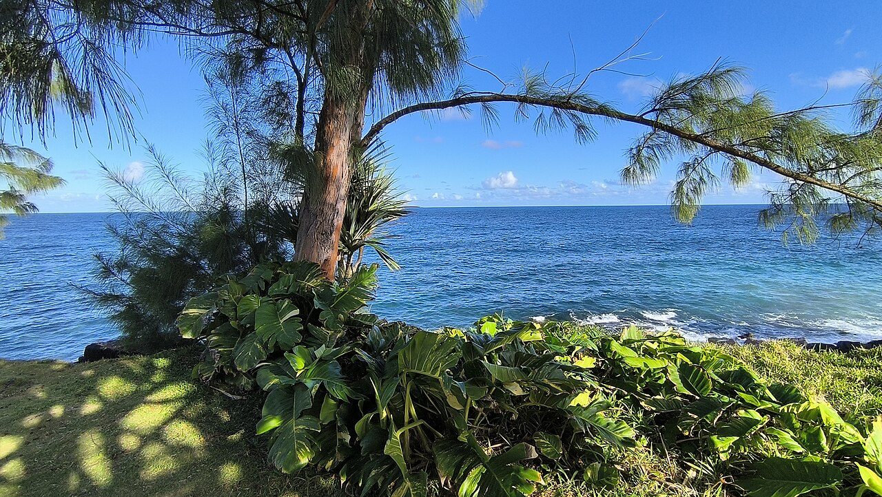 Photo: Clémenceau Lauret · CC BY-SA 4.0
Protected areas cover 100% of Saint-Philippe’s land. Mapped woodland covers 48% of Saint-Philippe. 66 km of footpaths cross Saint-Philippe (0.4 km per km²). France has no Outdoors Grade yet: these are the figures, each beside the compared towns’ median.
Throughout this page, the Réunion median and the France median are the median of compared communes (those with an overall grade), each figure its own median.
Read from the data: what stands out first, good and less good.
What sets Saint-Philippe apart: the national park all around it, then its woods. It is shorter on footpaths.
Each figure against the 3,798 compared French towns (communes with an overall grade): the marked bar is the town’s, the line the median. Described, not graded.
Percentiles among compared French towns; ties count half.
The 40 compared French towns nearest in population (5,036 to 5,131 residents), by km of footpath per km². Hover for each one’s protected land and woods; click for its page.
From Giberville (5.1 km per km²) to Laventie (0.1 km per km²).
| Town | Paths (km/km²) | Woodland | Protected | Coast | |
|---|---|---|---|---|---|
| 1 | Giberville Calvados | 5.1 | 3.2% | 0% | 11 km |
| 2 | Pulnoy Meurthe-et-Moselle | 4.7 | 25% | 0% | 368 km |
| 3 | Château-Arnoux-Saint-Auban Alpes-de-Haute-Provence | 4.3 | 45% | 17% | 95 km |
| 4 | Billy-Berclau Pas-de-Calais | 4 | 15% | 0% | 67 km |
| 5 | Bezannes Marne | 3.4 | 1.8% | 0.1% | 198 km |
| 6 | Ornex Ain | 3.2 | 22% | 0% | 299 km |
| 7 | Sommières Gard | 2.8 | 21% | 1.3% | 25 km |
| 8 | Le Val d'Hazey Eure | 2.6 | 32% | 0.3% | 77 km |
| 9 | Châteaulin Finistère | 2.5 | 21% | 100% | On it |
| 10 | Dives-sur-Mer Calvados | 2.5 | 8.8% | 0% | 1.2 km |
| 11 | Haillicourt Pas-de-Calais | 2.5 | 0.2% | 0% | 63 km |
| 12 | Saint-Georges-de-Didonne Charente-Maritime | 2.3 | 19% | 37% | On it |
| 13 | Bonnières-sur-Seine Yvelines | 2.1 | 45% | 20% | 99 km |
| 14 | Champagne-sur-Oise Val-d'Oise | 1.8 | 33% | 54% | 119 km |
| 15 | Baden Morbihan | 1.8 | 15% | 100% | On it |
| 16 | Cucq Pas-de-Calais | 1.5 | 2.7% | 8.6% | On it |
| 17 | Yffiniac Côtes-d'Armor | 1.5 | 4.4% | 0.1% | 1.8 km |
| 18 | La Ferté Macé Orne | 1.4 | 27% | 100% | 73 km |
| 19 | Chavanoz Isère | 1.3 | 12% | 0% | 258 km |
| 20 | Petite-Forêt Nord | 1.3 | 1.8% | 1.4% | 102 km |
| 21 | Genlis Côte-d'Or | 1.3 | 0.4% | 0% | 418 km |
| 22 | Villefranche-de-Lauragais Haute-Garonne | 1.2 | 0.5% | 0% | 117 km |
| 23 | Cilaos Réunion | 1.1 | 43% | 100% | 18 km |
| 24 | Muzillac Morbihan | 1 | 4.9% | 7.8% | On it |
| 25 | Villenoy Seine-et-Marne | 1 | 4.7% | 0% | 161 km |
| 26 | Maen Roch Ille-et-Vilaine | 1 | 3.9% | 0% | 25 km |
| 27 | Faulquemont Moselle | 0.9 | 22% | 0% | 354 km |
| 28 | Saint-Marcellin-en-Forez Loire | 0.8 | 25% | 1.8% | 215 km |
| 29 | Luynes Indre-et-Loire | 0.8 | 39% | 3.5% | 176 km |
| 30 | Aÿ-Champagne Marne | 0.7 | 16% | 100% | 211 km |
| 31 | Blaye Gironde | 0.7 | 2.7% | 58% | On it |
| 32 | Habsheim Haut-Rhin | 0.7 | 49% | 50% | 438 km |
| 33 | Saint-Sever Landes | 0.6 | 17% | 4.2% | 67 km |
| 34 | Val-de-Moder Bas-Rhin | 0.5 | 5.9% | 0.1% | 424 km |
| 35 | Saint-Philippe Réunion | 0.4 | 48% | 100% | On it |
| 36 | Ferrière-la-Grande Nord | 0.4 | 8.1% | 100% | 133 km |
| 37 | Sully-sur-Loire Loiret | 0.4 | 25% | 40% | 238 km |
| 38 | Villeneuve-en-Retz Loire-Atlantique | 0.2 | 7.1% | 36% | 5.1 km |
| 39 | Saint-Pantaléon-de-Larche Corrèze | 0.2 | 25% | 0.3% | 161 km |
| 40 | Moncoutant-sur-Sèvre Deux-Sèvres | 0.2 | 7% | 0% | 62 km |
| 41 | Laventie Pas-de-Calais | 0.1 | 0.7% | 0% | 54 km |
Tap a number to zoom to a park or wood. Tap a layer to hide it. The dashed line is the commune’s boundary.
Named parks, gardens and woods in the commune or within 400 m, the biggest and best-pathed first: Forêt de Mare Longue leads, at 274 ha. Directions go to a point inside.
Source: © OpenStreetMap contributors (ODbL): named parks, gardens and woods; sizes are the whole site.
The protected areas reaching the commune, and the nearest: national parks, regional nature parks, nature reserves and Natura 2000 sites.
Designations overlap (a regional park can hold a Natura 2000 site), so the rows don’t add up; the first counts each piece of land once.
100% of Saint-Philippe’s land is protected, more than in 95% of compared French towns; the median compared town in Réunion has 69%. A national park’s outer area (aire d’adhésion) is made of the communes that signed the park’s charter: it guides how they grow, but it isn’t strict protection like the core. Natura 2000 doesn’t apply in the overseas départements.
Source: INPN / PatriNat, protected areas July 2026, Natura 2000 December 2024; shares of IGN’s commune boundary.
Paths, bridleways, steps and tracks open on foot, and waymarked hiking routes, mapped on OpenStreetMap inside the commune; woods are mapped forest and woodland, private woods included.
That is less than in 89% of compared French towns for footpaths per km², and for woodland more than in 90% of compared French towns. Hiking routes often follow paths and lanes already counted, so the two lengths overlap: don’t add them. Every home in Saint-Philippe is within 800 m of a mapped park or wood, as in most French towns.
Source: © OpenStreetMap contributors (ODbL), extracts of October 25, 2026 (Geofabrik).
Météo-France’s 1991–2020 normals at St-Joseph_Sapc, 15 km away, and the daylight at the town’s latitude. Outlined months have long days, highs of 15 to 30 °C and little rain for the place.
| Jan | Feb | Mar | Apr | May | Jun | Jul | Aug | Sep | Oct | Nov | Dec | |
|---|---|---|---|---|---|---|---|---|---|---|---|---|
| Daylight (h) | 13.3 | 12.8 | 12.3 | 11.6 | 11.1 | 10.8 | 10.9 | 11.4 | 12.0 | 12.6 | 13.2 | 13.4 |
| High (°C) | 31 | 31 | 30 | 29 | 28 | 26 | 25 | 25 | 26 | 27 | 29 | 30 |
| Rain (mm) | 190 | 233 | 218 | 193 | 159 | 127 | 155 | 97 | 75 | 57 | 66 | 93 |
October is the driest month (57 mm) and January the warmest (highs of 31 °C). 233 mm of rain falls in February, the wettest month. Summer highs reach 31 °C, too hot for the outline. The climate in Saint-Philippe →
Named gardens in the commune.
Source: © OpenStreetMap contributors (ODbL) and Wikidata.
The nearest towns of 2,500 or more, colored by the share of their land in protected areas.
| Town | Protected | Woodland | Paths (km/km²) | Coast |
|---|---|---|---|---|
| Saint-Philippe | 100% | 48% | 0.4 | On it |
| Saint-Joseph 39,207 · 13 km | 85% | 50% | 0.6 | On it |
| Petite-Île 13,067 · 20 km | 4.9% | 22% | 0.6 | On it |
| Sainte-Rose 6,557 · 24 km | 100% | 48% | 0.5 | On it |
| Le Tampon 82,579 · 26 km | 19% | 23% | 0.7 | 10 km |
| La Plaine-des-Palmistes 6,936 · 28 km | 100% | 64% | 0.5 | 14 km |
| Saint-Pierre 85,038 · 29 km | 18% | 9.1% | 0.9 | On it |
Yes: Saint-Philippe lies in Réunion National Park (24% of the commune).
OpenStreetMap maps 66 km of footpaths and tracks open on foot in the commune, 0.4 km per km² (the median compared town: 1.7 km per km²); 28 km of waymarked hiking routes cross it.
48% of the commune is mapped woodland, private woods included; the median compared French town has 13%.
Yes: the commune touches the coast, 0.6 km from its center.
October and November: long days, mild highs and little rain, from Météo-France’s 1991–2020 normals at the nearest suitable station.
TownRatings grades the outdoors in the U.S. and the UK; the French figures are new and not graded yet. This page sets each one beside the median compared French town instead.
Sources: INPN / PatriNat (protected areas 2026, Natura 2000 2024) · © OpenStreetMap contributors, ODbL (paths, hiking routes, woods, coast, gardens) · INSEE, Filosofi 2021 200 m grid (residents) · IGN Admin Express (boundaries) · Météo-France normals 1991–2020 · Medians and percentiles: TownRatings, over compared French towns, updated November 9, 2026. Under the Licence Ouverte / Open Licence 2.0 (Etalab).
Contains public sector information under the Licence Ouverte / Open Licence 2.0 (Etalab): INSEE, DGFiP, the Interior Ministry’s statistics service (SSMSI), the Ministry of Education (DEPP), the Health Ministry’s statistics service (DREES) and the Housing Ministry (Carte des loyers). Commune boundaries: IGN Admin Express.