Windsor Locks dates to 1633, and 14% of its homes were built before 1940
More historic than 75% of U.S. towns · #105 of 155 in Connecticut. What drives it
4 places in town are on the National Register, among them a historic district with 6 buildings. Below: 27 old photos and papers, maps from 1892 on, and the census since 1860.
Founding year: Wikidata. First post office: 1833.The full story ↓
History grade
What drives Windsor Locks’ History grade
On its age, its old homes and the National Register, Windsor Locks is more historic than 75% of U.S. towns, #105 of 155 in Connecticut. Its age holds the grade up; its National Register listings pull it down.
A−
HistoryA character grade: shown, never part of Windsor Locks’ overall grade.
Connecticut towns list more on the Register than most of the country (a typical Connecticut town has 73.3 per 10,000 residents, the U.S. 2.4), so Windsor Locks’ 7.9 sits below most of its state (7% of Connecticut towns have fewer) while its 10 historic buildings outnumber those of 76% of U.S. towns.
NoteThe founding year comes from Wikidata alone; no second source gives 1633.
How sure. Graded on any two of the three inputs instead, the letter would range from B− to A−. The pre-1940 share is a Census survey estimate (±3.9 points).
Founding year: Wikidata (other dates in Quick answers). Homes: Census ACS 2020–24. National Register: National Park Service, May 2026 list; each listing counted once (boundary changes and added documentation belong to their listing), and a historic district counts its contributing buildings. How TownRatings grades history →
What stands out about Windsor Locks’ past
Read from the archive, the National Register and the record. The page puts what stands out first.
Nothing in the archives for these yearsWeddings on Main Street, storms, parades, school pictures, the old store. If it’s in your family album, it belongs here.
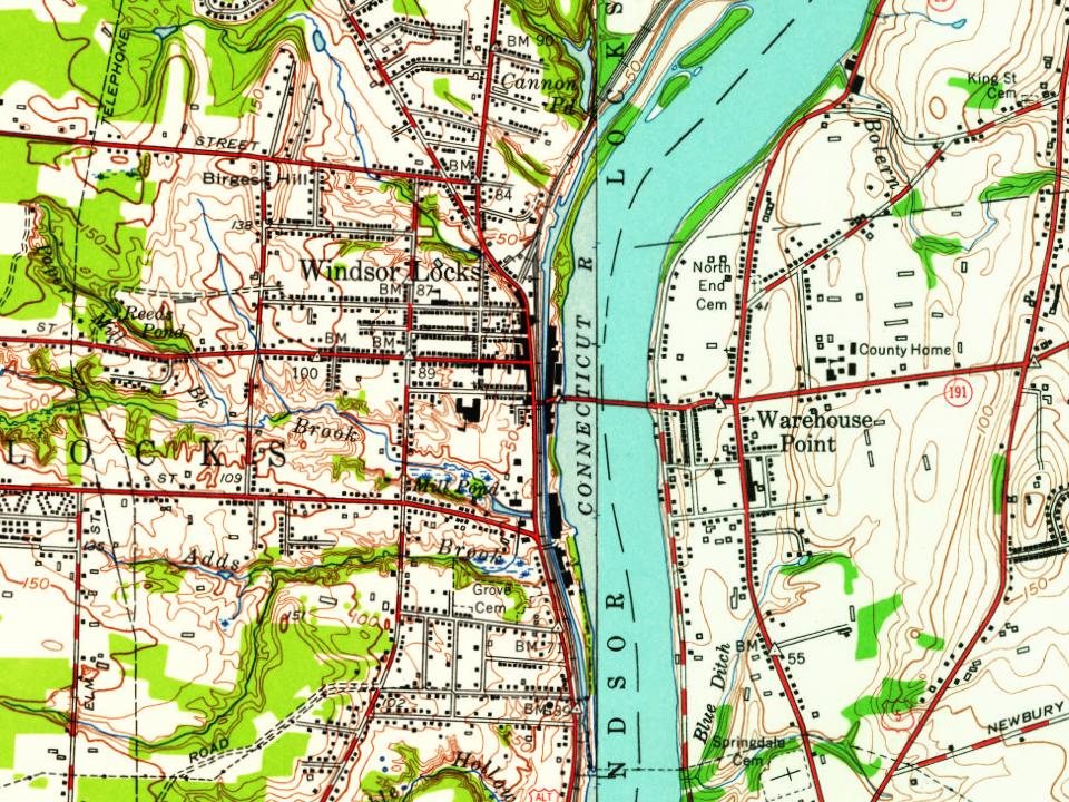
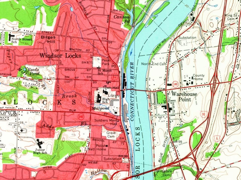
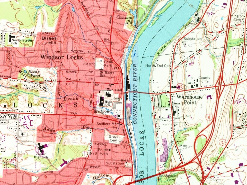
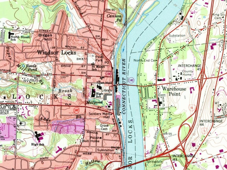
Every edition of the U.S. Geological Survey’s map of Windsor Locks. Tap a year, or press play to watch the town change.
1892Hartford sheet · 1:62,500
U.S. Geological Survey historical topographic maps (public domain), via Esri’s collection of the scans. The red ring marks the center of Windsor Locks.
Originally part of Windsor, Windsor Locks incorporated as a separate town in 1854. It is named after the thriving Enfield Locks going around Enfield Falls, which opened in 1829. Bradley International Airport opened as a military base in 1940, and opened to civilian use in 1947. In 1967 the town boundary was altered due to the opening of the Bradley Airport Connector. The town boundary between Windsor Locks and Windsor changed several times and currently sits with Windsor Locks being on the westbound side and Windsor on the eastbound side of the median of CT Route 20.
Passages that mention Windsor Locks, cut from the printed page as they were published.
History of ancient Windsor, Connecticut, including East Windsor, South Windsor, and Ellington, prior to 1768, the date of their separation from the old town1859 · page 500Read the page →
Read the text
Windsor Locks. The northern portion of the ancient town of Windsor, was, from its early settlement, called Pine Meadow, down to 1833, when a post office was established and the name changed to Windsor Locks, combining the good old name of Windsor with the canal improvements which were completed in 1829.
Text read by machine from the scan; it may contain errors.
History of ancient Windsor, Connecticut, including East Windsor, South Windsor, and Ellington, prior to 1768, the date of their separation from the old town1859 · page 85Read the page →
Read the text
were reckoned at two thousand. At that time, it was the general opinion, that there were nineteen Indians, in that town, to one Englishman. There was a great body of them in the centre Haydon of Windsor Locks, has a little of the corn raised by the Windsor Indians, which bears strong marks of its culture. It is a portion of a bushel or more, which was uncovered by the breaking away of the banks of the Connecticut River, a little above the mouth of the Tunxis or Farmington, some years since. It probably dates back prior to the settlement
Text read by machine from the scan; it may contain errors.
Scans and text from the Internet Archive. Books published in 1930 or earlier, which are in the public domain.
Then & now
Stand where they stood
No then-and-now pairs yet. Take a photo from the same spot as an old one and they appear here side by side.
Retake this viewConnecticut - Norwalk through, 1936
Find the spot, match the angle, and add your photo. It becomes the first then-and-now pair on Windsor Locks’ page.
In 1633, according to Wikidata. Windsor Locks’ post office opened in 1833, and the census of 1860 counted 1,587 people here.
How does Windsor Locks rank for history?
Windsor Locks is more historic than 75% of U.S. towns, #105 of 155 in Connecticut. The History grade combines the town’s founding era, the share of homes built before 1940 and its National Register listings. It’s a character grade, so it isn’t part of the overall grade. How it works.
What is on the National Register in Windsor Locks?
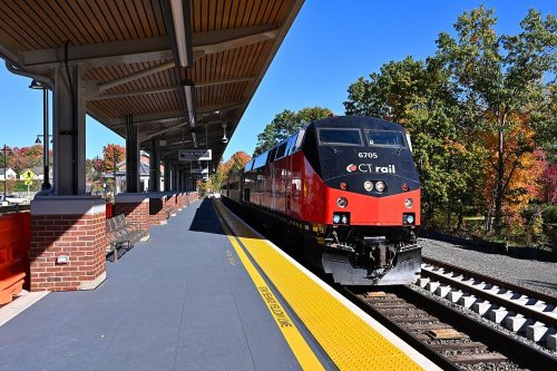
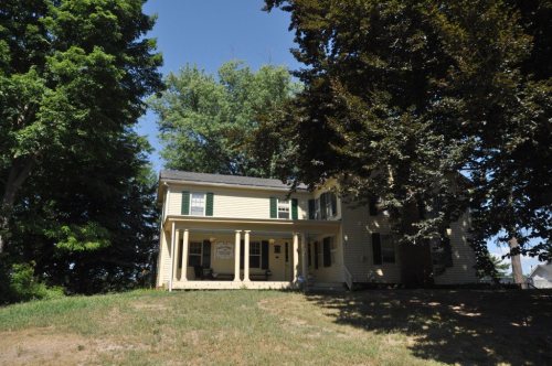
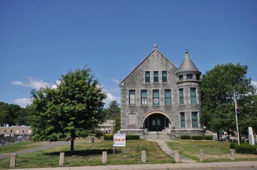
4 listings: 3 buildings, among them the Windsor Locks Passenger Station (listed 1975, the first), and 1 historic district, the Montgomery, J.R., Company Industrial Complex, with 6 contributing buildings. 10 historic buildings in all.
How old are the homes in Windsor Locks?
14% of Windsor Locks’ homes were built before 1940 (Census estimate, ±3.9 points), against a typical 15% for a Connecticut town; the median home was built in 1961.
Founding dates: Wikidata, Wikipedia, the U.S. post office records of Blevins & Helbock (CC0) and the Census. Homes by year built: Census ACS 2020–24. National Register of Historic Places: National Park Service (list of May 22, 2026). Old photos, postcards and papers: Wikimedia Commons, the Library of Congress and other public archives, credited on each item’s page. Maps: U.S. Geological Survey historical topographic maps (via Esri) and Sanborn fire-insurance maps (Library of Congress). History text and census tables: Wikipedia (CC BY-SA 4.0). Places that used to be: USGS Geographic Names Information System (2021).
From Wikimedia Commons (12), the Library of Congress (23), the National Register of Historic Places (4), Wikipedia, Wikidata and Wikipedia for famous people, U.S. Geological Survey historical maps, U.S. Census counts (via Wikipedia), the US Post Offices dataset (Blevins & Helbock), the USGS Geographic Names Information System and old county and town histories (Internet Archive). Archive images are copied here with their credits and licenses, shown on each photo’s page. Refreshed monthly.


 1937
 1937
 1939
 1939
 1939
 1939
 1939
 1939
 1939
 1939
 1939
 1939
 1939
 1940
 1940
 1941
 1941
 1941
 1941
 1941
 1941
 1941
 1941
 1941
 1942
 2024
 2019
 2018
 2016
 2015
 2009
 2007
 2007