West MountainCT
The town, home to 387 people, lies in Connecticut.
Is West Mountain a good place to live?
79% of adults 25 and older hold a bachelor’s degree or more in West Mountain, above both Connecticut’s towns (45%) and U.S. towns (29%). Of the 156 Connecticut towns we compare, none has a higher share of children under 18 than West Mountain. The biggest park or preserve is Sturges Park, at 45 acres. West Mountain has fewer than 1,000 residents, too few for fair grades; the figures below are still real.
387 people, and everyone knows the way
In a town this size, neighbors are the best guide. Ask them anything.
United States Military Academy and 152 more within 40 miles
Museums, parks, gardens and other places to visit around West Mountain. Close and well known come first.
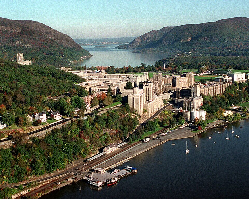 Big draw23 mi MuseumUnited States Military Academy
 Big draw38 mi Stadium & arenaYankee Stadium
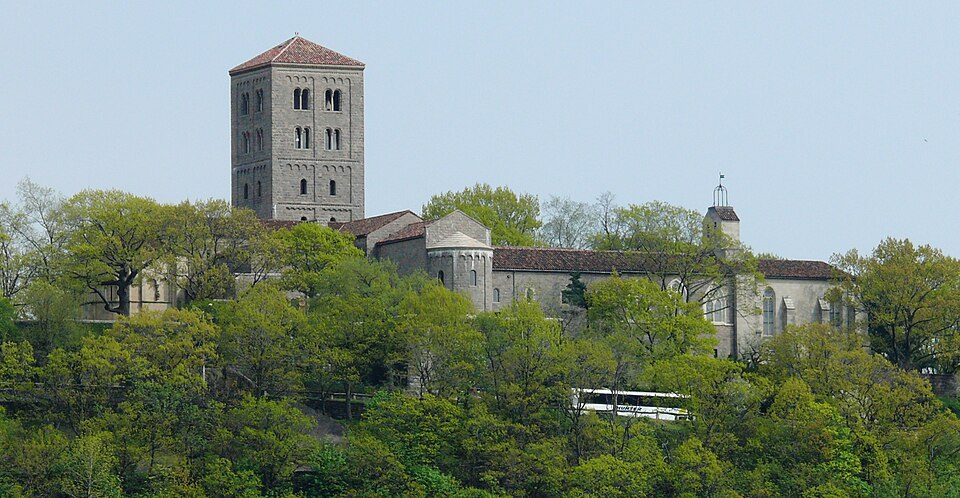 Big draw36 mi MuseumThe Cloisters
 24 mi LandmarkFerncliff Cemetery
 40 mi National MemorialGeneral Grant National Memorial63K visitors a year
 36 mi Zoo & aquariumBronx Zoo
Photo credits
United States Military Academy: USMA Public Affairs Office, Public domain · Yankee Stadium: Matt Boulton, CC BY-SA 2.0 · The Cloisters: Paweł Drozd on Wiki Drozdpl cropped by Beyond My Ken (talk) 17:05, 27 December 2, CC BY-SA 3.0 · Ferncliff Cemetery: Anthony22 at English Wikipedia, CC BY-SA 3.0 · General Grant National Memorial: Daniel Schwen, CC BY-SA 3.0 · Bronx Zoo: Stavenn, CC BY-SA 3.0


Moving to West Mountain: who provides what
West Mountain is unincorporated, so Fairfield County and regional agencies provide most services.
EPA SDWIS (Oct 9, 2026) · HIFLD + EIA-861 2025 · Census 2020 ZCTAs · NCES 2024–25 · registration: vote.gov, updated Sep 30, 2026.
The data
Ordered by what stands out in West Mountain.
The median household income in West Mountain is higher than in the typical Connecticut or U.S. town
The top destinations are Ridgefield (27%), Stamford (8%) and Danbury (7%). Half commute less than 14 miles. For residents in West Mountain, the share who live below the poverty line is 9.8%.
| West Mountain | Connecticut towns | U.S. towns | |
|---|---|---|---|
| Median household income | $250,000 | $109,000 | $80,000 |
| Below the poverty line | 9.8% | 5.8% | 9.6% |
Where working residents work
Census LEHD 2023 · ACS
Low risk in West Mountain, with inland flooding at the top
FEMA puts 62% of West Mountain’s expected hazard losses down to inland flooding, and 25% to hurricanes. Compared with 72% of U.S. communities, expected storm and flood damage locally is lower.
FEMA National Risk Index · OpenFEMA
In West Mountain, expect snowy winters and pleasant summers
A winter brings about 49 inches of snow, with January nights at 19° and July afternoons at 83°.
Typical low → high °F
NOAA U.S. Climate Normals, 1991–2020
West Mountain stands out in Connecticut and nationally, with fewer of its adults who have diabetes
In West Mountain, 78% of adults had a checkup this year. Only 2 of the 155 Connecticut towns we compare have a lower share of adults who have high blood pressure than West Mountain. The town does better than the Connecticut average on 23 of 32 CDC measures and worse on 1.
| West Mountain | Connecticut towns | U.S. towns | |
|---|---|---|---|
| Obesity (CDC PLACES) | 23% | 30% | 35% |
| High blood pressure (CDC PLACES) | 26% | 33% | 35% |
| Frequent physical distress (CDC PLACES) | 9.2% | 12% | 14% |
| Diabetes (CDC PLACES) | 6.7% | 9.4% | 12% |
| What stands out | West Mountain | CT |
|---|---|---|
| Fewer older adults who have lost all their teeth | 2.8% | 9.8% |
| Fewer adults facing food insecurity | 6.7% | 14.9% |
| More binge drinkers | 18.6% | 15.4% |
CDC PLACES 2025 · modeled estimates for adults · CMS · HRSA
9% of West Mountain is conserved land
For West Mountain, the concentration of trails is 0.8 miles per square mile. Walkers can cover 1.8 miles of trail in 8 parks and preserves. Parks and preserves here: 8, covering 152 acres.
| West Mountain | Connecticut towns | U.S. towns | |
|---|---|---|---|
| Miles of trail per square mile | 0.8 miles per square mile | 1.3 | 0.4 |
| Conserved land | 9% | 14% | 4.3% |
| Biggest places to walk | Trails | Acres |
|---|---|---|
| 1. Sturges Park | 0.6 mi | 45 |
| 2. West Mountain Refuge (Reed Section) | 0.5 mi | 24 |
| 3. Land Cons. Of Ridgefield (W. Mt. Road) 3 Parcels | — | 59 |
Trails & parks © OpenStreetMap contributors · Conserved land: USGS PAD-US
Homes in West Mountain sell for about $2.15M
Of the 156 Connecticut towns we compare, none has a higher home-ownership rate than West Mountain.
Census ACS, 2020–24 · Zillow Home Value Index · Redfin Data Center
Everything we know about West Mountain
Colleges nearby
1 within 15 miles of the center of West Mountain
About 4 of every 100 West Mountain residents are enrolled in college, against 7 across Connecticut.
100% of working residents leave West Mountain for work
Where West Mountain’s working residents go each day. Line width shows the share.
Census LEHD 2023
About West Mountain
Census-designated place in Connecticut, United States
West Mountain is a census-designated place (CDP) in the town of Ridgefield, Connecticut, United States. As of the 2020 census, West Mountain had a population of 603. It is on the west side of Ridgefield and is bordered to the west by the towns of North Salem and Lewisboro in Westchester County, New York. The West Mountain Historic District occupies 425 acres (172 ha) at the center of the CDP, and newer residences occupy portions of the remainder of the CDP. West Mountain was first listed as a CDP prior to the 2020 census.
From Wikipedia, licensed CC BY-SA 4.0 · facts via Wikidata (CC0)
- Elevation
- 843 ft
Questions about West Mountain
Short answers, built from the data on this page.
Is West Mountain, CT a good place to live?
West Mountain has fewer than 1,000 residents, too few for fair grades; the figures below are still real.