341 years in pictures
Census counts: 3,031 in 1790, 86,518 in 2020. The archive holds 18 old photos and papers going back to 1800 and 6 maps from 1892 on.
12 places on the National Register of Historic Places.
- 1685Danbury is settled
Each edition grades its towns against each other only.

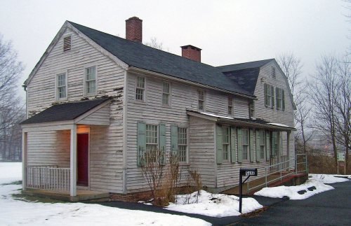
Homes are expensive, about $490K for a typical one and 5.4 times the county’s $90K median household income. Overall it grades C−, 135th among Connecticut's 151 graded towns. It has 48 miles of trail and it is more walkable than 77% of U.S. towns. Its weakest subject is schools: its public schools trail 86% of Connecticut towns on state tests and graduation. 31% of working residents work locally in Danbury, where Connecticut’s towns sit at 11% and U.S. towns at 8%. Only 2 of Connecticut’s 174 towns score lower on civic life. Its National Register listings include Charles Ives House and Ball and Roller Bearing Company.
Where Danbury beats most towns.
Census counts: 3,031 in 1790, 86,518 in 2020. The archive holds 18 old photos and papers going back to 1800 and 6 maps from 1892 on.
12 places on the National Register of Historic Places.
Danbury takes its name from Danbury in Essex, England, 3,430 miles across the Atlantic.
UKUK editionDanbury, settled in 1685, takes its name from Danbury, a town in Essex, England.
Named after: each U.S. town’s Wikipedia article. Grades compare each town with towns in its own country, so they aren’t a head-to-head.
Each subject compared with towns across the country (schools within Connecticut), ordered by how far Danbury is from typical.
How TownRatings grades towns →
Museums, parks, gardens and other places to visit around Danbury. Close and well known come first.
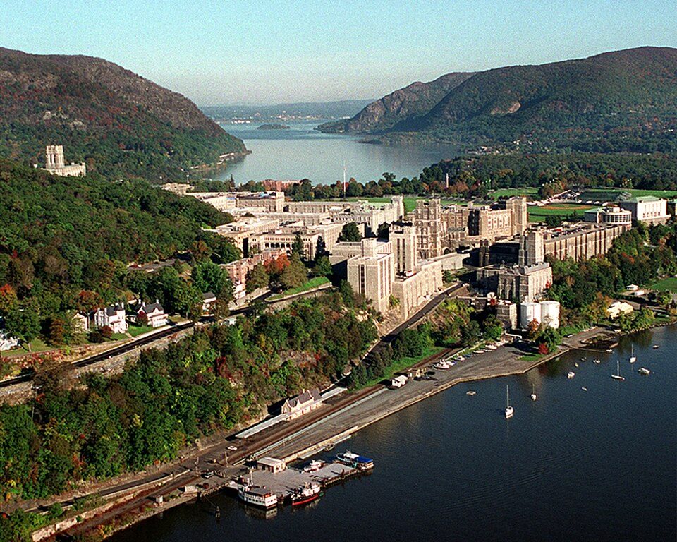
Big draw25 mi MuseumUnited States Military Academy
7 mi LakeCandlewood Lake
32 mi LandmarkFerncliff Cemetery
33 mi National Historic SiteHome of Franklin D. Roosevelt National Historic Site102K visitors a year
28 mi Stadium & arenaYale Bowl
18 mi MuseumGlass HouseUnited States Military Academy: USMA Public Affairs Office, Public domain · Candlewood Lake: Carol M. Highsmith, Public domain · Ferncliff Cemetery: Anthony22 at English Wikipedia, CC BY-SA 3.0 · Home of Franklin D. Roosevelt National Historic Site: Crunch, CC BY-SA 4.0 · Yale Bowl: Kenneth Zirkel, CC BY-SA 4.0 · Glass House: Carol M. Highsmith, Public domain
Who provides power, water and the rest in Danbury, and how to reach them.
EPA SDWIS (Oct 9, 2026) · HIFLD + EIA-861 2025 · Census 2020 ZCTAs · NCES 2024–25 · registration: vote.gov, updated Sep 30, 2026.
Ordered by what stands out in Danbury.
Danbury costs less than Brookfield or any other town next door and is healthy by national standards but behind most towns in Connecticut; it also reports more crime than Brookfield and its other graded neighbors.
Each of its 5 graded neighbors has a higher School Grade than its D, Redding highest at A+.
Its public schools are run by the Danbury School District. Two of its 27 schools are below, each with why it’s listed.
| School | Level | Students | Letter |
|---|---|---|---|
| Broadview Middle SchoolLargest public middle schoolGrades 6–8 | Grades 6–8 | 1,070 | C− |
| Danbury High SchoolLargest public high schoolGrades 9–12 | Grades 9–12 | 3,612 | C |
NCES · EDFacts · graded within CT on state tests and graduation
Within Connecticut it is less healthy than 76% of the 154 graded towns: Connecticut sets a high bar. All 5 graded neighbors score healthier than its B+, from Bethel (A) to Ridgefield (A+).
Danbury beats the Connecticut average on 4 of 32 CDC measures and trails it on 11. 16% of adults 18 to 64 have no health insurance in Danbury. No town among the 154 in Connecticut we compare has a lower share of adults who had a checkup this year than Danbury.
| Danbury | Connecticut towns | U.S. towns | |
|---|---|---|---|
| No health insurance, 18–64 (CDC PLACES) | 16% | 6.1% | 8.1% |
| Feel lonely (CDC PLACES) | 36% | 31% | 33% |
| Depression (CDC PLACES) | 18% | 22% | 23% |
| Yearly checkup (CDC PLACES) | 76% | 81% | 79% |
| What stands out | Danbury | CT |
|---|---|---|
| Fewer adults who have had cancer | 7% | 8.5% |
| Fewer adults with arthritis | 20.8% | 24.7% |
| More uninsured adults | 15.6% | 10% |
CDC PLACES 2025 · modeled estimates for adults · CMS · HRSA
48 miles of trail in 25 parks and preserves. The biggest place to walk is Tarrywile Park, 554 acres with 9.7 miles of trail. Danbury’s trail density is 1.1 miles per square mile.
| Biggest places to walk | Trails | Acres |
|---|---|---|
| 1. Tarrywile Park | 9.7 mi | 554 |
| 2. Bear Mountain Reservation | 4.6 mi | 239 |
| 3. Wooster Mountain State Park | 4 mi | 442 |
Trails & parks © OpenStreetMap contributors · Conserved land: USGS PAD-US
Danbury has chilly, snowy winters and pleasant summers, with plenty of rain. July afternoons reach 84°, January nights drop to 18° and about 49 inches of snow falls in a winter.
NOAA U.S. Climate Normals, 1991–2020
About one in 3 of Danbury’s working residents works in town. The average trip to work in Danbury is 30 minutes. The top destinations are Bethel (5%), New York (4%) and Ridgefield (4%).
| Danbury | Connecticut towns | U.S. towns | |
|---|---|---|---|
| Average trip to work | 30 minutes | 27 minutes | 25 minutes |
| Below the poverty line | 12% | 5.8% | 9.6% |
| Median household income | $83,000 | $109,000 | $80,000 |
| Work from home | 13% | 16% | 11% |
Census LEHD 2023 · ACS
No broad age group is more than 4 points off the Connecticut average. 34% of Danbury adults 25 and older hold a bachelor’s degree or more. Danbury has grown 2.5% since 2020, to 89,033 residents in the Census Bureau’s 2025 estimate.
| Danbury | Connecticut towns | U.S. towns | |
|---|---|---|---|
| Bachelor’s degree or more, 25+ | 34% | 45% | 29% |
| Aged 65 or older | 17% | 20% | 18% |
| Median age | 40.6 years | 44.4 years | 40.5 years |
| Under 18 | 20% | 19% | 22% |
49% women, 51% men
That’s an even split within the survey’s margin of ±1.1 points. Across Connecticut, 50.9% of residents are women. Median age: women 42.0, men 39.3.
| Danbury | CT | U.S. | |
|---|---|---|---|
| Under 10 | 9.7% | 10.4% | 11.6% |
| 10 to 17 | 9.9% | 9.8% | 10.3% |
| 18 to 24 | 10.3% | 9.3% | 9.1% |
| 25 to 34 | 13.5% | 12.6% | 13.7% |
| 35 to 44 | 13% | 12.7% | 13.2% |
| 45 to 54 | 13.5% | 12.5% | 12.2% |
| 55 to 64 | 12.9% | 14.2% | 12.7% |
| 65 to 74 | 10.4% | 10.7% | 10.2% |
| 75 and older | 6.7% | 7.8% | 7% |
| No diploma | 16.6% | 8.5% | 10.4% |
| High school | 26.3% | 25.3% | 26% |
| Some college | 16.8% | 16.1% | 19.1% |
| Associate’s | 6.3% | 7.6% | 8.8% |
| Bachelor’s | 19.5% | 23.3% | 21.6% |
| Graduate | 14.5% | 19.2% | 14.1% |
Census population estimates, 2025 · U.S. Census Bureau · ACS 2020-2024 5-year estimates
186 flood insurance claims have been filed here, and 30 properties have flooded more than once.
Expected storm and flood damage is higher than in 59% of U.S. communities. Since 1978, 186 flood insurance claims have been paid out in Danbury.
FEMA flood insurance claims · FEMA National Risk Index · OpenFEMA
Its typical home is the least expensive on its borders; Brookfield is next at $581K.
Typical home values rose 4.6% in the year to September 2026.
| Danbury | Connecticut towns | U.S. towns | |
|---|---|---|---|
| Households that own their home | 54% | 81% | 73% |
| Median rent | $1,846 a month | $1,448 a month | $1,185 a month |
| Renters paying 30%+ of income on rent | 52% | 50% | 48% |
Zillow Home Value Index · Redfin Data Center
Each of the 4 graded towns on its borders reports less crime per resident, from Brookfield (A−) to Ridgefield (A+). At 19.6 crimes per 1,000 residents a year, it reports more crime than 70% of Connecticut’s graded towns.
FBI crime data, 2025 · crimes reported to police
1 within 15 miles of the center of Danbury
About 8 of every 100 Danbury residents are enrolled in college, about the same as Connecticut.
12 places in Danbury on the National Register of Historic Places.
50 notable people were born in Danbury.
City in Connecticut, United States
Danbury ( DAN-berr-ee) is a city in Fairfield County, Connecticut, United States, located approximately 50 miles (80 km) northeast of New York City. Danbury's population as of 2020 was 86,518. It is the third-largest city in Western Connecticut, and the seventh-largest city in Connecticut. The city is part of the Western Connecticut Planning Region. Located within the heart of the Housatonic Valley region, the city is a historic commercial hub of western Connecticut, home to many commuters and summer residents from the New York metropolitan area and New England. Danbury is nicknamed the "Hat City", because it was once the center of the American hat industry, during the nineteenth and early …
From Wikipedia, licensed CC BY-SA 4.0 · facts via Wikidata (CC0)
8 towns share a border with Danbury.
All 5 graded towns on its borders grade higher than its C−; New Fairfield (B+) is closest.
| Town | CT rank | Overall | Cost | Safety | Schools | Health |
|---|---|---|---|---|---|---|
| Danbury | #135 | C− | D− | B− | D | B+ |
| Bethel | #31 | A− | C− | A | B− | A |
| New Fairfield | #63 | B+ | D | — | A− | A |
| Ridgefield | #2 | A+ | D | A+ | A | A+ |
| Ridgebury | — | — | — | — | — | — |
| Brookfield | #45 | A− | C | A− | B | A+ |
| Taylor Corners | — | — | — | — | — | — |
| Redding | #4 | A+ | D | A+ | A+ | A+ |
New Fairfield reports no FBI crime data of its own. Ridgebury and Taylor Corners aren’t graded (fewer than 1,000 residents, or not enough data). Compare Danbury with a neighbor →
Short answers, built from the data on this page.
Danbury grades C− overall, better than 18% of U.S. towns and #135 of 151 in Connecticut. It grades B+ for health, B− for safety and D for schools. Cost of living is its weak spot, with a D−.
Yes. Cost of living, which also weighs rents, property taxes and how many households pay 30% or more of their income for housing, grades D−.
50 notable people were born here, including Charles Ives and Jonathan Brandis.