
LC-DIG-nclc-00725 Child Labor Rural, 2003
Weatogue’s story
164 years in pictures
The archive holds 6 old photos and papers going back to 2003.
- 1862Weatogue is settled
Each edition grades its towns against each other only.

2,672 people live in this town, settled in 1862.
80% of adults 25 and older hold a bachelor’s degree or more in Weatogue, above both the Connecticut town median (45%) and the median of U.S. towns (29%). No town among the 156 in Connecticut we compare has a lower share of residents below the poverty line than Weatogue. Weatogue’s trail density is 2.9 miles per square mile, against 1.3 in Connecticut’s towns and 0.4 across U.S. towns. The biggest place to walk is Stratton Brook Open Space, 64 acres with 1.2 miles of trail. We don’t grade Weatogue yet; the figures below are still real.
Where Weatogue’s working residents go each day. Line width shows the share.
Census LEHD 2023
The archive holds 6 old photos and papers going back to 2003.
Museums, parks, gardens and other places to visit around Weatogue. Close and well known come first.
 10 mi Stadium & arenaPeoplesBank Arena
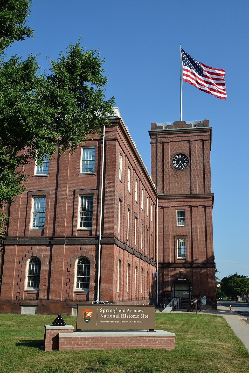 22 mi National Historic SiteSpringfield Armory National Historic Site14K visitors a year
 15 mi Theme parkLake Compounce
 17 mi Theme parkSix Flags New England
 12 mi Stadium & arenaPratt & Whitney Stadium
 9 mi MuseumMark Twain House
PeoplesBank Arena: PeoplesBank Arena, CC BY 2.5 · Springfield Armory National Historic Site: National Park Service, Public domain · Lake Compounce: Wildcat1 at English Wikipedia, Public domain · Six Flags New England: Canadaolympic989, Public domain · Pratt & Whitney Stadium: Quintin Soloviev, CC BY 4.0 · Mark Twain House: Makemake at German Wikipedia, CC BY-SA 3.0
Weatogue is unincorporated, so Hartford County and regional agencies provide most services.
EPA SDWIS (Oct 9, 2026) · HIFLD + EIA-861 2025 · Census 2020 ZCTAs · NCES 2024–25 · registration: vote.gov, updated Sep 30, 2026.
Ordered by what stands out in Weatogue.
8.8 miles of trail wind through 6 parks and preserves.
| Biggest places to walk | Trails | Acres |
|---|---|---|
| 1. Stratton Brook Open Space | 1.2 mi | 64 |
| 2. Town Open Space | 1 mi | 33 |
| 3. Town Forest | 0.4 mi | 6 |
Trails & parks © OpenStreetMap contributors · Conserved land: USGS PAD-US
Most working residents leave Weatogue for work: only 2% work in town. Its middle household income is $164,000. Jobs based in the town fell to 617 in 2023, 1,890 fewer than in 2013. The top destinations are Hartford (17%), Simsbury (14%) and Farmington (7%).
| Weatogue | Connecticut towns | U.S. towns | |
|---|---|---|---|
| Median household income | $164,000 | $109,000 | $80,000 |
| Working residents who work in town | 1.5% | 11% | 8% |
| Average trip to work | 27 minutes | 27 minutes | 25 minutes |
Census LEHD 2023 · ACS
July afternoons reach 85°, January nights drop to 18° and about 39 inches of snow falls in a winter.
NOAA U.S. Climate Normals, 1991–2020
For adults in Weatogue, the share who say their health is fair or poor is 9.6%. Among 155 Connecticut towns, just 2 have a lower share of adults who get no exercise outside work than Weatogue. On the CDC’s 32 measures, Weatogue is ahead of Connecticut on 24 and behind on 1.
| Weatogue | Connecticut towns | U.S. towns | |
|---|---|---|---|
| Frequent physical distress (CDC PLACES) | 9.1% | 12% | 14% |
| Smoke cigarettes (CDC PLACES) | 6.5% | 9.7% | 14% |
| Fair or poor health (CDC PLACES) | 9.6% | 14% | 19% |
| Get no exercise (CDC PLACES) | 16% | 22% | 25% |
| What stands out | Weatogue | CT |
|---|---|---|
| Fewer adults facing food insecurity | 5.9% | 14.9% |
| Fewer uninsured adults | 4% | 10% |
| More adults who have had cancer | 9.8% | 8.5% |
CDC PLACES 2025 · modeled estimates for adults · CMS · HRSA
Expected damage from storms and floods is higher here than in 57% of U.S. communities. FEMA puts 83% of Weatogue’s expected hazard losses down to inland flooding.
FEMA National Risk Index · OpenFEMA
Only 5 of the 152 Connecticut towns we compare have a higher midpoint rent than Weatogue. Homes sold in Weatogue spent a median 32 days on the market. 86% of the homes sold in Weatogue went for more than their asking price.
| Weatogue | Connecticut towns | U.S. towns | |
|---|---|---|---|
| Median rent | $2,950 a month | $1,450 a month | $1,185 a month |
| Households that own their home | 78% | 81% | 73% |
Census ACS, 2020–24 · Zillow Home Value Index · Redfin Data Center
9 within 15 miles of the center of Weatogue
About 8 of every 100 Weatogue residents are enrolled in college, about the same as Connecticut.
Census-designated place in Connecticut, United States
Weatogue ( WEE-tawg) is a village and census-designated place in Simsbury, Connecticut, United States. As of the 2020 census, Weatogue had a population of 2,906.
From Wikipedia, licensed CC BY-SA 4.0 · facts via Wikidata (CC0)
2 towns share a border with Weatogue.
| Town | CT rank | Overall | Cost | Safety | Schools | Health |
|---|---|---|---|---|---|---|
| Weatogue | — | — | — | — | — | — |
| Simsbury Center | — | — | — | — | — | — |
| West Simsbury | — | — | — | — | — | — |
Weatogue, Simsbury Center and West Simsbury aren’t graded (fewer than 1,000 residents, or not enough data). Compare Weatogue with a neighbor →
Short answers, built from the data on this page.
We don’t grade Weatogue yet; the figures below are still real.


