The indigenous village of Sasqua, inhabited by Quiripi language speakers, was located in the area. Members of that community later formed the Golden Hill Paugussett Indian Nation.
Passages that mention Southport, cut from the printed page as they were published.
History of Fairfield county, Connecticut1881 · page 350Read the page →
Read the text
The village of Southport was originally included in the parish of Fairfield. A general desire on the part of its residents to enjoy the privileges of the .sanctuary within a more convenient distance led to the completion of a church edifice in their village in the year 1843.
Text read by machine from the scan; it may contain errors.
History of Fairfield County, Connecticut, 1639-19281929 · page 280Read the page →
Read the text
large tract of land in Stratford. He also owned property in i ldgeport. He at one time owned and operated the old toll bridge over the Pequonnock river and also owned the noted Tide Mill at Southport. Eliakim Hough, who was a pioneer real estate developer in Bridgeport and vicinity and an outstanding figure
Text read by machine from the scan; it may contain errors.
The history of Fairfield, Fairfield County, Connecticut, from the settlement of the town in 1639 to 18181889 · page 452Read the page →
Read the text
its own. The parish at Stratfield also had erected a church upon the Plain of Pequonnuc a short distance east of the grove near the new cemetery, the number of families by this time having increased to about twenty-five. By these changes the parish of Fairfield was reduced in limits to the villages of Greens Farms, Greenfield, & Southport, or Mill River. The parishes of Stratfield & Norfield, however, continued under the care of the Rev. Mr. Lamson who preached once a month at Stratfield, & at Norfield, giving them besides as much of his time as his parish at Fairfield would allow. He was an able & accomplished scholar, a devoted and enthusiastic churchman, greatly beloved among his
Text read by machine from the scan; it may contain errors.
Scans and text from the Internet Archive. Books published in 1930 or earlier, which are in the public domain.
By decade
Southport, decade by decade
2 decades in the archive, from the 1880s to the 1900s. Scroll each row; tap a photo for its story.
Nothing in the archives for these yearsWeddings on Main Street, storms, parades, school pictures, the old store. If it’s in your family album, it belongs here.
Fire insurance maps drew every building, what it was made of and what it was used for, so insurers could price the risk of fire. Pick a year, then a sheet.
Founding dates: Wikidata, Wikipedia, the U.S. post office records of Blevins & Helbock (CC0) and the Census. Homes by year built: Census ACS 2020–24. National Register of Historic Places: National Park Service (list of May 22, 2026). Old photos, postcards and papers: Wikimedia Commons, the Library of Congress and other public archives, credited on each item’s page. Maps: U.S. Geological Survey historical topographic maps (via Esri) and Sanborn fire-insurance maps (Library of Congress). History text and census tables: Wikipedia (CC BY-SA 4.0). Places that used to be: USGS Geographic Names Information System (2021). How TownRatings grades history →
From Wikimedia Commons (5), the Library of Congress (1), Wikipedia, Wikidata and Wikipedia for famous people, U.S. Geological Survey historical maps, Sanborn fire insurance maps (Library of Congress) and old county and town histories (Internet Archive). Archive images are copied here with their credits and licenses, shown on each photo’s page. Refreshed monthly.


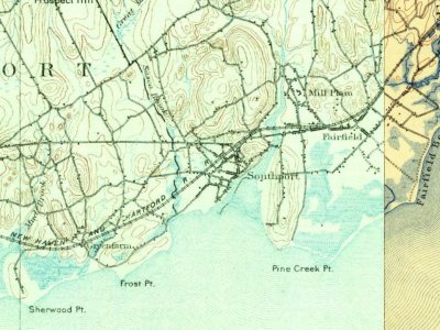


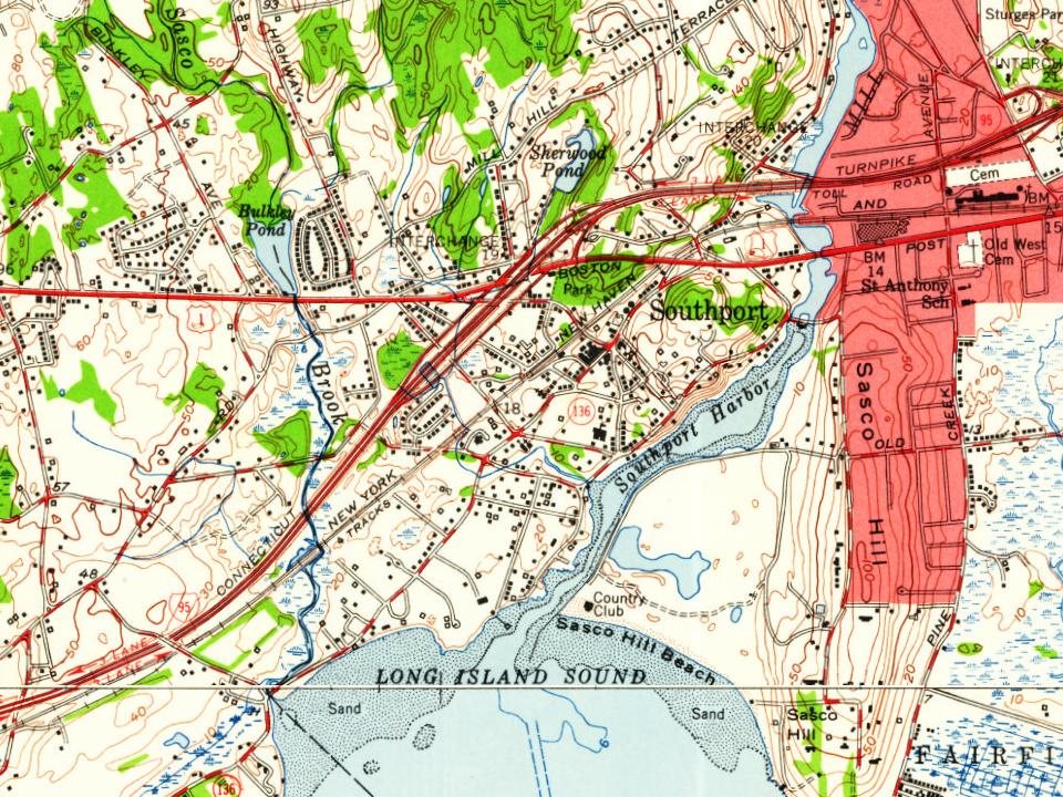


 1900
 1903
 1905
 c. 1905

