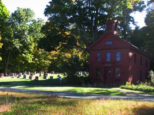
Southbury dates to 1787, and 12 of its places are on the National Register
More historic than 74% of U.S. towns · #106 of 155 in Connecticut. What drives it
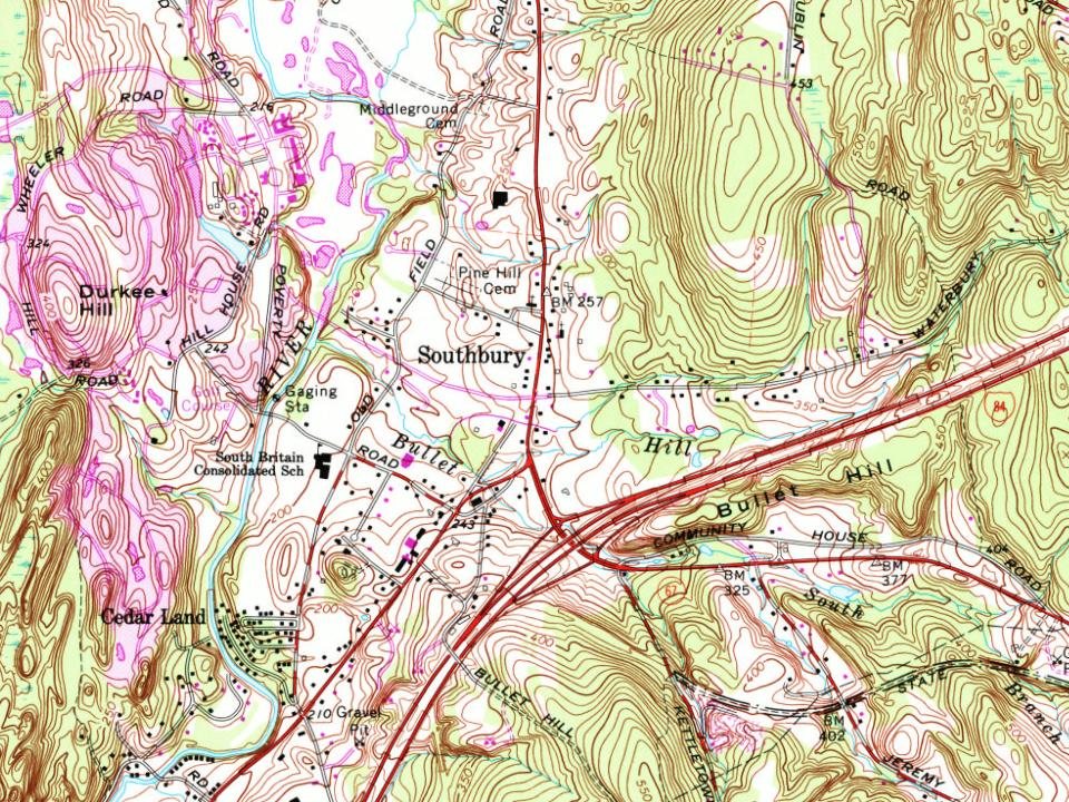
Most of Southbury was built recently: 8% of its homes predate 1940 and the median home dates from 1977. 12 places in town are on the National Register, among them five historic districts with 180 buildings between them. Below: 1 old photo or paper, maps from 1889 on, and the census since 1800.
Founding year: Wikidata. First post office: 1813.The full story ↓
History grade
What drives Southbury’s History grade
On its age, its old homes and the National Register, Southbury is more historic than 74% of U.S. towns, #106 of 155 in Connecticut. Its age holds the grade up; its share of homes from before 1940 pulls it down.
B+
HistoryA character grade: shown, never part of Southbury’s overall grade.
Connecticut towns list more on the Register than most of the country (a typical Connecticut town has 73.3 per 10,000 residents, the U.S. 2.4), so Southbury’s 97.7 sits near the middle of its state (57% of Connecticut towns have fewer) while its 196 historic buildings outnumber those of 93% of U.S. towns.
NoteThe founding year comes from Wikidata alone; no second source gives 1787.
How sure. Graded on any two of the three inputs instead, the letter would range from B to A−. The pre-1940 share (±2.1 points) is firm at this size.
Founding year: Wikidata (other dates in Quick answers). Homes: Census ACS 2020–24. National Register: National Park Service, May 2026 list; each listing counted once (boundary changes and added documentation belong to their listing), and a historic district counts its contributing buildings. How TownRatings grades history →
What stands out about Southbury’s past
Read from the archive, the National Register and the record. The page puts what stands out first.
The town of Southbury was one of several towns formed out of parcels of land purchased from the Pootatuck Native Americans. Southbury was originally part of Woodbury, which was settled in 1673. A meetinghouse for the Southbury Ecclesiastical Society was built in 1733, and in 1787 the town of Southbury was incorporated. After two decades within Litchfield County, Southbury was transferred to New Haven County in 1807.
In the 1800s, water power became essential to the growth of Southbury's industries, which included mills, tanneries, and distilleries. The power for these industries came primarily from the Pomperaug River and the Housatonic River. As the industrial revolution progressed, many of these businesses left for Waterbury.
Passages that mention Southbury, cut from the printed page as they were published.
History of ancient Woodbury, Connecticut, from the first Indian deed in 1659 including the present towns of Washington, Southbury, Bethlem, Roxbury, and a part of Oxford and Middlebury1871 · page 237Read the page →
Read the text
" Voted to request the Gen' Assembly that in case they should incorporate the parish of South Britain, Southbury, and part of Oxford parish into a sepirate town, or the parish of Bethlehem, or the parish of Koxbury, that they would order and decree that each inhabitant, that has land lying in the bounds of Woodbury, as the bounds now are, shall put all his lands into the list In that town where the owner shall reside after such Incorporation.'' * This petition was granted at the May session of the General Assembly, lj787 ; and the town incorporated by the name of South-
Text read by machine from the scan; it may contain errors.
History of ancient Woodbury, Connecticut, from the first Indian deed in 1659 including the present towns of Washington, Southbury, Bethlem, Roxbury, and a part of Oxford and Middlebury1871 · page 88Read the page →
Read the text
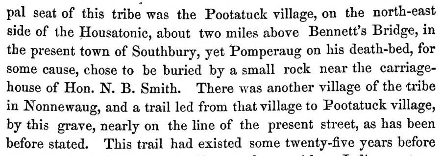
pal seat of this tribe was the Pootatuck village, on the north-east side of the Housatonic, about two miles above Bennett's Bridge, in the present town of Southbury, yet Pomperaug on his death-bed, for some cause, chose to be buried by a small rock near the carriagehouse of Hon. N. B. Smith. There was another village of the tribe in Nonnewaug, and a trail led from that village to Pootatuck village, by this grave, nearly on the line of the present street, as has been before stated. This trail had existed some twenty-five years before
Text read by machine from the scan; it may contain errors.
History of ancient Woodbury, Connecticut, from the first Indian deed in 1659 ... including the present towns of Washington, Southbury, Bethlem, Roxbury, and a part of Oxford and Middlebury1854 · page 792Read the page →
Read the text
Southbury was set off from Woodbury and incorporated in 1787. following is a list of Eepresentatives to the present time. The May Session.
Text read by machine from the scan; it may contain errors.
History of ancient Woodbury, Connecticut, from the first Indian deed in 1659 ... including the present towns of Washington, Southbury, Bethlem, Roxbury, and a part of Oxford and Middlebury1854 · page 797Read the page →
Read the text
Southbury incorporated as a town. May, 1787. Bethlehem Society incorporated, Oct., 1739. Great Sickness in that society, 1750.
Text read by machine from the scan; it may contain errors.
Scans and text from the Internet Archive. Books published in 1930 or earlier, which are in the public domain.
Timeline
Southbury, 1704 to 2003
Woven from the archive, old maps, post office records, the National Register and the people born here.
Nothing in the archives for these yearsWeddings on Main Street, storms, parades, school pictures, the old store. If it’s in your family album, it belongs here.
In 1787, according to Wikidata. Southbury’s post office opened in 1813, and the census of 1800 counted 1,757 people here.
How does Southbury rank for history?
Southbury is more historic than 74% of U.S. towns, #106 of 155 in Connecticut. The History grade combines the town’s founding era, the share of homes built before 1940 and its National Register listings. It’s a character grade, so it isn’t part of the overall grade. How it works.
What is on the National Register in Southbury?
12 listings: 7 buildings and 5 historic districts with 180 contributing buildings. 196 historic buildings in all.
How old are the homes in Southbury?
8% of Southbury’s homes were built before 1940 (Census estimate, ±2.1 points), against a typical 15% for a Connecticut town; the median home was built in 1977.
Founding dates: Wikidata, Wikipedia, the U.S. post office records of Blevins & Helbock (CC0) and the Census. Homes by year built: Census ACS 2020–24. National Register of Historic Places: National Park Service (list of May 22, 2026). Old photos, postcards and papers: Wikimedia Commons, the Library of Congress and other public archives, credited on each item’s page. Maps: U.S. Geological Survey historical topographic maps (via Esri) and Sanborn fire-insurance maps (Library of Congress). History text and census tables: Wikipedia (CC BY-SA 4.0). Places that used to be: USGS Geographic Names Information System (2021).
From Wikimedia Commons (15), Wikidata (3), the National Register of Historic Places (12), Wikipedia, Wikidata and Wikipedia for famous people, U.S. Geological Survey historical maps, U.S. Census counts (via Wikipedia), the US Post Offices dataset (Blevins & Helbock), the USGS Geographic Names Information System and old county and town histories (Internet Archive). Archive images are copied here with their credits and licenses, shown on each photo’s page. Refreshed monthly.






 2014
 2014
 2013
 2013
 2013
 2013
 2013
 2012
 2012
 2012
 2010
 2009
 2006
 2006