Middletown dates to 1651, and 23% of its homes were built before 1940
More historic than 93% of U.S. towns · #28 of 155 in Connecticut. What drives it
35 places in town are on the National Register, among them 2 National Historic Landmarks and ten historic districts with 315 buildings between them. Below: 11 old photos and papers, maps from 1884 on, and the census since 1810.
Founding year: Wikidata. First post office: 1776.The full story ↓
History grade
What drives Middletown’s History grade
On its age, its old homes and the National Register, Middletown is more historic than 93% of U.S. towns, #28 of 155 in Connecticut. All 3 inputs are above most U.S. towns; its age ranks highest and its National Register listings lowest.
A
HistoryA character grade: shown, never part of Middletown’s overall grade.
Connecticut towns list more on the Register than most of the country (a typical Connecticut town has 73.3 per 10,000 residents, the U.S. 2.4), so Middletown’s 72.4 sits near the middle of its state (48% of Connecticut towns have fewer) while its 347 historic buildings outnumber those of 96% of U.S. towns.
NoteThe founding year comes from Wikidata alone; no second source gives 1651.
How sure. Graded on any two of the three inputs instead, the letter would range from A− to A. The pre-1940 share (±1.9 points) is firm at this size.
Founding year: Wikidata (other dates in Quick answers). Homes: Census ACS 2020–24. National Register: National Park Service, May 2026 list; each listing counted once (boundary changes and added documentation belong to their listing), and a historic district counts its contributing buildings. How TownRatings grades history →
What stands out about Middletown’s past
Read from the archive, the National Register and the record. The page puts what stands out first.
The land on the western bank of the Connecticut River where Middletown now lies was home to a village of the Wangunk, a tribe of Algonquian-speaking Native Americans. The village was named Mattabesset (also spelled Mattabesett, Mattabesec, Mattabeseck, and Mattabesek); the area they inhabited—now Middletown and the surrounding area—was named after it. When the primarily English European settlers arrived in the region the Mattabesset were a part of the Wangunk, a large tribe in the Connecticut Valley, at the time under a sachem named Sowheag.
Passages that mention Middletown, cut from the printed page as they were published.
History of Middlesex county, Connecticut, with biographical sketches of its prominent men1884 · page 245Read the page →
Read the text
" The poor of said town of Middletown who were born within the limits hereby incorporated and who have not by residence or otherwise gained a settlement elsewhere in this State than within said limits, shall be deemed inhabitants of said town of Cromwell, and shall be inaintained accordingly. And said town of Cromwell shall be liable to maintain all such poor of the town of Middletown as are or may be absent therefrom. Provided, such
Text read by machine from the scan; it may contain errors.
History of Middlesex county, Connecticut, with biographical sketches of its prominent men1884 · page 244Read the page →
Read the text
Soon after the first settlement of Middletown, the section north of Little River began to be called " Upper Houses," or vulgarly '' Upper Housen." When it was made a separate parish, it was designated in the official documents as " The Second Ecclesiastical Society of Middletown." Frequently in the reports of the Society it is called " North Society." When a post office was established, this part of the town was known as " Middle-
Text read by machine from the scan; it may contain errors.
Scans and text from the Internet Archive. Books published in 1930 or earlier, which are in the public domain.
By decade
Middletown, decade by decade
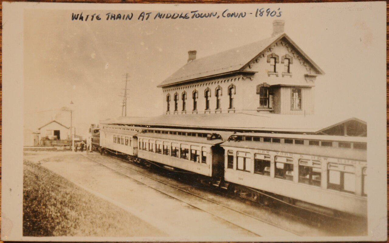
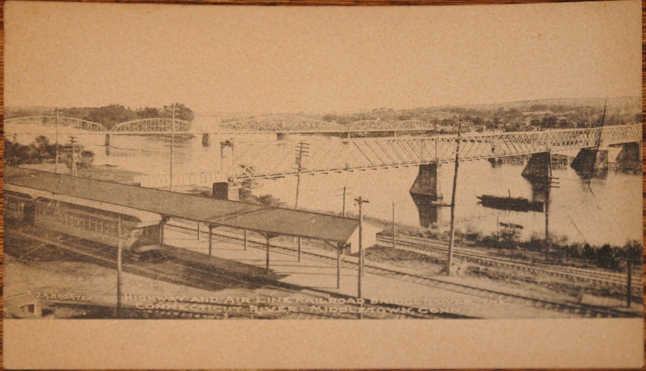
4 decades in the archive, from the 1870s to the 1900s. Scroll each row; tap a photo for its story.
Nothing in the archives for these yearsWeddings on Main Street, storms, parades, school pictures, the old store. If it’s in your family album, it belongs here.
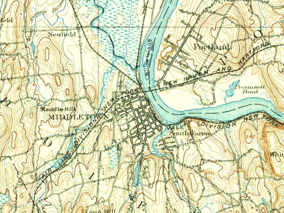
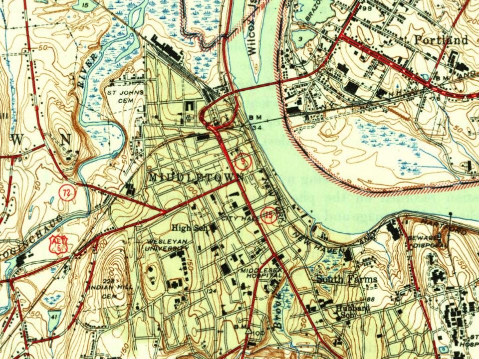
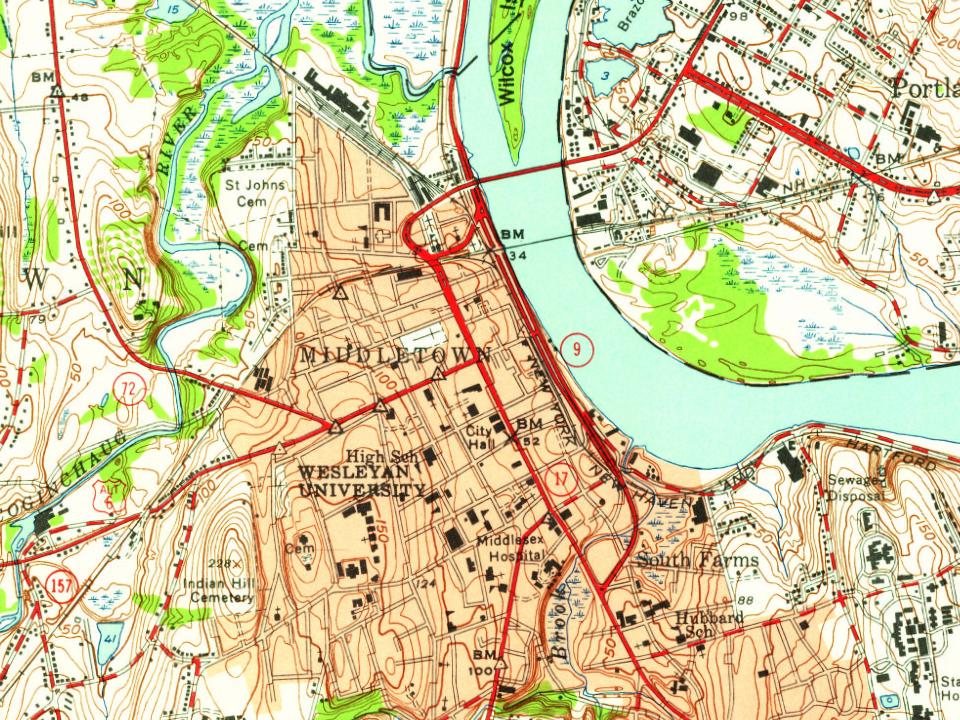
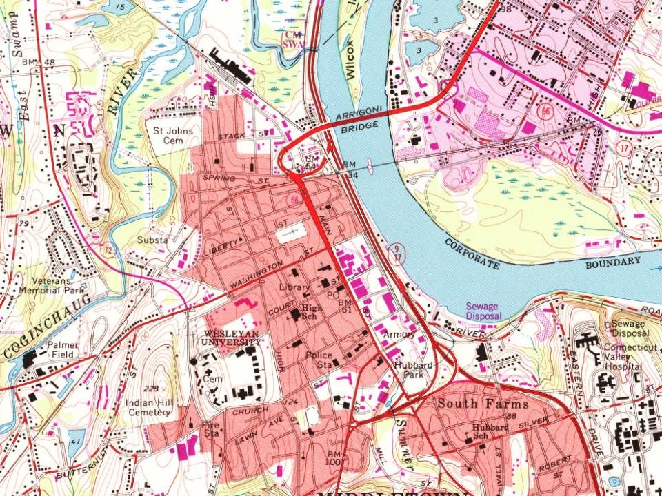
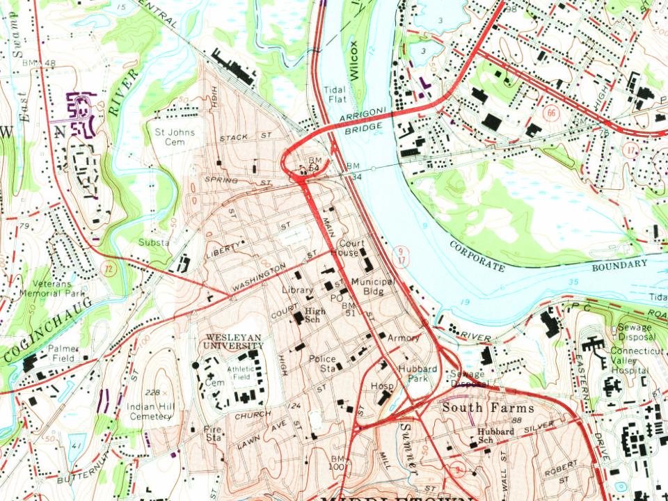
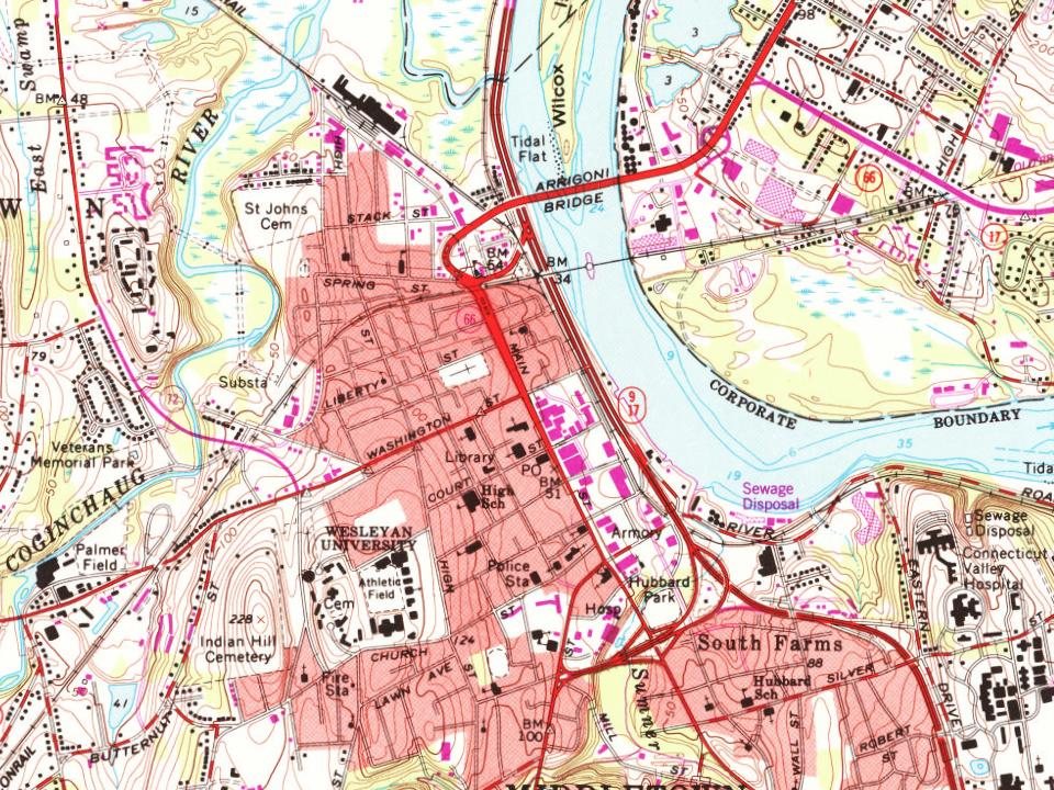
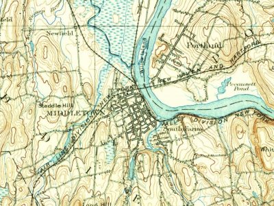
Every edition of the U.S. Geological Survey’s map of Middletown. Tap a year, or press play to watch the town change.
1893Middletown sheet · 1:62,500
U.S. Geological Survey historical topographic maps (public domain), via Esri’s collection of the scans. The red ring marks the center of Middletown.
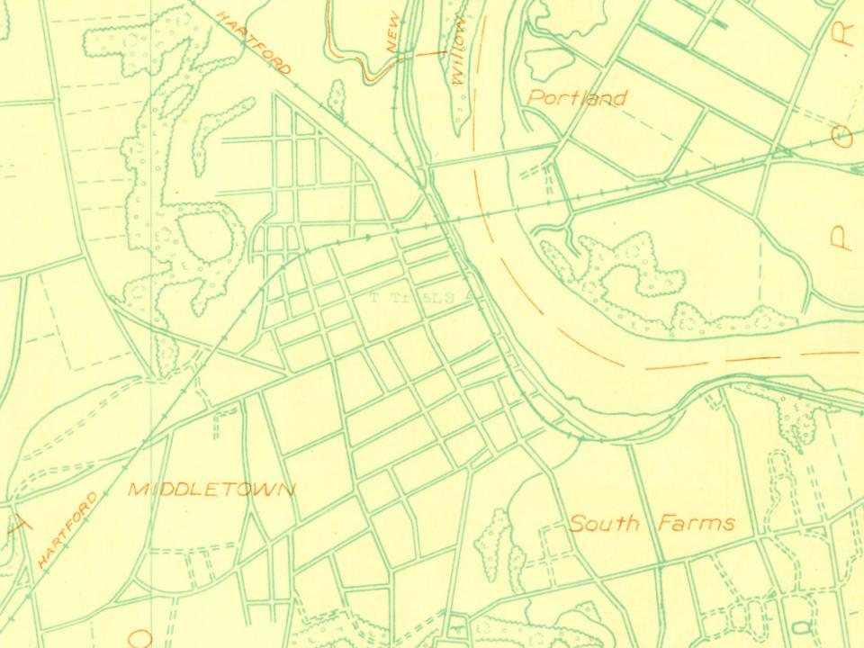
Every building
Middletown, building by building, 1884–1913
Fire insurance maps drew every building, what it was made of and what it was used for, so insurers could price the risk of fire. Pick a year, then a sheet.
Lost post offices, old corners, places now gone and burying grounds
Middletown’s post office has been open since 1776. Another post office, Little River, opened and closed inside today’s town.
Middletown
1776–today
Little River
1876–1928
17701900today
Hamlets and corners on the map
AchenbachBretton HeightsHighlandHighland EstatesLakeridge HeightsLong HillLong HIll EstatesMaromasMiramichiNewfield HeightsSouth FarmsWestfield
Gone or out of use
American LIterary Scientific and Military AcademyschoolBerkeley Divinity SchoolschoolLock Shop Pond DamdamNorth EndlocaleRussell Company Upper MilllocaleSaint Lukes Home for Destitute and Aged WomenbuildingSanseer MilllocaleWilcox Crittenden Milllocale
18cemeteries and burying grounds inside Middletown
CalhounCalvaryIndian HillMaromasMinerMortimerOld EastOld Farm HillOld South HillOld WestfieldPine GroveRiversideSaint JohnSaint MaryState VeteransVeterans Memorial ParkWashington StreetWilcox
US Post Offices dataset (Blevins & Helbock, CC0). Places and cemeteries from the USGS Geographic Names Information System (2021).
Help out
Finish Middletown’s story
Most archives stop around 1920. The photos from after that are in family albums, not libraries.
Decades since 1900 with photos
00s10s20s30s40s50s60s70s80s90s
1 of 10 decades. The empty ones are waiting for someone’s album.
In 1651, according to Wikidata. Middletown’s post office opened in 1776, and the census of 1810 counted 2,014 people here.
How does Middletown rank for history?
Middletown is more historic than 93% of U.S. towns, #28 of 155 in Connecticut. The History grade combines the town’s founding era, the share of homes built before 1940 and its National Register listings. It’s a character grade, so it isn’t part of the overall grade. How it works.
What is on the National Register in Middletown?
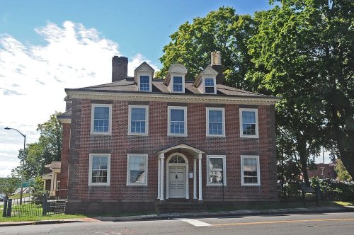
35 listings, 2 of them National Historic Landmarks: 23 buildings, among them the Richard IV Alsop House (a National Historic Landmark since 2009) and the Seth Wetmore House (listed 1970, the first), 10 historic districts with 315 contributing buildings, and 2 structures. 347 historic buildings in all.
How old are the homes in Middletown?
23% of Middletown’s homes were built before 1940 (Census estimate, ±1.9 points), against a typical 15% for a Connecticut town; the median home was built in 1972.
Founding dates: Wikidata, Wikipedia, the U.S. post office records of Blevins & Helbock (CC0) and the Census. Homes by year built: Census ACS 2020–24. National Register of Historic Places: National Park Service (list of May 22, 2026). Old photos, postcards and papers: Wikimedia Commons, the Library of Congress and other public archives, credited on each item’s page. Maps: U.S. Geological Survey historical topographic maps (via Esri) and Sanborn fire-insurance maps (Library of Congress). History text and census tables: Wikipedia (CC BY-SA 4.0). Places that used to be: USGS Geographic Names Information System (2021).
From Wikimedia Commons (11), Wikidata (1), the National Register of Historic Places (35), Wikipedia, Wikidata and Wikipedia for famous people, U.S. Geological Survey historical maps, U.S. Census counts (via Wikipedia), the US Post Offices dataset (Blevins & Helbock), the USGS Geographic Names Information System, Sanborn fire insurance maps (Library of Congress) and old county and town histories (Internet Archive). Archive images are copied here with their credits and licenses, shown on each photo’s page. Refreshed monthly.



 ★ Landmark
 ★ Landmark





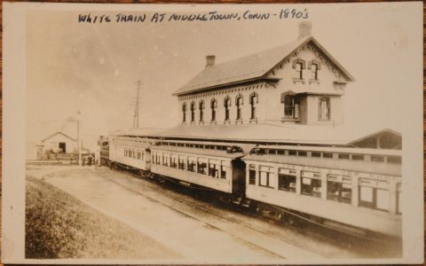



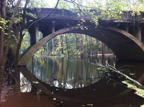


 1891
 1891
 1891
 c. 1900
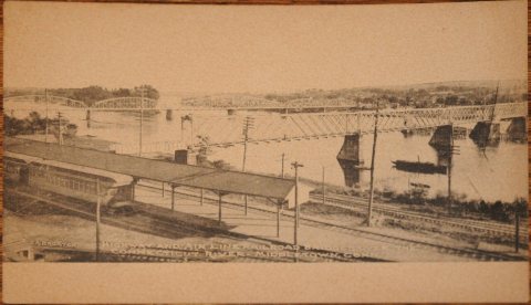 1901–1907
 1906
 1906