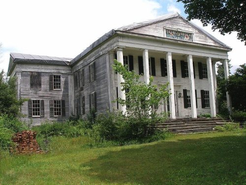
9 places in town are on the National Register, among them the Steward's House, Foreign Mission School, a National Historic Landmark. Below: maps from 1892 on and the census since 1820.
Founding year: Wikipedia. First post office: 1802.The full story ↓
History grade
What drives Cornwall’s History grade
On its age, its old homes and the National Register, Cornwall is more historic than 96% of U.S. towns. All 3 inputs are above most U.S. towns; its age ranks highest and its National Register listings lowest.
A+
HistoryA character grade: shown, never part of Cornwall’s overall grade.
Connecticut towns list more on the Register than most of the country (a typical Connecticut town has 73.3 per 10,000 residents, the U.S. 2.4), so Cornwall’s 91.2 sits near the middle of its state (53% of Connecticut towns have fewer) while its 13 historic buildings outnumber those of 77% of U.S. towns.
NoteThe founding year comes from Wikipedia alone; no second source gives 1740.
How sure. Graded on any two of the three inputs instead, the letter would range from A to A+. The pre-1940 share is a Census survey estimate (±5.2 points).
Founding year: Wikipedia (other dates in Quick answers). Homes: Census ACS 2020–24. National Register: National Park Service, May 2026 list; each listing counted once (boundary changes and added documentation belong to their listing), and a historic district counts its contributing buildings. How TownRatings grades history →
What stands out about Cornwall’s past
Read from the archive, the National Register and the record. The page puts what stands out first.
The town of Cornwall, Connecticut, is named after the county of Cornwall, England. The town was incorporated in 1740, nearly four decades before the United States declared its independence. The town encompasses three townships: Cornwall Bridge and West Cornwall, each bordered by the Housatonic River to the west, and Cornwall Village, located three miles east of the river. In addition to those three townships, there are also the hamlets of East Cornwall and Cornwall Hollow, both distinct communities within the town. One significant natural feature is the vast amount of forested land, including hundreds of acres of Mohawk State Forest, resulting in Cornwall often being called “the “Greenest Town in Connecticut”.
Passages that mention Cornwall, cut from the printed page as they were published.
Genealogy of the descendants of Thomas Tanner, sr., of Cornwall, Connecticut, with brief notes of several allied families, also short sketches of several towns of their early residence1893Read the page →
Read the text
These settlements are supposed to have been made in the southern part wliere the first village of Cornwall was located; but soon after settlements were made in the north part, in Cornwall Hollow, lying among tlie mountains. Among these settlers was one William Tanner. Jr.. calle<l 'Mh-eat Tanner," from his large
Text read by machine from the scan; it may contain errors.
Historical records of the town of Cornwall, Litchfield County, Connecticut1904 · page 160Read the page →
Read the text
"Upon the petition of Noah Rogers, and others, Resolved by this Assembly, that such of the petitioners and others, inhabitants of town of Cornwall, residing within the limits of the First Ecclesiastical Society in Cornwall, as shall, on or before the first day of December enrol themselves as hereinafter directed, shall be and constitute an ecclesiastical society by the name of the Second Ecclesiastical Society in Cornwall ; and Noah Rogers J% of said town is hereby appointed to enrol the names of all such persons as shall by said day elect to be enrolled as
Text read by machine from the scan; it may contain errors.
Historical records of the town of Cornwall, Litchfield County, Connecticut1904 · page 22Read the page →
Read the text
The Housatonic is now crossed by three bridges, maintained jointly with Sharon, two of wood and one of iron: one at West Cornwall, formerly Hart's Bridge; one at Cornwall Bridge; and one in the southwest part of the town, caUed Swift's Bridge. This latter was rebuilt in 1875 of iron, at a cost of $2,500, a single span, as it was difficult to maintain a pier from the ice.
Text read by machine from the scan; it may contain errors.
Scans and text from the Internet Archive. Books published in 1930 or earlier, which are in the public domain.
Timeline
Cornwall, 1740 to 2016
Woven from the archive, old maps, post office records, the National Register and the people born here.
In 1740, according to Wikipedia’s history of the town. Cornwall’s post office opened in 1802, and the census of 1820 counted 1,661 people here.
How does Cornwall rank for history?
Cornwall is more historic than 96% of U.S. towns. The History grade combines the town’s founding era, the share of homes built before 1940 and its National Register listings. It’s a character grade, so it isn’t part of the overall grade. How it works.
What is on the National Register in Cornwall?
9 listings: 8 buildings, among them the Steward's House, Foreign Mission School (a National Historic Landmark since 2016), and the Cornwall Bridge Railroad Station (listed 1972, the first), and 1 structure. 13 historic buildings in all.
How old are the homes in Cornwall?
40% of Cornwall’s homes were built before 1940 (Census estimate, ±5.2 points), against a typical 15% for a Connecticut town; the median home was built in 1959.
Founding dates: Wikidata, Wikipedia, the U.S. post office records of Blevins & Helbock (CC0) and the Census. Homes by year built: Census ACS 2020–24. National Register of Historic Places: National Park Service (list of May 22, 2026). Old photos, postcards and papers: Wikimedia Commons, the Library of Congress and other public archives, credited on each item’s page. Maps: U.S. Geological Survey historical topographic maps (via Esri) and Sanborn fire-insurance maps (Library of Congress). History text and census tables: Wikipedia (CC BY-SA 4.0). Places that used to be: USGS Geographic Names Information System (2021).
From Wikimedia Commons (18), the Library of Congress (11), Wikidata (3), the National Register of Historic Places (9), Wikipedia, Wikidata and Wikipedia for famous people, U.S. Geological Survey historical maps, U.S. Census counts (via Wikipedia), the US Post Offices dataset (Blevins & Helbock), the USGS Geographic Names Information System and old county and town histories (Internet Archive). Archive images are copied here with their credits and licenses, shown on each photo’s page. Refreshed monthly.


 2019
 2016
 2016
 2016
 2012
 2011
 2011
 2011
 2011
 2011
 2011
 2011
 2011
 2011
 2011
 2011
 2011
 2011
 2011
 2011
 2011
 2011
 2011
 2011
 2011
 2011
 2011
 2010
 2006