Guest, Sign inJoin

Post to Castle Rock

We’ll email a one-tap link to publish your post. No password, and nothing is public until you click it.
Already a member? Sign in
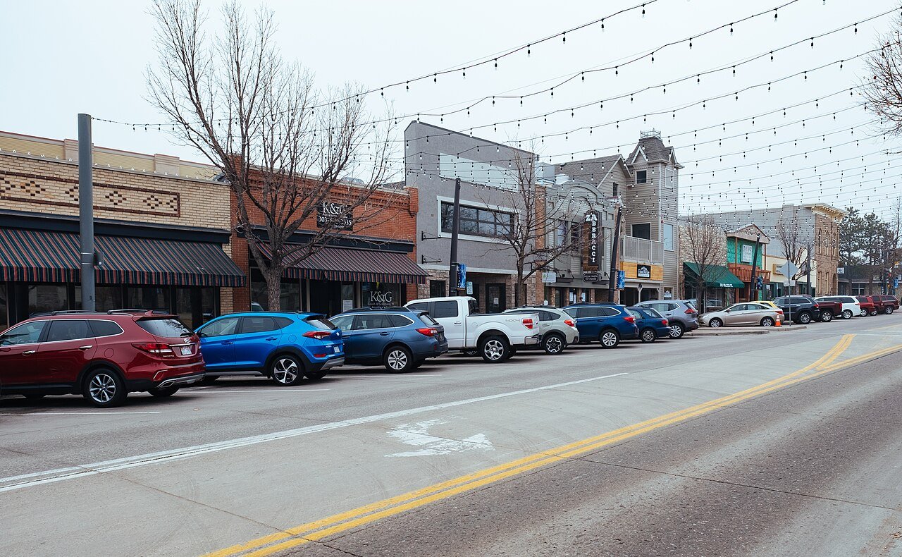
Castle Rock, COPhoto: Jared Winkler · CC BY-SA 4.0
AOutdoors
Outdoors in Castle Rock

Castle Rock has 79 miles of mapped trails, 2.3 for every square mile of land

12% of Castle Rock’s land is conserved, about 2,579 acres. 91% of residents live within a half mile of a park. The biggest trail networks: Ridgeline Open Space (10.9 mi), Philip S. Miller Park (9.8 mi), Metzler Family Open Space (4.3 mi).

Ahead of 94% of U.S. towns · #40 of 159 in Colorado. What drives it

Conserved land
12%
2,579 acres · of 34.7 sq mi of land
Trails
79 mi
2.3 per sq mi of land
Park land
2,766 ac
35 acres per 1,000 residents
Near a park
91%
of residents within ½ mile
Bike routes
95 mi
24 mi lanes · 71 mi paths

What kind of outdoors town is Castle Rock?

Read from the map. The page puts what stands out first.

Outdoors grade

How much outdoors does Castle Rock have?

On conserved land, trails, park land and how close residents live to a park, Castle Rock is ahead of 94% of U.S. towns, #40 of 159 in Colorado. All four inputs are above most U.S. towns; trail miles rank highest, park acres per resident lowest.

A
OutdoorsA character grade: shown, never part of Castle Rock’s overall grade.
All U.S. towns we grade (21,298)Ahead of 94%
LessMore
Colorado towns of 2,500+ (159)Ahead of 75%

Colorado towns conserve more land than most (a typical one, 7%; the U.S., 4%), so Castle Rock’s 12% is ahead of 67% of Colorado towns, while its trails per square mile lead 73% of them.

How sure. Graded on any three of the four inputs instead, the letter would still be A. Trails and many small parks come from OpenStreetMap, mapped by volunteers, so coverage varies from town to town; the half mile is a straight line from each census block, so a river or highway in the way isn’t counted against it.

PAD-US, OpenStreetMap (© OpenStreetMap contributors), Census 2025 Gazetteer and 2020 blocks; details in Sources below. How TownRatings grades the outdoors →

The map

Conserved land, trails & bike routes

Tap a number to zoom to a park. Tap a layer to hide it.

12345678
Easements protect land from building but are usually private.© OpenStreetMap contributors · USGS PAD-US
Places to walk

Pick a walk

The longest trail network is Ridgeline Open Space, with 10.9 miles. Directions go to the nearest trailhead or public parking.

Ridgeline Open Space

Park
363 acres10.9 mi of trail
Green Loop TrailRed Loop TrailBlue Loop TrailYellow Loop Trail+1
Dog rules not recorded
Directionsto Ridgeline Trailhead Parking (Coachline Road)

Philip S. Miller Park

Managed by Town of Castle Rock
283 acres9.8 mi of trail
Gold Loop TrailRed Loop TrailGreen Loop TrailPurple Loop Trail+1
Dogs allowed
Directionsto the parking lot

Metzler Family Open Space

Park
116 acres4.3 mi of trail
Gus' Gultch TrailBob's TrailRancher's Ridge TrailFounder's Vista Trail+1
Dog rules not recorded
Directionsto the parking lot

Hidden Mesa Open Space

Managed by Douglas County, Colorado
631 acres4.2 mi of trail
Hidden Mesa - Mesa Rim LoopHidden Mesa TrailPleasant Pass Trail
Dog rules not recorded
Directionsto Pleasant View Entrance

Rock Park

Park
65 acres1.9 mi of trail
John Emerson Summit TrailPaul Hill Trail (East Trail)Paul Hill Trail (Rock Street)
Dog rules not recorded
Directionsto Rock Park Trailhead

Memmen Ridge Open Space

Park
45 acres1.8 mi of trail
Memmen Ridge Open Space Trail
Dog rules not recorded
Directionsto Memmen Ridge Open Space Trailhead

Rhyolite Regional Park

Park
53 acres1.4 mi of trail
Cyclocross Course TrailQuarry Mesa Trail (Madge Trail)Rhyolite Bike Park Trail Pump TrackRhyolite Bike Park Trail+1
Dog rules not recorded
Directionsto Rhyolite Regional Park

Cobblestone Ranch Park

Park
60 acres0.8 mi of trail
Access Path owned by Castle Rock
Dog rules not recorded
No trailhead mapped yet
All 33 parks & preserves
Ridgeline Open Space363 acres · 10.9 mi of trail
Directions
Philip S. Miller Park283 acres · 9.8 mi of trail · Town of Castle Rock
Directions
Metzler Family Open Space116 acres · 4.3 mi of trail
Directions
Hidden Mesa Open Space631 acres · 4.2 mi of trail · Douglas County, Colorado
Directions
Rock Park65 acres · 1.9 mi of trail
Directions
Memmen Ridge Open Space45 acres · 1.8 mi of trail
Directions
Rhyolite Regional Park53 acres · 1.4 mi of trail
Directions
Cobblestone Ranch Park60 acres · 0.8 mi of trail
Wrangler Park14 acres · 0.7 mi of trail
Directions
Matney Park10 acres · 0.6 mi of trail
Directions
Deputy Zack S. Parrish III Memorial Park5 acres · 0.6 mi of trail · Town of Castle Rock
Directions
Quarry Mesa Open Space132 acres · 0.5 mi of trail
Directions
Douglas County Fairgrounds52 acres · 0.4 mi of trail
Directions
Gemstone Park6 acres · 0.4 mi of trail
Directions
Butterfield Crossing Park25 acres · 0.3 mi of trail
Directions
Fireman's Park7 acres · 0.3 mi of trail
Mercantile Park2 acres · 0.3 mi of trail · Town of Castle Rock
Directions
Douglas County Fairgrounds Fields32 acres · 0.2 mi of trail
Directions
Founders Park24 acres · 0.1 mi of trail
Directions
Paintbrush Park19 acres · 0.1 mi of trail
Directions
Festival Park2 acres · 0.1 mi of trail
Directions
Metzler Park40 acres
Directions
The Grange15 acres
Directions
Centennial Park14 acres
Directions
Bison Park13 acres
Directions
Wiggly Field10 acres
Directions
Mitchell Gultch Park8 acres
Plum Creek North Park6 acres
Directions
Castle Highlands Park4 acres
Directions
Castle North Park2 acres
Directions
Suncatcher Park1 acres
Tyler Park1 acres · HOA in the Meadows
Directions
New Haven Neighborhood Park1 acres
Directions
Who protects it

2,579 conserved acres

12% of Castle Rock’s land. Who manages Castle Rock’s conserved land, from the USGS Protected Areas Database. Approximate, because parcels can overlap.

County2,380 ac
Town or city962 ac
Land trusts & nonprofits247 ac
Regional agency55 ac
Local Park · 1,170 acLocal Recreation Area · 1,150 acLocal Other or Unknown · 754 acOther Easement · 239 acConservation Easement · 195 ac
Good to know

Conserved doesn’t always mean open to visitors. 36 acres are conservation easements, usually private land. Public access isn’t recorded for 1 of 47 parcels. The walks above are places people visit.

The biggest protected parcels
Parcel (PAD-US)Managed byAcresPublic access
Hidden Mesa
Local Recreation Area
County1,271Open
Ridgeline Open Space
Local Park
County417Open
Philip S. Miller Park
Local Park
County271Open
Red Hawk Ridge Golf Course
Local Recreation Area
Town or city198Open
Gateway Mesa
Local Recreation Area
County196Open
East Plum Creek Trail
Local Conservation Area
Town or city103Open
Bowl Open Space
Local Recreation Area
Town or city91Open
Hidden Mesa (Castle Rock)
Local Other or Unknown
Town or city76Open
Rock Park
Local Park
County63Open
Paintbrush Park
Local Park
Town or city52Open

5 smaller protected places aren’t shown.

Things to do

119 places to go in Castle Rock

Beaches, playgrounds, peaks, falls and more. Pick a kind.

Scenic views in Castle Rock
Interpretive Station
Directions
Interpretive Station
Directions
Interpretive Station
Directions
Interpretive Station
Directions
Outdoor Classroom
Directions
Trails & water

25 named trails

Named trails
Open to bikes · 48.7 miHorses · 4.5 miUnpaved · 58.7 mi
Green Loop Trail5.8 mi
Red Loop Trail3.6 mi
Santa Fe Quarry Trail2.5 mi
Blue Loop Trail2.4 mi
Gold Loop Trail2.0 mi
Memmen Ridge Open Space Trail1.8 mi
Legacy Trail1.7 mi
Hidden Mesa - Mesa Rim Loop1.7 mi
Chuck's Loop Trail1.6 mi
Hidden Mesa Trail1.6 mi
15 more trails
Yellow Loop Trail
1.3 mi
Pleasant Pass Trail
1.2 mi
Gus' Gultch Trail
1.0 mi
Cyclocross Course Trail
1.0 mi
Purple Loop Trail
0.9 mi
Mitchell Creek Canyon Trail
0.7 mi
Bob's Trail
0.6 mi
Castle Rock Elementary Trail
0.6 mi
Access Path owned by Castle Rock
0.6 mi
Madge Trail
0.5 mi
Rancher's Ridge Trail
0.5 mi
John Emerson Summit Trail
0.5 mi
Founder's Vista Trail
0.5 mi
Lucas' Trail
0.5 mi
Snooty Fox Loop
0.4 mi
Biking & sports

95 miles of bike routes

Bike lanes are often missing from the map in smaller towns, so that number is likely low.

24 mi
painted or protected bike lanes
71 mi
off-road bike paths
Courts & fields
30Tennis
26Soccer
23Basketball
20Baseball
13Pickleball
6Tracks
3Football
2Volleyball

Includes school and college facilities, which aren’t always open to the public.

History along the way

6 places on the National Register

The country’s official list of places worth saving (National Park Service).

History →
Castle Rock DepotBuilding · listed 1974
About it
Castle Rock Elementary SchoolBuilding · listed 1984
About it
Benjamin Hammar HouseBuilding · listed 1993
About it
First National Bank of Douglas CountyBuilding · listed 1995
About it
Keystone HotelBuilding · listed 1997
About it
Samuel Dyer HouseBuilding · listed 2016
About it
When to get out

The best walking months in Castle Rock: May to August

NOAA’s 1991–2020 normals for the town and the daylight at its latitude. Outlined months have long days, highs of 59 to 86 °F and little rain for the place.

JanFebMarAprMayJunJulAugSepOctNovDec
Daylight (h)9.710.711.813.214.314.914.713.712.411.110.09.4
High (°F)454653596880858376645344
Rain (in)0.60.71.52.22.21.92.32.21.41.10.80.7

January is the driest month (0.6 in) and July the warmest (highs of 85 °F). 2.3 inches fall in July, the wettest month. The climate in Castle Rock →

Next door

Castle Rock and its neighbors

Castle Rock has the most mapped trails of the 4 towns around it. Tap a town to see its outdoors.

TownConserved
of land
Trail mi
per sq mi
Park acres
per 1,000
Near a park
½ mile
Outdoors
Castle Rock12%2.33591%A
Castle Pines Village2%2.6under 110%C
Castle Pines6%1.82799%A
The Pinery11%1.65296%A+

The four inputs of the Outdoors grade, from the engine; shares are of land, not water.

Questions about parks and trails in Castle Rock

Where can I hike in Castle Rock?

The longest trail networks: Ridgeline Open Space, 10.9 miles; Philip S. Miller Park, 9.8 miles; Metzler Family Open Space, 4.3 miles; Hidden Mesa Open Space, 4.2 miles. Each one is on the map above, with directions to the nearest trailhead or parking.

How much of Castle Rock is conserved land?

12% of its land, against a typical 7% for a Colorado town and 4% nationally (PAD-US). Conserved doesn’t always mean open to visitors: easements are usually private land.

Are dogs allowed on Castle Rock’s trails?

OpenStreetMap records dogs as welcome at Philip S. Miller Park. For the rest, check the signs at the trailhead.

Where can I bike in Castle Rock?

95 miles of bike routes are on the map: 24 of painted or protected lanes and 71 of off-road paths.

Is there public land near Castle Rock?

33,411 acres of parks and open public land lie inside Castle Rock or within 10 miles of it (PAD-US), 2,766 of them inside the town line.

How much outdoors does Castle Rock have?

Ahead of 94% of U.S. towns on the Outdoors grade, #40 of 159 in Colorado. The grade combines the share of land that is conserved, miles of mapped trail per square mile of land, park acres per 1,000 residents and the share of residents within a half mile of a park. It’s a character grade, so it isn’t part of the overall grade. How it works.

Trail talk

Conditions, parking and favorite walks from Castle Rock neighbors.
Town Square →
Share a tip
Sources

Where this page comes from

Conserved and public land: USGS Protected Areas Database of the United States (PAD-US), service updated July 2026. Parks, trails, playgrounds, beaches and other places: OpenStreetMap (© OpenStreetMap contributors, ODbL), map data as of 2026-10-28. Land and water area: Census 2025 Gazetteer. Residents near a park: 2020 Census blocks. National Register: National Park Service. How TownRatings grades the outdoors →