Guest, Sign inJoin

Post to Aurora

We’ll email a one-tap link to publish your post. No password, and nothing is public until you click it.
Already a member? Sign in
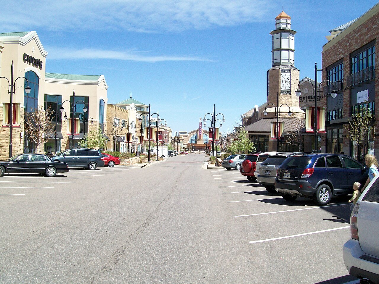
Aurora, CO, USA - panoramio (1)Photo: Mountain Mike Johans… · CC BY 3.0
AOutdoors
Outdoors in Aurora

10% of Aurora’s land is conserved, and 99% of residents live within a half mile of a park

10% of Aurora’s land is conserved, about 10,481 acres. The biggest trail networks: Morrison Nature Center (2.3 mi), Proghorn Nature Area (1.9 mi), Jewell Wetlands (1.9 mi). 118 miles of mapped trail cross Aurora, 0.7 per square mile of land.

Ahead of 90% of U.S. towns · #59 of 159 in Colorado. What drives it

Conserved land
10%
10,481 acres · of 164.1 sq mi of land
Trails
118 mi
0.7 per sq mi of land
Park land
10,585 ac
27 acres per 1,000 residents
Near a park
99%
of residents within ½ mile
Bike routes
257 mi
127 mi lanes · 123 mi paths
Lakes & rivers
15
3 beaches · 2 boat launches

What kind of outdoors town is Aurora?

Read from the map. The page puts what stands out first.

Outdoors grade

How much outdoors does Aurora have?

On conserved land, trails, park land and how close residents live to a park, Aurora is ahead of 90% of U.S. towns, #59 of 159 in Colorado. All four inputs are above most U.S. towns; the share of residents near a park ranks highest, park acres per resident lowest.

A
OutdoorsA character grade: shown, never part of Aurora’s overall grade.
All U.S. towns we grade (21,298)Ahead of 90%
LessMore
Colorado towns of 2,500+ (159)Ahead of 63%

Among the 400 U.S. cities of 100,000 or more, Aurora ranks #80 on Outdoors.

Colorado towns conserve more land than most (a typical one, 7%; the U.S., 4%), so Aurora’s 10% is ahead of 64% of Colorado towns, while its trails per square mile lead 26% of them.

How sure. Graded on any three of the four inputs instead, the letter would range from A− to A. Trails and many small parks come from OpenStreetMap, mapped by volunteers, so coverage varies from town to town; the half mile is a straight line from each census block, so a river or highway in the way isn’t counted against it.

PAD-US, OpenStreetMap (© OpenStreetMap contributors), Census 2025 Gazetteer and 2020 blocks; details in Sources below. How TownRatings grades the outdoors →

The map

Conserved land, trails & bike routes

Tap a number to zoom to a park. Tap a layer to hide it.

12345678
Easements protect land from building but are usually private.© OpenStreetMap contributors · USGS PAD-US
Places to walk

Pick a walk

The longest trail network is Morrison Nature Center, with 2.3 miles. Directions go to the nearest trailhead or public parking.

Morrison Nature Center

Nature preserve
242 acres2.3 mi of trail
Dog rules not recorded
Directionsto the parking lot

Proghorn Nature Area

Managed by City of Aurora
540 acres1.9 mi of trail
Proghorn Path North
Dog rules not recorded
Directionsto the parking lot

Jewell Wetlands

Park
51 acres1.9 mi of trail
BoardwalkJewel Wetlands Trail
Dogs on leash
Directionsto the parking lot

Sand Creek Park

Park
77 acres1.1 mi of trail
Dog rules not recorded
Directionsto the trailhead

Meadowood Park

Park
44 acres1.1 mi of trail
Dog rules not recorded
Directionsto the parking lot

Windy Plumes Park

Park
15 acres1 mi of trail
Dog rules not recorded
No trailhead mapped yet

Sand Creek Riparian Preserve

Park
321 acres0.7 mi of trail
Triple Creek Greenway Corridor
Dog rules not recorded
Directionsto the trailhead

Quincy Reservoir Park

Park
287 acres0.7 mi of trail
Quincy Reservoir Trail
Dog rules not recorded
Directionsto the trailhead
All 145 parks & preserves
Morrison Nature Center242 acres · 2.3 mi of trail
Directions
Proghorn Nature Area540 acres · 1.9 mi of trail · City of Aurora
Directions
Jewell Wetlands51 acres · 1.9 mi of trail
Directions
Sand Creek Park77 acres · 1.1 mi of trail
Directions
Meadowood Park44 acres · 1.1 mi of trail
Directions
Windy Plumes Park15 acres · 1 mi of trail
Sand Creek Riparian Preserve321 acres · 0.7 mi of trail
Directions
Quincy Reservoir Park287 acres · 0.7 mi of trail
Directions
Horseshoe Park104 acres · 0.7 mi of trail · City of Aurora
Directions
Hogan Park @ Highlands Creek99 acres · 0.7 mi of trail · The Aurora Highlands
Directions
Traditions Park17 acres · 0.7 mi of trail
Del Mar Park45 acres · 0.6 mi of trail · City of Aurora
Directions
Adonea Community Center Pool & Park14 acres · 0.6 mi of trail
Sagebrush Park16 acres · 0.5 mi of trail
Directions
Generals Park9 acres · 0.5 mi of trail
Directions
Olympic Park43 acres · 0.4 mi of trail
Directions
Red-Tailed Hawk Park30 acres · 0.4 mi of trail
Directions
Pathfinder Park8 acres · 0.4 mi of trail · Inspiration Metro District
Aurora South Soccer Complex47 acres · 0.3 mi of trail
Directions
Great Plains Park34 acres · 0.3 mi of trail · Aurora Parks and Open Space
Directions
Reckenbaugh Park22 acres · 0.3 mi of trail
Directions
Nome Park17 acres · 0.3 mi of trail · City of Aurora
Directions
Marina Park11 acres · 0.3 mi of trail · City of Aurora
Aqua Vista Park11 acres · 0.3 mi of trail · City of Aurora
Directions
Eagle Park7 acres · 0.3 mi of trail
Larkspur Park7 acres · 0.3 mi of trail
Directions
Mission Viejo Park28 acres · 0.2 mi of trail · City of Aurora
Directions
Mountain View Park16 acres · 0.2 mi of trail · City of Aurora
Directions
City Center Park12 acres · 0.2 mi of trail · City of Aurora
Directions
City Park6 acres · 0.2 mi of trail · City of Aurora
Directions
Golden Eagle Park6 acres · 0.2 mi of trail
Directions
Shenandoah Park5 acres · 0.2 mi of trail
Directions
Wagon Trail Park5 acres · 0.2 mi of trail
Inspiration Club4 acres · 0.2 mi of trail · Inspiration Metro District
Estates HOA Park3 acres · 0.2 mi of trail · Ponderosa Residential Homeowners Association
Directions
Mountain View Neighborhood Activity Center1 acres · 0.2 mi of trail
Sand Creek Regional Greenway64 acres · 0.1 mi of trail
Directions
Utah Park49 acres · 0.1 mi of trail
Directions
Bicentennial Park31 acres · 0.1 mi of trail
Directions
Sidecreek Park28 acres · 0.1 mi of trail · Aurora Parks and Open Space
Directions
Anchor Point Park25 acres · 0.1 mi of trail
Directions
Boettcher Commons17 acres · 0.1 mi of trail
Directions
Sunrise Park8 acres · 0.1 mi of trail · Aurora Parks and Open Space
Directions
Seven Hills Park8 acres · 0.1 mi of trail
Directions
Toll Gate Park8 acres · 0.1 mi of trail · Aurora Parks and Open Space
Directions
Kalispell Park7 acres · 0.1 mi of trail
Directions
Spencer Garrett Park6 acres · 0.1 mi of trail
Winged Melody Park6 acres · 0.1 mi of trail
Directions
Wheatlands Community Park5 acres · 0.1 mi of trail
Directions
Triangle Park5 acres · 0.1 mi of trail · City of Aurora
Andover Glen Park5 acres · 0.1 mi of trail
Directions
La Parquita Park3 acres · 0.1 mi of trail · City of Aurora
Directions
Orange Park3 acres · 0.1 mi of trail
Ridge Park2 acres · 0.1 mi of trail · Arapahoe Parks and Recreation Department
Watering Hole Neighbohood Activity Center2 acres · 0.1 mi of trail · Inspiration Metro District
Bear's Lair Neighborhood Activity Center1 acres · 0.1 mi of trail · Inspiration Metro District
Painterd Prarie Park1 acres · 0.1 mi of trail
Ponderosa Preserve65 acres
Directions
Expo Park59 acres
Directions
The Aurora Highlands Community Park35 acres
University of Colorado Hospital Greenway Park-31 acres
Directions
CentrePointe Park31 acres
Directions
Highline Park & Ballfields29 acres · City of Aurora
Directions
Wheel Park28 acres
Directions
Horseshoe Natural Area27 acres
Directions
Center Park Site26 acres · City of Aurora
Directions
Highland Hollows Park25 acres
Rocky Ridge Park16 acres · City of Aurora
Hoffman Park11 acres · City of Aurora
Directions
Tierra Park10 acres
Directions
Montview Park10 acres · City of Aurora
Carson Park9 acres
Tollgate Crossing Park9 acres · Tollgate Crossing Metro District
Directions
Park Lane Park8 acres
Directions
Eldorado Park8 acres · City of Aurora
Directions
Village Green Park8 acres · City of Aurora
Directions
Canterbury Park8 acres
Directions
Wheatlands Open Space8 acres
Directions
HOA Park8 acres · Auburn Hill
Fulton Park8 acres · City of Aurora
Directions
Colorado Freedom Memorial8 acres
Directions
Prairie Winds Park7 acres
Hill Top Park7 acres
Directions
Settlers Park7 acres
Directions
Sunset Park7 acres
Appaloosa Park7 acres
Directions
Terrace Park7 acres · City of Aurora
Directions
Wheeling Park6 acres · City of Aurora
Kestrel Point Natural Area6 acres · City of Aurora
Directions
Summer Valley Park6 acres
Singletree Park6 acres
Directions
Switchgrass Park6 acres
Directions
Pheasant Run Park6 acres
Directions
Peoria Hills Park5 acres
Directions
Cottonwood Park5 acres
Blue Grama Grass Park5 acres
Directions
Beacon Point Park5 acres
Apache Mesa Park5 acres · City of Aurora
Directions
Native Grasses Restoration Study Area5 acres
Directions
Swing Park5 acres
Village East Park5 acres
Eastridge Park4 acres
Directions
Grandview Dog Park4 acres
Directions
World War 1 Memorial Park4 acres
Directions
Tollgate Crossing Neighborhood Park4 acres
Southlands Metro District Park4 acres
Directions
Beacon Point Pocket Park4 acres
Westerly Creek Trail3 acres
Directions
Moorhead Memorial Park3 acres
Directions
Panorama Park3 acres
Directions
Country Lane Park3 acres · Arapahoe County Parks
Directions
Hampden Run Park3 acres
Directions
Horizon Park3 acres
Directions
McMullen Park3 acres · City of Aurora
Bioscience Park3 acres
Directions
Sterling Hills West Park3 acres
Sunburst Park3 acres
Directions
Los Ninos Park3 acres · City of Aurora
Directions
Havana Heights Pond Park3 acres
Havana Park2 acres
Flanders Park2 acres
Directions
Parade Grounds2 acres
Directions
Sterling Hills Park2 acres
Pagosa Park2 acres
Crestridge Park2 acres · City of Aurora
Bellewood Park2 acres · City of Aurora
Directions
First Light Park2 acres
Aurora Sundail2 acres
Directions
Sandy Creek Children's Park2 acres
Possible Future Community Garden2 acres
Directions
Food Truck Park2 acres
Directions
Westerly Creek Park1 acres
Directions
Alta Vista Park1 acres
Havana Heights Park1 acres
Directions
Saddle Rock East Park1 acres
Directions
Norfolk Glen Park1 acres · City of Aurora
Directions
Del Mar Family Aquatic Center1 acres
Directions
Fairplay Park1 acres
Hoops Park1 acres
Directions
Creekside Eagle Park1 acres · Creekside HOA
Quincy Park1 acres
Kingsborough Park1 acres
Jewel Park1 acres · City of Aurora
Willow Bend Park1 acres
Directions
Fletcher Park1 acres
Directions
Who protects it

10,481 conserved acres

10% of Aurora’s land. Who manages Aurora’s conserved land, from the USGS Protected Areas Database. Approximate, because parcels can overlap.

Town or city12,306 ac
Regional agency1,471 ac
Land trusts & nonprofits1,237 ac
County1,164 ac
Army Corps of Engineers508 ac
Private owners219 ac
State land board75 ac
Local Conservation Area · 5,207 acConservation Easement · 2,469 acLocal Park · 2,377 acLocal Other or Unknown · 2,350 acOther Easement · 1,997 ac
Good to know

Conserved doesn’t always mean open to visitors. 916 acres are conservation easements, usually private land. Public access isn’t recorded for 27 of 283 parcels. The walks above are places people visit.

The biggest protected parcels
Parcel (PAD-US)Managed byAcresPublic access
Dia Nmp
Local Conservation Area
Town or city1,743Open
Plains Conservation Center
Local Conservation Area
Regional agency1,384Restricted
DIA NMP (Part 3 - G)
Local Other or Unknown
Town or city1,045Unknown
Pronghorn Natural Area
Local Conservation Area
Town or city857Restricted
Cherry Creek Recreation Area
Recreation Management Area
Army Corps of Engineers508Open
Cherry Creek Spillway
Local Other or Unknown
Regional agency366Unknown
Sand Creek Greenway
Local Other or Unknown
Town or city346Closed
DIA NMP (Part 5 - L)
Local Other or Unknown
Town or city299Closed
Signature Park
Local Park
Town or city296Open
Quincy Reservoir Natural Area
Local Conservation Area
Town or city284Open

5 smaller protected places aren’t shown.

Things to do

657 places to go in Aurora

Beaches, playgrounds, peaks, falls and more. Pick a kind.

Beaches in Aurora
Boat Beach
Directions
Scuba Beach
Directions
Swim Beach
Directions
Trails & water

19 named trails and 15 lakes & rivers

Named trails
Open to bikes · 24.1 miHorses · 0.9 miUnpaved · 56.3 mi
Proghorn Path North1.8 mi
Aurora Reservoir 5K Trail1.2 mi
First Creek Trail1.0 mi
Proghorn Nature South0.8 mi
Badger Internal Trail0.7 mi
Front Range Fork0.7 mi
Seven Hills Trail0.5 mi
Tollgate Fork0.4 mi
East Toll Gate Creek Regional Trail0.4 mi
Triple Creek Greenway Corridor0.3 mi
9 more trails
East The Aurora Highlands Parkway
0.3 mi
Hampden Run Path
0.3 mi
Side Creek Trail
0.3 mi
Great Plains Park Internal Fitness Trail
0.3 mi
Power Line Trail
0.3 mi
East 36th Place
0.2 mi
The Aurora Highlands Parkway
0.2 mi
Quincy Reservoir Trail
0.2 mi
Hutton Street Trail
0.1 mi
Lakes & rivers tap for directions
Biking & sports

257 miles of bike routes

Bike lanes are often missing from the map in smaller towns, so that number is likely low.

127 mi
painted or protected bike lanes
123 mi
off-road bike paths
6.8 mi
shoulders & shared lanes
Plains TrailBike route
1.6 mi
YaleBike route
1 mi
Marina Park TrailBike route
0.6 mi
Norfolk Glen PathBike route
0.5 mi
East Tollgate Creek TrailBike route
0.4 mi
Powerline TrailBike route
0.4 mi
Courts & fields
195Basketball
179Tennis
114Baseball
106Soccer
26Pickleball
23Tracks
22Volleyball
20Football

Includes school and college facilities, which aren’t always open to the public.

History along the way

10 places on the National Register

The country’s official list of places worth saving (National Park Service). The map also marks 29 historic points from OpenStreetMap: plaques, memorials and old buildings.

History →
Melvin SchoolBuilding · listed 1984
About it
William Smith HouseBuilding · listed 1985
About it
Gully HomesteadBuilding · listed 1986
About it
DeLaney BarnBuilding · listed 1989
About it
Blanche A. Wilson HouseBuilding · listed 1996
About it
Commandant of Cadets Building, US Air Force AcademyBuilding · listed 2007
About it
M.J. Lavina Robidoux HouseBuilding · listed 2011
About it
Granville Fuller HouseBuilding · listed 2012
About it
Jamaica Primary SchoolBuilding · listed 2017
About it
Wilson, S.A., Elementary SchoolBuilding · listed 2017
About it
When to get out

The best walking months in Aurora: April to June

NOAA’s 1991–2020 normals for the town and the daylight at its latitude. Outlined months have long days, highs of 59 to 86 °F and little rain for the place.

JanFebMarAprMayJunJulAugSepOctNovDec
Daylight (h)9.610.611.813.214.315.014.713.712.411.19.99.4
High (°F)454655617183898679655344
Rain (in)0.40.51.11.82.31.82.21.91.21.00.70.4

January is the driest month (0.4 in) and July the warmest (highs of 89 °F). 2.3 inches fall in May, the wettest month. Summer highs reach 89 °F, too hot for the outline. The climate in Aurora →

Next door

Aurora and its neighbors

Aurora has the second most mapped trails of the 6 towns around it. Tap a town to see its outdoors.

TownConserved
of land
Trail mi
per sq mi
Park acres
per 1,000
Near a park
½ mile
Outdoors
Aurora10%0.72799%A
Centennial10%1.71398%A
Denver7%1.2999%+A−
Watkins— not graded: under 1,000 residents or part of its town
Parker20%2.71599%+A+
Four Square Mile10%1.4399%+A−

The four inputs of the Outdoors grade, from the engine; shares are of land, not water.

Questions about parks and trails in Aurora

Where can I hike in Aurora?

The longest trail networks: Morrison Nature Center, 2.3 miles; Proghorn Nature Area, 1.9 miles; Jewell Wetlands, 1.9 miles; Sand Creek Park, 1.1 miles. Each one is on the map above, with directions to the nearest trailhead or parking.

How much of Aurora is conserved land?

10% of its land, against a typical 7% for a Colorado town and 4% nationally (PAD-US). Conserved doesn’t always mean open to visitors: easements are usually private land.

Are dogs allowed on Aurora’s trails?

OpenStreetMap records dogs as welcome at Jewell Wetlands (on leash). For the rest, check the signs at the trailhead.

Where can I bike in Aurora?

257 miles of bike routes are on the map: 127 of painted or protected lanes, 123 of off-road paths and 6.8 of shoulders and shared lanes. Named routes: Plains Trail, Yale and Marina Park Trail.

Is there public land near Aurora?

37,011 acres of parks and open public land lie inside Aurora or within 10 miles of it (PAD-US), 11,035 of them inside the city line.

How much outdoors does Aurora have?

Ahead of 90% of U.S. towns on the Outdoors grade, #59 of 159 in Colorado. The grade combines the share of land that is conserved, miles of mapped trail per square mile of land, park acres per 1,000 residents and the share of residents within a half mile of a park. It’s a character grade, so it isn’t part of the overall grade. How it works.

Trail talk

Conditions, parking and favorite walks from Aurora neighbors.

Town Square →
Share a tip
Sources

Where this page comes from

Conserved and public land: USGS Protected Areas Database of the United States (PAD-US), service updated July 2026. Parks, trails, playgrounds, beaches and other places: OpenStreetMap (© OpenStreetMap contributors, ODbL), map data as of 2026-10-28. Land and water area: Census 2025 Gazetteer. Residents near a park: 2020 Census blocks. National Register: National Park Service. How TownRatings grades the outdoors →