 Top
Classified heritage building (Québec) · 1754–1782Maison Routhier3325 rue RochambeauPhoto: GBoivinT · CC BY-SA 3.0 · Commons file
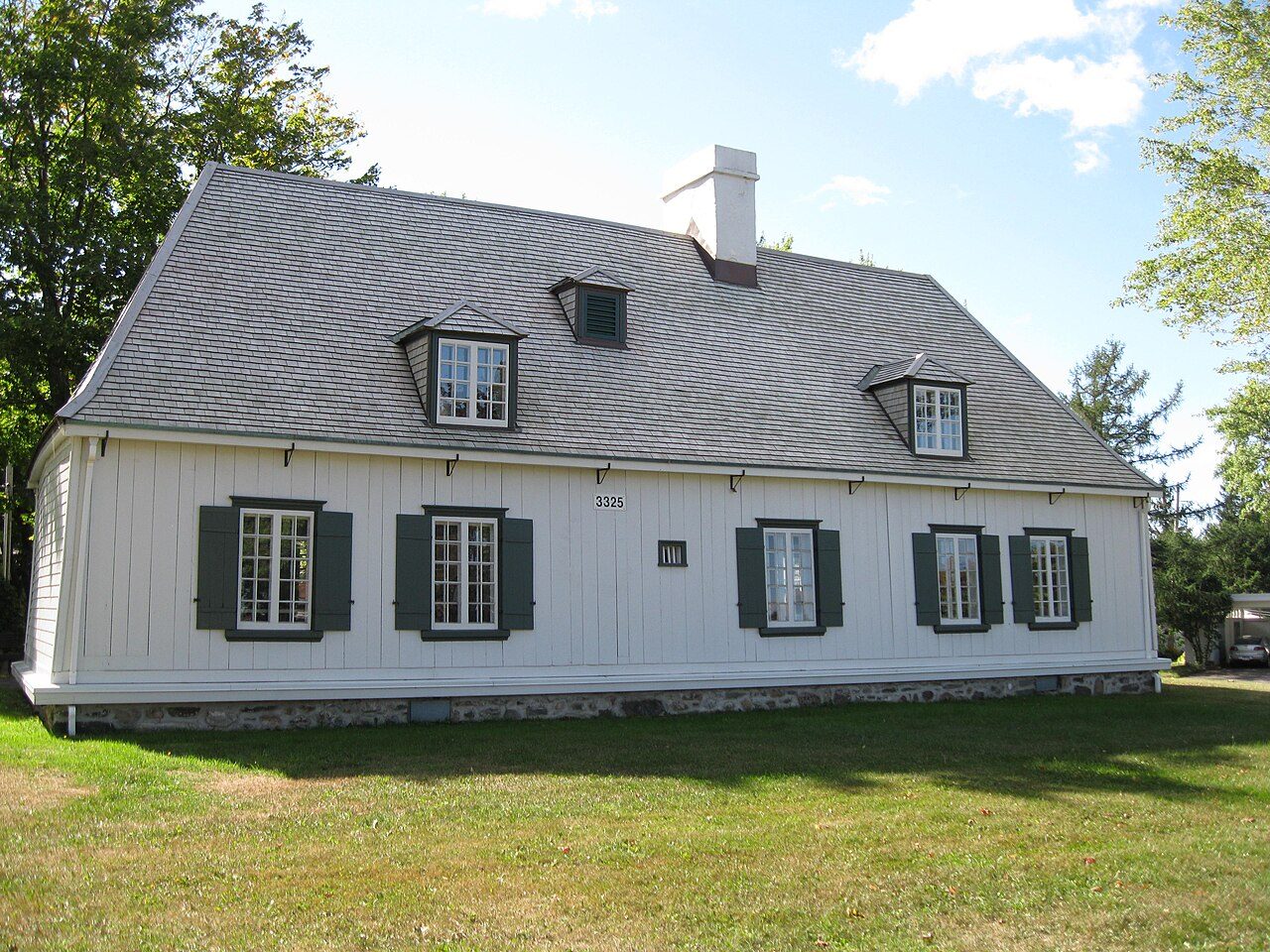 Maison Routhier · Photo: GBoivinT · CC BY-SA 3.0
1historic place on the registers
History of Pointe-de-Sainte-Foy · Canada’s heritage registers
Pointe-de-Sainte-Foy’s record starts in 1754 with Maison Routhier
Inside Pointe-de-Sainte-Foy there is 1 historic place, a top designation. Relative to its size the figure is 0.7 per 10,000 residents, more than in 76% of Canadian towns. Few homes are old by the census: 5.7% before 1961, against 18%.
Historic places
1
0.7 per 10,000 residents
Highest designations
1
National Historic Sites, classified federal buildings and Québec’s classements
Oldest building
1754
the first construction date on its record
Homes built before 1961
5.7%
typical town: 18%
The map
Where Pointe-de-Sainte-Foy’s history is
Every place on the registers inside the town, by its designation.
Highest designations
Dots open their places’ pages; hover first to read the name.
The 1, by tier
1 Highest designations
Parks Canada’s federal directory and Québec’s Répertoire du patrimoine culturel supply these places: federal designations, the province’s classements and the municipalities’ citations.
Points from Wikidata (Parks Canada’s files carry none) and from Québec’s register, as mapped there.
Highest designations
Pointe-de-Sainte-Foy’s top designation
National Historic Sites and Classified Federal Heritage Buildings, Canada’s highest federal recognition. Each one opens its own page.
Around the town
Fort Charlesbourg Royal, 2 km from Pointe-de-Sainte-Foy, is the closest
By designation: 6 places classified by Québec and 2 National Historic Sites. They stand in 5 towns, Cap-Rouge, L'Ancienne-Lorette and Cité-Universitaire among them. Count to 5 km and there are 8.
The 8 nearest, within 5 km
| Fort Charlesbourg RoyalNational Historic Site · 1541–1542 · 2 km away, in Cap-Rouge |
| Site archéologique Cartier-RobervalClassified heritage site (Québec) · 2 km away, in Cap-Rouge |
| Site archéologique de l'Ancienne-Poterie-de-Cap-RougeClassified heritage site (Québec) · 1861–1862 · 2.2 km away, in Cap-Rouge |
| Parc de la VisitationClassified heritage site (Québec) · 2.5 km away, in Cité-Universitaire |
| Québec BridgeNational Historic Site · 1917–1918 · 3.4 km away, in Lévis |
| Maison Hamel-BruneauClassified heritage building (Québec) · 1855–1858 · 4.1 km away, in Sillery |
| Maison Woodbury-MatteClassified heritage building (Québec) · 1835 · 4.1 km away, in L'Ancienne-Lorette |
| Calvaire de Notre-Dame-de-l'AnnonciationClassified heritage building (Québec) · 1894 · 4.9 km away, in L'Ancienne-Lorette |
Homes by age
Little new building in Pointe-de-Sainte-Foy: 2.4% of homes date from 2016 to 2021, against 4.1%
Over half of the homes in Pointe-de-Sainte-Foy were already standing by 2001. The largest single period is from 1981 to 2000, with 41% of Pointe-de-Sainte-Foy’s homes. 21% of Pointe-de-Sainte-Foy’s homes were built from 2001 to 2015, more than the typical town’s 15%.
5.7%
Before 1961
30%
1961–80
41%
1981–2000
21%
2001–15
2.4%
2016–21
Pointe-de-Sainte-FoyTypical town
2021 Census, private dwellings by period of construction (Statistics Canada); the typical town is the middle Canadian town of 2,500 or more.
Towns its size
Pointe-de-Sainte-Foy has the 4th most of 16 towns its size
Towns of 14,500 to 14,700 residents, by places on the registers.
Pointe-de-Sainte-Foy1
Only Vieux-Montréal, Truro and Mont-Laurier have more. The middle one has 0. 9 of them have none.
Neighbours
Pointe-de-Sainte-Foy and its neighbours
| Town | People | Places | Highest | Oldest |
|---|---|---|---|---|
| Pointe-de-Sainte-Foy | 14,541 | 1 | 1 | 1754 |
| Plateau | 14,176 | 0 | 0 | — |
| Cap-Rouge | 17,139 | 3 | 3 | 1541 |
| Saint-Louis | 15,792 | 0 | 0 | — |
| L'Aéroport | 13,630 | 0 | 0 | — |
| Cité-Universitaire | 22,546 | 4 | 3 | 1818 |
| L'Ancienne-Lorette | 17,876 | 2 | 2 | 1835 |
In brief
Pointe-de-Sainte-Foy in brief
The registers count 1 historic place in Pointe-de-Sainte-Foy, one with the highest designation, Maison Routhier first. Only 3 of the 16 towns nearest its size have more historic places. Most of its homes are post-1960: only 5.7% came earlier, against 18% in the typical town. Beyond that, its designation dates from 1956.
How to read these numbers
What this data can and can’t tell you
- Protection. Here the register is also the protection: classement and citation under Québec’s cultural heritage law control changes, while federal recognition does not.
- People and events. Persons of national historic significance come with no location; a town gets one only by birthplace (name and both life years agreeing) or by one of its own places that bears the name and whose record tells the story. Events, which can’t be tied, are left out.
- The federal register. Federal places come from Parks Canada’s directory, which counts National Historic Sites, federal heritage buildings, stations and lighthouses; their statements are the register’s own.
- Québec’s register. In Québec the ministry of culture publishes its register openly: provincial classements, declared sites and the municipalities’ citations all appear, with their descriptions.
- The tiers. Three tiers: the top for National Historic Sites, classified federal buildings and Québec’s classements, a second for the other federal designations, a third for provincial and municipal listings.
- The grade. History is described, not graded, for every Canadian town.
Questions about Pointe-de-Sainte-Foy’s history
What is the oldest building in Pointe-de-Sainte-Foy?
Maison Routhier, a Classified heritage building (Québec), begun in 1754.
Which places in Pointe-de-Sainte-Foy have the highest designation?
Maison Routhier.
How old are the homes in Pointe-de-Sainte-Foy?
5.7% of its homes were built before 1961, against 18% in the typical Canadian town.
Contains information licensed under the Open Government Licence – Canada (Parks Canada). Québec register data: Ministère de la Culture et des Communications du Québec, CC BY 4.0.
Sources: Parks Canada, Directory of Federal Heritage Designations · Canadian Register of Historic Places (federal extract) · Répertoire du patrimoine culturel du Québec (MCC, Données Québec) · Wikidata (CC0) for map points, other names and articles · Statistics Canada, 2021 Census (homes by period of construction). Under the Statistics Canada Open Licence.
Adapted from Statistics Canada (Census of Population 2021, population estimates 2025, 2021 census boundaries) under the Statistics Canada Open Licence; this does not constitute an endorsement by Statistics Canada. Neighbourhood names in some cities © OpenStreetMap contributors (ODbL).