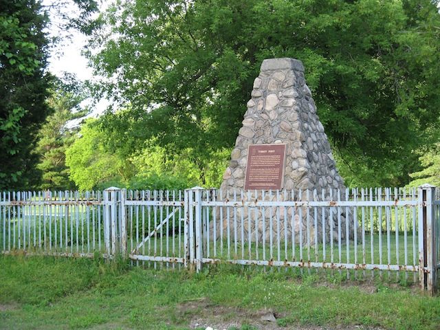
Fort Norfolk
76 Old Hill Road, Simcoe
About Fort Norfolk
Canada counts Fort Norfolk among Simcoe’s 4 National Historic Sites. The register gives 1814–1816 for Fort Norfolk.
Fort Norfolk National Historic Site of Canada is located at the entrance to Turkey Point Provincial Park golf course, bounded by the eastern edge of Old Hill Road, near Lake Erie. The site consists of mixed landscape features and foliage, and is surrounded by the vast lawns of the nearby golf course. There are no known extant remains of Fort Norfolk; however, since its designation the site has been the subject of several archival research projects. Official recognition refers to the polygon of land bounded by the eastern edge of Old Hill Road in Turkey Point, Ontario.
From the Canadian Register of Historic Places, Fort Norfolk National Historic Site of Canada · Open Government Licence – Canada · quoted as the register has it
National Historic Sites are places the Minister of Environment designates, on the advice of the Historic Sites and Monuments Board, for their national significance.
Finding Fort Norfolk
Simcoe


No second historic place is close enough here to make a walk of it.
Questions about Fort Norfolk
Is Fort Norfolk protected?
National Historic Site status commemorates; legal protection, where there is any, comes from the province or municipality, or from federal ownership.
Can you visit Fort Norfolk?
From outside, yes; going in depends on who owns or runs it.
When was Fort Norfolk built?
Its register puts the building of Fort Norfolk at 1814–1816.
What is Fort Norfolk?
Canada named Fort Norfolk a National Historic Site in 1925.
Contains information licensed under the Open Government Licence – Canada (Parks Canada).
Sources: Parks Canada, Directory of Federal Heritage Designations · Canadian Register of Historic Places (federal extract) · Photos: Wikimedia Commons, each credited with its licence and copied to our own server · Wikidata (CC0) for map points, other names and articles.
Adapted from Statistics Canada (Census of Population 2021, population estimates 2025, 2021 census boundaries) under the Statistics Canada Open Licence; this does not constitute an endorsement by Statistics Canada. Neighbourhood names in some cities © OpenStreetMap contributors (ODbL).