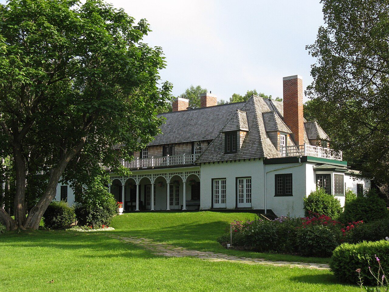
Stephen Leacock Museum / Old Brewery Bay · Photo: Jcart1534 · CC BY-SA 3.0
2historic places on the registers
History of Orillia · Canada’s heritage registers
One top designation among Orillia’s 2 historic places
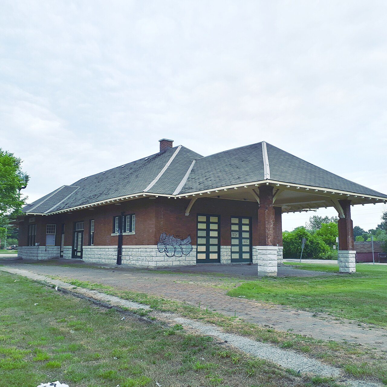
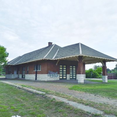
The record has a heritage railway station. Canadian National Railway Station, Orillia, Ontario, begun in 1917, is the oldest by its record. Measured against its size, Orillia’s 0.5 per 10,000 residents puts it ahead of 75% of Canadian towns. Local registers add one more place, counted here but not paged: Wikidata holds its number and little else.
Photos show both of the places Orillia’s registers name. To start: Stephen Leacock Museum / Old Brewery Bay, and “Canadian National Railway Station, Orillia, Ontario”.
Photos from Wikimedia Commons, each credited to its photographer with its licence; names open the place’s page. Tap a photo to step through them full screen.
Through time
1909–1924: Orillia in old pictures
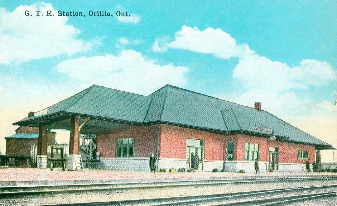
3 old photographs of the town, then the oldest view of one of its historic places, set out by date. Hover a dot for its date; tap a picture to see it full screen.
1890190019101920193019401950Confederation to 1900Boom yearsThe wars and betweenAfter the war
Public domain or CC0, made before 1950, from Wikimedia Commons; old views of places can be drawings, prints or maps of their time. Each credit opens the image’s page.
How it began
Orillia through its dates, from 1867
1867 is the date of Orillia’s municipality in Wikidata, and like many such dates it may record a charter, not the first homes. The first railway station on record, Orillia Railway Station, opened in 1917.
Every place on the registers inside the town, by its designation.
Highest designationsOther federal designations
Dots open their places’ pages; hover first to read the name.
The 2, by tier
1 Highest designations1 Other federal designations
What the map shows is the open record: the federal directory in full, and from provincial or municipal lists only the places Wikidata ties to an encyclopedia article.
Points from Wikidata (Parks Canada’s files carry none) and from Québec’s register, as mapped there.
Highest designations
One place in Orillia with the highest designation
National Historic Sites and Classified Federal Heritage Buildings, Canada’s highest federal recognition. Each one opens its own page.
Orillia’s surroundings: 15 historic places within 50 km
Closest of all is Mnjikaning Fish Weirs, in Ramara, 4.6 km off. The mix: 11 National Historic Sites, 3 provincial or municipal listings and a heritage railway station. They belong to 13 towns, chiefly Tay, Ramara and Oro-Medonte.
Glengarry LandingNational Historic Site · 1814 · 41 km away, in Springwater
St. James on-the-LinesOntario Heritage Trust easement · 1840 · 44 km away, in Penetanguishene
Homes by age
A town of older homes: 31% of Orillia’s were built before 1961 (18% is typical)
From 2016 to 2021 Orillia added 7.1% of its homes, more than the typical town’s 4.1%. Half of the homes standing in Orillia today were built before 1981. Homes built from 1961 to 1980 make up 27% of Orillia’s, about the typical 27%.
31%
Before 1961
27%
1961–80
23%
1981–2000
12%
2001–15
7.1%
2016–21
OrilliaTypical town
2021 Census, private dwellings by period of construction (Statistics Canada); the typical town is the middle Canadian town of 2,500 or more.
People of the past
One of Canada’s national historic persons, tied to Orillia
The register links Stephen Leacock to Stephen Leacock Museum / Old Brewery Bay. There are 13 people born here before 1914 with an article to show for it. Fame, by Wikipedia: Franklin Carmichael first, in 16 languages. It starts with Fanny Kelly, born in 1845.
Fanny Kelly
Jacob Gaudaur
Duncan E. McKinlay
Stephen Leacock
D'Arcy Plunkett
H. J. Rose
Franklin Carmichael
Eric Harvie
John Sissons
Stanley Alvin Watson
Charles Howard Curran
Leslie Frost
Nobby Clark
Elizabeth Wyn Wood
1800182518501875190019251950
Franklin Carmichael1890–1945 · Canadian artist
HR
H. J. Rose1883–1961 · British classical philologist
CC
Charles Howard Curran1894–1972 · Canadian entomologist
Leslie Frost1895–1973 · Canadian politician
Duncan E. McKinlay1862–1914 · American politician
EW
Elizabeth Wyn Wood1903–1966 · Canadian sculptor
Fanny Kelly1845–1904 · American pioneer
Jacob Gaudaur1858–1937 · Canadian rower
Everyone born in Orillia → Born before 1914, or named by one of the town’s historic places. Birthplaces from Wikidata, each checked against Wikipedia; national historic persons from Parks Canada’s Directory of Federal Heritage Designations, matched by name and life years.
Towns its size
Orillia has the 4th most of 16 towns its size
Towns of 37,000 to 38,700 residents, by places on the registers.
Housing in Orillia includes 31% built before 1961, against 18% in the typical town. The lists come to 2 historic places, one with the highest designation, including Stephen Leacock Museum / Old Brewery Bay. Only 3 of the 16 towns nearest its size have more historic places. Among the lives from its past: Franklin Carmichael (1890), H. J. Rose (1883) and Charles Howard Curran (1894). Otherwise the figures are ordinary: the designations ran from 1992 to 1994.
How to read these numbers
What this data can and can’t tell you
•
The federal register. Every federal designation is in Parks Canada’s directory, and the Canadian Register of Historic Places gives most of them a bilingual statement of significance.
•
Map points. Where a federal place sits on the map is Wikidata’s placing; the directory itself has no coordinates.
•
The tiers. National Historic Sites and the most protected buildings form the top tier; recognized federal buildings, stations and lighthouses the second; provincial and municipal listings the third.
•
Provincial and municipal lists. The local and provincial lists outside Québec aren’t published openly, so this page counts what Wikidata records and pages only the places an encyclopedia describes.
•
Protection. Being on these registers doesn’t mean a building can’t change. Federal designation commemorates; protection is provincial or municipal, and those lists aren’t open here.
•
People and events. Parks Canada’s open file gives its national historic persons no place. A town’s page names one only when the person was born there (matched by name and both life years) or one of its own historic places carries the name and its record speaks of them; national historic events stay off.
•
The grade. History isn’t one of Canada’s graded pillars, so this page describes and compares without a letter.
Questions about Orillia’s history
Which places in Orillia have the highest designation?
Just one: Stephen Leacock Museum / Old Brewery Bay.
How old are the homes in Orillia?
31% of its homes were built before 1961, against 18% in the typical Canadian town.
What is the oldest building in Orillia?
Canadian National Railway Station, Orillia, Ontario — its record dates it to 1917 (Heritage Railway Station).
Why might a heritage building in Orillia be missing here?
Provincial and municipal registers outside Québec aren’t open data. Wikidata knows one more listing in Orillia, but without an open description or an encyclopedia article it gets no page.
Contains information licensed under the Open Government Licence – Canada (Parks Canada).
Sources: Parks Canada, Directory of Federal Heritage Designations · Canadian Register of Historic Places (federal extract) · Wikidata (CC0) for map points, other names and articles · Statistics Canada, 2021 Census (homes by period of construction). Under the Statistics Canada Open Licence.
 1909
 1917
 c. 1923
 1924
 Top
 Fed


