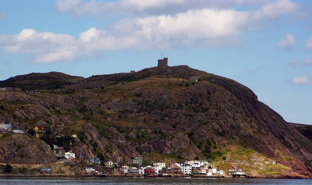
Signal Hill
230 Signal Hill Road, St. John's
About Signal Hill
Signal Hill is one of 23 National Historic Sites in St. John's. By its record, Signal Hill was built in 1697–1698. Captain Robert Pringle, R.E designed it. One other place on the registers stands within 400 m.
Signal Hill National Historic Site of Canada, located at the northeastern end of St. John’s harbour, is composed of two cultural landscapes – Signal Hill itself and the south side of the Narrows. Signal Hill is the steep hill that frames the entrance on the north side of St. John’s Harbour from St. John’s Bay. Identifiable by the castellated profile of Cabot Tower, Signal Hill descends gently in ridges and valleys towards St. John's to the west and Quidi Vidi waterway to the north. Across the Narrows, a ribbon of land at the base of the steep Southside Hills contains several fortification and communication sites including Noone Room, South Castle, Frederick’s Battery and Fort Amherst National Historic Site of Canada. Today the historic place of Noone Room and its mooring area known as Ring Noone are buried beneath an industrial marine boat basin built in the 1980s.
From the Canadian Register of Historic Places, Signal Hill National Historic Site of Canada · Open Government Licence – Canada · quoted as the register has it
National Historic Sites are places the Minister of Environment designates, on the advice of the Historic Sites and Monuments Board, for their national significance.
Finding Signal Hill
St. John's


There is no walk from here to another historic place; see farther afield.
1 within 300 m
Every place on the record within this distance; each opens its own page.
Questions about Signal Hill
What is Signal Hill?
Canada named Signal Hill a National Historic Site in 1951.
Is Signal Hill protected?
National Historic Site status commemorates; legal protection, where there is any, comes from the province or municipality, or from federal ownership.
When was Signal Hill built?
By its record, Signal Hill dates from 1697–1698.
Can you visit Signal Hill?
Its exterior is visible from public ground; access inside is up to the owner.
Contains information licensed under the Open Government Licence – Canada (Parks Canada).
Sources: Parks Canada, Directory of Federal Heritage Designations · Canadian Register of Historic Places (federal extract) · Photos: Wikimedia Commons, each credited with its licence and copied to our own server · Wikidata (CC0) for map points, other names and articles.
Adapted from Statistics Canada (Census of Population 2021, population estimates 2025, 2021 census boundaries) under the Statistics Canada Open Licence; this does not constitute an endorsement by Statistics Canada. Neighbourhood names in some cities © OpenStreetMap contributors (ODbL).