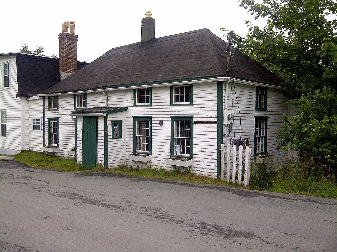
Mallard Cottage
In French: Cottage Mallard
2 Barrows Road, St. John's
About Mallard Cottage
In St. John's, Mallard Cottage is one of 23 National Historic Sites. The register gives 1820–1841 for Mallard Cottage. Another historic place stands within 400 m of it.
Mallard Cottage is a picturesque one-and-a-half storey wood-frame house set on a small lot near the road in the hamlet of Quidi Vidi, a suburb of St. John's Newfoundland. The designation refers to the house on its legal lot at the time of designation (1983).
From the Canadian Register of Historic Places, Mallard Cottage National Historic Site of Canada · Open Government Licence – Canada · in the register’s words, not edited
National Historic Site status comes on the advice of the Historic Sites and Monuments Board of Canada.
Make it a walk: 2 historic places in about 5 minutes
St. John's · about 100 m on foot, as the crow flies


- 1Mallard CottageStart here
- 2Christ Church / Quidi Vidi ChurchNational Historic Site · 100 m on
1 within 300 m
Every place on the record within this distance; each opens its own page.
Questions about Mallard Cottage
What is Mallard Cottage?
Mallard Cottage is a National Historic Site of Canada, designated in 1983.
Is Mallard Cottage protected?
National Historic Site status commemorates; legal protection, where there is any, comes from the province or municipality, or from federal ownership.
Can you visit Mallard Cottage?
Its register lists it as a museum, so it is likely open to visitors; check the hours with whoever runs it.
When was Mallard Cottage built?
The register dates the construction of Mallard Cottage to 1820–1841.
Contains information licensed under the Open Government Licence – Canada (Parks Canada).
Sources: Parks Canada, Directory of Federal Heritage Designations · Canadian Register of Historic Places (federal extract) · Photos: Wikimedia Commons, each credited with its licence and copied to our own server · Wikidata (CC0) for map points, other names and articles.
Adapted from Statistics Canada (Census of Population 2021, population estimates 2025, 2021 census boundaries) under the Statistics Canada Open Licence; this does not constitute an endorsement by Statistics Canada. Neighbourhood names in some cities © OpenStreetMap contributors (ODbL).