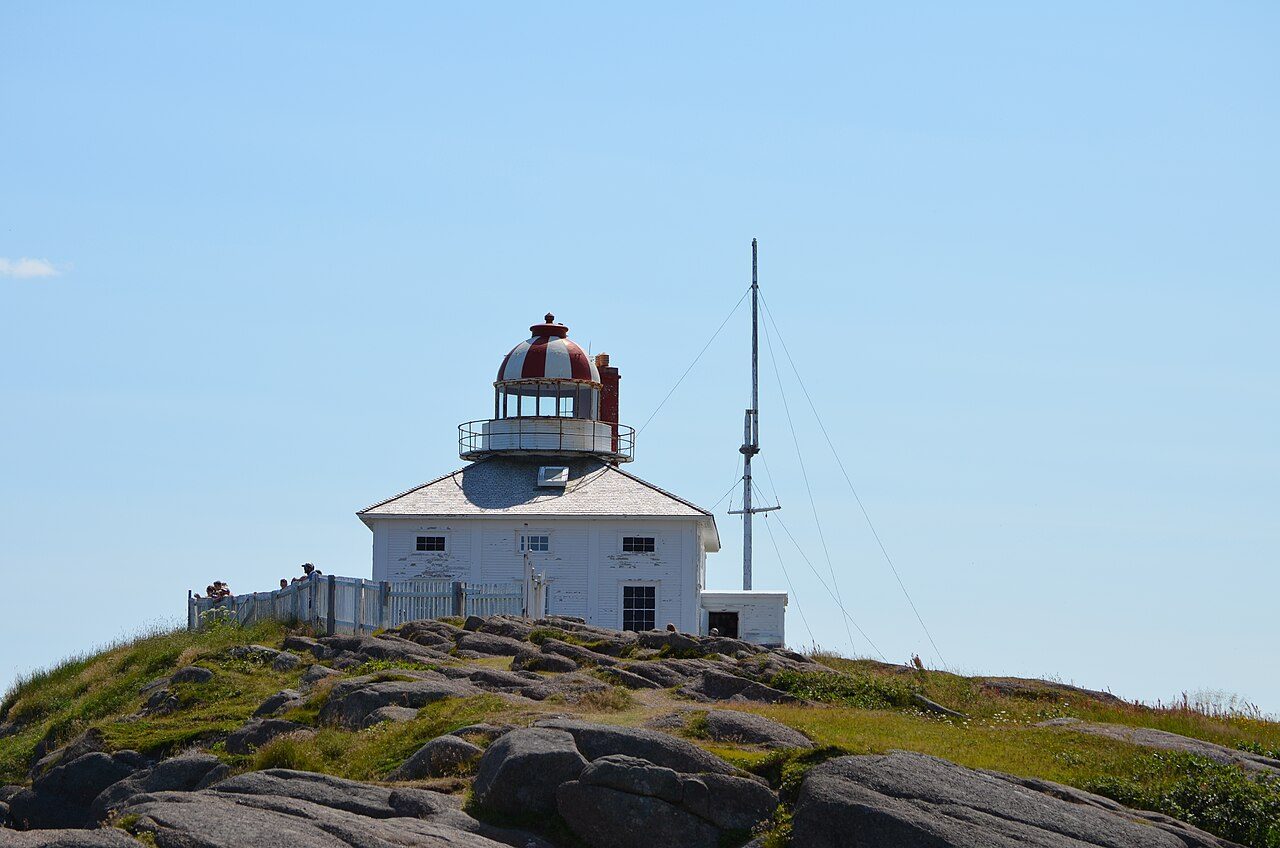
Cape Spear Lighthouse
In French: Phare du Cap-Spear
Blackhead Road / Route 11, St. John's
About Cape Spear Lighthouse
Cape Spear Lighthouse is one of 23 National Historic Sites in St. John's. Its record dates Cape Spear Lighthouse to 1835–1836.
The Cape Spear (Old) Lighthouse combines a lighthouse and keepers’ dwelling, a popular 19th century design. Built in 1835, the circular stone tower measures 9 metres (30 feet), and is encircled by a two-storey, wood-frame residence. The Cape Spear (Old) Lighthouse stands on a rocky peninsula that forms the easternmost point of North America.
From the Canadian Register of Historic Places, Cape Spear Lighthouse National Historic Site of Canada · Open Government Licence – Canada · quoted as the register has it
National Historic Sites are places the Minister of Environment designates, on the advice of the Historic Sites and Monuments Board, for their national significance.
Finding Cape Spear Lighthouse
St. John's


Nothing else on the registers lies within an easy stroll of it.
Questions about Cape Spear Lighthouse
What is Cape Spear Lighthouse?
Cape Spear Lighthouse has been a National Historic Site of Canada since 1962.
When was Cape Spear Lighthouse built?
The register dates the construction of Cape Spear Lighthouse to 1835–1836.
Can you visit Cape Spear Lighthouse?
Its register lists it as a museum, so it is likely open to visitors; check the hours with whoever runs it.
Is Cape Spear Lighthouse protected?
The designation recognizes its national significance; it doesn’t by itself protect a building the federal government doesn’t own. Provincial or municipal designation may.
Contains information licensed under the Open Government Licence – Canada (Parks Canada).
Sources: Parks Canada, Directory of Federal Heritage Designations · Canadian Register of Historic Places (federal extract) · Photos: Wikimedia Commons, each credited with its licence and copied to our own server · Wikidata (CC0) for map points, other names and articles.
Adapted from Statistics Canada (Census of Population 2021, population estimates 2025, 2021 census boundaries) under the Statistics Canada Open Licence; this does not constitute an endorsement by Statistics Canada. Neighbourhood names in some cities © OpenStreetMap contributors (ODbL).