 Photo: Marinadeshippagan · Public domain
4 old photographs of Shippagan, 1900 to 1944
Within 25 km of Shippagan there are 6 designated places; Big Shippegan Shore Light, at 4.8 km, is the closest. Heritage of the first rank begins 9.4 km away, in Shippagan. 2 people on record were born in Shippagan before 1914, Albany Robichaud the earliest.
1900–1944: Shippagan in old pictures
4 old photographs of the town, from oldest to latest. Swipe along the strip; each picture opens at full size.
 1900
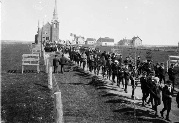 1904
 1930
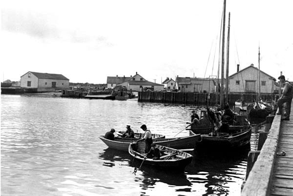 1944
Public domain or CC0, made before 1950, from Wikimedia Commons; old views of places can be drawings, prints or maps of their time. Each credit opens the image’s page.
6 designated places lie within 25 km of Shippagan
Oldest of them is Sainte-Anne-du-Bocage Chapel (1836), 22 km off. Their towns number 3: Caraquet, Shippagan and Bas-Caraquet first. Closest of all is Big Shippegan Shore Light, in Shippagan, 4.8 km off.
The 6 nearest, within 25 km
| Big Shippegan Shore LightRecognized Federal Heritage Building · 1905–1907 · 4.8 km away, in Shippagan |
| Gabriel Giraud SiteProvincial heritage place · 13 km away, in Bas-Caraquet |
| Collège de Caraquet SiteLocal historic place · 19 km away, in Caraquet |
| Église Saint-Pierre-aux-Liens de CaraquetProvincial heritage place · 1860 · 19 km away, in Caraquet |
| Couvent de CaraquetLocal historic place · 19 km away, in Caraquet |
| Sainte-Anne-du-Bocage ChapelLocal historic place · 1836 · 22 km away, in Caraquet |
Shippagan added few homes from 2016 to 2021: 2.1%, where most towns have 4.1%
Before 1961: 20% of Shippagan’s homes, near the usual 18%. More of Shippagan’s homes were built from 1961 to 1980 than in any other period: 39%. Few of Shippagan’s homes date from 2001 to 2015: 10%, the norm 15%.
2021 Census, private dwellings by period of construction (Statistics Canada); the typical town is the middle Canadian town of 2,500 or more.
How Shippagan compares with 16 towns its size
Towns of 3,100 to 3,100 residents, by places on the registers.
Just these have more: Cap-Saint-Ignace, Crescentwood, Normandin and Sudbury, Unorganized, North Part. Their median is 0. 12 of them have nothing on the registers.
Shippagan and its neighbours
Shippagan in brief
Housing in Shippagan includes 20% built before 1961, against 18% in the typical town. Most towns its size have more historic places: the typical one has 0. The other figures are unremarkable: its past has lives on the record such as Hédard Robichaud (1911) and Albany Robichaud (1903).
What this data can and can’t tell you
- People and events. The open directory puts its national historic persons nowhere, so a town shows one only on firm ground: a birth there, matched by name and life years, or a historic place there named for the person whose record says so. Events are left out.
- The tiers. Tiers follow the designation: national recognition and classement first, other federal designations next, provincial and local listings last.
- The grade. There is no history grade: the page sets out the record and compares it with other towns.
- Provincial and municipal lists. Outside Québec, provinces’ and municipalities’ heritage registers aren’t open data; their places are known only through Wikidata items with a register number, and only those with an encyclopedia article get a page.
- The federal register. Parks Canada’s Directory of Federal Heritage Designations lists every National Historic Site, federal heritage building, heritage railway station and lighthouse; the Canadian Register of Historic Places adds their statements in English and French.
- Protection. National historic designation honours a place but binds only federal owners; a private building’s protection depends on its province or municipality.
Questions about Shippagan’s history
How many historic places does Shippagan have on the registers?
Shippagan has none of its own yet. Big Shippegan Shore Light, in Shippagan, is the nearest, 4.8 km away.
How old are the homes in Shippagan?
The 2021 Census dates 20% of its homes before 1961 (18% in the typical town).
Contains information licensed under the Open Government Licence – Canada (Parks Canada).
Sources: Parks Canada, Directory of Federal Heritage Designations · Canadian Register of Historic Places (federal extract) · Wikidata (CC0) for map points, other names and articles · Statistics Canada, 2021 Census (homes by period of construction). Under the Statistics Canada Open Licence.
Adapted from Statistics Canada (Census of Population 2021, population estimates 2025, 2021 census boundaries) under the Statistics Canada Open Licence; this does not constitute an endorsement by Statistics Canada. Neighbourhood names in some cities © OpenStreetMap contributors (ODbL).