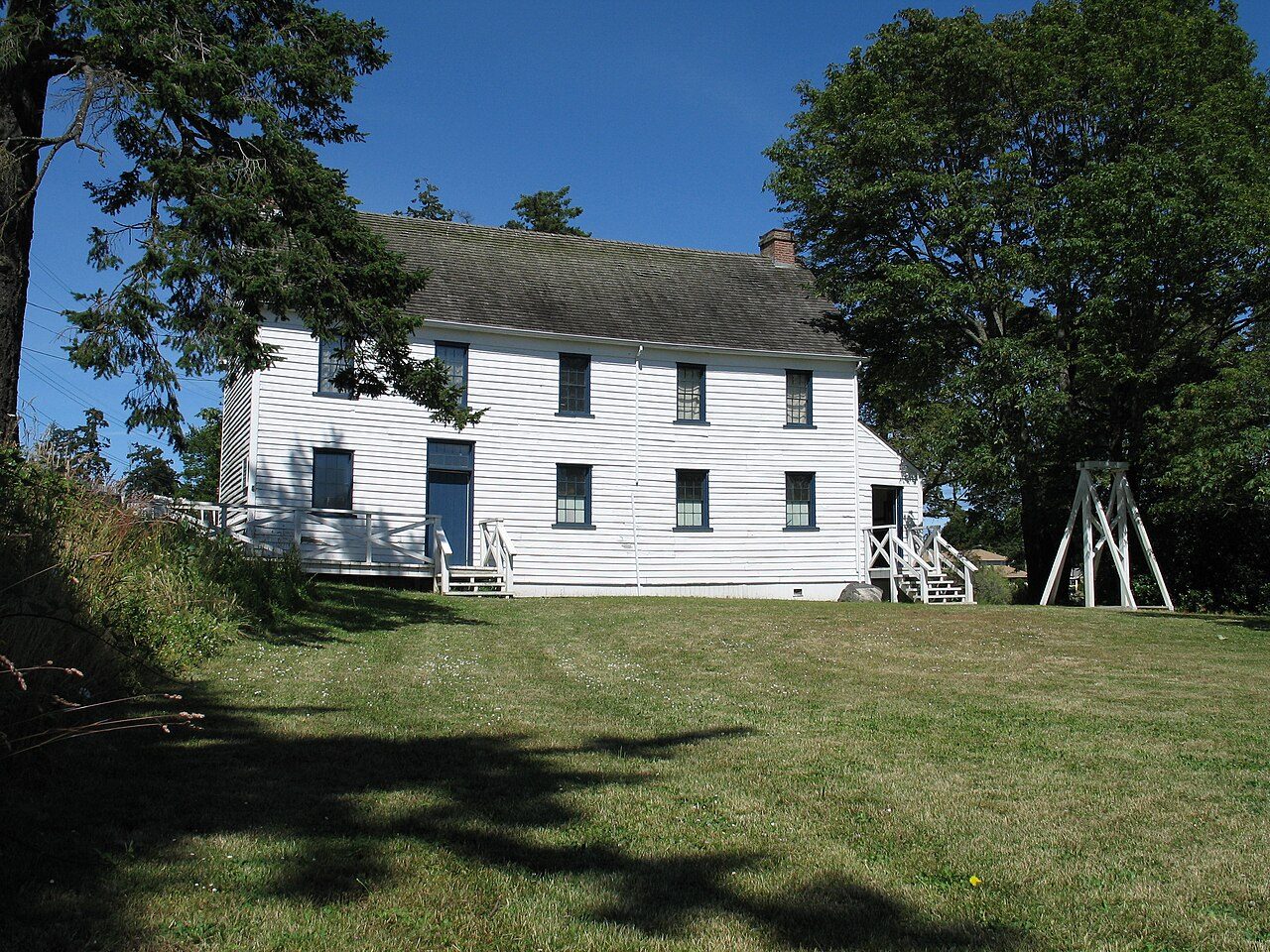
Craigflower Schoolhouse
In French: École Craigflower
Also known as Maple Point School
2765 Admirals Road, Saanich
About Craigflower Schoolhouse
In Saanich, Craigflower Schoolhouse is one of 2 National Historic Sites. Craigflower Schoolhouse dates from 1854–1856.
The Craigflower Schoolhouse National Historic Site of Canada is a two-storey timber-framed building located on the north bank of the Gorge Estuary in the greater Victoria area. Built in 1854-1855, to meet the educational needs of children at Craigflower Farm, the building’s five bay plan, gable roof, Georgian proportions and white clapboard exterior echo the form and design of the nearby Craigflower Manor House National Historic Site of Canada. The schoolhouse is a conspicuously sited historical landmark. Official recognition refers to the building on its lot.
From the Canadian Register of Historic Places, Craigflower Schoolhouse National Historic Site of Canada · Open Government Licence – Canada · in the register’s words, not edited
National Historic Site status comes on the advice of the Historic Sites and Monuments Board of Canada.
Finding Craigflower Schoolhouse
Saanich


It stands apart from the town’s other historic places.
Questions about Craigflower Schoolhouse
What is Craigflower Schoolhouse?
Craigflower Schoolhouse became a National Historic Site in 1964.
Can you visit Craigflower Schoolhouse?
Its register lists it as a museum, so it is likely open to visitors; check the hours with whoever runs it.
When was Craigflower Schoolhouse built?
The record of Craigflower Schoolhouse gives 1854–1856.
Is Craigflower Schoolhouse protected?
National Historic Site status commemorates; legal protection, where there is any, comes from the province or municipality, or from federal ownership.
Contains information licensed under the Open Government Licence – Canada (Parks Canada).
Sources: Parks Canada, Directory of Federal Heritage Designations · Canadian Register of Historic Places (federal extract) · Photos: Wikimedia Commons, each credited with its licence and copied to our own server · Wikidata (CC0) for map points, other names and articles.
Adapted from Statistics Canada (Census of Population 2021, population estimates 2025, 2021 census boundaries) under the Statistics Canada Open Licence; this does not constitute an endorsement by Statistics Canada. Neighbourhood names in some cities © OpenStreetMap contributors (ODbL).