Santa Clara dates to 1777, and 7 of its places are on the National Register
More historic than 72% of U.S. towns · #48 of 847 in California. What drives it
Most of Santa Clara was built recently: 4% of its homes predate 1940 and the median home dates from 1974. 7 places in town are on the National Register, among them two historic districts with 70 buildings between them. Below: 8 old photos and papers, maps from 1887 on, and the census since 1880.
Founding year: Wikidata. First post office: 1851.The full story ↓
History grade
What drives Santa Clara’s History grade
On its age, its old homes and the National Register, Santa Clara is more historic than 72% of U.S. towns, #48 of 847 in California. Its National Register listings hold the grade up; its share of homes from before 1940 pulls it down.
B+
HistoryA character grade: shown, never part of Santa Clara’s overall grade.
Among the 400 U.S. cities of 100,000 or more, Santa Clara ranks #160 on History.
Few California towns list much on the Register (a typical California town has 0.0 per 10,000 residents, the U.S. 2.4), so Santa Clara’s 6.1 sits above most of its state (89% of California towns have fewer) while its 79 historic buildings outnumber those of 88% of U.S. towns.
NoteThe founding year comes from Wikidata alone; no second source gives 1777.
How sure. Graded on any two of the three inputs instead, the letter would range from B− to A. The pre-1940 share (±0.7 points) is firm at this size.
Founding year: Wikidata (other dates in Quick answers). Homes: Census ACS 2020–24. National Register: National Park Service, May 2026 list; each listing counted once (boundary changes and added documentation belong to their listing), and a historic district counts its contributing buildings. How TownRatings grades history →
What stands out about Santa Clara’s past
Read from the archive, the National Register and the record. The page puts what stands out first.
Prior to the arrival of Europeans in the 18th century, the Tamien tribe of the Ohlone nation of Indigenous Californians had inhabited the area for several millennia.
The first European to visit the valley was José Francisco Ortega in 1769. The Spanish began to colonize California with 21 missions, and the Mission Santa Clara de Asís was founded in 1777.
The Battle of Santa Clara, one of the last battles of the Conquest of California, was fought between a contingent of Californios, led by Francisco Sánchez, against the invading American forces.
In 1851, Santa Clara College was established on the grounds of the original Mission. In 1852, Santa Clara was incorporated as a town; it became state-chartered by 1862.
Passages that mention Santa Clara, cut from the printed page as they were published.
History of Santa Clara County, California1881 · page 547Read the page →
Read the text
Santa Clara College. — Santa Clara College is situated in the town of Santa Clara, which is justly celebrated for the beauty of its surrounding scenery, and the mildness and salubrity of its climate. The Southern Pacific and the South Pacific Coast railroads pass through the town.
Text read by machine from the scan; it may contain errors.
History of Santa Clara County, California1881 · page 539Read the page →
Read the text
Products. — The products of Santa Clara township do not vary from those of other parts of the county. Cereals, in every variety, fruits, vegetables, and tubers, all attain the highest perfection imaginable, while there is easy means of export by the Southern Pacific and South Pacific Coast Railroads, both of which companies have depots in the town of Santa Clara.
Text read by machine from the scan; it may contain errors.
History of Santa Clara County California1922 · page 279Read the page →
Read the text
University of Santa Clara The leading educational institution of Santa Clara is the University of Santa Clara, formerly called Santa Clara College. It is located on the site of the old Mission of Santa Clara. On January 12, 1777, two Franciscan Padres, de la Pena and Murguia, jjlanted the Alission cross on the banks of a little stream,
Text read by machine from the scan; it may contain errors.
History of Santa Clara County California1922 · page 541Read the page →
Read the text
piililic opinion, an efficient and popular public official, well known in the newspaper fraternity and the country at large through his literary work. Charles D. South, the postmaster of Santa Clara has done his full share in putting the now famous Mission town of Santa Clara on the map. and incidentally to advance the degree of culture in the new commonwealth. A New Yorker by birth and a Californian by adoption,
Text read by machine from the scan; it may contain errors.
Scans and text from the Internet Archive. Books published in 1930 or earlier, which are in the public domain.
Timeline
Santa Clara, 1777 to 1998
Woven from the archive, old maps, post office records, the National Register and the people born here.
Nothing in the archives for these yearsWeddings on Main Street, storms, parades, school pictures, the old store. If it’s in your family album, it belongs here.
In 1777, according to Wikidata. Santa Clara’s post office opened in 1851, and the census of 1880 counted 2,416 people here.
How does Santa Clara rank for history?
Santa Clara is more historic than 72% of U.S. towns, #48 of 847 in California. The History grade combines the town’s founding era, the share of homes built before 1940 and its National Register listings. It’s a character grade, so it isn’t part of the overall grade. How it works.
What is on the National Register in Santa Clara?
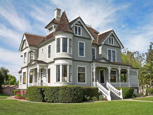
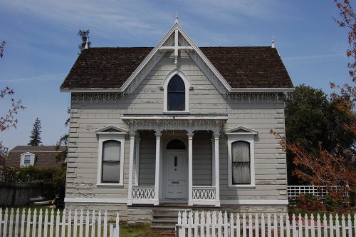
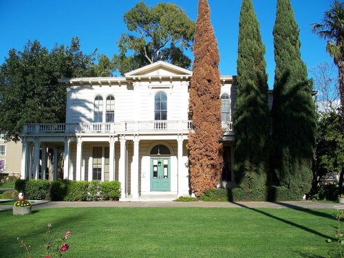
7 listings: 5 buildings, among them the Charles Copeland Morse House (listed 1977, the first), and 2 historic districts, the Agnews Insane Asylum and the Pomeroy Green, with 70 contributing buildings. 79 historic buildings in all.
How old are the homes in Santa Clara?
4% of Santa Clara’s homes were built before 1940 (Census estimate), against a typical 3.4% for a California town; the median home was built in 1974.
Founding dates: Wikidata, Wikipedia, the U.S. post office records of Blevins & Helbock (CC0) and the Census. Homes by year built: Census ACS 2020–24. National Register of Historic Places: National Park Service (list of May 22, 2026). Old photos, postcards and papers: Wikimedia Commons, the Library of Congress and other public archives, credited on each item’s page. Maps: U.S. Geological Survey historical topographic maps (via Esri) and Sanborn fire-insurance maps (Library of Congress). History text and census tables: Wikipedia (CC BY-SA 4.0). Places that used to be: USGS Geographic Names Information System (2021).
From Wikimedia Commons (5), the Library of Congress (6), Wikidata (1), the National Register of Historic Places (7), Wikipedia, Wikidata and Wikipedia for famous people, U.S. Geological Survey historical maps, U.S. Census counts (via Wikipedia), the US Post Offices dataset (Blevins & Helbock), the USGS Geographic Names Information System, Sanborn fire insurance maps (Library of Congress) and old county and town histories (Internet Archive). Archive images are copied here with their credits and licenses, shown on each photo’s page. Refreshed monthly.




 1907
 1907
 1909
 1937
 1938
 2016
 2014
 2012

