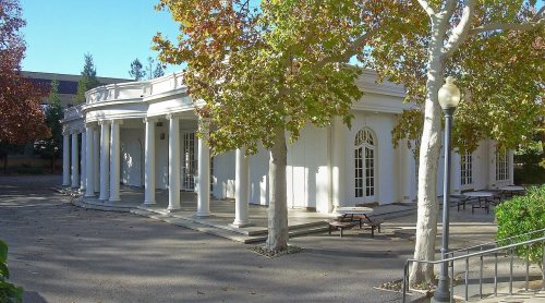
Cupertino’s post office opened in 1882, and 3 of its places are on the National Register
More historic than 39% of U.S. towns · #234 of 847 in California. What drives it
Most of Cupertino was built recently: 1% of its homes predate 1940 and the median home dates from 1973. Its Register listings are the Le Petit Trianon, the Woodhills and the Picchetti Brothers Winery. Below: 4 old photos and papers, maps from 1897 on, and the census since 1960.
Founding year: the first Cupertino post office (Blevins & Helbock, CC0). Wikidata: 1947.The full story ↓
History grade
What drives Cupertino’s History grade
On its age, its old homes and the National Register, Cupertino is more historic than 39% of U.S. towns, #234 of 847 in California. Its National Register listings hold the grade up; its share of homes from before 1940 pulls it down.
C+
HistoryA character grade: shown, never part of Cupertino’s overall grade.
Few California towns list much on the Register (a typical California town has 0.0 per 10,000 residents, the U.S. 2.4), so Cupertino’s 1.7 sits above most of its state (79% of California towns have fewer) while its 10 historic buildings outnumber those of 76% of U.S. towns.
How sure. Graded on any two of the three inputs instead, the letter would range from C− to B. The pre-1940 share (±0.5 points) is firm at this size. The founding year is the first post office, not a stated founding date; Wikidata gives 1947.
Founding year: the first post office (other dates in Quick answers). Homes: Census ACS 2020–24. National Register: National Park Service, May 2026 list; each listing counted once (boundary changes and added documentation belong to their listing), and a historic district counts its contributing buildings. How TownRatings grades history →
What stands out about Cupertino’s past
Read from the archive, the National Register and the record. The page puts what stands out first.
In the 19th century, Cupertino was a small rural village at the crossroads of Stevens Creek Road and Saratoga-Mountain View Road (also known locally as Highway 9; later Saratoga–Sunnyvale Road, and then renamed to De Anza Boulevard within Cupertino city limits). For decades, the intersection was dominated on the southeast corner by the R. Cali Brothers Feed Mill, which is replaced today with the Cali Mill Plaza and City Hall. Back then, it was known as the West Side and was part of Fremont Township. The primary economic activity was fruit agriculture. Almost all of the land within Cupertino's present-day boundaries was covered by prune, plum, apricot, and cherry orchards. A winery on Montebello Ridge overlooking the Cupertino valley region was also in operation by the late 19th century.
Passages that mention Cupertino, cut from the printed page as they were published.
History of Santa Clara County California1922 · page 305Read the page →
Read the text
miles above Los Gatos. Since the opening of the railroad to Santa Cruz, all the business has gone to Alma. And lastly, there is Monte Vista, a mile west of Cupertino, which is little more than a station on the Peninsular Railway.
Text read by machine from the scan; it may contain errors.
History of Santa Clara County California1922 · page 1339Read the page →
Read the text
1902. As the larger portion was coming, not from Montebello, as formerly, but from the valley, it was decided in 1907 to close the chapel and build a church at Cupertino. Alex Montgomery donated the site of one acre and the church was erected at a cost of $9,000, with Father Gabriel in charge. After this Rev. W. McMillan, S. J., was in charge for three years, being again replaced by Father Gabriel, the
Text read by machine from the scan; it may contain errors.
Scans and text from the Internet Archive. Books published in 1930 or earlier, which are in the public domain.
Timeline
Cupertino, 1882 to 1981
Woven from the archive, old maps, post office records, the National Register and the people born here.
The Cupertino post office opened in 1882, the earliest record of the town by name (U.S. post office records). Wikidata gives 1947.
How does Cupertino rank for history?
Cupertino is more historic than 39% of U.S. towns, #234 of 847 in California. The History grade combines the town’s founding era, the share of homes built before 1940 and its National Register listings. It’s a character grade, so it isn’t part of the overall grade. How it works.
What is on the National Register in Cupertino?
Three places: the Le Petit Trianon (listed 1972), the Woodhills (1978) and the Picchetti Brothers Winery (1979).
How old are the homes in Cupertino?
1% of Cupertino’s homes were built before 1940 (Census estimate), against a typical 3.4% for a California town; the median home was built in 1973.
Founding dates: Wikidata, Wikipedia, the U.S. post office records of Blevins & Helbock (CC0) and the Census. Homes by year built: Census ACS 2020–24. National Register of Historic Places: National Park Service (list of May 22, 2026). Old photos, postcards and papers: Wikimedia Commons, the Library of Congress and other public archives, credited on each item’s page. Maps: U.S. Geological Survey historical topographic maps (via Esri) and Sanborn fire-insurance maps (Library of Congress). History text and census tables: Wikipedia (CC BY-SA 4.0). Places that used to be: USGS Geographic Names Information System (2021).
From Wikimedia Commons (5), the Library of Congress (7), Wikidata (1), the National Register of Historic Places (3), Wikipedia, Wikidata and Wikipedia for famous people, U.S. Geological Survey historical maps, U.S. Census counts (via Wikipedia), the US Post Offices dataset (Blevins & Helbock), the USGS Geographic Names Information System, Sanborn fire insurance maps (Library of Congress) and old county and town histories (Internet Archive). Archive images are copied here with their credits and licenses, shown on each photo’s page. Refreshed monthly.

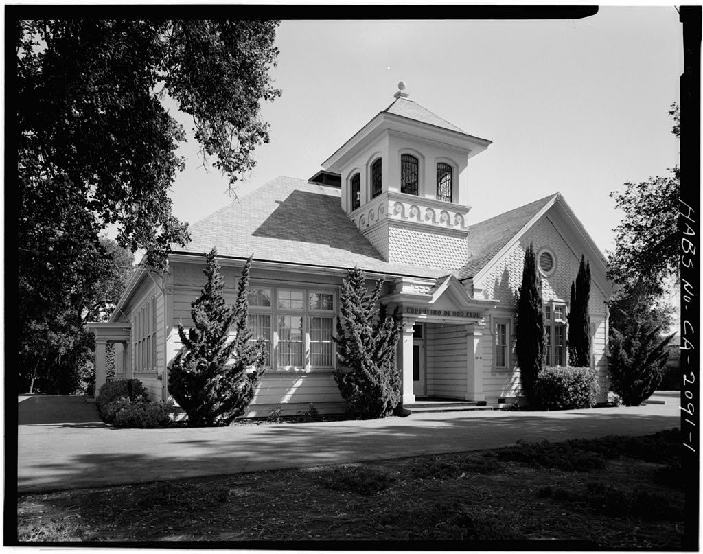


 Date?
 Date?
 Date?
 Date?
 2023
 2023
 2023
 2017
 2013
 2012
 2012
 2012