13 of San Juan Capistrano’s places are on the National Register
More historic than 54% of U.S. towns · #133 of 847 in California. What drives it
Most of San Juan Capistrano was built recently: 1% of its homes predate 1940 and the median home dates from 1979. Below: 4 old photos and papers, maps from 1948 on, and the census since 1880.
On its age, its old homes and the National Register, San Juan Capistrano is more historic than 54% of U.S. towns, #133 of 847 in California. Its National Register listings hold the grade up; its share of homes from before 1940 pulls it down.
B−
HistoryA character grade: shown, never part of San Juan Capistrano’s overall grade.
Few California towns list much on the Register (a typical California town has 0.0 per 10,000 residents, the U.S. 2.4), so San Juan Capistrano’s 13.7 sits above most of its state (93% of California towns have fewer) while its 48 historic buildings outnumber those of 85% of U.S. towns.
How sure. Graded on two of the three inputs, so a change in either one moves the letter more than it would with three. The pre-1940 share (±0.9 points) is firm at this size.
Founding year: our sources. Homes: Census ACS 2020–24. National Register: National Park Service, May 2026 list; each listing counted once (boundary changes and added documentation belong to their listing), and a historic district counts its contributing buildings. How TownRatings grades history →
What stands out about San Juan Capistrano’s past
Read from the archive, the National Register and the record. The page puts what stands out first.
The region was populated by the Acjachemen, referred to by the Spanish as Juaneños, an Indigenous Californian nation. They lived in the area for approximately 10,000 years, with some of their oldest villages being confirmed as over 9,600 years old. The mother village of Putuidem was located in what is now San Juan Capistrano, as well as the village of Acjacheme.
Passages that mention San Juan Capistrano, cut from the printed page as they were published.
History of Orange County, California1921 · page 676Read the page →
Read the text
service of George Borgfeldt and Company, the most important importers of toys and many other lines of high-grade wares in America, doing business on Sixth Street and Irving Place, New York. Coming to California, Mr. Stoflfel pitched his tent at San Juan Capistrano in January, 1916, and began business here right after the disaster to the Otay Dam at San Diego, which was carried away by a freshet. Then the Santa Ana River overflowed its banks, and the waters of the Trabuco and the San Juan flooded the streets of San Juan Capistrano, and buried the Santa Fe tracks, so that traffic was crippled for three months. It was discouraging enough to the young man
Text read by machine from the scan; it may contain errors.
History of Orange County, California1921 · page 1432Read the page →
Read the text
Le Roy R. Cook was born at San Juan Capistrano on April 21, 1884, and bought his present homeplace four years ago, becoming a member and -stockholder of the Capistrano Walnut Growers Association at San Juan Capistrano. His father had come down to San Juan Capistrano from the San Mateo Valley, and so had early identified himself with the development of this section. The lad attended the common schools at San Juan and Santa .\na. and then worked in the railway shops at San Bernardino, continuing there for four years. After purchasing his ranch, eighty-five acres devoted principally to raising walnuts and Valencia oranges, he remodeled the residence and
Text read by machine from the scan; it may contain errors.
Scans and text from the Internet Archive. Books published in 1930 or earlier, which are in the public domain.
Timeline
San Juan Capistrano, 1776 to 1992
Woven from the archive, old maps, post office records, the National Register and the people born here.
Nothing in the archives for these yearsWeddings on Main Street, storms, parades, school pictures, the old store. If it’s in your family album, it belongs here.
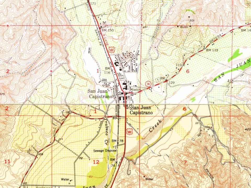
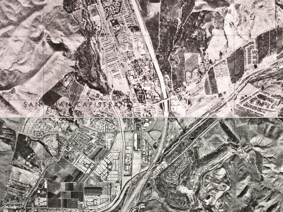
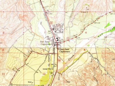
Every edition of the U.S. Geological Survey’s map of San Juan Capistrano. Tap a year, or press play to watch the town change.
1948San Juan Capistrano sheet · 1:24,000
U.S. Geological Survey historical topographic maps (public domain), via Esri’s collection of the scans. The red ring marks the center of San Juan Capistrano.
Then & now
Stand where they stood
No then-and-now pairs yet. Take a photo from the same spot as an old one and they appear here side by side.
Retake this viewThe present chapel of San Juan Capistrano, 1890
Find the spot, match the angle, and add your photo. It becomes the first then-and-now pair on San Juan Capistrano’s page.
Old hamlets and crossroads still carry their names on the map.
Hamlets and corners on the map
Capistrano Terrace Mobile Home ParkCapistrano Valley Mobile Home EstatesEl Nido Mobile Home EstatesRancho Alipaz Mobile Home ParkRancho del Avion Capistrano Mobile Home ParkSan Juan Mobile Home EstatesVilla San Juan Mobile Home Park
Gone or out of use
Capistrano Airportairport
1cemetery inside San Juan Capistrano
Mission
Places and cemeteries from the USGS Geographic Names Information System (2021).
Stories next door
History across the town line
Each neighbor’s History grade, on the same three inputs.
San Juan Capistrano is more historic than 54% of U.S. towns, #133 of 847 in California. The History grade combines the town’s founding era, the share of homes built before 1940 and its National Register listings. It’s a character grade, so it isn’t part of the overall grade. How it works.
What is on the National Register in San Juan Capistrano?
13 listings: 12 buildings, among them the Mission San Juan Capistrano (listed 1971, the first), and 1 historic district, the Los Rios Street Historic District, with 28 contributing buildings. 48 historic buildings in all.
How old are the homes in San Juan Capistrano?
1% of San Juan Capistrano’s homes were built before 1940 (Census estimate), against a typical 3.4% for a California town; the median home was built in 1979.
Founding dates: Wikidata, Wikipedia, the U.S. post office records of Blevins & Helbock (CC0) and the Census. Homes by year built: Census ACS 2020–24. National Register of Historic Places: National Park Service (list of May 22, 2026). Old photos, postcards and papers: Wikimedia Commons, the Library of Congress and other public archives, credited on each item’s page. Maps: U.S. Geological Survey historical topographic maps (via Esri) and Sanborn fire-insurance maps (Library of Congress). History text and census tables: Wikipedia (CC BY-SA 4.0). Places that used to be: USGS Geographic Names Information System (2021).
From the Library of Congress (4), Wikidata (2), the National Register of Historic Places (13), Wikipedia, Wikidata and Wikipedia for famous people, U.S. Geological Survey historical maps, U.S. Census counts (via Wikipedia), the USGS Geographic Names Information System and old county and town histories (Internet Archive). Archive images are copied here with their credits and licenses, shown on each photo’s page. Refreshed monthly.


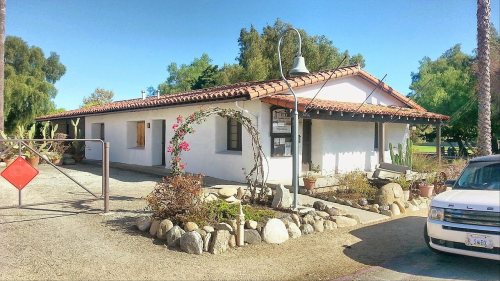
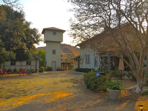




 1890
 1895
 1899