San Carlos’ post office opened in 1895, and 3 of its places are on the National Register
More historic than 51% of U.S. towns · #148 of 847 in California. What drives it
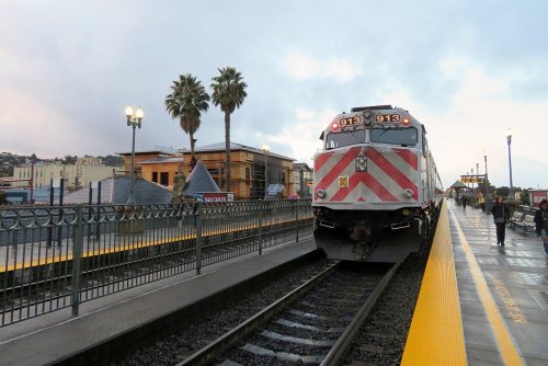
Most of San Carlos was built recently: 8% of its homes predate 1940 and the median home dates from 1962. Its Register listings are the Southern Pacific Depot, the Brittan, Nathanial, Party House and the Timby House. Below: maps from 1926 on and the census since 1930.
Founding year: the first San Carlos post office (Blevins & Helbock, CC0).The full story ↓
History grade
What drives San Carlos’ History grade
On its age, its old homes and the National Register, San Carlos is more historic than 51% of U.S. towns, #148 of 847 in California. Its National Register listings hold the grade up; its age pulls it down.
B−
HistoryA character grade: shown, never part of San Carlos’ overall grade.
Few California towns list much on the Register (a typical California town has 0.0 per 10,000 residents, the U.S. 2.4), so San Carlos’ 1.7 sits above most of its state (79% of California towns have fewer) while its 5 historic buildings outnumber those of 70% of U.S. towns.
How sure. Graded on any two of the three inputs instead, the letter would range from C to B. The pre-1940 share (±1.2 points) is firm at this size. The founding year is the first post office, not a stated founding date.
Founding year: the first post office (other dates in Quick answers). Homes: Census ACS 2020–24. National Register: National Park Service, May 2026 list; each listing counted once (boundary changes and added documentation belong to their listing), and a historic district counts its contributing buildings. How TownRatings grades history →
What stands out about San Carlos’ past
Read from the archive, the National Register and the record. The page puts what stands out first.
Prior to the Spanish arrival in 1769, the land of San Carlos was occupied by a group of Native Americans who called themselves the Lamchins. While they considered themselves to have a separate identity from other local tribes, modern scholars consider them to be a part of the Ohlone or Costanoan tribes that inhabited the Bay Area.
The Lamchins referred to the area of their primary residence—probably on the north bank of Pulgas creek—as "Cachanihtac", which included their word for vermin. When the Spanish arrived, they translated this as "the fleas", or "las Pulgas", giving many places and roads their modern names.
Passages that mention San Carlos, cut from the printed page as they were published.
The architectural history of Mission San Carlos Borromeo, California1921 · page 32Read the page →
Read the text
Victoria prevented the putting of this order into effect,-" and the controversy regarding the secularization of the California missions continued for some years longer. Finally on November 4, 1834, the act of secularization was adopted and announced by Governor Figueroa. By it San Carlos and Monterey were combined as a curacy of the first class."" In accordance with the plan of secularization an inventory was made of the property of the various missions. That of San Carlos, dated December 10, 1834, valued the mission property at approximately $46,022. Of this the church itself
Text read by machine from the scan; it may contain errors.
The architectural history of Mission San Carlos Borromeo, California / By Frances Rand Smith1921 · page 38Read the page →
Read the text
Eduard Vischer, C. W. J. Johnson, C. E. Watkins, E. J. Muybridge, Perkins, Fiske and Taber, all of whom have made valuable contributions.40 First in time, if not in importance, is Eduard Vischer, whose mission sketches constitute a most valuable legacy. Three of these sketches are views of San Carlos ; unfortunately, however, since they are among his earliest work they do not give as much information as one would desire. Writing in 1872, he says of San Carlos :41 "This mission, after an occupation of half a century, was, like others subsequent to
Text read by machine from the scan; it may contain errors.
The architectural history of Mission San Carlos Borromeo, California / By Frances Rand Smith1921 · page 32Read the page →
Read the text
Victoria prevented the putting of this order into effect,29 and the controversy regarding the secularization of the California missions continued for some years longer. Finally on November 4, 1834, the act of secularization was adopted and announced by Governor Figueroa. By it San Carlos and Monterey were combined as a curacy of the first class.30 In accordance with the plan of secularization an inventory was made of the property of the various missions. That of San Carlos, dated December 10, 1834, valued the mission property at approximately $46,022. Of this the church itself
Text read by machine from the scan; it may contain errors.
The architectural history of Mission San Carlos Borromeo, California1921 · page 31Read the page →
Read the text
Alvarado says a portion of the road from Monterey to San Carlos was known as that of Calvary, that twelve crosses were planted along the road at equal distances representing the twelve stations of the "Via Crucis," and that on Good Friday appropriate religious services were always celebrated.-' Secularisation of the Mission. The best days of San Carlos were over.
Text read by machine from the scan; it may contain errors.
Scans and text from the Internet Archive. Books published in 1930 or earlier, which are in the public domain.
Timeline
San Carlos, 1872 to 1998
Woven from the archive, old maps, post office records, the National Register and the people born here.
The San Carlos post office opened in 1895, the earliest record of the town by name (U.S. post office records).
How does San Carlos rank for history?
San Carlos is more historic than 51% of U.S. towns, #148 of 847 in California. The History grade combines the town’s founding era, the share of homes built before 1940 and its National Register listings. It’s a character grade, so it isn’t part of the overall grade. How it works.
What is on the National Register in San Carlos?
Three places: the Southern Pacific Depot (listed 1984), the Brittan, Nathanial, Party House (1994) and the Timby House (2024).
How old are the homes in San Carlos?
8% of San Carlos’ homes were built before 1940 (Census estimate, ±1.2 points), against a typical 3.4% for a California town; the median home was built in 1962.
Founding dates: Wikidata, Wikipedia, the U.S. post office records of Blevins & Helbock (CC0) and the Census. Homes by year built: Census ACS 2020–24. National Register of Historic Places: National Park Service (list of May 22, 2026). Old photos, postcards and papers: Wikimedia Commons, the Library of Congress and other public archives, credited on each item’s page. Maps: U.S. Geological Survey historical topographic maps (via Esri) and Sanborn fire-insurance maps (Library of Congress). History text and census tables: Wikipedia (CC BY-SA 4.0). Places that used to be: USGS Geographic Names Information System (2021).
From Wikimedia Commons (3), Wikidata (1), the National Register of Historic Places (3), Wikipedia, Wikidata and Wikipedia for famous people, U.S. Geological Survey historical maps, U.S. Census counts (via Wikipedia), the US Post Offices dataset (Blevins & Helbock), the USGS Geographic Names Information System, Sanborn fire insurance maps (Library of Congress) and old county and town histories (Internet Archive). Archive images are copied here with their credits and licenses, shown on each photo’s page. Refreshed monthly.

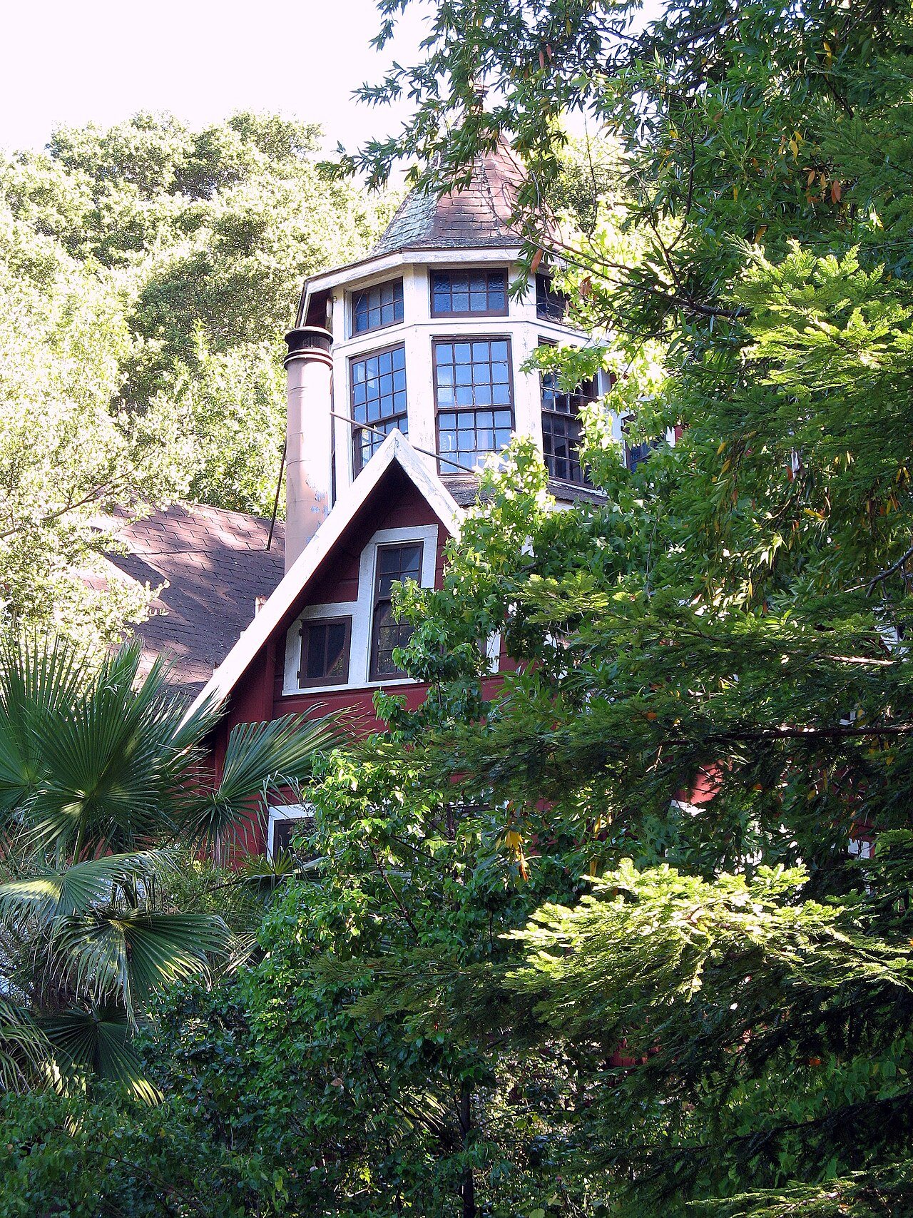




 2008
 2008
 2008