RosedaleCA
A town of 18,877, settled in 1891.
What should you know before moving to Rosedale?
Homes are expensive, about $609K for a typical one and 8.7 times the Bakersfield metro’s $70K median household income. Overall it grades C+, 301st among California's 841 graded towns. The median household earns $136K and residents are healthier than 80% of U.S. towns on CDC estimates. Its weakest subject is hazard risk: FEMA rates its natural-hazard risk higher than 70% of U.S. communities, with inland flooding at the top. Rosedale’s peak summer temperature is 99°F, above both the California town median (89°F) and the median of U.S. towns (85°F).
Rosedale has grown 33% from 2010 to 2020
14,058 counted in 2010 and 18,639 in 2020.
U.S. Census 2010 & 2020 counts
How Rosedale grades
Each subject compared with towns across the country (schools within California), ordered by how far Rosedale is from typical.
How TownRatings grades towns →
Moving to Rosedale: who provides what
Rosedale is unincorporated, so Kern County and regional agencies provide most services.
EPA SDWIS (Oct 9, 2026) · HIFLD + EIA-861 2025 · Census 2020 ZCTAs · NCES 2024–25 · registration: vote.gov, updated Nov 18, 2024.
The data
Ordered by what stands out in Rosedale.
Rosedale has more 90° days than nearly all U.S. towns, has less food insecurity than most of California and has added a third more jobs in ten years.
Rosedale earns an A− for health
Its widest gap with California is food insecurity: 11% of its 13,564 adults worry about having enough food, against 17.9% statewide. Against the 3,938 U.S. towns with household incomes like Rosedale’s, it is less healthy than 61%: its national edge comes with its incomes.
Rosedale: nearly three quarters of adults had a checkup this year. Of 32 CDC measures, Rosedale beats the California average on 14 and trails it on 3. Two figures for adults locally: 20% get no exercise outside work, 9.5% have diabetes.
| Rosedale | California towns | U.S. towns | |
|---|---|---|---|
| Binge drink (CDC PLACES) | 19% | 16% | 16% |
| Get no exercise (CDC PLACES) | 20% | 24% | 25% |
| Diabetes (CDC PLACES) | 9.5% | 12% | 12% |
| Yearly checkup (CDC PLACES) | 74% | 72% | 79% |
| What stands out | Rosedale | CA |
|---|---|---|
| Fewer adults facing food insecurity | 11% | 17.9% |
| Fewer uninsured adults | 6.6% | 10.6% |
| More binge drinkers | 18.9% | 15.3% |
CDC PLACES 2025 · modeled estimates for adults · CMS · HRSA
Public schools in Rosedale beat 58% of California districts
The Rosedale Union Elementary school district runs its public schools. One of its 3 schools is below, with the reason it’s listed.
| School | Level | Students | Letter |
|---|---|---|---|
| Rosedale MiddleLargest public middle schoolGrades 7–8 | Grades 7–8 | 810 | – |
NCES · EDFacts · graded within CA on state tests and graduation
About two in five of Rosedale’s working residents commute to Bakersfield
Jobs based here grew from 3,759 in 2013 to 5,077.
Most people who work leave Rosedale to do it: just 6% work in town. Jobs in Rosedale grew by 1,318 from 2013 to 2023, reaching 5,077. Among residents locally, 6.4% live below the poverty line. Half the trips to work are shorter than 9 miles.
| Rosedale | California towns | U.S. towns | |
|---|---|---|---|
| Median household income | $136,000 | $95,000 | $80,000 |
| Below the poverty line | 6.4% | 10% | 9.6% |
| Work from home | 9.2% | 14% | 11% |
| Average trip to work | 28 minutes | 28 minutes | 25 minutes |
Where working residents work
Census LEHD 2023 · ACS
0.3% of the land in Rosedale is protected from building
20 miles of trail wind through 2 parks and preserves. In Rosedale, the trail density is 0.7 miles per square mile.
| Rosedale | California towns | U.S. towns | |
|---|---|---|---|
| Conserved land | 0.3% | 4.3% | 4.3% |
| Miles of trail per square mile | 0.7 miles per square mile | 1.0 | 0.4 |
| Biggest places to walk | Trails | Acres |
|---|---|---|
| 1. Silver Oak Park | — | 9 |
| 2. Austin Creek Park | — | 8 |
Trails & parks © OpenStreetMap contributors · Conserved land: USGS PAD-US
Top of a high hazard risk in Rosedale: inland flooding
Of the losses FEMA expects in Rosedale, 54% come from inland flooding and 35% from earthquakes. The town has had one paid flood insurance claim since 2020.
FEMA National Risk Index · OpenFEMA
Mild winters and hot summers: that is Rosedale’s year
The Bakersfield Ap weather station, 9 miles away, records that about 112 days a year reach 90°, more than in 97% of U.S. towns. July afternoons average 98.7°, hotter than in 99% of U.S. towns; January nights average 39.9°.
Rosedale’s January low comes in at 40°F. Snow is almost unheard of.
Typical low → high °F
NOAA U.S. Climate Normals, 1991–2020
Fewer adults under 35 in Rosedale than across California
For residents in Rosedale, the share who are under 18 is 27%. Adults 18 to 34 are 19% of residents (24% statewide); children under 18 are 27% of residents (22% statewide). Among adults 25 and older, 41% have a four-year degree or more, against 37% across California.
| Rosedale | California towns | U.S. towns | |
|---|---|---|---|
| Under 18 | 27% | 22% | 22% |
| Bachelor’s degree or more, 25+ | 41% | 29% | 29% |
| Aged 65 or older | 13% | 16% | 18% |
| Median age | 37.6 years | 39.1 years | 40.5 years |
Ages · share of residents
Education · adults 25 and older
Women and men · all residents
50% women, 50% men
That’s an even split within the survey’s margin of ±6 points. Across California, 50.1% of residents are women.
| Rosedale | CA | U.S. | |
|---|---|---|---|
| Under 10 | 14.6% | 11.4% | 11.6% |
| 10 to 17 | 12.1% | 10.5% | 10.3% |
| 18 to 24 | 6.8% | 9.1% | 9.1% |
| 25 to 34 | 11.7% | 14.8% | 13.7% |
| 35 to 44 | 13.7% | 13.9% | 13.2% |
| 45 to 54 | 13.3% | 12.5% | 12.2% |
| 55 to 64 | 14.4% | 12.1% | 12.7% |
| 65 to 74 | 7.3% | 9.2% | 10.2% |
| 75 and older | 6.2% | 6.5% | 7% |
| No diploma | 11.6% | 15.3% | 10.4% |
| High school | 18.4% | 20.5% | 26% |
| Some college | 21.7% | 19.3% | 19.1% |
| Associate’s | 7.1% | 7.9% | 8.8% |
| Bachelor’s | 24.9% | 22.7% | 21.6% |
| Graduate | 16.2% | 14.4% | 14.1% |
U.S. Census Bureau · ACS 2020-2024 5-year estimates
A home in Rosedale sells for about $720K at the median
In Rosedale, 86% of households are owner-occupiers. Homes sold in Rosedale spent a median 50 days on the market.
Census ACS, 2020–24 · Zillow Home Value Index · Redfin Data Center
Dignity Health Arena and 6 more within 40 miles
Museums, parks, gardens and other places to visit around Rosedale. Close and well known come first.
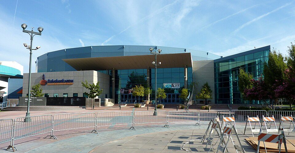 11 mi Stadium & arenaDignity Health Arena
 40 mi MuseumFort Tejon
 38 mi National MonumentCésar E. Chávez National Monument31K visitors a year
 11 mi MuseumKern County Museum85K visitors a year18 mi Zoo & aquariumCalifornia Living Museum
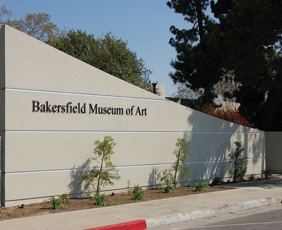 11 mi MuseumBakersfield Museum of Art
Photo credits
Dignity Health Arena: Bobak Ha'Eri, CC BY 3.0 · Fort Tejon: Yellowute at English Wikipedia, Public domain · César E. Chávez National Monument: Bobak Ha'Eri, CC BY 3.0 · Kern County Museum: (WT-de) Mistoffeles, CC BY-SA 4.0 · Bakersfield Museum of Art: Skyman9999. Skyman9999, CC0


Everything we know about Rosedale
Colleges nearby
3 within 15 miles of the center of Rosedale
About 6 of every 100 Rosedale residents are enrolled in college, against 8 across California.
94% of working residents leave Rosedale for work
Where Rosedale’s working residents go each day. Line width shows the share.
Census LEHD 2023
About Rosedale
Census-designated place in California, United States
Rosedale is a census-designated place (CDP) in Kern County, California, United States. The population was 18,639 at the 2020 census, up from 14,058 at the 2010 census. Formerly a country town 10 miles (16 km) west of Bakersfield, it is now surrounded by suburban housing and currently has the highest household income in Kern County, according to Census estimates.
From Wikipedia, licensed CC BY-SA 4.0 · facts via Wikidata (CC0)
- Area
- 30 sq mi
- Elevation
- 364 ft
- Area code
- 661
Rosedale’s neighbors
2 towns share a border with Rosedale.
| Town | CA rank | Overall | Cost | Safety | Schools | Health |
|---|---|---|---|---|---|---|
| Rosedale | #301 | C+ | D− | — | B | A− |
| Bakersfield | #780 | D− | D− | D | C | C |
| Greenacres | #370 | C | D | — | B | B− |
Rosedale and Greenacres report no FBI crime data of their own. Compare Rosedale with a neighbor →
Questions about Rosedale
Short answers, built from the data on this page.
Is Rosedale, CA a good place to live?
Rosedale grades C+ overall, better than 38% of U.S. towns and #301 of 841 in California. It grades A− for health and B for schools. Cost of living is its weak spot, with a D−.
Is Rosedale, CA expensive?
Yes. The typical home is worth about $609,000, 20% below the California typical home. Cost of living, which also weighs rents, property taxes and how many households pay 30% or more of their income for housing, grades D−.