More historic than 18% of U.S. towns · #517 of 847 in California. What drives it
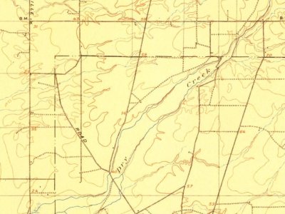
Most of Rio Linda was built recently: 9% of its homes predate 1940 and the median home dates from 1969. Below: maps from 1902 on and old-book passages.
Founding year: the first Rio Linda post office (Blevins & Helbock, CC0).The full story ↓
History grade
What drives Rio Linda’s History grade
On its age, its old homes and the National Register, Rio Linda is more historic than 18% of U.S. towns, #517 of 847 in California. Its share of homes from before 1940 holds the grade up; its age pulls it down.
C−
HistoryA character grade: shown, never part of Rio Linda’s overall grade.
Few California towns list much on the Register (a typical California town has 0.0 per 10,000 residents, the U.S. 2.4), so Rio Linda’s 0.0 sits below most of its state (31% of California towns have fewer) while its 0 listings outnumber those of 23% of U.S. towns.
How sure. Graded on any two of the three inputs instead, the letter would range from D to C. The pre-1940 share is a Census survey estimate (±3.8 points). The founding year is the first post office, not a stated founding date.
Founding year: the first post office (other dates in Quick answers). Homes: Census ACS 2020–24. National Register: National Park Service, May 2026 list; each listing counted once (boundary changes and added documentation belong to their listing), and a historic district counts its contributing buildings. How TownRatings grades history →
What stands out about Rio Linda’s past
Read from the archive, the National Register and the record. The page puts what stands out first.
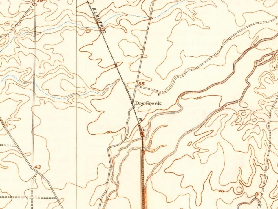
The Rio Linda/Elverta community is located on part of the Rancho Del Paso Mexican land grant of 1844. In 1910, a Fruit Land Company of Minneapolis acquired 12,000 acres (49 km2) of the Grant and in 1912 the area was subdivided. Renamed Rio Linda in 1913, it was known as "Dry Creek Station", a flag stop for the Northern Electric Railroad, renamed the Sacramento Northern Railway after joining the San Francisco–Sacramento system to improve service in the Sacramento Valley. Two families settled in Rio Linda by 1912, three more arrived in 1913, and nine more in 1914. By 1918, approximately 50 families in the community, mostly of Scandinavian and German descent. By 1920, poultry farming had proved to be feasible in the area which was advertised throughout several Eastern states during the 1920s. The Sacramento Northern Railway stopped commuter services in 1940, redirecting focus to freight in…
Passages that mention Rio Linda, cut from the printed page as they were published.
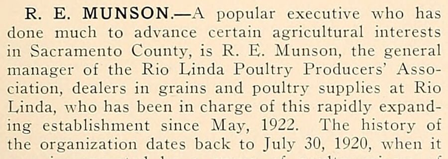
History of Sacramento County, California, with biographical sketches of the leading men and women of the county who have been identified with its growth and development from the early days to the present1923 · page 653Read the page →
Read the text
R. E. MUNSON. — A popular executive who has done much to advance certain agricultural interests in Sacramento County, is R. E. Munson, the general manager of the Rio Linda Poultry Producers' Association, dealers in grains and poultry supplies at Rio Linda, who has been in charge of this rapidly expanding establishment since Maj', 1922. The history of the organization dates back to July 30, 1920, when it
Text read by machine from the scan; it may contain errors.
History of Sacramento County, California, with biographical sketches of the leading men and women of the county who have been identified with its growth and development from the early days to the present1923 · page 640Read the page →
Read the text
tion of friends, he continued to serve in an advisory capacity until, late in 1919, the Sacramento Suburban Fruit Lands Company sought and obtained his services as their poultry adviser at Rio Linda. He maintains his ofiice at 617 J Street, Sacramento, and also spends a large portion of his time on the grounds, visiting the new and fast-growing poultry colony at Rio Linda. He is president of the Rio Linda Poultry
Text read by machine from the scan; it may contain errors.
Scans and text from the Internet Archive. Books published in 1930 or earlier, which are in the public domain.
Timeline
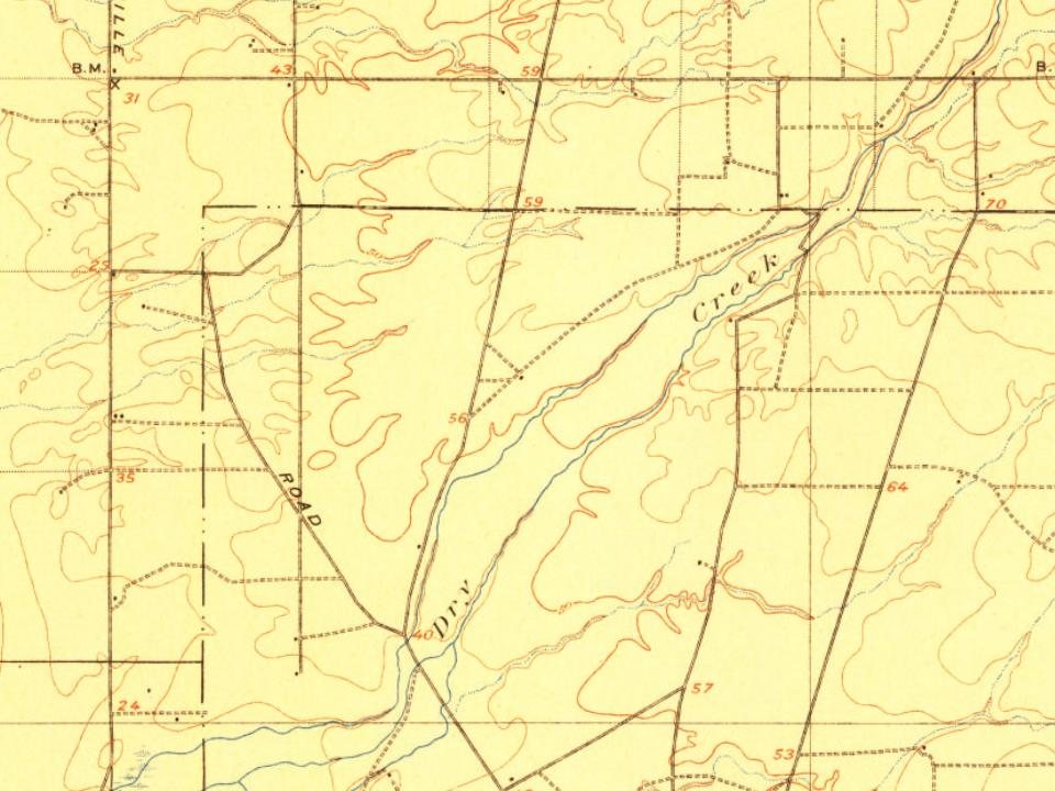
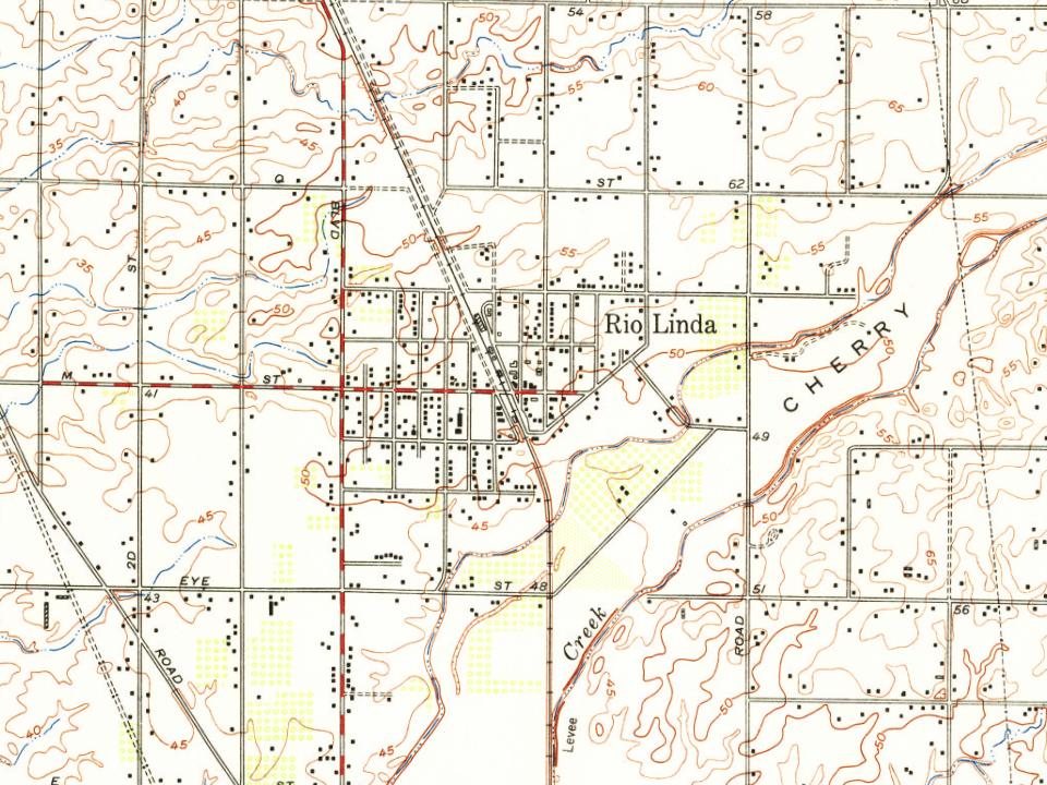
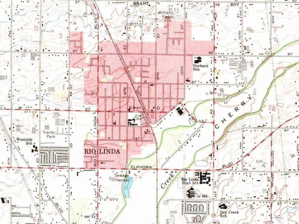
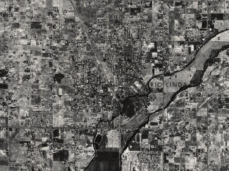
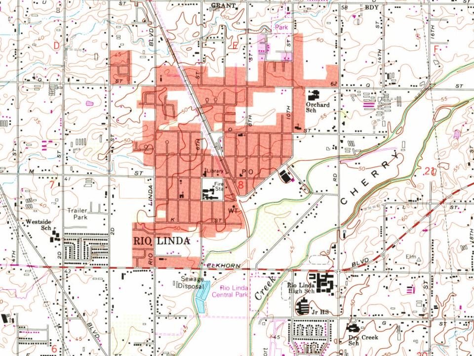
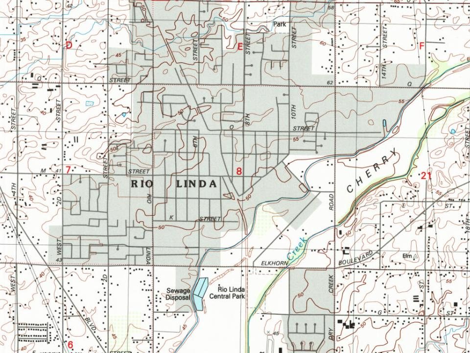
Rio Linda, 1902 to 2002
Woven from the archive, old maps, post office records, the National Register and the people born here.
The Rio Linda post office opened in 1914, the earliest record of the town by name (U.S. post office records).
How does Rio Linda rank for history?
Rio Linda is more historic than 18% of U.S. towns, #517 of 847 in California. The History grade combines the town’s founding era, the share of homes built before 1940 and its National Register listings. It’s a character grade, so it isn’t part of the overall grade. How it works.
How old are the homes in Rio Linda?
9% of Rio Linda’s homes were built before 1940 (Census estimate, ±3.8 points), against a typical 3.4% for a California town; the median home was built in 1969.
Founding dates: Wikidata, Wikipedia, the U.S. post office records of Blevins & Helbock (CC0) and the Census. Homes by year built: Census ACS 2020–24. National Register of Historic Places: National Park Service (list of May 22, 2026). Old photos, postcards and papers: Wikimedia Commons, the Library of Congress and other public archives, credited on each item’s page. Maps: U.S. Geological Survey historical topographic maps (via Esri) and Sanborn fire-insurance maps (Library of Congress). History text and census tables: Wikipedia (CC BY-SA 4.0). Places that used to be: USGS Geographic Names Information System (2021).
From Wikimedia Commons (5), Wikipedia, Wikidata and Wikipedia for famous people, U.S. Geological Survey historical maps, the US Post Offices dataset (Blevins & Helbock), the USGS Geographic Names Information System and old county and town histories (Internet Archive). Archive images are copied here with their credits and licenses, shown on each photo’s page. Refreshed monthly.



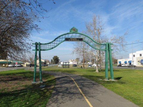 2013
 2013
 2013
 2013
 2013